Category:Unemployment rate maps of Germany
Jump to navigation
Jump to search
Media in category "Unemployment rate maps of Germany"
The following 24 files are in this category, out of 24 total.
-
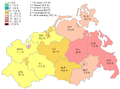
 Arbeitslosenquote Kreisebene 2021.svg 946 × 1,253; 686 KB
-
 Arbeitslosenquote Mecklenburg-Vorpommern 12.07.PNG 763 × 566; 29 KB
-
 Arbeitslosenquote Mecklenburg-Vorpommern.PNG 763 × 566; 59 KB
-
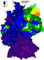
 Arbeitslosigkeit 2010-10.png 2,814 × 3,841; 471 KB
-
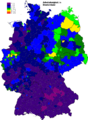
 Arbeitslosigkeit 2011-10.png 2,814 × 3,841; 721 KB
-
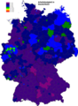
 Arbeitslosigkeit 2012-10.png 2,814 × 3,841; 718 KB
-
 Arbeitslosigkeit 2013-10.png 2,814 × 3,841; 718 KB
-
 Arbeitslosigkeit 2014-10.png 2,814 × 3,841; 1.42 MB
-
 Arbeitslosigkeit 2015-10.png 2,814 × 3,841; 1.41 MB
-
 Arbeitslosigkeit 2017-10.png 2,814 × 3,841; 1.31 MB
-
 Arbeitslosigkeit 2018-10.png 2,814 × 3,841; 1.3 MB
-
 Arbeitslosigkeit 2019-10.png 2,814 × 3,841; 1.17 MB
-
 Arbeitslosigkeit 2020-10.png 2,814 × 3,841; 1.17 MB
-
 Arbeitslosigkeit 2021-10.png 2,814 × 3,841; 1.31 MB
-
 Arbeitslosigkeit 2022-10.png 2,814 × 3,841; 1.31 MB
-
 Arbeitslosigkeit 2023-10.png 2,814 × 3,841; 1.31 MB
-
 ArbeitslosigkeitInDeutschland1997.png 920 × 1,336; 340 KB
-
 ArbeitslosigkeitInDeutschland1997Lat.PNG 920 × 1,336; 217 KB
-
 Germany Laender Arbeitslos.png 668 × 910; 25 KB
-
 Optionskarte Stand 01.01.2012f-mit Kreisnamen.jpg 2,197 × 3,076; 3.37 MB
-
 Optionskarte Stand 01.01.2012f-ohne Kreisnamen.jpg 2,197 × 3,076; 2.69 MB
-
 SoziodemographieDeutschlandsNachDerWiedervereinigung.png 1,637 × 986; 487 KB
-
 Arbeitslosigkeit TH 0407.PNG 710 × 606; 75 KB
-
 Unemployment in Germany 2003 by states.png 522 × 729; 112 KB


