Category:Labor market maps of Germany
Jump to navigation
Jump to search
Subcategories
This category has only the following subcategory.
U
Media in category "Labor market maps of Germany"
The following 13 files are in this category, out of 13 total.
-
DGB Bezirke.svg 592 × 801; 111 KB
-
ErwerbstaetigeUndBeschaeftigungsstrukturDeutschland1997.png 1,551 × 2,311; 442 KB
-
Forsttechnikereinsatzorte-neu.png 7,015 × 9,933; 3.22 MB
-
Forsttechnikereinsatzorte.jpg 7,015 × 9,933; 2.21 MB
-
Forsttechnikereinsatzorte.png 3,507 × 4,960; 1.44 MB
-
FT Beschäftigungsorte.png 7,015 × 9,933; 3.96 MB
-
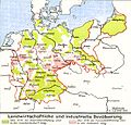
Lange diercke sachsen deutschland landwirtschaftliche und industrielle bevoelkerung.jpg 1,262 × 1,213; 534 KB
-
Optionskarte Stand 01.01.2012f-mit Kreisnamen.jpg 2,197 × 3,076; 3.37 MB
-
Optionskarte Stand 01.01.2012f-ohne Kreisnamen.jpg 2,197 × 3,076; 2.69 MB
-
Orte-DINA3.jpeg 3,507 × 4,960; 992 KB
-
Sozialversicherungspflichtig Beschäftigte am Arbeitsort 2021.svg 946 × 1,253; 693 KB
-
Sozialversicherungspflichtig Beschäftigte am Wohnort 2021.svg 946 × 1,253; 693 KB
-
SoziodemographieDeutschlandsNachDerWiedervereinigung.png 1,637 × 986; 487 KB


