Category:Uig, Isle of Lewis
Jump to navigation
Jump to search
Scottish civil parish on the Isle of Lewis  | |||||
| Upload media | |||||
| Instance of | |||||
|---|---|---|---|---|---|
| Location |
| ||||
| Population |
| ||||
| Area |
| ||||
 | |||||
English: Uig is a civil parish comprising a 'bay backed machair and hills' on the western coast of the Isle of Lewis in the Outer Hebrides, Scotland. The name derives from the Norse word Vik meaning 'a bay'.
Gàidhlig: An Sgìre as iomallaiche ann an Leòdhas.
Subcategories
This category has the following 15 subcategories, out of 15 total.
A
- Abhainn Dearg Distillery (6 F)
B
- Breaclete (38 F)
- Breasclete (63 F)
C
- Crùlabhig (4 F)
G
I
- Islibhig (2 F)
L
- Linshader (7 F)
M
- Miabhaig, Isle of Lewis (14 F)
R
- Reef, Isle of Lewis (16 F)
T
U
- Uig Lodge (11 F)
V
- Valtos, Isle of Lewis (8 F)
Media in category "Uig, Isle of Lewis"
The following 200 files are in this category, out of 1,143 total.
(previous page) (next page)-
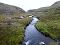
 A burn draining Geàrraidh Mhòr - geograph.org.uk - 5774608.jpg 1,600 × 1,067; 552 KB
-
 A deep cleft - geograph.org.uk - 4597606.jpg 640 × 640; 154 KB
-
 A fence ends in Loch Barabhat - geograph.org.uk - 3202857.jpg 1,600 × 1,119; 323 KB
-

-
 A house near Timsgearraidh - geograph.org.uk - 4747925.jpg 640 × 480; 104 KB
-
 A jumble of rocks on Laibheal a Tuath - geograph.org.uk - 5702994.jpg 1,024 × 751; 187 KB
-
 A lonely rowan by Loch Ceann Hulabhig - geograph.org.uk - 4130838.jpg 1,024 × 751; 198 KB
-
 A pretty lochan - geograph.org.uk - 3488321.jpg 800 × 600; 169 KB
-
 A raw day at Dùn Chàrlabhaigh - geograph.org.uk - 4130858.jpg 1,024 × 669; 142 KB
-
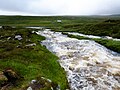
 A river tumbles down to Uig Bay - geograph.org.uk - 2340696.jpg 1,024 × 659; 174 KB
-
 A rocky buttress contains Tràigh na Beirigh - geograph.org.uk - 3202834.jpg 1,600 × 1,200; 273 KB
-
 A small bridge on the B8011 - geograph.org.uk - 3061754.jpg 5,184 × 3,456; 4.35 MB
-
 A small gap between rocks on the moorland - geograph.org.uk - 3188376.jpg 4,000 × 3,000; 6.56 MB
-
 A steep drop to Bhaltos and Pabaigh Mòr - geograph.org.uk - 6413486.jpg 1,600 × 963; 388 KB
-
 A typical view on Lewis - geograph.org.uk - 3488332.jpg 800 × 600; 168 KB
-
 A view over Loch Barraglom - geograph.org.uk - 4758364.jpg 640 × 480; 103 KB
-
 A View Towards Teinnasval - geograph.org.uk - 3682089.jpg 2,560 × 1,920; 2.75 MB
-
 A' Bheirigh - geograph.org.uk - 4229768.jpg 1,600 × 1,200; 570 KB
-
 A' Bheirigh - geograph.org.uk - 5519276.jpg 640 × 427; 94 KB
-
 A' Bheirigh from Suaineabhal - geograph.org.uk - 3188486.jpg 3,994 × 1,720; 4.68 MB
-
 A858 by Cleit Aulaidh - geograph.org.uk - 3052884.jpg 5,184 × 3,456; 3.65 MB
-
 A858 crosses moorland near Siadar - geograph.org.uk - 3286114.jpg 1,600 × 995; 328 KB
-
 Abandoned church at Uig - geograph.org.uk - 5902380.jpg 640 × 480; 277 KB
-
 Abandoned croft house near Lundal - geograph.org.uk - 4018010.jpg 1,439 × 957; 1.16 MB
-
 Abhainn an Ath' Dheirg - geograph.org.uk - 5901853.jpg 640 × 480; 301 KB
-
 Abhainn Charlabhaigh - geograph.org.uk - 5145537.jpg 640 × 480; 63 KB
-
 Abhainn Chàrlabhaigh - geograph.org.uk - 4762485.jpg 640 × 480; 214 KB
-
 Abhainn Chàrlabhaigh and Pentland Road - geograph.org.uk - 3473625.jpg 3,264 × 2,448; 3.29 MB
-
 Abhainn Chàrlabhaigh, Càrlabhagh - geograph.org.uk - 4229743.jpg 1,600 × 1,200; 693 KB
-
 Abhainn Dearg - Red River Distillery - geograph.org.uk - 2649905.jpg 2,560 × 1,920; 2.35 MB
-
 Abhainn Dearg bridge - geograph.org.uk - 5901856.jpg 640 × 480; 310 KB
-
 Abhainn Dearg Distillery - geograph.org.uk - 2649889.jpg 2,560 × 1,920; 2.36 MB
-
 Abhainn Dearg Distillery - geograph.org.uk - 3061830.jpg 5,056 × 3,371; 5.12 MB
-
 Abhainn Dearg Distillery - geograph.org.uk - 5517927.jpg 640 × 427; 100 KB
-
 Abhainn Dearg Distillery - geograph.org.uk - 5901847.jpg 640 × 480; 299 KB
-
 Abhainn Dearg Distillery.jpg 5,141 × 3,210; 4.48 MB
-
 Abhainn Dearg Road Bridge - geograph.org.uk - 4756113.jpg 640 × 480; 221 KB
-
 Abhainn Dearg Road End - geograph.org.uk - 2649897.jpg 2,560 × 1,920; 2.34 MB
-
 Abhainn Ghriomarstaidh (Grimersta River) - geograph.org.uk - 2427921.jpg 640 × 427; 434 KB
-
 Abhainn Ghriomarstaidh (Grimersta River) - geograph.org.uk - 2427925.jpg 640 × 427; 373 KB
-
 Abhainn Langadail - geograph.org.uk - 2012930.jpg 640 × 480; 129 KB
-
 Abhainn Mhòr a' Ghlinne Ruaidh - geograph.org.uk - 5775678.jpg 1,600 × 1,067; 386 KB
-
 Abhainn Morsgail - geograph.org.uk - 1905418.jpg 800 × 640; 117 KB
-
 Abhainn na Muilne - geograph.org.uk - 2672064.jpg 1,600 × 1,200; 564 KB
-
 Abhainn Ruadh - geograph.org.uk - 3281201.jpg 1,600 × 1,200; 720 KB
-
 Abhainn Stocaill - geograph.org.uk - 3685298.jpg 2,560 × 1,920; 2.55 MB
-
 Abhainn Thabhsaigh runs down to Ceann Loch Reasort - geograph.org.uk - 5720963.jpg 4,000 × 3,000; 2.41 MB
-
 Abhainn Uasaig - geograph.org.uk - 5774603.jpg 1,600 × 1,067; 523 KB
-
 Above Geodha nan Uan - geograph.org.uk - 2641302.jpg 2,560 × 1,920; 2.29 MB
-

-
 Achmore, towards Loch Ganvich - geograph.org.uk - 3283758.jpg 640 × 480; 62 KB
-
 Aftermath of a windy bin day - geograph.org.uk - 3474018.jpg 3,264 × 2,448; 2.59 MB
-
 Aineabhal Summit Cairn - geograph.org.uk - 3683274.jpg 2,560 × 1,920; 3.18 MB
-
 Aird Feinis - geograph.org.uk - 2440367.jpg 640 × 480; 410 KB
-
 Aird Feinis - geograph.org.uk - 2440483.jpg 640 × 480; 535 KB
-
 Aird Feinis - geograph.org.uk - 2440513.jpg 640 × 476; 392 KB
-
 Aird Feinis - geograph.org.uk - 3084923.jpg 640 × 427; 74 KB
-
 Aird Meinish - geograph.org.uk - 3280628.jpg 1,600 × 1,082; 411 KB
-
 Aird Mhangarstadh - geograph.org.uk - 2440349.jpg 640 × 480; 482 KB
-
 Aird Mhangarstaidh - geograph.org.uk - 4392942.jpg 640 × 480; 79 KB
-
 Aird Mheadhonach - geograph.org.uk - 4229919.jpg 1,600 × 1,200; 779 KB
-
 Aird Mheadhonach - geograph.org.uk - 4229944.jpg 1,600 × 1,200; 705 KB
-
 Aird Mòr Mangarstadh - geograph.org.uk - 2440259.jpg 640 × 480; 489 KB
-
 Aird Uig - geograph.org.uk - 3274877.jpg 1,600 × 1,200; 498 KB
-
 Aird Uig - geograph.org.uk - 3274879.jpg 1,600 × 1,200; 444 KB
-
 Airighean Bo Nighean Mhuirich - geograph.org.uk - 5098490.jpg 640 × 379; 82 KB
-
 Airighean Tighe Dhubastail - geograph.org.uk - 5099409.jpg 640 × 355; 95 KB
-
 Allt Hatasaidh reaching the Atlantic - geograph.org.uk - 5774683.jpg 1,600 × 1,067; 399 KB
-
 Allt Leatha - geograph.org.uk - 4566801.jpg 640 × 479; 125 KB
-
 Allt na Muilne drains into Loch Griomarstadh - geograph.org.uk - 5723095.jpg 4,000 × 3,000; 2.14 MB
-
 An Isle of Lewis Berserker - geograph.org.uk - 5922284.jpg 480 × 640; 314 KB
-
 Ancient fuel, modern packaging - geograph.org.uk - 4989709.jpg 3,264 × 2,448; 4.76 MB
-
 Approaching Bostadh Iron Age Village - geograph.org.uk - 2647212.jpg 1,461 × 1,000; 1.3 MB
-
 Approaching Cairisiadar on the B8011 - geograph.org.uk - 5860243.jpg 1,024 × 768; 391 KB
-
 At the end of the road south of Mealasta - geograph.org.uk - 4752854.jpg 640 × 480; 158 KB
-
 At the Scallop Shack - geograph.org.uk - 5922224.jpg 640 × 480; 344 KB
-
 Axis of the Calanais Stone Circle - geograph.org.uk - 2296746.jpg 1,200 × 788; 298 KB
-
 B8011 cut through the hillside - geograph.org.uk - 3061277.jpg 5,184 × 3,456; 4.05 MB
-

-
 Baile na Cille - geograph.org.uk - 2648152.jpg 2,560 × 1,920; 2 MB
-
 Baile-na-Cille - geograph.org.uk - 2648164.jpg 2,560 × 1,920; 2.3 MB
-
 Baile-na-Cille Guesthouse in 1986 - geograph.org.uk - 2746235.jpg 1,200 × 777; 225 KB
-
 Bathtub, Mhangarstadh, Isle of Lewis - geograph.org.uk - 6503785.jpg 1,946 × 1,459; 655 KB
-
 Bay Below Sron na Faing - geograph.org.uk - 2648225.jpg 2,560 × 1,920; 2.4 MB
-
 Beach at Bostadh - geograph.org.uk - 5106930.jpg 3,264 × 2,448; 3.43 MB
-

-
 Beach north of Bhalasaigh - geograph.org.uk - 2602433.jpg 1,600 × 1,063; 552 KB
-
 Bealach a' Sgail - geograph.org.uk - 2641493.jpg 2,560 × 1,920; 2.44 MB
-
 Bealach a' Sgail at Bostadh - geograph.org.uk - 5106997.jpg 3,264 × 2,448; 4.65 MB
-
 Beannan Beag - geograph.org.uk - 2441355.jpg 480 × 640; 530 KB
-
 Beanntainn Uige - geograph.org.uk - 1905625.jpg 800 × 600; 51 KB
-
 Beehive Cell at Gearhaidh Milebhat - geograph.org.uk - 4566769.jpg 640 × 480; 99 KB
-
 Beehive dwellings below Sgalabhal - geograph.org.uk - 5105739.jpg 640 × 480; 127 KB
-
 Beehive house or Bothan - geograph.org.uk - 2707010.jpg 2,552 × 1,305; 665 KB
-
 Beer Garden at the Doune Braes - geograph.org.uk - 4017850.jpg 1,439 × 957; 969 KB
-
 Beinn an Toib - geograph.org.uk - 2641422.jpg 2,560 × 1,920; 2.4 MB
-
 Beinn na Bheirigh - geograph.org.uk - 1964942.jpg 2,048 × 1,536; 1.01 MB
-
 Beinn Scarastaigh from near Lundale - geograph.org.uk - 5114233.jpg 3,264 × 2,448; 5.61 MB
-
 Ben Borrowston - geograph.org.uk - 4185631.jpg 2,560 × 1,920; 2.25 MB
-
 Ben Laimishader - geograph.org.uk - 4185621.jpg 2,560 × 1,920; 2.39 MB
-
 Ben Mohal (Beinn Mothal) - geograph.org.uk - 3693751.jpg 2,560 × 1,920; 3.56 MB
-
 Ben Mohal (Beinn Mothal) Cairn - geograph.org.uk - 3693745.jpg 2,560 × 1,920; 2.59 MB
-
 Ben Mohal (Beinn Mothal) Summit - geograph.org.uk - 3693757.jpg 2,560 × 1,920; 3.24 MB
-
 Benisval Cairn and Trig Point - geograph.org.uk - 3668880.jpg 2,560 × 1,920; 2.76 MB
-
 Benview - geograph.org.uk - 5896244.jpg 640 × 480; 272 KB
-
 Berie Sands Caravan Park - geograph.org.uk - 2649969.jpg 2,560 × 1,920; 2.05 MB
-
 Bernera Bridge plaque - geograph.org.uk - 1965167.jpg 1,536 × 2,048; 688 KB
-
 Berserker at Uig - geograph.org.uk - 2648175.jpg 1,920 × 2,560; 2.45 MB
-
 Berserker, Red River Distillery - geograph.org.uk - 2649919.jpg 2,560 × 1,920; 2.06 MB
-
 Beside the Pentland Road - geograph.org.uk - 4763089.jpg 640 × 480; 196 KB
-
 Bhaltos - Valtos - geograph.org.uk - 2649946.jpg 2,560 × 1,920; 2.33 MB
-
 Bhaltos village - geograph.org.uk - 5922270.jpg 640 × 480; 293 KB
-
 Birdwatchers on the pier at Bhaltos - geograph.org.uk - 5922255.jpg 640 × 480; 272 KB
-
 Black House - geograph.org.uk - 3637740.jpg 3,648 × 2,736; 3.87 MB
-
 Blackhouse at Na Gearannan - geograph.org.uk - 3473611.jpg 3,264 × 2,448; 5.37 MB
-
 Blackhouse at Na Gearrannan - geograph.org.uk - 2157096.jpg 800 × 532; 141 KB
-
 Blackhouse base at Carloway - geograph.org.uk - 4974505.jpg 3,264 × 2,448; 6.16 MB
-
 Blackhouse Museum, Gearrannan - geograph.org.uk - 2631932.jpg 2,560 × 1,920; 1.97 MB
-
 Blackhouse Village at Garenin - geograph.org.uk - 5900198.jpg 640 × 480; 248 KB
-
 Blackhouse Village Na Gearrannan - geograph.org.uk - 1922797.jpg 3,648 × 2,736; 2.2 MB
-
 Blackhouse Village Na Gearrannan - geograph.org.uk - 1922813.jpg 3,648 × 2,736; 2.12 MB
-
 Blackhouse Village Na Gearrannan - geograph.org.uk - 1922825.jpg 3,648 × 2,736; 2.18 MB
-
 Blackhouse Village, Gearrannan - geograph.org.uk - 2631091.jpg 2,560 × 1,920; 2.36 MB
-
 Blackhouses at Na Gearrannan - geograph.org.uk - 2025857.jpg 640 × 427; 97 KB
-
 Blanket bog by the Rathad a' Phentland - geograph.org.uk - 3525331.jpg 3,264 × 2,448; 5.44 MB
-

-
 Blooming Thistle - geograph.org.uk - 2648191.jpg 2,560 × 1,920; 1.93 MB
-
 Blue boat on the slipway at Bhaltos - geograph.org.uk - 3086405.jpg 640 × 427; 80 KB
-
 Boat on the shore of Tòb Liongaim - geograph.org.uk - 5896021.jpg 640 × 480; 294 KB
-
 Boats at Iarsiadar - geograph.org.uk - 5113454.jpg 3,264 × 2,448; 5.46 MB
-
 Boats moored to pontoon at Miabhaig - geograph.org.uk - 3086437.jpg 640 × 427; 50 KB
-
 Boats tied up at the pontoon at Miabhaig - geograph.org.uk - 5774643.jpg 1,600 × 1,067; 255 KB
-

-
 Bog beside the Pentland Road - geograph.org.uk - 4762495.jpg 640 × 480; 204 KB
-
 Bog pool at Cnoc an Fheòir - geograph.org.uk - 5774657.jpg 1,600 × 1,067; 442 KB
-
 Boggy and rocky - geograph.org.uk - 3488343.jpg 800 × 600; 269 KB
-
 Borranais a Muigh - geograph.org.uk - 2648144.jpg 2,560 × 1,920; 2.02 MB
-
 Bosta - Bostadh - geograph.org.uk - 2641510.jpg 2,560 × 1,920; 2.34 MB
-
 Bosta Beach - geograph.org.uk - 1917313.jpg 640 × 358; 54 KB
-
 Bosta iron-age house - geograph.org.uk - 2183889.jpg 1,440 × 810; 488 KB
-
 Bostadh Beach - geograph.org.uk - 2294054.jpg 1,200 × 769; 277 KB
-
 Bostadh Beach - geograph.org.uk - 5895880.jpg 640 × 480; 277 KB
-
 Bostadh Iron Age House - geograph.org.uk - 2031953.jpg 3,648 × 2,736; 4.36 MB
-
 Bostadh Iron Age House - geograph.org.uk - 4990022.jpg 3,264 × 2,448; 4.67 MB
-
 Bostadh Iron Age Settlement - geograph.org.uk - 2026002.jpg 2,961 × 1,974; 1 MB
-
 Bostadh Iron Age Village - geograph.org.uk - 2641570.jpg 2,560 × 1,920; 2.3 MB
-

-
 Bothan a' Chlair Mhoir - geograph.org.uk - 5880675.jpg 640 × 299; 56 KB
-
 Bothy, Loch na Muilne - geograph.org.uk - 2641678.jpg 2,560 × 1,920; 2.35 MB
-
 Boulder Beside Estate Track - geograph.org.uk - 3685326.jpg 2,560 × 1,920; 3.03 MB
-
 Boulder on North Shore of Loch Reasort - geograph.org.uk - 4533008.jpg 3,074 × 2,304; 2.66 MB
-
 Boulder-strewn Hillside - geograph.org.uk - 2440397.jpg 640 × 480; 489 KB
-
 Branch of the Pentland Road to Breascleit - geograph.org.uk - 4663049.jpg 1,800 × 1,013; 1.18 MB
-
 Breacleit church and war memorial - geograph.org.uk - 2646817.jpg 1,555 × 1,000; 1.17 MB
-
 Breacleit Church, Great Bernera - geograph.org.uk - 1522837.jpg 640 × 426; 233 KB
-
 Breacleit explosion sunset - geograph.org.uk - 3101700.jpg 1,600 × 1,200; 223 KB
-
 Breacleit, Bernera - geograph.org.uk - 2639638.jpg 2,560 × 1,920; 2.42 MB
-
 Breakwater at Iarsiadar - geograph.org.uk - 5113441.jpg 3,264 × 2,448; 5.61 MB
-
 Bridge at Bhalasaigh - geograph.org.uk - 2610010.jpg 640 × 481; 109 KB
-
 Bridge on the road to Bhalasaigh - geograph.org.uk - 2293993.jpg 1,200 × 786; 333 KB
-
 Bridge over Abhainn Chàrlabhaigh - geograph.org.uk - 3490249.jpg 2,048 × 1,536; 801 KB
-
 Bridge over the Abhainn Mhor a' Ghlinne Ruaidh - geograph.org.uk - 5860204.jpg 1,024 × 768; 458 KB
-
 Broch at Carloway - geograph.org.uk - 3113014.jpg 640 × 425; 95 KB
-
 Broch at Doun Carloway - geograph.org.uk - 5144741.jpg 640 × 480; 59 KB
-
 Broch at Dun Carloway - geograph.org.uk - 6471919.jpg 1,799 × 1,199; 212 KB
-
 Building remains, Lundal, Isle of Lewis - geograph.org.uk - 6484466.jpg 1,946 × 1,208; 529 KB
-
 Buildings in Gearrannan Blackhouse Village - geograph.org.uk - 5859975.jpg 1,024 × 768; 366 KB
-
 Burial ground at Baile-na-Cille - geograph.org.uk - 3084997.jpg 640 × 427; 53 KB
-
 Burial ground at Bostadh - geograph.org.uk - 3087856.jpg 640 × 427; 62 KB
-
 Burial ground at Tolsta Carloway - geograph.org.uk - 4013273.jpg 1,439 × 957; 1.08 MB
-
 Burial Ground at Traigh na Cille - geograph.org.uk - 2746159.jpg 1,200 × 802; 282 KB
-
 Burn flowing into Tòb Cheannullagtob - geograph.org.uk - 5896239.jpg 640 × 480; 293 KB
-
 Bus shelter near the Tweed Mill - geograph.org.uk - 5145557.jpg 640 × 480; 58 KB
-
 Bus shelter, Miabhaig, Isle of Lewis - geograph.org.uk - 5241566.jpg 1,459 × 850; 210 KB
-
 By Loch a'Sgail, is he quite safe^ - geograph.org.uk - 1965112.jpg 2,048 × 1,536; 1.09 MB
-
 By Loch Geal - geograph.org.uk - 4758360.jpg 640 × 480; 129 KB
-
 Café in old school - geograph.org.uk - 2651131.jpg 1,333 × 1,000; 1.13 MB
-
 Cairisiadar (Carishader) - geograph.org.uk - 2427963.jpg 640 × 427; 337 KB
-
 Cairisiadar from Loch Rog - geograph.org.uk - 5723020.jpg 4,000 × 3,000; 4.66 MB
-
 Cairisiadar, croft boundaries and common grazings - geograph.org.uk - 5775662.jpg 1,600 × 1,014; 548 KB
-
 Cairn above Airigh Cleitshal, Isle of Lewis - geograph.org.uk - 5230650.jpg 1,418 × 1,094; 409 KB
-
 Cairn at the summit of Snoidibridh, Isle of Lewis - geograph.org.uk - 6177273.jpg 1,946 × 1,306; 528 KB
-
 Cairn Near Summit Of Codiunn - geograph.org.uk - 4184007.jpg 2,560 × 1,920; 1.98 MB
-
 Cairn on Aird Feinis - geograph.org.uk - 2440382.jpg 640 × 386; 360 KB
-
 Cairn on Carnan Gibegeo - geograph.org.uk - 2641439.jpg 2,560 × 1,920; 2.34 MB
-
 Cairn, Cleit na Faoghalach, Isle of Lewis - geograph.org.uk - 6184276.jpg 1,792 × 1,312; 864 KB
-
 Cairn, Druim Sandavig, Isle of Lewis - geograph.org.uk - 6205867.jpg 1,946 × 1,459; 683 KB
-
 Cairn, Druim Sandavig, Isle of Lewis - geograph.org.uk - 6205869.jpg 1,946 × 1,459; 581 KB
-
 Cairn, Snoidibridh, Isle of Lewis - geograph.org.uk - 6515635.jpg 1,636 × 1,264; 667 KB
-
 Calanais Standing Stones, Isle of Lewis - geograph.org.uk - 6499058.jpg 1,280 × 853; 338 KB
-
 Calanais Standing Stones, Lewis - geograph.org.uk - 6499053.jpg 1,280 × 853; 474 KB
-

-
 Camas Bastadh-Bostadh - geograph.org.uk - 4758302.jpg 640 × 480; 125 KB
-
 Camas Bostadh - geograph.org.uk - 5106919.jpg 3,264 × 2,448; 4.36 MB
-
 Camas na Clibhe - geograph.org.uk - 4018900.jpg 1,439 × 957; 1.04 MB
-
 Camas na h-Airde - geograph.org.uk - 3275688.jpg 1,600 × 1,200; 461 KB
-
 Camas Sanndaig - geograph.org.uk - 2602345.jpg 1,600 × 1,063; 466 KB
-
 Camas Sanndaig - geograph.org.uk - 5895779.jpg 640 × 480; 246 KB
-
 Camas Tràigh Bhoisadair - geograph.org.uk - 3202877.jpg 1,600 × 1,200; 430 KB
-
 Camas Uig Bay - geograph.org.uk - 6109668.jpg 3,648 × 2,432; 2.1 MB


_-_geograph.org.uk_-_2427921.jpg)
_-_geograph.org.uk_-_2427925.jpg)


_-_geograph.org.uk_-_3693751.jpg)
_Cairn_-_geograph.org.uk_-_3693745.jpg)
_Summit_-_geograph.org.uk_-_3693757.jpg)


_-_geograph.org.uk_-_4758404.jpg)


_-_geograph.org.uk_-_2427963.jpg)


