Category:Udny (civil parish)
Jump to navigation
Jump to search
Scottish parish in Aberdeenshire, Scotland, UK | |||||
| Upload media | |||||
| Instance of | |||||
|---|---|---|---|---|---|
| Named after |
| ||||
| Location |
| ||||
| Population |
| ||||
| Area |
| ||||
 | |||||
Media in category "Udny (civil parish)"
The following 200 files are in this category, out of 364 total.
(previous page) (next page)-
 "Eat on the Green", Udny Green - geograph.org.uk - 6213269.jpg 2,592 × 1,944; 1.32 MB
-
 "Full many a gem of purest ray serene" - geograph.org.uk - 2994375.jpg 1,600 × 1,030; 353 KB
-

-
 A glimpse of Mains of Orchardtown... - geograph.org.uk - 6324690.jpg 6,000 × 4,000; 6.1 MB
-
 A glimpse of Udny Station... - geograph.org.uk - 6544617.jpg 6,000 × 4,000; 6.28 MB
-
 A look at bridge 635 on the Formartine and Buchan Way - geograph.org.uk - 6544657.jpg 6,000 × 4,000; 6.79 MB
-
 A wetland wood - geograph.org.uk - 5639934.jpg 1,024 × 683; 483 KB
-
 A920 heading north east - geograph.org.uk - 3978744.jpg 640 × 480; 83 KB
-
 A947 Junction - geograph.org.uk - 6539506.jpg 5,184 × 3,456; 2.15 MB
-
 A947 towards Aberdeen - geograph.org.uk - 3974013.jpg 640 × 480; 58 KB
-
 Aberdeenshire country road - geograph.org.uk - 2941494.jpg 1,600 × 1,064; 425 KB
-
 Aberdeenshire country road - geograph.org.uk - 6324694.jpg 6,000 × 4,000; 7.19 MB
-
 Approaching Place Farm - geograph.org.uk - 5869569.jpg 5,184 × 3,888; 4.4 MB
-
 Approaching Udny Station - geograph.org.uk - 5640995.jpg 1,024 × 683; 350 KB
-
 Approaching Woodland - geograph.org.uk - 5869460.jpg 5,184 × 3,888; 3.97 MB
-
 Arch sculpture - geograph.org.uk - 2445641.jpg 2,272 × 1,704; 2.86 MB
-
 Auchenhuive Silos - geograph.org.uk - 6539512.jpg 5,184 × 3,456; 2.34 MB
-
 Autumn ploughing... - geograph.org.uk - 6325416.jpg 4,672 × 3,508; 4.17 MB
-
 B9000 heading east - geograph.org.uk - 3988172.jpg 640 × 480; 105 KB
-
 B9000 heading east past Tillyfar - geograph.org.uk - 3988230.jpg 640 × 480; 109 KB
-
 B9000 heading out of Pitmedden - geograph.org.uk - 3988183.jpg 640 × 480; 94 KB
-
 B9000 towards Newburgh - geograph.org.uk - 3988204.jpg 640 × 480; 59 KB
-
 B9000 towards Newburgh - geograph.org.uk - 3988211.jpg 640 × 480; 82 KB
-
 B9000 towards Newburgh - geograph.org.uk - 3988218.jpg 640 × 480; 62 KB
-
 B9000 towards Newburgh - geograph.org.uk - 3988272.jpg 640 × 480; 69 KB
-
 B9000 towards Newburgh at Logierieve - geograph.org.uk - 3988245.jpg 640 × 480; 78 KB
-
 B999 heading north - geograph.org.uk - 3978691.jpg 640 × 480; 69 KB
-
 B999 heading north - geograph.org.uk - 3978697.jpg 640 × 480; 103 KB
-
 B999 heading north - geograph.org.uk - 3978699.jpg 640 × 437; 56 KB
-
 B999 heading north - geograph.org.uk - 3978702.jpg 640 × 480; 96 KB
-
 Barley near Corthymuir - geograph.org.uk - 6562100.jpg 1,024 × 684; 282 KB
-
 Barley near Mains of Pitrichie - geograph.org.uk - 6561337.jpg 1,024 × 684; 316 KB
-
 Barley near Woodlands and Knapperna - geograph.org.uk - 6562099.jpg 1,024 × 684; 283 KB
-
 Barn, North Coullie - geograph.org.uk - 3978721.jpg 640 × 480; 68 KB
-
 Between the gates... - geograph.org.uk - 6544663.jpg 6,000 × 4,000; 6.17 MB
-
 Blackness Farm - geograph.org.uk - 1018573.jpg 640 × 361; 49 KB
-

-

-
 Bronie Burn Path - geograph.org.uk - 965063.jpg 640 × 480; 127 KB
-
 Cairnfechel Farm - geograph.org.uk - 991342.jpg 640 × 449; 85 KB
-
 Cattle and Change Hill - geograph.org.uk - 6562091.jpg 1,024 × 684; 259 KB
-
 Cattle near Tillycorthie - geograph.org.uk - 5869440.jpg 5,184 × 3,888; 4.75 MB
-
 Cattle, Woodland - geograph.org.uk - 6562094.jpg 1,024 × 684; 205 KB
-
 Changehill with mast - geograph.org.uk - 1172396.jpg 640 × 427; 45 KB
-
 Christmas trees - geograph.org.uk - 2897755.jpg 1,600 × 1,064; 318 KB
-
 Cloisterseat Farm - geograph.org.uk - 1009101.jpg 640 × 425; 41 KB
-
 Concrete Hut - geograph.org.uk - 5869579.jpg 4,854 × 3,640; 4.48 MB
-
 Corner Cottage at Bridgend. - geograph.org.uk - 995273.jpg 640 × 438; 52 KB
-
 Corthymuir farm - geograph.org.uk - 993964.jpg 640 × 427; 52 KB
-
 Cottages at Mains of Orchardton - geograph.org.uk - 1061515.jpg 640 × 427; 266 KB
-
 Coullie Farm - geograph.org.uk - 995287.jpg 640 × 427; 44 KB
-
 Coullie Woodlands - geograph.org.uk - 1018571.jpg 640 × 427; 56 KB
-
 Country churchyard - geograph.org.uk - 2941271.jpg 1,600 × 1,064; 524 KB
-
 Country cottage - geograph.org.uk - 2941277.jpg 1,600 × 1,064; 342 KB
-
 Country Junction - geograph.org.uk - 2940281.jpg 1,600 × 1,064; 448 KB
-
 Country Lane at Changehill, Aberdeenshire - geograph.org.uk - 6257418.jpg 2,400 × 1,600; 1.38 MB
-

-
 Country Road heading north - geograph.org.uk - 3988284.jpg 640 × 436; 61 KB
-
 Country road heading south west - geograph.org.uk - 3978734.jpg 640 × 480; 61 KB
-
 Country road heading west - geograph.org.uk - 3978704.jpg 640 × 480; 55 KB
-
 Country road towards West Cannahars - geograph.org.uk - 3978662.jpg 640 × 480; 100 KB
-
 County road heading north - geograph.org.uk - 3973994.jpg 640 × 480; 83 KB
-
 Crop field near Cairnfechel - geograph.org.uk - 3978722.jpg 640 × 493; 88 KB
-
 Crop field Sauchenhillock - geograph.org.uk - 3978741.jpg 640 × 492; 64 KB
-
 Crop field, Tillyfar - geograph.org.uk - 3988224.jpg 640 × 486; 68 KB
-
 Crop field, Tillyfar - geograph.org.uk - 3988238.jpg 640 × 480; 83 KB
-
 Crossing point... - geograph.org.uk - 6321403.jpg 6,000 × 4,000; 6.09 MB
-
 Distant view of Logiemuir Farm - geograph.org.uk - 6324698.jpg 6,000 × 4,000; 7.49 MB
-

-
 Disused Railway Lineside Hut, Aberdeenshire - geograph.org.uk - 6243633.jpg 2,400 × 1,600; 1.91 MB
-
 Disused railway near Tillycorthie - geograph.org.uk - 3978690.jpg 640 × 480; 95 KB
-
 Disused railway near West-town - geograph.org.uk - 3978655.jpg 480 × 640; 99 KB
-
 Drain, Udny Bridge - geograph.org.uk - 3978707.jpg 640 × 480; 92 KB
-
 Driveway Entrance at Tillygreig, Aberdeenshire - geograph.org.uk - 6257413.jpg 2,400 × 1,590; 2.5 MB
-
 Dyke and grassland - geograph.org.uk - 2731740.jpg 640 × 480; 98 KB
-
 Entrance to Hattoncrook - geograph.org.uk - 4707344.jpg 640 × 459; 97 KB
-
 Farm shop, Hattoncrook - geograph.org.uk - 6074062.jpg 5,614 × 3,670; 5.9 MB
-
 Farmland - geograph.org.uk - 962555.jpg 640 × 480; 49 KB
-
 Farmland and woodland, Gilmorton - geograph.org.uk - 3978717.jpg 640 × 463; 63 KB
-
 Farmland and woodland, Logiemuir - geograph.org.uk - 3988262.jpg 640 × 480; 74 KB
-

-
 Farmland and woodland, Tillycorthie - geograph.org.uk - 3978688.jpg 640 × 480; 91 KB
-
 Farmland Denend - geograph.org.uk - 3978705.jpg 640 × 480; 75 KB
-
 Farmland near Tillyfar - geograph.org.uk - 3988217.jpg 640 × 480; 62 KB
-
 Farmland near West-town - geograph.org.uk - 3978659.jpg 640 × 480; 55 KB
-
 Farmland off the A947 - geograph.org.uk - 3974017.jpg 640 × 480; 69 KB
-
 Farmland off the B9000 - geograph.org.uk - 3988206.jpg 640 × 480; 56 KB
-
 Farmland towards West Craig - geograph.org.uk - 3978701.jpg 640 × 480; 72 KB
-

-
 Farmland, Pettymuick - geograph.org.uk - 3978696.jpg 640 × 480; 64 KB
-
 Farmland, Udny Bridge - geograph.org.uk - 3978708.jpg 640 × 480; 88 KB
-
 Fechel Fields - geograph.org.uk - 1006262.jpg 640 × 426; 40 KB
-
 Fechel woodland - geograph.org.uk - 1006275.jpg 640 × 427; 51 KB
-
 Field by Millbank - geograph.org.uk - 2530854.jpg 3,456 × 2,304; 1.31 MB
-
 Field entrance, Bronie Bridge - geograph.org.uk - 3978726.jpg 640 × 480; 101 KB
-
 Fields near Udny Station, Aberdeenshire - geograph.org.uk - 6241902.jpg 2,400 × 1,590; 1.81 MB
-
 Fingerpost sign, Udny Green - geograph.org.uk - 2941498.jpg 1,064 × 1,600; 653 KB
-
 Footpath Junction near Udny Station, Aberdeenshire - geograph.org.uk - 6257412.jpg 2,400 × 1,590; 2.83 MB
-
 Footpath to Udny - geograph.org.uk - 5536679.jpg 4,272 × 2,848; 2.96 MB
-
 Formal Gardens at Pitmedden - geograph.org.uk - 4572777.jpg 800 × 600; 165 KB
-
 Formal Gardens at Pitmedden - geograph.org.uk - 4572781.jpg 800 × 600; 131 KB
-
 Formal Gardens at Pitmedden - geograph.org.uk - 4572784.jpg 800 × 600; 148 KB
-
 Formartine and Buchan Way - geograph.org.uk - 2731735.jpg 640 × 480; 87 KB
-
 Formartine and Buchan Way - geograph.org.uk - 2733431.jpg 640 × 480; 112 KB
-
 Formartine and Buchan Way - geograph.org.uk - 2733441.jpg 640 × 480; 105 KB
-
 Formartine and Buchan Way - geograph.org.uk - 2733491.jpg 640 × 480; 104 KB
-
 Formartine and Buchan Way - geograph.org.uk - 3042868.jpg 640 × 480; 102 KB
-
 Formartine and Buchan Way - geograph.org.uk - 3042877.jpg 640 × 480; 122 KB
-
 Formartine and Buchan Way - geograph.org.uk - 5639894.jpg 1,024 × 683; 317 KB
-
 Formartine and Buchan Way - geograph.org.uk - 5639896.jpg 1,024 × 683; 352 KB
-
 Formartine and Buchan Way - geograph.org.uk - 5639900.jpg 1,024 × 683; 346 KB
-
 Formartine and Buchan Way - geograph.org.uk - 5639931.jpg 1,024 × 683; 447 KB
-
 Formartine and Buchan way at Udny Station - geograph.org.uk - 6325447.jpg 6,000 × 4,000; 7.11 MB
-
 Formartine and Buchan Way passes Tillyeve - geograph.org.uk - 5639897.jpg 1,024 × 683; 268 KB
-
 Formartine United 3 - Brora Rangers 2 - geograph.org.uk - 5682754.jpg 1,800 × 1,012; 1.18 MB
-
 Former Christmas Tree farm near Tillygreig, Aberdeenshire - geograph.org.uk - 6257415.jpg 2,400 × 1,600; 1.85 MB
-
 Gate by Denend - geograph.org.uk - 2530875.jpg 3,456 × 2,304; 1.68 MB
-
 Going round the bend... - geograph.org.uk - 6324686.jpg 6,000 × 4,000; 6.94 MB
-
 Grannies Steppies - geograph.org.uk - 965066.jpg 640 × 480; 134 KB
-
 Grazing near Millbank - geograph.org.uk - 2530869.jpg 3,456 × 2,304; 1.86 MB
-
 Grazing, Auchenhuive - geograph.org.uk - 3973990.jpg 640 × 480; 67 KB
-
 Grazing, Hattoncrook - geograph.org.uk - 3974010.jpg 640 × 480; 88 KB
-
 Heading for Udny Station... - geograph.org.uk - 6544607.jpg 6,000 × 4,000; 6.28 MB
-
 Heading south on the Formartine and Buchan Way... - geograph.org.uk - 6544626.jpg 6,000 × 4,000; 6.46 MB
-
 Hillbrae Farm - geograph.org.uk - 3978664.jpg 640 × 480; 48 KB
-
 Hillocks Farm - geograph.org.uk - 6514552.jpg 5,184 × 3,456; 2.35 MB
-
 Hillocks Farm - geograph.org.uk - 995311.jpg 640 × 426; 26 KB
-
 Hilltop Path - geograph.org.uk - 1760994.jpg 2,304 × 3,456; 2.69 MB
-
 Horseshoe Inn, Hattoncrook - geograph.org.uk - 3973998.jpg 640 × 480; 70 KB
-
 House in Pitmedden - geograph.org.uk - 3988177.jpg 640 × 480; 74 KB
-
 Interested Local - geograph.org.uk - 5869597.jpg 4,517 × 3,387; 4.32 MB
-
 Iriewells Farm - geograph.org.uk - 981654.jpg 640 × 427; 50 KB
-
 Junction pylon - geograph.org.uk - 6722082.jpg 3,987 × 2,995; 3.59 MB
-
 Knapperna Field - geograph.org.uk - 2455113.jpg 3,456 × 2,304; 1.71 MB
-
 Lamp standard and phone in Udny Green - geograph.org.uk - 991375.jpg 447 × 640; 60 KB
-
 Leaning Pole at Linkshill - geograph.org.uk - 5869465.jpg 5,184 × 3,888; 4.74 MB
-
 Leaving Udny Green - geograph.org.uk - 6213245.jpg 2,592 × 1,944; 1.56 MB
-
 Level crossing Gate - geograph.org.uk - 5869463.jpg 3,319 × 2,489; 5.21 MB
-

-
 Light and shadow... - geograph.org.uk - 6325410.jpg 6,000 × 4,000; 5.55 MB
-
 Line Hut - geograph.org.uk - 5869659.jpg 4,496 × 3,373; 4.28 MB
-
 Line South - geograph.org.uk - 5869558.jpg 4,768 × 3,575; 3.09 MB
-
 Linkshill Crossing - geograph.org.uk - 5869466.jpg 5,184 × 3,888; 3.47 MB
-
 Lion, Pitmedden Walled Garden - geograph.org.uk - 3452717.jpg 1,600 × 1,200; 1.23 MB
-
 Little Woodlands - geograph.org.uk - 6562090.jpg 1,024 × 684; 297 KB
-
 Little Woodlands Farm - geograph.org.uk - 2455125.jpg 3,456 × 2,304; 2.21 MB
-
 Logiemuir - geograph.org.uk - 3988256.jpg 640 × 480; 56 KB
-
 Logierieve Station - geograph.org.uk - 5835031.jpg 1,024 × 768; 239 KB
-
 Logierieve Wood - geograph.org.uk - 2583610.jpg 3,456 × 2,304; 964 KB
-
 Logierieve Wood - geograph.org.uk - 3042881.jpg 640 × 480; 142 KB
-
 Long road to Smiddyhill cottages - geograph.org.uk - 6075011.jpg 4,877 × 3,660; 4.05 MB
-
 Long straight road - geograph.org.uk - 5641345.jpg 1,024 × 576; 321 KB
-

-
 Looking south-south-east to Beauty Hill - geograph.org.uk - 937486.jpg 640 × 427; 134 KB
-
 Looking toward Pitmedden Walled Garden - geograph.org.uk - 2253722.jpg 3,504 × 1,971; 4 MB
-
 Looking towards Mill of Allathan - geograph.org.uk - 1061496.jpg 640 × 427; 205 KB
-
 Lower Affleck Farm - geograph.org.uk - 2941511.jpg 1,600 × 958; 330 KB
-
 Lower Walled Garden, Pitmedden - geograph.org.uk - 3452699.jpg 1,600 × 1,200; 545 KB
-
 Mains of Dumbreck - geograph.org.uk - 981635.jpg 640 × 425; 40 KB
-
 Mains of Mosstown - geograph.org.uk - 5641351.jpg 1,024 × 576; 262 KB
-
 Mains of Orchardton - geograph.org.uk - 1061510.jpg 640 × 427; 250 KB
-
 Meilke Tillyeve Houses - geograph.org.uk - 5869734.jpg 5,184 × 3,888; 3.64 MB
-
 Mill of Allathan - geograph.org.uk - 1061499.jpg 640 × 427; 259 KB
-
 Mill Of Fechil - geograph.org.uk - 981563.jpg 640 × 449; 72 KB
-
 Mill of Fechil from the south - geograph.org.uk - 993949.jpg 640 × 427; 73 KB
-
 Milton Croft - geograph.org.uk - 5865028.jpg 3,985 × 2,657; 1.26 MB
-
 Milton of Couilie - geograph.org.uk - 1006287.jpg 427 × 640; 82 KB
-
 Milton of Dumbreck - geograph.org.uk - 981646.jpg 640 × 427; 40 KB
-
 Minor road towards Undy Green - geograph.org.uk - 3988191.jpg 640 × 480; 110 KB
-
 National Cycle Route 1 - geograph.org.uk - 3978706.jpg 640 × 480; 65 KB
-
 National Cycle Route 1 - geograph.org.uk - 3978709.jpg 640 × 480; 89 KB
-
 National Cycle Route 1 - geograph.org.uk - 3978719.jpg 640 × 480; 51 KB
-
 National Cycle Route 1 - geograph.org.uk - 3978725.jpg 640 × 480; 70 KB
-
 National Cycle Route 1 - geograph.org.uk - 3978730.jpg 640 × 480; 63 KB
-
 Newcraig a onetime farm - geograph.org.uk - 995265.jpg 640 × 427; 51 KB
-
 Newly planted trees - geograph.org.uk - 6562088.jpg 1,024 × 684; 297 KB
-
 Newseat of Dumbreck - geograph.org.uk - 981641.jpg 640 × 427; 25 KB
-
 North Affleck - geograph.org.uk - 1064673.jpg 640 × 427; 42 KB
-
 North Coullie - geograph.org.uk - 991365.jpg 640 × 427; 38 KB
-
 Oldcraig Farm - geograph.org.uk - 995252.jpg 427 × 640; 59 KB
-
 Oldcraig Steading - geograph.org.uk - 5537136.jpg 4,272 × 2,848; 2.88 MB
-

-
 Paddock by Orchardstown - geograph.org.uk - 2583590.jpg 3,456 × 2,304; 1.3 MB
-
 Pastoral scene by Tillycorthie West Lodge - geograph.org.uk - 6544645.jpg 4,404 × 3,305; 5.2 MB
-
 Path Ahead - geograph.org.uk - 5869410.jpg 5,184 × 3,888; 5.74 MB
-
 Path to Pitmedden - geograph.org.uk - 965060.jpg 480 × 640; 110 KB
-
 Pettymuick - geograph.org.uk - 3978693.jpg 640 × 480; 94 KB
-
 Pettymuick - geograph.org.uk - 6562102.jpg 1,024 × 684; 362 KB
-
 Pitmedden Bar - geograph.org.uk - 6543699.jpg 4,845 × 3,231; 2.48 MB
-
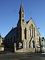 Pitmedden Church - geograph.org.uk - 3988175.jpg 480 × 640; 61 KB
-
 Pitmedden Church - geograph.org.uk - 6213240.jpg 2,592 × 1,944; 1.5 MB
-
 Pitmedden Garden - geograph.org.uk - 2948557.jpg 2,520 × 1,680; 555 KB
-
 Pitmedden Garden - geograph.org.uk - 4281705.jpg 4,854 × 2,776; 6.87 MB
-
 Pitmedden Garden - geograph.org.uk - 4281713.jpg 3,698 × 2,545; 6.89 MB
-
 Pitmedden Garden - geograph.org.uk - 4281744.jpg 4,830 × 3,161; 7.27 MB
-
 Pitmedden Garden - geograph.org.uk - 4281748.jpg 2,371 × 4,134; 6.77 MB
-
 Pitmedden Garden - geograph.org.uk - 4281751.jpg 3,302 × 3,926; 7.23 MB
-
 Pitmedden Garden - geograph.org.uk - 4312103.jpg 4,854 × 3,194; 5.49 MB
-
 Pitmedden Garden - geograph.org.uk - 4312109.jpg 4,515 × 2,910; 7.77 MB
-
 Pitmedden Garden - geograph.org.uk - 4312111.jpg 4,430 × 2,389; 6.26 MB


&filefrom=Pitmedden+Garden+-+geograph.org.uk+-+4312125.jpg#mw-category-media)