Category:USGS maps of Guam
Jump to navigation
Jump to search
Media in category "USGS maps of Guam"
The following 22 files are in this category, out of 22 total.
-
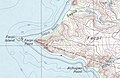 Agat USGS 2000 (Facpi Point).jpg 700 × 456; 81 KB
-
 Agat USGS 2000.jpg 3,989 × 5,000; 3.46 MB
-
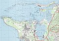 Apra Harbor USGS 2000 (cropped).jpg 2,512 × 1,754; 1,018 KB
-
 Apra Harbor USGS 2000.jpg 3,955 × 5,000; 2.61 MB
-
 Cross-sections of geology map of Guam (cropped).jpg 8,718 × 1,988; 466 KB
-
 Cross-sections of geology map of Guam.pdf 5,100 × 3,300; 57 KB
-
 Dededo USGS 2000.jpg 3,967 × 5,000; 3.07 MB
-
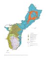
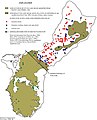
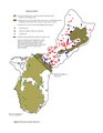
 Geologic map of Guam (cropped).jpg 4,393 × 5,621; 1.66 MB
-
 Geologic map of Guam.pdf 2,550 × 3,300; 1.72 MB
-
 Guam I13215B1 geo.jpg 8,966 × 10,747; 8.73 MB
-
 Hagåtña USGS 1975.jpg 2,371 × 1,516; 814 KB
-
 Hagåtña USGS 2000.jpg 3,970 × 5,000; 3.37 MB
-
 Inarajan USGS 2000 (cropped).jpg 750 × 500; 87 KB
-
 Inarajan USGS 2000.jpg 4,058 × 5,000; 2.38 MB
-
 Merizo USGS 2000.jpg 3,993 × 5,000; 2.17 MB
-
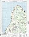
 Northwest Field USGS 2000.jpg 1,825 × 1,340; 491 KB
-
 Pati Point USGS 2000.jpg 3,992 × 5,000; 2.41 MB
-
 Ritidian Point USGS 2000 (cropped).jpg 1,742 × 1,395; 438 KB
-
 Ritidian Point USGS 2000.jpg 3,971 × 5,000; 2.73 MB
-
 Talofofo USGS 2000.jpg 4,007 × 5,000; 4.17 MB
-
 Water levels in selected wells, Guam (cropped).jpg 2,155 × 2,664; 507 KB
-
 Water levels in selected wells, Guam.pdf 1,275 × 1,650; 156 KB
.jpg)

.jpg)


.jpg)


.jpg)


.jpg)


.jpg)
.jpg)