Category:USGS Historical Topographic Maps for the Juneau Icefield area
Jump to navigation
Jump to search
| Upload media | |||||
| Instance of |
| ||||
|---|---|---|---|---|---|
| |||||
Media in category "USGS Historical Topographic Maps for the Juneau Icefield area"
The following 19 files are in this category, out of 19 total.
-
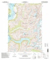
 AK Atlin A-7 354101 1960 63360 geo.pdf 2,704 × 3,262; 6.44 MB
-
 AK Atlin A-8 354103 1960 63360 geo.pdf 2,710 × 3,283; 8.73 MB
-
 AK Atlin B-8 354104 1960 63360 geo.pdf 2,556 × 3,120; 5.38 MB
-
 AK Juneau B-1 356327 1997 63360 geo.pdf 2,700 × 3,220; 14.81 MB
-
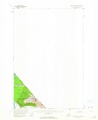
 AK Juneau B-2 353866 1949 62500 geo.pdf 2,550 × 3,087; 11.18 MB
-
 AK Juneau B-3 353867 1949 62500 geo.pdf 2,550 × 3,104; 14.81 MB
-
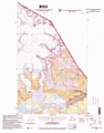
 AK Juneau C-1 356342 1960 63360 geo.pdf 2,547 × 3,106; 7.49 MB
-
 AK Juneau C-2 356344 1960 63360 geo.pdf 2,550 × 3,118; 9.8 MB
-
 AK Juneau C-3 356349 1996 63360 geo.pdf 2,700 × 3,233; 15.85 MB
-
 AK Juneau D-1 356361 1960 63360 geo.pdf 2,702 × 3,268; 6.51 MB
-
 AK Juneau D-2 356365 1997 63360 geo.pdf 2,697 × 3,220; 13.79 MB
-
 AK Juneau D-3 356366 1953 63360 geo.pdf 2,541 × 3,114; 12.29 MB
-
 AK Juneau D-4 356371 1951 63360 geo.pdf 2,550 × 3,129; 9.79 MB
-
 AK Skagway A-1 359184 1951 63360 geo.pdf 2,552 × 3,125; 12.57 MB
-
 AK Skagway B-1 359204 1951 63360 geo.pdf 2,554 × 3,127; 14.37 MB
-
 AK Taku River B-5 359498 1951 63360 geo.pdf 2,716 × 3,247; 8.1 MB
-
 AK Taku River B-6 359499 1994 63360 geo.pdf 2,700 × 3,218; 15.35 MB
-
 AK Taku River C-5 359504 1960 63360 geo.pdf 2,552 × 3,125; 5.54 MB
-
 AK Taku River C-6 359505 1995 63360 geo.pdf 2,700 × 3,435; 11.65 MB