Category:U.S. Route 385 in Texas
Jump to navigation
Jump to search
section of U.S. Numbered Highway in Texas, United States _map.svg) | |||||
| Upload media | |||||
| Instance of | |||||
|---|---|---|---|---|---|
| Location | Texas | ||||
| Transport network | |||||
| Inception |
| ||||
| Length |
| ||||
| |||||
English: Media related to U.S. Route 385 in Texas, a 441.309-mile (710.218 km) section of U.S. Highway in Texas, United States.
Subcategories
This category has only the following subcategory.
Media in category "U.S. Route 385 in Texas"
The following 19 files are in this category, out of 19 total.
-
 Big Bend National Park at Southern Terminus of 385 - panoramio.jpg 3,264 × 2,186; 1.65 MB
-
 Brewster County, TX, USA - panoramio - Idawriter (13).jpg 3,264 × 2,033; 1.35 MB
-
 Brewster County, TX, USA - panoramio - Idawriter (2).jpg 3,264 × 1,991; 1.26 MB
-
 Brewster County, TX, USA - panoramio - Idawriter (4).jpg 3,176 × 1,649; 1.04 MB
-
 Brewster County, TX, USA - panoramio - Idawriter (8).jpg 3,264 × 1,953; 1.22 MB
-
 Brewster County, TX, USA - panoramio - Idawriter (9).jpg 1,944 × 1,235; 579 KB
-
 Brewster County, TX, USA - panoramio.jpg 2,762 × 2,023; 1.17 MB
-
 Magnolia Station, Vega, TX IMG 4908.JPG 4,000 × 3,000; 2.71 MB
-
 Santiago Peak - panoramio.jpg 3,214 × 2,038; 1.41 MB
-
 SH 385 at SW 5000 - panoramio (1).jpg 4,320 × 3,240; 5.04 MB
-
 SH 385 at SW 5000 - panoramio.jpg 4,320 × 3,240; 5.11 MB
-
 Sign for Santiago Peak - panoramio.jpg 3,264 × 2,160; 1.35 MB
-
 Sign to Cal Farley's Boys Ranch IMG 4921.JPG 4,000 × 3,000; 3.21 MB
-
 U.S. Highway 385 in Texas Panhandle IMG 4915.JPG 4,000 × 3,000; 2.79 MB
-
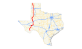 US 385 (TX) map.svg 870 × 516; 538 KB
-
 US 385 Texas 1926.svg 1,485 × 1,440; 32 KB
-
 US67 US385 North - Crane County Line Sign (45628395092).jpg 2,400 × 1,600; 1.9 MB
-
 US67 US385 North - Crockett County Line (43861009770).jpg 2,400 × 1,600; 1.83 MB
-
 US67 US385 North - Upton County Line Sign (43861010740).jpg 2,400 × 1,600; 1.95 MB

.jpg)
.jpg)
.jpg)
.jpg)
.jpg)


.jpg)


.jpg)
.jpg)
.jpg)