Category:U.S. Route 385 in Nebraska
Jump to navigation
Jump to search
section of U.S. Numbered Highway in Nebraska, United States _map.svg) | |||||
| Upload media | |||||
| Instance of | |||||
|---|---|---|---|---|---|
| Location | Nebraska | ||||
| Transport network |
| ||||
| Owned by | |||||
| Maintained by | |||||
| Inception |
| ||||
| Length |
| ||||
| |||||
Subcategories
This category has only the following subcategory.
Media in category "U.S. Route 385 in Nebraska"
The following 13 files are in this category, out of 13 total.
-
 Boxbuttecounty.png 2,617 × 2,013; 840 KB
-
 Chappell, Nebraska Second Street.jpg 1,001 × 719; 95 KB
-
 Dawes County.pdf 1,275 × 1,650; 9.34 MB
-
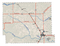
 Detailed map of Chadron, Nebraska.png 575 × 425; 16 KB
-
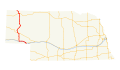 US 385 (NE) map.svg 1,180 × 688; 267 KB
-
 US30 East - NE17F Link South to I-80 Signs (48710821982).jpg 3,600 × 2,400; 2.91 MB
-
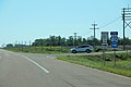
 US30 East - US385 South to I-80 Signs (48710822297).jpg 3,600 × 2,400; 2.96 MB
-
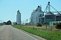 US30 East US385 South - Chappell Nebraska (48710326608).jpg 3,600 × 2,400; 3.15 MB
-
 US30 East US385 South - Deuel County (48710659296).jpg 3,600 × 2,400; 2.74 MB
-
 US30 East US385 South - Lincoln Highway Sign (48710659016).jpg 3,600 × 2,400; 2.54 MB
-
 US30 East US385 South - NE17E Link to I-80 Sign (48710821567).jpg 3,600 × 2,400; 2.63 MB
-
 US30 East US385 South Signs (48710658926).jpg 3,600 × 2,400; 2.93 MB
-
 US385 North - US30 East US385 South Right (48710325828).jpg 3,600 × 2,400; 3.13 MB


.jpg)
.jpg)
.jpg)
.jpg)
.jpg)
.jpg)
.jpg)
.jpg)