Category:Trowell
Jump to navigation
Jump to search
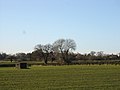
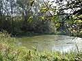
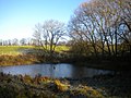
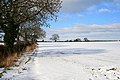
English: Trowell is a village and civil parish in Nottinghamshire, England. It lies a few miles west of Nottingham, in the borough of Broxtowe. According to the 2001 census it had a population of 2,568
village and civil parish in Nottinghamshire, England, UK  | |||||
| Upload media | |||||
| Instance of | |||||
|---|---|---|---|---|---|
| Location | Broxtowe, Nottinghamshire, East Midlands, England | ||||
| Population |
| ||||
 | |||||
Subcategories
This category has the following 2 subcategories, out of 2 total.
H
- St Helen's Church, Trowell (7 F)
T
- Trowell Services (21 F)
Media in category "Trowell"
The following 200 files are in this category, out of 240 total.
(previous page) (next page)-
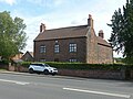 4 Nottingham Road, Trowell.jpg 1,280 × 960; 404 KB
-
 A choice of public right of way - geograph.org.uk - 809502.jpg 640 × 427; 113 KB
-
 A Future (for^) Erewash - geograph.org.uk - 832426.jpg 640 × 427; 284 KB
-
 A glimpse of the hill by Grange Wood - geograph.org.uk - 809732.jpg 640 × 427; 118 KB
-
 A6007 - geograph.org.uk - 4303231.jpg 640 × 430; 65 KB
-
 A609 - Trowell Moor - geograph.org.uk - 5444763.jpg 1,280 × 851; 391 KB
-
 Abandoned section of Nottingham Canal - geograph.org.uk - 4484709.jpg 1,280 × 960; 1.22 MB
-
 Above the Erewash Valley near Trowell - geograph.org.uk - 616353.jpg 640 × 474; 96 KB
-
 Along the Nottingham Canal bridleway - geograph.org.uk - 804499.jpg 640 × 427; 133 KB
-
 Approaching Grange Wood - geograph.org.uk - 804492.jpg 640 × 427; 126 KB
-
 Approaching Shaw's Plantation - geograph.org.uk - 2881735.jpg 4,320 × 3,240; 4.24 MB
-
 Arable land near Moor Farm - geograph.org.uk - 1767029.jpg 640 × 480; 133 KB
-
 Ashlands, Bilborough Road - geograph.org.uk - 3902747.jpg 1,280 × 930; 300 KB
-
 Balloon Wood Crossroads - geograph.org.uk - 6451927.jpg 4,032 × 3,024; 5.83 MB
-
 Before the rush - geograph.org.uk - 3857038.jpg 1,024 × 768; 107 KB
-
 Bilborough Road - geograph.org.uk - 3902759.jpg 1,280 × 960; 485 KB
-
 Blue door - geograph.org.uk - 4484029.jpg 1,280 × 960; 1.45 MB
-
 Boundary marker, Bilborough Road - geograph.org.uk - 3902752.jpg 1,280 × 960; 595 KB
-
 Brick bridge across the railway - geograph.org.uk - 761038.jpg 640 × 427; 305 KB
-

-

-
 Bridge on disused Nottingham Canal - geograph.org.uk - 2740668.jpg 1,024 × 768; 247 KB
-
 Bridge over disused Nottingham Canal - geograph.org.uk - 4483997.jpg 1,280 × 960; 1.63 MB
-
 Bridge over former Nottingham Canal, Trowell - geograph.org.uk - 4292396.jpg 1,024 × 768; 244 KB
-
-
 Bridge Over the Nottingham Canal - geograph.org.uk - 1013944.jpg 640 × 480; 59 KB
-
 Bridge over the Nottingham Canal - geograph.org.uk - 6273844.jpg 1,024 × 768; 241 KB
-
 Bridge over the railway - geograph.org.uk - 6454408.jpg 4,032 × 3,024; 5.86 MB
-
 Bridleway between Trowell Moor and Cossall - geograph.org.uk - 2881918.jpg 4,320 × 3,240; 3.25 MB
-

-
 Bridleway Leading From Trowell Road - geograph.org.uk - 942229.jpg 640 × 480; 53 KB
-
 Bridleway over Trowell Moor - geograph.org.uk - 5310543.jpg 1,280 × 851; 513 KB
-
 Bridleway Sign - geograph.org.uk - 1160463.jpg 640 × 427; 482 KB
-
 Bridleway south of Oldmoor Wood (3) - geograph.org.uk - 4907574.jpg 1,024 × 768; 215 KB
-
 Bus stop on Bilborough Road. (A6002) - geograph.org.uk - 5033070.jpg 640 × 480; 76 KB
-
 By the Nottingham Canal - geograph.org.uk - 5570574.jpg 1,024 × 768; 1.07 MB
-
 Causeway Bridge - geograph.org.uk - 6454386.jpg 4,032 × 3,024; 6.08 MB
-
 Chloe's Lido - geograph.org.uk - 4479037.jpg 800 × 533; 196 KB
-

-
 Cossall Road near the Nottingham Canal - geograph.org.uk - 1838174.jpg 640 × 480; 108 KB
-
 Cossall Road, Trowell - geograph.org.uk - 1838150.jpg 640 × 480; 68 KB
-
 Cossall Road, Trowell - geograph.org.uk - 1838152.jpg 640 × 480; 51 KB
-
 Cossall Road, Trowell - geograph.org.uk - 1838160.jpg 640 × 480; 44 KB
-
 Countryside near Trowell - geograph.org.uk - 620799.jpg 640 × 480; 87 KB
-
 Crop of maize - geograph.org.uk - 4303237.jpg 640 × 430; 68 KB
-
 Derelict lock gates east of Trowell - geograph.org.uk - 4292346.jpg 1,024 × 768; 286 KB
-

-
 Disused Nottingham Canal - geograph.org.uk - 6454383.jpg 4,032 × 3,024; 5.34 MB
-
 Down the Robin Hood Way - geograph.org.uk - 1160689.jpg 640 × 427; 264 KB
-
 Entering Derbyshire on the M1 motorway - geograph.org.uk - 4048349.jpg 1,600 × 1,378; 1.06 MB
-
 Entering Derbyshire, M1 - geograph.org.uk - 4682314.jpg 640 × 357; 25 KB
-
 Entering Trowell over Boundary Brook - geograph.org.uk - 1838133.jpg 640 × 480; 55 KB
-
 Farmland north of Stapleford - geograph.org.uk - 5033055.jpg 640 × 374; 47 KB
-
 Farmland, Meadow Farm - geograph.org.uk - 4303227.jpg 640 × 430; 46 KB
-
 Field near Trowell - geograph.org.uk - 3309369.jpg 1,024 × 768; 110 KB
-
 Field of maize - geograph.org.uk - 4303236.jpg 640 × 430; 75 KB
-
 Fields bounding Trowell Service Area - geograph.org.uk - 4858292.jpg 1,500 × 1,125; 1.48 MB
-
 Fields east of the M1 near Trowell - geograph.org.uk - 4292318.jpg 1,024 × 768; 119 KB
-

-
 Footpath and Bridge over the Nottingham Canal - geograph.org.uk - 6273830.jpg 1,024 × 768; 370 KB
-
 Footpath by the disused Nottingham Canal - geograph.org.uk - 5784514.jpg 1,024 × 683; 257 KB
-
 Footpath Junction on Trowell Moor, Nottinghamshire - geograph.org.uk - 6168969.jpg 4,928 × 3,264; 2.33 MB
-
 Footpath on Trowell Moor, Nottinghamshire - geograph.org.uk - 6356678.jpg 4,928 × 3,264; 2.26 MB
-
 Footpath Sign in the trees - geograph.org.uk - 761393.jpg 640 × 427; 348 KB
-
 Footpath sign near Swansea Bridge - geograph.org.uk - 2911541.jpg 427 × 640; 107 KB
-
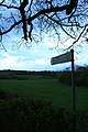
 Footpath signpost near Trowell - geograph.org.uk - 620801.jpg 480 × 640; 124 KB
-
 Footpath towards Ilkeston north of Trowell - geograph.org.uk - 4292923.jpg 1,024 × 768; 404 KB
-
 Former Nottingham Canal - geograph.org.uk - 6454373.jpg 4,032 × 3,024; 6.66 MB
-
 Former Nottingham Canal passing Grange Wood (1) - geograph.org.uk - 4292922.jpg 1,024 × 768; 284 KB
-
 Former Nottingham Canal passing Grange Wood (2) - geograph.org.uk - 4292924.jpg 1,024 × 768; 303 KB
-

-
 Gated field, Shortwood Farm - geograph.org.uk - 5784547.jpg 1,024 × 683; 274 KB
-

-
 Grange Wood - geograph.org.uk - 804508.jpg 427 × 640; 145 KB
-
 Grange Wood near Trowell - geograph.org.uk - 804506.jpg 640 × 427; 145 KB
-
 House Across The Fields - geograph.org.uk - 1013954.jpg 640 × 480; 63 KB
-
 Houses on Trowell Road - geograph.org.uk - 6454414.jpg 4,032 × 3,024; 3.84 MB
-
 In Grange Wood - geograph.org.uk - 804503.jpg 640 × 427; 168 KB
-
 Industrial unit, Trowell - geograph.org.uk - 3608398.jpg 640 × 480; 46 KB
-
 Is that a llama over there^ - geograph.org.uk - 4484015.jpg 1,280 × 960; 1.39 MB
-
-
 Lonely Tree Across a Snowy Field - geograph.org.uk - 1160472.jpg 427 × 640; 158 KB
-
 Long thin gardens, Ilkeston Rd - geograph.org.uk - 4303230.jpg 640 × 430; 58 KB
-
 Lorry park at Trowell service station - geograph.org.uk - 3309379.jpg 1,024 × 768; 122 KB
-
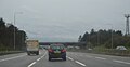
 M1 at Trowell - geograph.org.uk - 5547305.jpg 640 × 480; 375 KB
-
 M1 crossing of the Nottingham Canal - geograph.org.uk - 4292383.jpg 1,024 × 768; 316 KB
-
 M1 Motorway - geograph.org.uk - 3074647.jpg 1,024 × 682; 181 KB
-
 M1 near Trowell - geograph.org.uk - 620798.jpg 640 × 480; 87 KB
-
 M1, southbound - geograph.org.uk - 4682311.jpg 640 × 301; 24 KB
-
 M1, southbound carriageway - geograph.org.uk - 4303234.jpg 640 × 430; 48 KB
-
 M1, southbound in the rain - geograph.org.uk - 4682165.jpg 640 × 333; 22 KB
-

-
 Meadow Farm - geograph.org.uk - 4303225.jpg 640 × 430; 45 KB
-
 Meadow Farm - geograph.org.uk - 4303226.jpg 640 × 430; 47 KB
-
 Mobile telephone mast near Shortwood Farm - geograph.org.uk - 5784551.jpg 683 × 1,024; 243 KB
-
 Moor Farm - geograph.org.uk - 1766987.jpg 640 × 480; 120 KB
-
 Moor Farm, Trowell Moor - geograph.org.uk - 1160674.jpg 640 × 427; 254 KB
-
 Northbound M1 at Trowell Services - geograph.org.uk - 5547301.jpg 640 × 480; 402 KB
-
 Nottingham - Sheffield line at Stapleford - geograph.org.uk - 4483988.jpg 1,280 × 955; 1.31 MB
-
 Nottingham Canal - geograph.org.uk - 6454393.jpg 4,032 × 3,024; 6.15 MB
-
 Nottingham Canal Bridge - geograph.org.uk - 761382.jpg 640 × 427; 260 KB
-
 Nottingham Canal Bridge - geograph.org.uk - 761386.jpg 405 × 640; 294 KB
-
 Nottingham Canal east of Trowell - geograph.org.uk - 4292332.jpg 1,024 × 768; 240 KB
-
 Nottingham Canal Information Board - geograph.org.uk - 761041.jpg 640 × 427; 216 KB
-
 Nottingham Canal Path - geograph.org.uk - 2634477.jpg 1,280 × 856; 323 KB
-
 Nottingham Canal, near Trowell - geograph.org.uk - 2633205.jpg 1,280 × 856; 257 KB
-
 Nottingham Canal, Trowell - geograph.org.uk - 2633444.jpg 1,280 × 856; 328 KB
-
 Nottingham Canal, Trowell - geograph.org.uk - 2633848.jpg 1,280 × 856; 360 KB
-
 Nottingham Road - geograph.org.uk - 5784537.jpg 1,024 × 683; 236 KB
-
 Nottingham Road, Trowell - geograph.org.uk - 1838148.jpg 640 × 480; 43 KB
-
 Off the Motorway - geograph.org.uk - 3857049.jpg 1,024 × 768; 156 KB
-
 Once the Nottingham Canal - geograph.org.uk - 5570601.jpg 1,024 × 768; 1.29 MB
-
 Overgrown Nottingham Canal - geograph.org.uk - 4484027.jpg 1,280 × 960; 1.4 MB
-
 Overlooking Nottingham - geograph.org.uk - 1767057.jpg 640 × 480; 138 KB
-
 Partly frozen Nottingham Canal south of Cossall - geograph.org.uk - 4292925.jpg 1,024 × 768; 198 KB
-
 Passing Trowell Services on the M1 - geograph.org.uk - 2843219.jpg 800 × 596; 81 KB
-
 Path in Grange Wood near Trowell - geograph.org.uk - 6273779.jpg 1,024 × 768; 291 KB
-
 Path to Field Farm - geograph.org.uk - 6454388.jpg 4,032 × 3,024; 6.39 MB
-
 Pedestrian Bridge Across M1 at Trowell Services - geograph.org.uk - 5895378.jpg 1,024 × 747; 130 KB
-
 Pillbox on Trowell Moor - geograph.org.uk - 1067907.jpg 640 × 480; 49 KB
-
 Pixie's Ladder^ - geograph.org.uk - 1160498.jpg 427 × 640; 172 KB
-
 Pond on the Nottingham Canal - geograph.org.uk - 981955.jpg 640 × 480; 153 KB
-
-
 Public footpath to Trowell Church - geograph.org.uk - 4292328.jpg 1,024 × 768; 235 KB
-
 Railway and road bridges, M1 - geograph.org.uk - 4682313.jpg 640 × 393; 39 KB
-
 Railway at Trowell - geograph.org.uk - 2166411.jpg 3,872 × 2,592; 1.72 MB
-
 Railway bridge over Stapleford Road - geograph.org.uk - 1838138.jpg 640 × 480; 52 KB
-
 Railway line - geograph.org.uk - 6454399.jpg 4,032 × 3,024; 7.34 MB
-
 Railway line - geograph.org.uk - 6454405.jpg 4,032 × 3,024; 7.56 MB
-

-
 Rainbow over Trowell services on the M1 - geograph.org.uk - 2667289.jpg 768 × 1,024; 108 KB
-
 Rectory Farmhouse, Trowell.jpg 3,671 × 1,675; 1.28 MB
-
 Remains of the Nottingham Canal - geograph.org.uk - 5570584.jpg 1,024 × 768; 991 KB
-
 Residual pond, formerly part of Nottingham Canal - geograph.org.uk - 4484039.jpg 1,280 × 960; 1.63 MB
-
 Rest area - geograph.org.uk - 2436088.jpg 800 × 601; 355 KB
-
 Rise, Balloon Woods - geograph.org.uk - 6451921.jpg 4,032 × 3,024; 6.47 MB
-
 Robin Hood Way between Trowell and Strelley - geograph.org.uk - 2881759.jpg 4,320 × 3,240; 4.39 MB
-
 Robin Hood Way Logo - geograph.org.uk - 2878220.jpg 4,320 × 3,240; 3.52 MB
-
 Robin Hood Way near Trowell Garden Centre - geograph.org.uk - 760612.jpg 640 × 427; 273 KB
-
 Robin Hood Way near Trowell Service Station - geograph.org.uk - 2881750.jpg 4,320 × 3,240; 4.67 MB
-
 Robin Hood Way near Trowell Services - geograph.org.uk - 1767020.jpg 640 × 480; 147 KB
-
 Robin Hood Way to Shaw's Plantation - geograph.org.uk - 1161069.jpg 640 × 427; 133 KB
-
 Row of Trees on Trowell Moor - geograph.org.uk - 1067909.jpg 480 × 640; 133 KB
-
 Shaw's Plantation - geograph.org.uk - 1766970.jpg 640 × 480; 126 KB
-
 Shortcut - geograph.org.uk - 6664680.jpg 2,800 × 1,855; 1.03 MB
-
 Snow Field - geograph.org.uk - 1161067.jpg 640 × 427; 114 KB
-
 Southbound Coal - geograph.org.uk - 3849137.jpg 723 × 600; 263 KB
-
 Splitting paths on the Nottingham Canal, Trowell - geograph.org.uk - 4292921.jpg 1,024 × 768; 198 KB
-
 St Helen's Church, Trowell - geograph.org.uk - 4303228.jpg 640 × 430; 62 KB
-
 Stapleford Road at Trowell - geograph.org.uk - 1838144.jpg 640 × 480; 59 KB
-
 Stapleford Road crosses the M1 - geograph.org.uk - 3725602.jpg 4,053 × 2,035; 1.17 MB
-
 Stapleford Road, Trowell - geograph.org.uk - 5784500.jpg 1,024 × 683; 239 KB
-
 Stapleford Road, Trowell - geograph.org.uk - 616349.jpg 640 × 466; 52 KB
-
 Strelley, cottages on Main Street - geograph.org.uk - 2422710.jpg 1,024 × 746; 675 KB
-
 Swancar Farm - geograph.org.uk - 1013949.jpg 640 × 480; 64 KB
-
 Swancar Farm - geograph.org.uk - 2740671.jpg 1,024 × 768; 228 KB
-
 Swancar Farm - geograph.org.uk - 6454391.jpg 4,032 × 3,024; 6.24 MB
-
 Swancar Farm from Nottingham Canal - geograph.org.uk - 4292297.jpg 1,024 × 768; 182 KB
-
 Taking a break - geograph.org.uk - 3857024.jpg 1,024 × 768; 180 KB
-

-
 The Bucket is Still There - geograph.org.uk - 1165972.jpg 427 × 640; 161 KB
-
 The Erewash Canal nr Stanton, Derbyshire - geograph.org.uk - 16507.jpg 640 × 480; 155 KB
-
 The Erewash Valley - geograph.org.uk - 809754.jpg 640 × 427; 112 KB
-
 The former course of the Nottingham Canal - geograph.org.uk - 5570591.jpg 1,024 × 768; 1.08 MB
-
 The Nottingham Canal (disused) - geograph.org.uk - 761036.jpg 427 × 640; 263 KB
-
 The Nottingham Canal - geograph.org.uk - 4479025.jpg 800 × 533; 181 KB
-
 The Nottingham Canal at Trowell - geograph.org.uk - 5570623.jpg 1,024 × 768; 1.16 MB
-
 The Nottingham Canal near Trowell - geograph.org.uk - 4479033.jpg 800 × 533; 179 KB
-
 The Nottingham Canal near Wollaton - geograph.org.uk - 6273860.jpg 1,024 × 768; 202 KB
-
-

-
 The Robin Hood Way at Trowell, Nottinghamshire - geograph.org.uk - 6168966.jpg 4,777 × 3,164; 2.33 MB
-
 Track leading to Trowell - geograph.org.uk - 2881741.jpg 4,320 × 3,240; 3.84 MB
-
 Tracks in the Snow - geograph.org.uk - 1161050.jpg 640 × 427; 150 KB
-
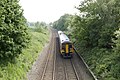
 Train at Trowell Junction - (1) - geograph.org.uk - 3044285.jpg 1,024 × 656; 588 KB
-
 Train at Trowell Junction - (2) - geograph.org.uk - 3044294.jpg 1,024 × 678; 661 KB
-
 Train at Trowell Junction - (3) - geograph.org.uk - 3044301.jpg 1,024 × 665; 568 KB
-
 Train near Trowell Junction - geograph.org.uk - 3041595.jpg 1,024 × 768; 238 KB
-
 Travelodge at Trowell Service Station (M1 north) - geograph.org.uk - 5773136.jpg 1,600 × 1,200; 391 KB
-
 Tree in a sea of maize - geograph.org.uk - 4303238.jpg 640 × 430; 70 KB
-
 Tree-Lined Track on Trowell Moor - geograph.org.uk - 1161004.jpg 640 × 427; 303 KB
-
 Trees on Cossall Road - geograph.org.uk - 1838170.jpg 640 × 480; 127 KB
-
 Trowell at twilight (a) - geograph.org.uk - 2705821.jpg 640 × 480; 48 KB
-
 Trowell at twilight (b) - geograph.org.uk - 2705827.jpg 640 × 480; 72 KB
-
 Trowell at twilight (c) - geograph.org.uk - 2705829.jpg 640 × 480; 58 KB
-
 Trowell at twilight (d) - geograph.org.uk - 2705839.jpg 640 × 480; 44 KB
-
 Trowell Garden Centre - geograph.org.uk - 1605766.jpg 640 × 428; 65 KB
-
 Trowell Garden Centre - geograph.org.uk - 6454395.jpg 4,032 × 3,024; 3.51 MB
-
 Trowell Junction - geograph.org.uk - 1109970.jpg 640 × 428; 106 KB
-
 Trowell Moor - geograph.org.uk - 2633115.jpg 1,280 × 856; 200 KB
-
 Trowell Motorway Services car park - geograph.org.uk - 3857051.jpg 1,024 × 768; 191 KB
-
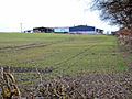
 Trowell Park Industries - geograph.org.uk - 5784507.jpg 1,024 × 683; 224 KB
-
 Trowell Post Office, Stapleford Road - geograph.org.uk - 982029.jpg 640 × 480; 80 KB
-
 Trowell Services - geograph.org.uk - 2236135.jpg 640 × 480; 60 KB
-
 Trowell Services Overbridge - geograph.org.uk - 3725600.jpg 3,701 × 2,078; 1.51 MB
-
 Trowell Services overbridge - geograph.org.uk - 4682169.jpg 640 × 383; 26 KB
-
 Trowell Services south bound - geograph.org.uk - 2225480.jpg 640 × 480; 82 KB
-
 Trowell services southbound - geograph.org.uk - 5869362.jpg 1,600 × 900; 384 KB
-
 Trowell, fields by the former canal - geograph.org.uk - 5570613.jpg 1,024 × 819; 1.13 MB
-
 Trowell, Nottingham Road - geograph.org.uk - 5570634.jpg 1,024 × 683; 772 KB


_Erewash_-_geograph.org.uk_-_832426.jpg)


_-_geograph.org.uk_-_981988.jpg)
_-_geograph.org.uk_-_982003.jpg)


_-_geograph.org.uk_-_4907574.jpg)
_-_geograph.org.uk_-_5033070.jpg)


_-_geograph.org.uk_-_4292922.jpg)
_-_geograph.org.uk_-_4292924.jpg)


_-_geograph.org.uk_-_981906.jpg)


_-_geograph.org.uk_-_761036.jpg)


_-_geograph.org.uk_-_3044285.jpg)
_-_geograph.org.uk_-_3044294.jpg)
_-_geograph.org.uk_-_3044301.jpg)

_-_geograph.org.uk_-_5773136.jpg)


_-_geograph.org.uk_-_2705821.jpg)
_-_geograph.org.uk_-_2705827.jpg)
_-_geograph.org.uk_-_2705829.jpg)
_-_geograph.org.uk_-_2705839.jpg)


