Category:Borough of Broxtowe
Jump to navigation
Jump to search
non-metropolitan district in Nottinghamshire, UK  | |||||
| Upload media | |||||
| Instance of |
| ||||
|---|---|---|---|---|---|
| Location | Nottinghamshire, East Midlands, England | ||||
| Capital | |||||
| Legislative body |
| ||||
| Inception |
| ||||
| Population |
| ||||
| Area |
| ||||
| Elevation above sea level |
| ||||
| official website | |||||
 | |||||
Subcategories
This category has the following 13 subcategories, out of 13 total.
Media in category "Borough of Broxtowe"
The following 200 files are in this category, out of 3,293 total.
(previous page) (next page)-
 "Bardill's" roundabout - geograph.org.uk - 1910489.jpg 683 × 1,024; 156 KB
-
 "The Dove" - geograph.org.uk - 1821086.jpg 1,024 × 683; 298 KB
-
 "The Vic" and Beeston Maltings - geograph.org.uk - 3195522.jpg 640 × 427; 98 KB
-
 "The Vic" and Beeston Maltings - geograph.org.uk - 3329665.jpg 640 × 427; 46 KB
-
 1 ½ miles to road closure - geograph.org.uk - 5068044.jpg 1,280 × 960; 333 KB
-
 1 ½ miles to where - geograph.org.uk - 5062413.jpg 1,024 × 768; 323 KB
-
 113 Cow Lane, Bramcote - geograph.org.uk - 6486819.jpg 4,032 × 3,024; 4.54 MB
-
 15 and 17 Thoresby Road - geograph.org.uk - 6432508.jpg 4,032 × 3,024; 4.37 MB
-
 164 and 166 Attenborough Lane - geograph.org.uk - 6444961.jpg 4,032 × 3,024; 4.17 MB
-
 165-169 High Road, Chilwell - geograph.org.uk - 6485104.jpg 3,648 × 2,432; 4.1 MB
-
 168 Attenborough Lane - geograph.org.uk - 6444960.jpg 4,032 × 3,024; 4.83 MB
-
 17 Town Street, Bramcote - geograph.org.uk - 6420284.jpg 4,032 × 3,024; 6.43 MB
-
 18 Hallam's Lane, Chilwell - geograph.org.uk - 6445385.jpg 4,032 × 3,024; 4.92 MB
-
 18 Hurts Croft, Chilwell - geograph.org.uk - 6489865.jpg 4,032 × 3,024; 4.1 MB
-
 19-23 Town Street, Bramcote - geograph.org.uk - 6420286.jpg 4,032 × 3,024; 4.82 MB
-
 191 Bye Pass Road, Chilwell - geograph.org.uk - 6485102.jpg 3,648 × 2,432; 3.95 MB
-
 2 and 4 Church Street, Bramcote - geograph.org.uk - 6445364.jpg 4,032 × 3,024; 3.47 MB
-
 2 Hurts Croft, Chilwell - geograph.org.uk - 6489869.jpg 4,032 × 3,024; 3.67 MB
-
 20 Bridle Road, Bramcote - geograph.org.uk - 6445362.jpg 4,032 × 3,024; 4.15 MB
-
 22 Town Street, Bramcote - geograph.org.uk - 6445370.jpg 4,032 × 3,024; 4.74 MB
-
 226 High Road, Chilwell - geograph.org.uk - 6489858.jpg 4,032 × 3,024; 5.38 MB
-
 24 Hurts Croft, Chilwell - geograph.org.uk - 6489863.jpg 4,032 × 3,024; 3.9 MB
-
 25 Claremont Avenue, Bramcote - geograph.org.uk - 6508053.jpg 4,032 × 3,024; 4 MB
-
 259 Stapleford Lane - geograph.org.uk - 6450132.jpg 4,032 × 3,024; 3.76 MB
-
 26 and 28 Bridle Road, Bramcote - geograph.org.uk - 6445361.jpg 4,032 × 3,024; 4.63 MB
-
 26 Hallam's Lane, Chilwell - geograph.org.uk - 6445384.jpg 4,032 × 3,024; 3.6 MB
-
 26 Park Road, Chilwell - geograph.org.uk - 6434524.jpg 4,032 × 3,024; 5.58 MB
-
 262 High Road, Chilwell - geograph.org.uk - 6432516.jpg 4,032 × 3,024; 3.85 MB
-
 28 Hallam's Lane, Chilwell - geograph.org.uk - 6445382.jpg 4,032 × 3,024; 4.97 MB
-
 291 Bye-pass Road - geograph.org.uk - 6484835.jpg 3,648 × 2,432; 3.72 MB
-
 2b Block nearly gone - geograph.org.uk - 4659026.jpg 1,280 × 960; 301 KB
-
 2B Block now empty - geograph.org.uk - 4163635.jpg 1,280 × 853; 246 KB
-
 2B Block now under wraps - geograph.org.uk - 4266808.jpg 1,280 × 853; 228 KB
-
 2B Block under wraps - geograph.org.uk - 4346987.jpg 1,280 × 720; 190 KB
-
 2B Block under wraps - geograph.org.uk - 4346990.jpg 1,280 × 720; 216 KB
-
 30 Bridle Road, Bramcote - geograph.org.uk - 6445360.jpg 4,032 × 3,024; 4.74 MB
-
 30 Lime Grove Avenue - geograph.org.uk - 6433722.jpg 4,032 × 3,024; 4.76 MB
-
 307 High Road, Chilwell - geograph.org.uk - 6481788.jpg 4,032 × 3,024; 4.08 MB
-
 34 Park Road, Chilwell - geograph.org.uk - 6434526.jpg 4,032 × 3,024; 5.05 MB
-
 35 and 37 have gone - geograph.org.uk - 2934173.jpg 640 × 427; 117 KB
-
 36 Hallam Lane, Chilwell - geograph.org.uk - 6445381.jpg 4,032 × 3,024; 7.22 MB
-
 38 Claremont Avenue, Bramcote - geograph.org.uk - 6508058.jpg 4,032 × 3,024; 4.71 MB
-
 39-39 Long Lane, Attenborough - geograph.org.uk - 6439645.jpg 4,032 × 3,024; 3.78 MB
-
 4 Hurts Croft, Chilwell - geograph.org.uk - 6489867.jpg 4,032 × 3,024; 3.91 MB
-
 40 and 42 Park Road, Chilwell - geograph.org.uk - 6434530.jpg 4,032 × 3,024; 4.51 MB
-
 42 Claremont Avenue, Bramcote - geograph.org.uk - 6508055.jpg 4,032 × 3,024; 4.78 MB
-
 42 Town Street, Bramcote - geograph.org.uk - 6445371.jpg 4,032 × 3,024; 4.49 MB
-
 42-47 Field Lane - geograph.org.uk - 6448532.jpg 4,032 × 3,024; 4.46 MB
-
 48 Park Road, Chilwell - geograph.org.uk - 6434533.jpg 4,032 × 3,024; 5.2 MB
-
 52 Park Road, Chilwell - geograph.org.uk - 6434538.jpg 4,032 × 3,024; 5.5 MB
-
 54a Park Road, Chilwell - geograph.org.uk - 6434541.jpg 4,032 × 3,024; 5.38 MB
-
 57 Park Road, Chilwell - geograph.org.uk - 6434548.jpg 4,032 × 3,024; 4.59 MB
-
 6 Fern Close, Bramcote - geograph.org.uk - 6445375.jpg 4,032 × 3,024; 6.07 MB
-
 65 School Lane, Chilwell - geograph.org.uk - 5159608.jpg 1,280 × 883; 333 KB
-
 69 Park Road, Chilwell - geograph.org.uk - 6434559.jpg 4,032 × 3,024; 4.98 MB
-
 7 Fern Close, Bramcote - geograph.org.uk - 6445377.jpg 4,032 × 3,024; 6.48 MB
-
 71 and 73 Park Road, Chilwell - geograph.org.uk - 6434561.jpg 4,032 × 3,024; 4.24 MB
-
 74 Park Road, Chilwell - geograph.org.uk - 6434556.jpg 4,032 × 3,024; 4.3 MB
-
 77 Park Road, Chilwell - geograph.org.uk - 6434569.jpg 4,032 × 3,024; 6.45 MB
-
 79 and 81 Thoresby Road - geograph.org.uk - 6432503.jpg 4,032 × 3,024; 6.35 MB
-
 8 Church Street, Bramcote - geograph.org.uk - 6445365.jpg 4,032 × 3,024; 3.38 MB
-
 8 ^ 10 Broadgate, Beeston - geograph.org.uk - 3816890.jpg 1,280 × 960; 318 KB
-
 80, 82, 84, 86, 92 and 94 Park Road, Chilwell - geograph.org.uk - 6434564.jpg 4,032 × 3,024; 5.23 MB
-
 81 Thoresby Road, Bramcote - geograph.org.uk - 5159313.jpg 1,280 × 960; 507 KB
-
 85 and 87 Park Road, Chilwell - geograph.org.uk - 6434573.jpg 4,032 × 3,024; 4.56 MB
-
 85 Grove Avenue, Chilwell - geograph.org.uk - 6435575.jpg 4,032 × 3,024; 5.18 MB
-
 9-11 Hanley Avenue, Bramcote - geograph.org.uk - 6459209.jpg 4,032 × 3,024; 4.8 MB
-
 A bike in the river - geograph.org.uk - 4317734.jpg 1,024 × 768; 174 KB
-
 A Bike on a frosty path - geograph.org.uk - 2206814.jpg 427 × 640; 95 KB
-
 A bit more concrete - geograph.org.uk - 2110301.jpg 1,024 × 683; 222 KB
-
 A Block Stores - geograph.org.uk - 3920147.jpg 640 × 640; 402 KB
-
 A bright afternoon on The Trent - geograph.org.uk - 4363245.jpg 1,280 × 720; 260 KB
-
 A Bucket excavator - geograph.org.uk - 2515712.jpg 427 × 640; 76 KB
-
 A busy day on the Beeston Canal - geograph.org.uk - 1974058.jpg 683 × 1,024; 178 KB
-
 A calm morning on the River Trent - geograph.org.uk - 6432527.jpg 4,032 × 3,024; 4.52 MB
-
 A Class 60 at Toton - geograph.org.uk - 3340304.jpg 1,200 × 900; 1.27 MB
-
 A corner of Beeston Churchyard - geograph.org.uk - 2738063.jpg 640 × 427; 82 KB
-
 A corner of Beeston parish churchyard - geograph.org.uk - 5315269.jpg 1,280 × 853; 433 KB
-
 A crane at work - geograph.org.uk - 3485020.jpg 427 × 640; 81 KB
-
-
 A cyclist approaches Barton Lane - geograph.org.uk - 2100727.jpg 1,024 × 683; 242 KB
-
 A Cyclist waits - geograph.org.uk - 3251694.jpg 640 × 427; 57 KB
-

-
 A door on demolition - geograph.org.uk - 4146013.jpg 854 × 1,280; 359 KB
-

-
 A fence replaces 2b block - geograph.org.uk - 4728056.jpg 1,028 × 579; 147 KB
-
 A fenced-in path - geograph.org.uk - 2110327.jpg 1,024 × 667; 317 KB
-
 A fine display - geograph.org.uk - 2284041.jpg 640 × 427; 116 KB
-
 A flood rages over Beeston Weir - geograph.org.uk - 2206406.jpg 640 × 436; 87 KB
-
 A flood wall in action - geograph.org.uk - 3257473.jpg 640 × 427; 43 KB
-
 A footpath is closed - geograph.org.uk - 2871545.jpg 640 × 427; 116 KB
-
 A footpath is closed - geograph.org.uk - 5169123.jpg 1,280 × 853; 332 KB
-
 A footpath reopens - geograph.org.uk - 2702993.jpg 640 × 427; 93 KB
-
 A frosty morning in Manor Farm Park - geograph.org.uk - 4317745.jpg 1,200 × 1,200; 748 KB
-
 A frosty playground swing - geograph.org.uk - 4317823.jpg 1,024 × 768; 270 KB
-
 A frozen Beeston Pond - geograph.org.uk - 2203137.jpg 640 × 431; 59 KB
-
 A frozen Tween Pond at dawn - geograph.org.uk - 2208105.jpg 640 × 427; 33 KB
-
 A Furniture shop returns - geograph.org.uk - 3226020.jpg 640 × 427; 175 KB
-
 A gap in the ice - geograph.org.uk - 2207398.jpg 640 × 422; 43 KB
-
 A heavy squall at Attenborough - geograph.org.uk - 5356501.jpg 2,000 × 1,333; 2.27 MB
-
 A hole in the ceiling - geograph.org.uk - 5014685.jpg 960 × 1,280; 241 KB
-
 A house now demolished - geograph.org.uk - 2916867.jpg 640 × 427; 106 KB
-
 A large display of fruit and veg. - geograph.org.uk - 3816836.jpg 1,280 × 960; 385 KB
-
 A light mist rising - geograph.org.uk - 6027286.jpg 1,280 × 960; 257 KB
-
 A line of trucks on Beeston Business Park - geograph.org.uk - 4858953.jpg 1,024 × 768; 153 KB
-
 A maize field at Windmill Farm - geograph.org.uk - 5025831.jpg 1,024 × 768; 1.15 MB
-
 A misty Beeston Canal - geograph.org.uk - 3193660.jpg 640 × 427; 43 KB
-
 A misty River Erewash - geograph.org.uk - 2668859.jpg 427 × 640; 80 KB
-
 A misty Trent - geograph.org.uk - 2163402.jpg 640 × 427; 45 KB
-
 A misty Trent valley - geograph.org.uk - 2374722.jpg 640 × 419; 50 KB
-
 A morning queue - geograph.org.uk - 3528490.jpg 640 × 640; 175 KB
-
 A murky morning on The Trent - geograph.org.uk - 4363238.jpg 1,280 × 720; 284 KB
-
 A NET auger - geograph.org.uk - 3402606.jpg 427 × 640; 111 KB
-
 A new car park awaits - geograph.org.uk - 3378038.jpg 640 × 427; 89 KB
-
 A New footbridge - geograph.org.uk - 3257462.jpg 640 × 427; 63 KB
-
 A new hump - geograph.org.uk - 1870695.jpg 1,024 × 683; 251 KB
-
 A new mouth for the Erewash - geograph.org.uk - 2042760.jpg 1,024 × 683; 211 KB
-
 A new pavilion for Attenborough - geograph.org.uk - 3320274.jpg 640 × 427; 62 KB
-
 A new pavilion for Attenborough - geograph.org.uk - 3320275.jpg 640 × 427; 64 KB
-
 A new pavilion for Attenborough - geograph.org.uk - 3688686.jpg 640 × 480; 132 KB
-
 A new pharmacist opens - geograph.org.uk - 5636383.jpg 1,280 × 960; 347 KB
-
 A new reason to queue - geograph.org.uk - 3569572.jpg 480 × 640; 132 KB
-
 A new view of the parish church - geograph.org.uk - 4394417.jpg 1,280 × 906; 314 KB
-
 A path beside the Erewash - geograph.org.uk - 6554656.jpg 960 × 1,280; 640 KB
-
 A path is open again - geograph.org.uk - 2181023.jpg 1,024 × 768; 318 KB
-
 A peek inside - geograph.org.uk - 3150928.jpg 640 × 427; 136 KB
-
 A Pile of rubbish from 2B Block - geograph.org.uk - 4326274.jpg 1,024 × 1,024; 386 KB
-
 A pony crosses a bridge - geograph.org.uk - 5138908.jpg 1,280 × 853; 405 KB
-
 A posher hut - geograph.org.uk - 2162282.jpg 1,024 × 683; 236 KB
-
 A Rainy day at Beeston church - geograph.org.uk - 4723392.jpg 1,280 × 1,280; 484 KB
-
 A re-grown friend - geograph.org.uk - 4346998.jpg 853 × 1,280; 547 KB
-
 A shop vacant again - geograph.org.uk - 2791997.jpg 640 × 427; 115 KB
-
 A single stem - geograph.org.uk - 1871823.jpg 1,024 × 683; 111 KB
-
 A sunny summer evening in Strelley - geograph.org.uk - 5043575.jpg 1,024 × 732; 1,002 KB
-
 A swollen By-Pass Channel - geograph.org.uk - 4778427.jpg 1,280 × 1,280; 463 KB
-
 A theodolite on The Strand - geograph.org.uk - 2326282.jpg 640 × 418; 91 KB
-
 A totally unnecessary roundabout - geograph.org.uk - 2233180.jpg 640 × 427; 52 KB
-
 A touch of Vera Duckworth - geograph.org.uk - 1914683.jpg 640 × 480; 61 KB
-
 A train passes the demolition - geograph.org.uk - 3176090.jpg 640 × 427; 80 KB
-
 A train passes the demolition - geograph.org.uk - 3332583.jpg 640 × 427; 58 KB
-
 A train passes the demolition - geograph.org.uk - 3338433.jpg 640 × 427; 59 KB
-
 A train passes the demolition - geograph.org.uk - 3346506.jpg 640 × 427; 51 KB
-
 A trench in The Square - geograph.org.uk - 3624797.jpg 640 × 427; 135 KB
-
 A Trent sunrise - geograph.org.uk - 3713365.jpg 640 × 640; 126 KB
-
 A trio of semi detached houses - geograph.org.uk - 5094100.jpg 5,472 × 3,648; 6.39 MB
-
 A walk by the river Trent - geograph.org.uk - 6372180.jpg 2,000 × 1,333; 2.78 MB
-
 A walk in a frozen nature reserve - geograph.org.uk - 2208097.jpg 427 × 640; 87 KB
-
 A willow in silhouette - geograph.org.uk - 2747481.jpg 640 × 427; 138 KB
-
 A1 motor stores - geograph.org.uk - 5193804.jpg 3,264 × 2,448; 2.25 MB
-
 A52 approaching Bardills Roundabout - geograph.org.uk - 3407677.jpg 800 × 514; 79 KB
-
 A52 approaching Bardills Roundabout - geograph.org.uk - 3470006.jpg 2,056 × 1,159; 1.46 MB
-
 A52 approaching roundabout at Bramcote - geograph.org.uk - 3469996.jpg 2,256 × 1,504; 1.34 MB
-
 A52 at Bramcote - geograph.org.uk - 6420160.jpg 4,032 × 3,024; 6.16 MB
-
 A52 Brian Clough Way - geograph.org.uk - 3603277.jpg 1,024 × 682; 185 KB
-
 A52 Derby Road - geograph.org.uk - 3469991.jpg 1,987 × 1,119; 1.39 MB
-
 A52 junction at Bramcote - geograph.org.uk - 6420280.jpg 4,032 × 3,024; 4.65 MB
-
 A52 junction at Bramcote - geograph.org.uk - 6420282.jpg 4,032 × 3,024; 5.29 MB
-
 A52 towards Derby - geograph.org.uk - 5031788.jpg 640 × 480; 57 KB
-
 A52 towards Derby - geograph.org.uk - 5031816.jpg 640 × 480; 64 KB
-
 A52 towards Nottingham - geograph.org.uk - 1915700.jpg 640 × 480; 80 KB
-
 A52 westbound at Bramcote - geograph.org.uk - 3469867.jpg 1,986 × 1,156; 1.32 MB
-
 A52, Bramcote - geograph.org.uk - 5031833.jpg 640 × 480; 69 KB
-
 A6005 devoid of traffic - geograph.org.uk - 6434515.jpg 4,032 × 3,024; 4.67 MB
-
 A6005 devoid of traffic - geograph.org.uk - 6434517.jpg 4,032 × 3,024; 4.64 MB
-
 A6005 entering Toton - geograph.org.uk - 3407561.jpg 640 × 414; 53 KB
-
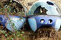 Abandoned monorail pods - geograph.org.uk - 3368188.jpg 640 × 427; 88 KB
-
 Abandoned roller for the Cricket pitch - geograph.org.uk - 1975031.jpg 640 × 480; 125 KB
-
 Abandoned rolling stock - geograph.org.uk - 6643686.jpg 1,280 × 853; 536 KB
-
 Abbey Drive, Beeston - geograph.org.uk - 3976044.jpg 1,600 × 1,063; 431 KB
-
 Abbey Road, Beeston - geograph.org.uk - 4592893.jpg 2,272 × 1,704; 828 KB
-
 Abel Collin's almshouses, east wing - geograph.org.uk - 5123230.jpg 1,280 × 909; 493 KB
-
 Abel Collin's almshouses, main entrance - geograph.org.uk - 5123223.jpg 1,280 × 960; 435 KB
-
 Abel Collins almshouses - geograph.org.uk - 5193797.jpg 3,264 × 2,448; 3.28 MB
-
 Abel Collins almshouses - geograph.org.uk - 5193801.jpg 2,718 × 2,038; 1.99 MB
-
 Acacia Walk, Beeston - geograph.org.uk - 2233186.jpg 640 × 427; 63 KB
-
 Access ladder and shadow - geograph.org.uk - 2106708.jpg 686 × 1,024; 164 KB
-
 Access over the flood barrier - geograph.org.uk - 1911679.jpg 640 × 480; 81 KB
-
 Access yard for The Square - geograph.org.uk - 2739404.jpg 640 × 427; 96 KB
-
 Advance warning of delays - geograph.org.uk - 2959590.jpg 640 × 427; 147 KB
-
 After the memorial service - geograph.org.uk - 2299206.jpg 2,048 × 1,536; 2.32 MB
-
 Airconditioning units - geograph.org.uk - 4086001.jpg 1,280 × 853; 1.04 MB
-
 Airedale Court - geograph.org.uk - 6448519.jpg 4,032 × 3,024; 4.64 MB
-
 Airedale Court, Inham Nook Estate - geograph.org.uk - 5159550.jpg 1,280 × 873; 296 KB
-
 AK series pylons - geograph.org.uk - 6658899.jpg 853 × 1,280; 204 KB
-
 Albert Road postbox ref NG9 629 - geograph.org.uk - 3006107.jpg 1,280 × 853; 209 KB
-
 Albert Road, Beeston - geograph.org.uk - 1910525.jpg 640 × 480; 100 KB
-
 Albert Road, Beeston - geograph.org.uk - 4592965.jpg 2,272 × 1,704; 889 KB
-
 Albion Street car park, Beeston - geograph.org.uk - 1811162.jpg 640 × 480; 53 KB
-
 Aldenham White School - geograph.org.uk - 2055271.jpg 640 × 427; 294 KB
-
 All gone now - geograph.org.uk - 3064226.jpg 640 × 423; 73 KB
-
 All the cabins have gone - geograph.org.uk - 4560247.jpg 1,280 × 960; 279 KB
-
 Allendale Avenue - geograph.org.uk - 2096217.jpg 1,024 × 683; 207 KB
-
 Along Eskdale Drive - geograph.org.uk - 1930064.jpg 1,280 × 854; 303 KB
-
 Alongside Central College - geograph.org.uk - 3720152.jpg 1,280 × 960; 210 KB
-
 Alongside Central College - geograph.org.uk - 3983917.jpg 1,280 × 960; 379 KB
-
 Alongside Central College - geograph.org.uk - 3983921.jpg 1,280 × 960; 467 KB
-
 Alongside Central College - geograph.org.uk - 4602198.jpg 1,280 × 960; 466 KB
-
 Alongside Eskdale Drive - geograph.org.uk - 3876409.jpg 1,280 × 960; 254 KB
-
 Alongside Eskdale Drive - geograph.org.uk - 4485077.jpg 1,280 × 960; 384 KB
-
 Alteration to a Beeston junction - geograph.org.uk - 1876053.jpg 1,024 × 683; 322 KB


