Category:Transport maps of Kyoto prefecture
Jump to navigation
Jump to search
日本語: 京都府の交通に関する地図
| Prefectures of Japan 交通に関する地図 | |||
|---|---|---|---|
|

| ||
Subcategories
This category has only the following subcategory.
R
Media in category "Transport maps of Kyoto prefecture"
The following 14 files are in this category, out of 14 total.
-
GleisplanKyotofu2015.png 4,379 × 8,197; 1.53 MB
-
Kyoto-Nara Railway Line Map.jpg 1,429 × 4,060; 1.37 MB
-
Kyoto-Nara Railway Line Map.svg 1,787 × 5,075; 1.65 MB
-
Kyōto Ichi-no-funairi.jpg 2,334 × 1,592; 233 KB
-
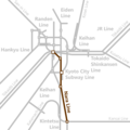
Railway map around Kyoto City (Eiden).png 1,400 × 1,400; 71 KB
-
Railway map around Kyoto City (Keihan).png 1,400 × 1,400; 73 KB
-
Railway map around Kyoto City (Kintetsu).png 1,400 × 1,400; 71 KB
-
Railway map around Kyoto City (Randen).png 1,400 × 1,400; 72 KB
-
Railway map around Kyoto City (Sagano Line).png 1,400 × 1,400; 74 KB
-
Railway map around Kyoto City Subway Karasuma Line.png 1,400 × 1,400; 69 KB
-
Railway map around Kyoto City Subway Tozzi Line.png 1,400 × 1,400; 69 KB
-
Railway map around Nara Line.png 1,400 × 1,400; 71 KB
-
Railway-Line-Osaka-Kyoto.jpg 1,200 × 1,470; 442 KB
-
Railway-Line-Osaka-Nara.jpg 2,478 × 1,375; 567 KB


