Category:Railway maps of Kintetsu Corporation
Jump to navigation
Jump to search
English: Category for railway maps of Kintetsu Corporation
日本語: 近畿日本鉄道(近鉄)の鉄道路線図に関するカテゴリ
Media in category "Railway maps of Kintetsu Corporation"
The following 40 files are in this category, out of 40 total.
-
Ise Electric Railway Linemap 1936.svg 1,396 × 2,954; 885 KB
-
ISL路線図.jpg 3,944 × 2,678; 754 KB
-
ISL路線図A.jpg 3,952 × 2,695; 905 KB
-
Kintetsu Corporation Linemap.svg 2,900 × 2,901; 2.94 MB
-
Kintetsu Limited Express Map.PNG 971 × 688; 35 KB
-
Kintetsu Limited Express Network.png 1,300 × 900; 192 KB
-
KINTETSU"SHIMAKAZE"ROUTE MAP.jpg 4,337 × 2,904; 6.94 MB
-
Kintetsu-Nagoya Station, Kintetsu (8554126779).jpg 2,560 × 1,920; 522 KB
-
Kintetsu-Nagoya Station, Kintetsu (8555234842).jpg 2,560 × 1,920; 639 KB
-
Kintetsu-Tomida Station (8554138033).jpg 2,560 × 1,920; 638 KB
-
Kintetsu-Yatomi Station, Kintetsu (8554129937).jpg 2,560 × 1,920; 593 KB
-
Kuwana Station (8555242340).jpg 2,560 × 1,920; 514 KB
-
Kyoto-Fushimi Railway Line Map.svg 2,104 × 1,800; 497 KB
-
Kyoto-Nara Railway Line Map.jpg 1,429 × 4,060; 1.37 MB
-
Kyoto-Nara Railway Line Map.svg 1,787 × 5,075; 1.65 MB
-
LineMap NagoyaIse.png 350 × 620; 64 KB
-
LineMap OsakaNara.png 770 × 370; 84 KB
-
MEIHAN A.jpg 3,152 × 2,358; 497 KB
-
MEIHAN B.jpg 3,756 × 2,342; 813 KB
-
Non-local-train-stops of Kintetsu.png 2,301 × 2,120; 763 KB
-
Non-local-train-stops of Kintetsu.svg 2,876 × 2,650; 202 KB
-
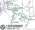
Osaka Railway Linemap 1943.svg 1,079 × 926; 332 KB
-
Railway Map of Kintetsu Line in Nagoya City 2023.svg 989 × 1,002; 378 KB
-
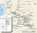
Sangu Kyuko Electric Railway Map in 1930s.jpg 924 × 516; 162 KB
-
Shinjuko station map.png 2,296 × 1,489; 534 KB
-
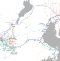
Wide Area Map of Kintetsu.png 2,148 × 1,604; 4.8 MB
-
さくらライナー路線図A.jpg 4,558 × 4,141; 1.51 MB
-
さくらライナー運行路線図.jpg 4,416 × 4,163; 1.38 MB
-
京都駅近鉄切符売り場.jpg 4,608 × 3,456; 3.24 MB
-
名阪路線図C.jpg 3,856 × 3,120; 1.74 MB
-
名阪路線図D.jpg 3,718 × 2,319; 798 KB
-
近鉄京伊特急ルートマップ 2013-3-17.png 6,656 × 4,608; 3.21 MB
-
近鉄京橿・京奈・阪奈特急ルートマップ 2013-3-17.png 3,768 × 3,939; 1.72 MB
-
近鉄内部線.jpg 5,205 × 3,470; 9.43 MB
-
近鉄吉野特急ルートマップ 2013-3-17.png 2,940 × 2,100; 1.02 MB
-
近鉄名伊特急ルートマップ 2013-3-17.png 5,448 × 5,936; 3.67 MB
-
近鉄名阪特急ルートマップ 2013-3-17.png 7,536 × 5,040; 3.87 MB
-
近鉄特急ルートマップ 20141010A.png 12,702 × 7,836; 3.54 MB
-
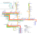
近鉄特急系統図2013.svg 6,703 × 3,779; 1.55 MB
-
近鉄阪伊特急ルートマップ 2013-3-17.png 7,608 × 4,584; 4 MB
Categories:
- Rail transport maps of Japan by operator
- Railway lines of Kintetsu Corporation
- Public transport maps of Osaka
- Public transport maps of Kyoto
- Public transport maps of Nagoya
- Transport maps of Osaka prefecture
- Transport maps of Kyoto prefecture
- Transport maps of Nara prefecture
- Transport maps of Mie prefecture
- Transport maps of Aichi prefecture


