Category:Transport maps of Europe
Jump to navigation
Jump to search
Subcategories
This category has the following 17 subcategories, out of 17 total.
Media in category "Transport maps of Europe"
The following 88 files are in this category, out of 88 total.
-
Map of the Post-Roads of Europe de John Rocque (1771).jpg 2,354 × 2,200; 6.69 MB
-
1939 Intourist Map of The Soviet Union and Europe Showing Principal Transportation Connections.jpg 14,458 × 10,630; 44.75 MB
-
Aachen-Frankfurter Heerstraße.jpg 1,007 × 537; 129 KB
-
Amber Road.jpg 2,247 × 3,276; 1.27 MB
-
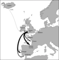
Bristol trade routes1492.png 1,735 × 1,761; 330 KB
-
Bursztynowy szlak.jpg 2,226 × 2,967; 733 KB
-
Car regulations for daytime running light in Europe.png 1,828 × 1,912; 36 KB
-
CarteRoulEurope.jpg 994 × 1,176; 196 KB
-
Color of European Motorway Signs.svg 645 × 690; 354 KB
-
Container deposit legislation in Europe.png 1,200 × 1,000; 50 KB
-
Core Road Network - South Eastern Europe.png 1,414 × 1,054; 670 KB
-
Countries of Europe driving on the left or right.svg 680 × 520; 800 KB
-
Croquis Northern Range, 7.png 3,500 × 1,762; 282 KB
-
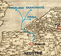
Doornik handelsroutes.jpg 1,366 × 1,258; 865 KB
-
E79 en new.png 517 × 518; 108 KB
-
E79.png 800 × 722; 155 KB
-
Eisenbahnen-Telegrafen-Mitteleuropa-um1850.jpg 1,843 × 1,418; 1.54 MB
-
EU air carrier restrictions map.svg 2,754 × 1,398; 1.06 MB
-
Europe busiest airports.png 1,475 × 1,200; 681 KB
-
Europe Completed Motorways Dec 2012.png 2,000 × 1,604; 507 KB
-
Europe Completed Motorways.png 2,000 × 1,604; 507 KB
-
European countries with left-hand or right-hand traffic.png 3,592 × 3,192; 1.14 MB
-
European railtrafficregions.png 891 × 782; 28 KB
-
European trafficregions.png 942 × 917; 32 KB
-
EuropeCent.PNG 946 × 786; 391 KB
-
EuroVelo Route 6 map.svg 1,116 × 764; 870 KB
-
Eurowhiff map.png 231 × 143; 26 KB
-
Flight CSA 540-ar.png 1,600 × 1,132; 532 KB
-
Flight CSA 540.png 1,600 × 1,132; 523 KB
-
Flight JAT367.png 1,280 × 924; 437 KB
-
Highway speed limits europe with indicator colors.png 1,561 × 1,000; 398 KB
-
Hinterland Anvers.JPG 960 × 720; 39 KB
-
Hyperloop Standarization.png 1,146 × 780; 454 KB
-
Hyperloop VisionForEurope.png 1,300 × 1,000; 1.41 MB
-
Interflug foreign flight connections 1973.svg 1,059 × 1,265; 63 KB
-
Ipeet.jpg 476 × 452; 45 KB
-
Itineraire.JPG 324 × 259; 29 KB
-
Itinerario de la línea 35 de EMT Valencia.JPG 1,000 × 356; 91 KB
-
Jakob Lines routes.png 669 × 445; 38 KB
-
Jerusalemweg.jpg 1,629 × 1,162; 352 KB
-
Kanal DOL.jpg 960 × 720; 69 KB
-
Kolejowe korytarze transportowe OSŻD.png 605 × 339; 426 KB
-
Logistics Designer.png 740 × 632; 812 KB
-
Map of European Air Routes in 1925.jpg 1,788 × 1,236; 459 KB
-
Map-tanker-trade-routes-after-sanctions.png 763 × 521; 320 KB
-
Mapa A Diogneto.png 679 × 450; 94 KB
-
Montenegro bus accident.png 496 × 404; 101 KB
-
North-South Transport Corridor map (RU).svg 1,088 × 851; 4.27 MB
-
Northern Range croquis.png 850 × 532; 102 KB
-
Number of Zebra crossing in European Capitals.jpg 1,414 × 1,615; 297 KB
-
One Big Lift (2nd Armored Division) -53067-2009-10-14-171055.jpg 3,517 × 2,472; 902 KB
-
Pan-European corridor VIII de.png 800 × 541; 490 KB
-
Pan-European corridor VIII mk.svg 392 × 486; 559 KB
-
Pan-European corridor X.svg 392 × 486; 559 KB
-
Pan-European corridors de.svg 392 × 486; 555 KB
-
Pan-European corridors mk.svg 392 × 486; 562 KB
-
Pan-European corridors ru.svg 392 × 486; 847 KB
-
Pan-European corridors.svg 392 × 486; 561 KB
-
Paneuropetransport.png 773 × 942; 32 KB
-
Postkurse 1563.jpg 3,205 × 2,297; 614 KB
-
Postkurse 1711.jpg 1,372 × 1,128; 509 KB
-
Red Europea de Carreteras.png 805 × 586; 131 KB
-
Rutas Eurovelo enteras.png 800 × 852; 259 KB
-
Ryanairdestinations.png 600 × 528; 30 KB
-
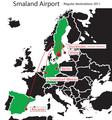
Smaland airport regualr destinations.pdf 1,752 × 1,881; 81 KB
-
Smaland airport regualr destinations.svg 394 × 426; 115 KB
-
Sonora Korridore.jpg 1,001 × 1,024; 111 KB
-
Strecke europa 2.JPG 741 × 546; 134 KB
-
Strecke europa.jpg 2,920 × 2,177; 783 KB
-
Subway in Europe.png 2,839 × 2,619; 885 KB
-
Trans-European Transport Network (2024).png 9,932 × 10,681; 23.79 MB
-
Trans-European Transport Network (2024, not final).jpg 9,934 × 14,032; 4.83 MB
-
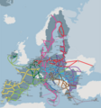
Trans-European Transport Network.jpg 1,424 × 1,350; 159 KB
-
Vehicle registration plates in Europe.jpg 2,802 × 2,745; 2.16 MB
-
Vehicle registration plates in Europe.png 1,800 × 1,539; 2.78 MB
-
Vercors geo territories roads map-fr.svg 1,350 × 1,700; 287 KB
-
Via domitia map600x600 (1).png 600 × 600; 58 KB
-
Via Imperii und Via Regia.png 1,286 × 938; 226 KB
-
Via Imperii.png 376 × 580; 47 KB
-
Via Regia und Via Imperii - hsb.png 1,286 × 938; 231 KB
-
Viking Age trade routes in north-west Europe.png 994 × 967; 441 KB
-
Vodní koridor D-O-L z pohledu evropské dopravní sítě TEN-T.png 1,228 × 733; 1.88 MB
-
Ways of St-2. James in Europe Workaround.svg 512 × 360; 171 KB
-
Ways of St-2. James in Europe.svg 2,955 × 2,080; 1.94 MB
-
ZoRCoCuK Travel Planning Map.png 2,100 × 1,525; 90 KB
-
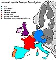
Zustellkarte HLG.jpg 395 × 425; 35 KB
-
Мапа транспортного коридору(УКР).png 1,280 × 1,280; 1.05 MB


