Category:Transport maps of Bavaria
Jump to navigation
Jump to search
Federal states of Germany:
Subcategories
This category has the following 5 subcategories, out of 5 total.
M
N
R
Media in category "Transport maps of Bavaria"
The following 42 files are in this category, out of 42 total.
-
 2014.12.28 alternative Trassenführung der B 15 neu (Dezember 2014).png 780 × 901; 177 KB
-

-
 2014.12.28 Trassenvarianten der B 15 neu.png 878 × 1,379; 287 KB
-
 2015.02.01 B15 neu - Oßner-Variante (14. Januar 2015).png 788 × 1,051; 141 KB
-
 2015.02.01 B15 neu - Seehofer-Variante (30. Januar 2015).png 641 × 930; 128 KB
-
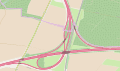 AD München-Feldmoching.svg 1,855 × 1,100; 959 KB
-
 AK München-Ost.png 2,294 × 1,740; 741 KB
-
 B 15n - Anmeldevariante 1 (März 2015).png 874 × 1,269; 273 KB
-
 B 15n - Anmeldevariante 2 (März 2015).png 876 × 1,267; 293 KB
-
 Bayern Flughäfen und Landeplätze.png 1,489 × 1,500; 781 KB
-
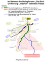
 Dialogforum 05.10.2015 - Trassenvariante - 1b.png 939 × 1,268; 213 KB
-
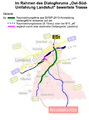
 Dialogforum 05.10.2015 - Trassenvariante - 1c.png 936 × 1,268; 211 KB
-
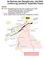
 Dialogforum 05.10.2015 - Trassenvariante - 2b.png 936 × 1,268; 222 KB
-
 Dialogforum 05.10.2015 - Trassenvariante - 3.png 936 × 1,266; 228 KB
-
 Dialogforum 05.10.2015 - Trassenvariante - 4.png 936 × 1,263; 236 KB
-
 Dialogforum 05.10.2015 - Trassenvariante - 5a.png 934 × 1,260; 214 KB
-
 Dialogforum 05.10.2015 - Trassenvariante - 5b.png 939 × 1,266; 233 KB
-
 Dialogforum 05.10.2015 - Trassenvariante - 6.png 934 × 1,263; 233 KB
-
 Dialogforum 05.10.2015 - Trassenvariante - 7.png 936 × 1,265; 230 KB
-
 Dialogforum 05.10.2015 - Trassenvariante - 8.png 936 × 1,266; 231 KB
-
 Dialogforum 05.10.2015 - Trassenvariante - 9.png 937 × 1,266; 204 KB
-
 Dialogforum 22.06.2015 - Trassenvariante - 1a.png 845 × 1,148; 195 KB
-
 Dialogforum 22.06.2015 - Trassenvariante - 1b.png 849 × 1,146; 182 KB
-
 Dialogforum 22.06.2015 - Trassenvariante - 2a.png 851 × 1,148; 187 KB
-
 Dialogforum 22.06.2015 - Trassenvariante - 2b.png 849 × 1,146; 189 KB
-
 Dialogforum 22.06.2015 - Trassenvariante - 4.png 847 × 1,146; 195 KB
-
 Dialogforum 22.06.2015 - Trassenvariante - 5a.png 845 × 1,146; 183 KB
-
 Dialogforum 22.06.2015 - Trassenvariante - 5b.png 847 × 1,148; 191 KB
-
 Dialogforum 22.06.2015 - Trassenvariante - 6.png 845 × 1,144; 180 KB
-
 Dialogforum 22.06.2015 - Trassenvariante - 7.png 847 × 1,146; 186 KB
-
 Flughafentangente Ost.png 983 × 2,130; 1.26 MB
-
 Isar-Überquerungen für KFZ im Raum Landshut.png 649 × 510; 64 KB
-
 Karte Limes-Radweg.png 1,465 × 875; 1.85 MB
-
 Map of the München-Nürnberg-Express in a Twindexx.jpg 4,032 × 3,024; 2.51 MB
-
 Ost-Süd-Umfahrung Landshut - Anmeldetrassen März 2015.png 1,018 × 1,483; 297 KB
-
 Ost-Süd-Umfahrung Landshut - Trassenvarianten (Dez2014-Mär2015).png 974 × 1,401; 252 KB
-
 Osttangente Landshut - Anbindungsvarianten Oktober 2014.png 1,429 × 489; 150 KB
-
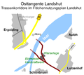 Osttangente Landshut - Lage im Flächennutzungsplan 2012.PNG 430 × 384; 45 KB
-
 Osttangente Landshut - Lageplan im Verkehrsnetz.png 657 × 527; 85 KB
-
 Straßenkarte Nordbayerns um 800.jpg 1,756 × 747; 325 KB
-
 Verkehrliche Anbindung Containerbahnhof Landshut.png 783 × 662; 100 KB
-
 Verkehrsentwicklung im Landshuter Westen (zwischen Moosburg und Landshut).png 3,014 × 2,738; 955 KB
.png)


.png)
.png)


.png)
.png)


.png)


.png)