Category:Tram maps of Adelaide
Jump to navigation
Jump to search
Subcategories
This category has only the following subcategory.
M
Media in category "Tram maps of Adelaide"
The following 16 files are in this category, out of 16 total.
-
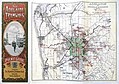
 1907 adelaide horsetrammap.png 535 × 657; 58 KB
-
 1907 Adelaide horsetrammap.svg 535 × 659; 61 KB
-
-
 Adelaide horse tramway routes at their maximum extent (1900s).png 4,570 × 4,960; 2.49 MB
-
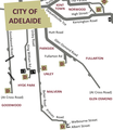
 Adelaide Metro tramways route map 2019.png 3,507 × 2,480; 2.11 MB
-
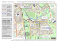
 Adelaide Tram Extension Project routes (Labor govt, 2017).png 7,015 × 4,960; 24.93 MB
-
 Adelaide trammap 1950s.png 715 × 870; 138 KB
-
 Adelaide's tram routes 2018.png 3,306 × 4,676; 14.71 MB
-
 Adelaide's tram routes before March 2018 election.png 7,015 × 4,960; 24.75 MB
-
 Adelaide-tram-bus-time-table-tram-adelaide-trams-a41.jpg 6,946 × 4,890; 32.5 MB
-
 Diagram of Adelaide electric tram routes in 1950s.png 1,892 × 1,742; 643 KB
-
 Diagram of Adelaide horse tram routes in 1907.png 1,724 × 1,756; 477 KB
-
 Horse tramways of Adelaide in the 1900s (max extent).png 4,479 × 4,889; 1.43 MB
-
 Map of Adelaide tramways, with Port Adelaide tramlines shown.png 715 × 870; 2.38 MB
-
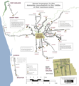
 Plan of the metropolitan public street transport system of Adelaide, May 1952.png 4,960 × 7,014; 41.25 MB
-


_--_city_and_south_lines_crop.png)
.png)

.png)


.png)

.png)