Category:Public transport maps of Adelaide
Jump to navigation
Jump to search
Media in category "Public transport maps of Adelaide"
The following 9 files are in this category, out of 9 total.
-
 Adelaide metro contract map.png 201 × 431; 6 KB
-
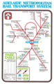 Adelaide Metropolitan Rail Transport System.webp 1,194 × 1,838; 150 KB
-
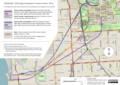 Adelaide–Glenelg train, tram and bus routes.png 7,014 × 4,960; 25.75 MB
-
 Belair Line diagram.png 3,906 × 3,255; 371 KB
-
 Belair Line diagram.svg 750 × 625; 25 KB
-
 King William St – North Tce tram intersection, Adelaide 2018.png 3,507 × 1,121; 851 KB
-
 MTT map of Adelaide's metropolitan public transport routes, 28 May 1952.png 1,653 × 2,338; 6.11 MB
-
 Plan of the metropolitan public street transport system of Adelaide, May 1952.png 4,960 × 7,014; 41.25 MB
-
 TransAdelaideRailwayMap.svg 700 × 900; 151 KB


