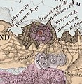
Category:The istmus of Auckland with its extinct volcanoes (1859)
Jump to navigation
Jump to search
A map of the Auckland Volcanic Field by Ferdinand von Hochstetter, 1864. Originally published in Geologisch-topographischer Atlas von Neu-Seeland (Hochstetter and Petermann, 1863), and republished in English in 1864.
Media in category "The istmus of Auckland with its extinct volcanoes (1859)"
The following 7 files are in this category, out of 7 total.
-
AucklandMapHochstetter1859 (cropped to Grafton Volcano).JPG 156 × 134; 9 KB
-
AucklandMapHochstetter1859 - Albert Park and Grafton Volcanoes crop.jpg 892 × 916; 267 KB
-
AucklandMapHochstetter1859 - Onehunga crop.jpg 300 × 400; 95 KB
-
AucklandMapHochstetter1859.JPG 1,999 × 2,665; 1.24 MB
-
The istmus of Auckland with its extinct volcanoes (1859) (cropped).tif 3,650 × 2,876; 26.87 MB
-
The istmus of Auckland with its extinct volcanoes (1859) (Onehunga crop).tif 996 × 1,158; 3.28 MB
-
The istmus of Auckland with its extinct volcanoes (1859).tif 4,613 × 5,993; 61.15 MB


