Category:Temple (civil parish)
Jump to navigation
Jump to search
Scottish parish in Midlothian, Scotland, UK | |||||
| Upload media | |||||
| Instance of | |||||
|---|---|---|---|---|---|
| Part of |
| ||||
| Named after | |||||
| Location |
| ||||
| Population |
| ||||
| Area |
| ||||
 | |||||
Subcategories
This category has the following 2 subcategories, out of 2 total.
C
T
Media in category "Temple (civil parish)"
The following 200 files are in this category, out of 483 total.
(previous page) (next page)-

-

-
 18thC tombstone, Temple Old Church - geograph.org.uk - 2021549.jpg 467 × 640; 122 KB
-
 A bend on the South Esk - geograph.org.uk - 5264458.jpg 1,024 × 678; 165 KB
-
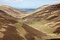
 A Burn Gully On Emly Bank - geograph.org.uk - 3330428.jpg 3,264 × 2,448; 2.92 MB
-
 A fine stand of mature Scots pine in Whinny plantation - geograph.org.uk - 2361557.jpg 3,072 × 2,304; 4.33 MB
-
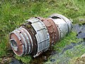
 A Gloster Javelin Nosewheel In The Burn - geograph.org.uk - 3330414.jpg 2,448 × 3,264; 2.86 MB
-

-
 A steep green place - geograph.org.uk - 1868306.jpg 640 × 359; 94 KB
-
 A view down the South Esk from Emly Bank - geograph.org.uk - 1836859.jpg 1,024 × 679; 301 KB
-
 Across Gladhouse Reservoir - geograph.org.uk - 5835091.jpg 4,764 × 3,176; 3.85 MB
-
 Almost dry spillway at Gladhouse Reservoir - geograph.org.uk - 4069901.jpg 1,024 × 682; 318 KB
-
 An expanse of heather, The Kipps - geograph.org.uk - 2250446.jpg 800 × 530; 160 KB
-
 Another brick shed by the South Esk - geograph.org.uk - 5265211.jpg 1,024 × 678; 180 KB
-
 Approach to former Esperston Lime Works - geograph.org.uk - 5857849.jpg 1,600 × 1,066; 632 KB
-
 Approaching Gladhouse Cottage - geograph.org.uk - 5264221.jpg 1,024 × 671; 183 KB
-
 Approaching Gladhouse Reservoir dam - geograph.org.uk - 4068527.jpg 1,024 × 682; 249 KB
-
 Aqueduct and leat feeding Gladhouse Reservoir - geograph.org.uk - 2363246.jpg 3,072 × 2,304; 4.37 MB
-
 Aqueduct, Gladhouse Reservoir - geograph.org.uk - 5651030.jpg 1,600 × 1,060; 532 KB
-

-

-

-

-
-

-
 Arniston West Lodge - geograph.org.uk - 3096874.jpg 800 × 530; 171 KB
-
 Arniston West Lodge - geograph.org.uk - 4021746.jpg 640 × 480; 207 KB
-
 At the crossroads - geograph.org.uk - 5835124.jpg 4,618 × 3,074; 5.06 MB
-
 B6372 at Rosebery - geograph.org.uk - 5450352.jpg 1,600 × 1,066; 578 KB
-
 Ballooning over Midlothian - geograph.org.uk - 2314839.jpg 800 × 530; 199 KB
-
 Barley near Outerston - geograph.org.uk - 2594002.jpg 2,592 × 1,944; 3.48 MB
-
 Bay on west side of Gladhouse Reservoir - geograph.org.uk - 5876136.jpg 1,600 × 1,066; 475 KB
-
 Blackhope Scar - geograph.org.uk - 3358173.jpg 1,600 × 1,200; 1.34 MB
-
 Bowbeat wind farm from the north - geograph.org.uk - 1837867.jpg 800 × 530; 186 KB
-
 Bowmans Gill, Jeffries Corse - geograph.org.uk - 5265204.jpg 1,024 × 678; 259 KB
-
 Bracken and bog - geograph.org.uk - 5447784.jpg 1,600 × 1,060; 503 KB
-
 Braidwood Bridge - geograph.org.uk - 3709741.jpg 640 × 480; 356 KB
-
 Braidwood Bridge - geograph.org.uk - 3709745.jpg 640 × 853; 493 KB
-
 Braidwood Bridge - geograph.org.uk - 3709748.jpg 640 × 480; 306 KB
-
 Braidwood Bridge over the River South Esk - geograph.org.uk - 2592804.jpg 2,592 × 1,944; 3.17 MB
-
 Braidwood Bridge, Temple - geograph.org.uk - 4021744.jpg 640 × 480; 160 KB
-
 Brick shed and sheepfold, South Esk - geograph.org.uk - 5265195.jpg 1,024 × 678; 324 KB
-
 Brick sheepfold by Hirendean Castle - geograph.org.uk - 1836464.jpg 800 × 530; 204 KB
-
 Brick sheepfold, Hirendean Burn - geograph.org.uk - 5264453.jpg 1,024 × 678; 173 KB
-
 Bridge at the inflow to Edgelaw Reservoir - geograph.org.uk - 5425547.jpg 1,600 × 1,066; 691 KB
-
 Bridge on the road to Moorfoot - geograph.org.uk - 1812207.jpg 640 × 480; 67 KB
-
 Bridge over Castleton Burn - geograph.org.uk - 4264453.jpg 1,024 × 678; 306 KB
-
 Bridge over Fullarton Water - geograph.org.uk - 2320857.jpg 2,048 × 1,536; 2.18 MB
-
 Bridge over Fullarton Water - geograph.org.uk - 2320890.jpg 2,048 × 1,536; 2.18 MB
-
 Bridge over Gladhouse Reservoir spillway - geograph.org.uk - 4069912.jpg 1,024 × 682; 319 KB
-

-
 Bridge over the Fullarton Water - geograph.org.uk - 4815084.jpg 1,024 × 678; 254 KB
-
 Buildings at Moorfoot - geograph.org.uk - 1812198.jpg 640 × 480; 112 KB
-
 Canal boat, Temple - geograph.org.uk - 3705566.jpg 1,024 × 682; 331 KB
-
 Cauldhall Glen - geograph.org.uk - 3882869.jpg 3,264 × 2,448; 5.21 MB
-
 Celandines at Rosebery - geograph.org.uk - 5754580.jpg 3,264 × 2,448; 5.54 MB
-
 Channel approaching Gladhouse Reservoir - geograph.org.uk - 5876130.jpg 1,600 × 1,066; 694 KB
-
 Channel into Gladhouse Reservoir - geograph.org.uk - 5876120.jpg 1,600 × 1,066; 623 KB
-
 Clear Water - geograph.org.uk - 5835104.jpg 4,896 × 3,264; 4.47 MB
-
 Cockmuir Bridge - geograph.org.uk - 2553944.jpg 2,592 × 1,944; 3.08 MB
-
 Cockmuir Bridge - geograph.org.uk - 5582778.jpg 1,600 × 1,060; 400 KB
-
 Cockmuir Road - geograph.org.uk - 3825250.jpg 640 × 480; 249 KB
-
 Conifer plantation in Tweeddale with Hog Hill behind - geograph.org.uk - 2363257.jpg 3,072 × 2,304; 2.18 MB
-
 Conifers in Cauldhall Glen - geograph.org.uk - 3882863.jpg 3,264 × 2,448; 6.57 MB
-
 Cottages at Gladhouse - geograph.org.uk - 3324293.jpg 800 × 530; 105 KB
-
 Cottages at Yorkston - geograph.org.uk - 4266201.jpg 1,024 × 657; 155 KB
-
 Country north of the Gladhouse Reservoir - geograph.org.uk - 4021731.jpg 640 × 480; 161 KB
-
 Cows grazing in Gillygub Dean - geograph.org.uk - 2362815.jpg 3,072 × 2,304; 3.81 MB
-
 Cyclists near Tweeddaleburn Cottage - geograph.org.uk - 4021202.jpg 640 × 480; 136 KB
-
 Dam and Spillway of Gladhouse Reservoir - geograph.org.uk - 2143315.jpg 2,640 × 1,980; 953 KB
-
 Dam and spillway, Gladhouse Reservoir - geograph.org.uk - 5876143.jpg 1,600 × 1,066; 502 KB
-
 Dam, Gladhouse Reservoir - geograph.org.uk - 4021723.jpg 640 × 480; 183 KB
-
 Dam, Gladhouse Reservoir - geograph.org.uk - 4021728.jpg 640 × 480; 150 KB
-
 Danger^ Bulls Keep Out - geograph.org.uk - 2593006.jpg 2,592 × 1,944; 2.87 MB
-
 Deer and young trees, Mauldslie - geograph.org.uk - 5447977.jpg 1,600 × 1,060; 432 KB
-
 Deer fence and shelterbelt trees - geograph.org.uk - 2397734.jpg 2,592 × 1,944; 2.82 MB
-
 Deer fence on Toxside Moss - geograph.org.uk - 6214207.jpg 1,600 × 1,066; 438 KB
-
 Descending the track to Moorfoot - geograph.org.uk - 1810071.jpg 640 × 480; 87 KB
-
 Descent from Blackburn Strip - geograph.org.uk - 5651190.jpg 1,600 × 1,060; 364 KB
-
 Driveway to Temple Farm Stables - geograph.org.uk - 4021757.jpg 640 × 480; 161 KB
-
 Dry spillway at Gladhouse Reservoir - geograph.org.uk - 5876140.jpg 1,600 × 1,066; 665 KB
-

-
 Easter Wood at Fountainside - geograph.org.uk - 2397857.jpg 2,592 × 1,944; 3.18 MB
-
 Edgelaw Reservoir - geograph.org.uk - 5425499.jpg 1,600 × 1,066; 485 KB
-
 Edgelaw Reservoir - geograph.org.uk - 6081681.jpg 3,264 × 2,448; 4.3 MB
-
 Entrance gate, Temple Quarry - geograph.org.uk - 4265302.jpg 1,024 × 678; 187 KB
-
 Entrance to Scottish Water at Rosebery - geograph.org.uk - 5757483.jpg 3,264 × 2,448; 2.68 MB
-
 Entry to tree plantation near Mauldslie - geograph.org.uk - 1812144.jpg 640 × 480; 115 KB
-
 Escarpment of the Moorfoot Hills - geograph.org.uk - 3692430.jpg 640 × 480; 94 KB
-
 Esperston farm road - geograph.org.uk - 5857987.jpg 1,600 × 1,066; 600 KB
-
 Exposed shore, Gladhouse Reservoir - geograph.org.uk - 5876124.jpg 1,600 × 1,066; 578 KB
-
 Fairhope, Jeffries Corse - geograph.org.uk - 5265378.jpg 1,024 × 678; 204 KB
-
 Fallen tombstone, Temple Old Church - geograph.org.uk - 2021558.jpg 480 × 640; 111 KB
-
 Fallen tombstone, Temple Old Church - geograph.org.uk - 2021567.jpg 480 × 640; 118 KB
-

-
 Farm machinery on the edge of a field - geograph.org.uk - 5906669.jpg 1,024 × 768; 644 KB
-
 Farm road at Huntly Cot - geograph.org.uk - 5875769.jpg 1,600 × 1,066; 543 KB
-
 Farm track and buildings at Mauldslie - geograph.org.uk - 5755455.jpg 3,264 × 2,448; 2.12 MB
-
 Farm track near Rosebery Farm - geograph.org.uk - 2362842.jpg 3,072 × 2,304; 3.74 MB
-
 Farmhouse and buildings at Mauldslie - geograph.org.uk - 5754113.jpg 3,264 × 2,448; 3.55 MB
-
 Farmland access track through Whinny plantation - geograph.org.uk - 2361568.jpg 3,072 × 2,304; 3.99 MB
-
 Farmland near Outerston - geograph.org.uk - 4265308.jpg 1,024 × 678; 140 KB
-
 Farmland near Temple Farm - geograph.org.uk - 2592951.jpg 2,592 × 1,944; 2.57 MB
-
 Farmland south of Yorkston - geograph.org.uk - 5509716.jpg 1,600 × 1,066; 512 KB
-
 Featureless moorland, Huntly Cot - geograph.org.uk - 5446935.jpg 1,600 × 1,060; 479 KB
-
 Featurless Midlothian pasture - geograph.org.uk - 2323743.jpg 2,048 × 1,536; 2.35 MB
-
 Fence and grouse butts, Mauldslie Hill - geograph.org.uk - 4686028.jpg 1,024 × 678; 231 KB
-
 Fence corner, New Moss - geograph.org.uk - 2250655.jpg 800 × 530; 180 KB
-

-
 Fence junction, Jeffries Corse - geograph.org.uk - 5248025.jpg 1,024 × 678; 159 KB
-

-
 Field and road south of Temple Farm - geograph.org.uk - 4021758.jpg 640 × 480; 167 KB
-
 Field at Rosebery - geograph.org.uk - 5754594.jpg 3,264 × 2,448; 4.83 MB
-
 Field at Temple Farm Stables - geograph.org.uk - 2592983.jpg 2,592 × 1,944; 2.48 MB
-
 Field corner, Tweeddale Burn Wood - geograph.org.uk - 6214198.jpg 1,600 × 1,066; 387 KB
-
 Field near Braidwood Bridge - geograph.org.uk - 5906670.jpg 1,024 × 768; 520 KB
-
 Field path from Mauldslie - geograph.org.uk - 5875761.jpg 1,600 × 1,066; 520 KB
-
 Fields and woods north of Yorkton - geograph.org.uk - 4021736.jpg 640 × 480; 165 KB
-
 Fields at Temple Farm - geograph.org.uk - 4021760.jpg 640 × 480; 199 KB
-
 Fields at Yorkston - geograph.org.uk - 4266196.jpg 1,024 × 678; 172 KB
-
 Fields with sheep north of Yorkton - geograph.org.uk - 4021740.jpg 640 × 480; 130 KB
-
 Fishing boats, Gladhouse Reservoir - geograph.org.uk - 4068537.jpg 1,024 × 682; 156 KB
-
 Fishing stance, Edgelaw Reservoir - geograph.org.uk - 5425536.jpg 1,600 × 1,066; 589 KB
-
 Flooding, Yorkston - geograph.org.uk - 3791272.jpg 640 × 426; 199 KB
-

-
 Footpath to Cockmuir Bridge - geograph.org.uk - 4293710.jpg 1,024 × 678; 323 KB
-
 Footpath to Moorfoot - geograph.org.uk - 3324297.jpg 800 × 530; 121 KB
-
 Forest boundary fence - geograph.org.uk - 6214200.jpg 1,600 × 1,066; 354 KB
-
 Forest ride, Toxside Moss - geograph.org.uk - 6214218.jpg 1,600 × 1,066; 426 KB
-
 Forestry track in Whinny plantation - geograph.org.uk - 2361562.jpg 3,072 × 2,304; 3.49 MB
-
 Former engine shed, Esperston Lime Works - geograph.org.uk - 5857855.jpg 1,600 × 1,066; 545 KB
-

-
 Former Toxside school - geograph.org.uk - 4295964.jpg 1,024 × 678; 202 KB
-
 Former Upperside Quarry - geograph.org.uk - 5506161.jpg 1,600 × 1,066; 682 KB
-
 Fountainside - geograph.org.uk - 2397565.jpg 2,592 × 1,944; 2.42 MB
-
 Fountainside - geograph.org.uk - 5506183.jpg 1,600 × 1,066; 333 KB
-
 Gantry on Gladhouse Reservoir - geograph.org.uk - 4068548.jpg 1,024 × 682; 200 KB
-
 Gas pipeline marker, Blackburn Strip - geograph.org.uk - 5651059.jpg 1,600 × 1,060; 667 KB
-

-

-
 Gate, Bowbeat Wind Farm - geograph.org.uk - 6142590.jpg 1,600 × 1,029; 286 KB
-
 Gates near the Tweeddale Burn, Toxside Moss - geograph.org.uk - 4294725.jpg 1,024 × 678; 283 KB
-
 Gathering ground of the Hirendean Burn - geograph.org.uk - 2250337.jpg 800 × 530; 171 KB
-
 Glacial debris revealed, Toxside Moss - geograph.org.uk - 4295878.jpg 1,024 × 818; 424 KB
-
 Gladhouse Mains - geograph.org.uk - 5835120.jpg 1,024 × 701; 190 KB
-
 Gladhouse Plantation - geograph.org.uk - 2397763.jpg 2,592 × 1,944; 4.02 MB
-
 Gladhouse Plantation - geograph.org.uk - 3791306.jpg 640 × 426; 225 KB
-
 Gladhouse Reservoir - geograph.org.uk - 2129753.jpg 640 × 430; 54 KB
-
 Gladhouse reservoir - geograph.org.uk - 2129758.jpg 640 × 431; 106 KB
-
 Gladhouse Reservoir - geograph.org.uk - 2397534.jpg 2,592 × 1,944; 2.44 MB
-
 Gladhouse Reservoir - geograph.org.uk - 2397792.jpg 2,592 × 1,944; 2.85 MB
-
 Gladhouse Reservoir - geograph.org.uk - 3791298.jpg 640 × 426; 258 KB
-
 Gladhouse Reservoir - geograph.org.uk - 4021228.jpg 640 × 480; 213 KB
-
 Gladhouse Reservoir - geograph.org.uk - 4021232.jpg 640 × 480; 207 KB
-
 Gladhouse Reservoir - geograph.org.uk - 4021237.jpg 640 × 480; 181 KB
-
 Gladhouse Reservoir - geograph.org.uk - 5263911.jpg 1,024 × 678; 294 KB
-
 Gladhouse Reservoir - geograph.org.uk - 5560379.jpg 640 × 480; 111 KB
-
 Gladhouse Reservoir - geograph.org.uk - 6156131.jpg 1,600 × 1,067; 309 KB
-
 Gladhouse Reservoir and Mauldslie - geograph.org.uk - 6081661.jpg 3,264 × 2,448; 4.48 MB
-
 Gladhouse Reservoir and Moorfoot - geograph.org.uk - 6081654.jpg 3,264 × 2,448; 4.31 MB
-
 Gladhouse Reservoir from Cotly Hill - geograph.org.uk - 5248388.jpg 1,024 × 678; 136 KB
-
 Gladhouse Reservoir from Cotly Hill - geograph.org.uk - 5248393.jpg 1,024 × 678; 150 KB
-
 Gladhouse Reservoir from Cotly Hill - geograph.org.uk - 6156124.jpg 1,600 × 1,067; 280 KB
-
 Gladhouse Reservoir from Mauldslie - geograph.org.uk - 5754125.jpg 3,264 × 2,448; 3.47 MB
-
 Gladhouse Reservoir from the air - geograph.org.uk - 4278171.jpg 640 × 480; 125 KB
-
 Gladhouse Reservoir from the air - geograph.org.uk - 5222171.jpg 640 × 480; 124 KB
-
 Gladhouse Reservoir from the northeast - geograph.org.uk - 5651183.jpg 1,600 × 1,060; 253 KB
-
 Gladhouse Reservoir outlet and road bridge over - geograph.org.uk - 2397885.jpg 2,592 × 1,944; 3.27 MB
-
 Gladhouse Reservoir, looking south - geograph.org.uk - 2397537.jpg 2,592 × 1,944; 2.96 MB
-
 Gloster Javelin Nosewheel - geograph.org.uk - 3330422.jpg 2,448 × 3,264; 3.52 MB
-
 Gloster Javelin Tail Unit Wreckage - Image ^1 - geograph.org.uk - 3330439.jpg 3,264 × 2,448; 2.93 MB
-
 Gloster Javelin Tail Unit Wreckage - Image ^2 - geograph.org.uk - 3330441.jpg 2,448 × 3,264; 2.77 MB
-
 Gloster Javelin Tail Unit Wreckage - Image ^3 - geograph.org.uk - 3330449.jpg 3,264 × 2,448; 3.12 MB
-
 Gorge of the South Esk - geograph.org.uk - 4021745.jpg 480 × 640; 267 KB
-
 Grassland near Gladhouse - geograph.org.uk - 5755458.jpg 3,264 × 2,448; 5.1 MB
-
 Gravestones at Temple - geograph.org.uk - 2021338.jpg 480 × 640; 98 KB
-
 Gully, Dundreich - geograph.org.uk - 1868300.jpg 640 × 359; 86 KB
-
 Gully, Jeffries Corse - geograph.org.uk - 5265191.jpg 1,024 × 678; 298 KB
-
 Hawkster Gill Burn, Jeffries Corse - geograph.org.uk - 1837876.jpg 800 × 530; 210 KB
-
 Head of bay on Gladhouse Reservoir - geograph.org.uk - 4021225.jpg 640 × 480; 232 KB
-
 Headstone of John Craig in churchyard at Temple - geograph.org.uk - 2143258.jpg 1,980 × 2,640; 1.49 MB
-
 Headstone, Temple Churchyard - geograph.org.uk - 1836265.jpg 1,200 × 1,600; 628 KB
-
 Heather moor south of The Kipps - geograph.org.uk - 2250644.jpg 800 × 530; 185 KB
-
 Heather moss at Toxside - geograph.org.uk - 6099047.jpg 3,264 × 2,448; 2.51 MB
-
 Here we go^ - geograph.org.uk - 4021735.jpg 640 × 480; 123 KB
-
 Hill path to Gladhouse Reservoir - geograph.org.uk - 5447447.jpg 1,600 × 1,060; 459 KB
-
 Hilly pasture at Outerston - geograph.org.uk - 2593009.jpg 2,592 × 1,944; 2.57 MB
-
 Hirendean Burn - geograph.org.uk - 1836476.jpg 800 × 530; 210 KB
-
 Hirendean Castle - geograph.org.uk - 1836742.jpg 800 × 530; 165 KB
-
 Hirendean Castle - geograph.org.uk - 5264456.jpg 1,024 × 678; 172 KB
-
 Hirendean Castle and the South Esk - geograph.org.uk - 2250312.jpg 800 × 530; 94 KB
-
 Hirendean Castle from the burn - geograph.org.uk - 5446881.jpg 1,600 × 1,060; 545 KB
-
 Hirendean Castle from the south - geograph.org.uk - 2250321.jpg 800 × 530; 164 KB
-
 Houses at Cockmuir - geograph.org.uk - 5583089.jpg 1,600 × 1,060; 582 KB
-
 Huntly Cot Hills from Mauldslie - geograph.org.uk - 5754095.jpg 3,264 × 2,448; 3.48 MB
-

-
 Inflow channel for Gladhouse Reservoir - geograph.org.uk - 3323828.jpg 800 × 530; 139 KB
-

-
 Inside Temple Old Church - geograph.org.uk - 2021331.jpg 504 × 640; 102 KB
-
 Jeffries Corse from Hirendean Castle - geograph.org.uk - 6460046.jpg 1,024 × 313; 100 KB


_-_geograph.org.uk_-_3323839.jpg)


&filefrom=Jetty+and+car+park%2C+Gladhouse+Reservoir+-+geograph.org.uk+-+4021722.jpg#mw-category-media)