Category:TIFF versions of Sanborn maps of Manhattan published in 1896
Jump to navigation
Jump to search
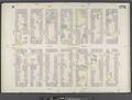
Maps from: Insurance Maps of the City of New York Surveyed and Published by Sanborn–Perris Map Co., Limited. Volume 8. (New York City: 1896), comprising 26 maps (double-page plates) numbered 153–178, plus street index and double-page volume key.
Source: The New York Public Library Digital Collections website, Atlas 122. Vol. 8, 1896.
Media in category "TIFF versions of Sanborn maps of Manhattan published in 1896"
The following 28 files are in this category, out of 28 total.
-
 Index NYPL1992808.tiff 5,408 × 7,208, 2 pages; 111.59 MB
-

-
 Manhattan, V. 8, Double Page Plate No. 153 (Map bounded by E. 77th St., East River, E. 72nd St., 1st Ave.) NYPL1992811.tiff 7,209 × 5,409, 2 pages; 111.62 MB
-
 Manhattan, V. 8, Double Page Plate No. 154 (Map bounded by 3rd Ave., E. 79th St., 1st Ave., E. 72nd St.) NYPL1992812.tiff 7,131 × 5,368, 2 pages; 109.58 MB
-
 Manhattan, V. 8, Double Page Plate No. 155 (Map bounded by E. 78th St., 3rd Ave., E. 72nd St., 5th Ave.) NYPL1992813.tiff 7,131 × 5,368, 2 pages; 109.58 MB
-
 Manhattan, V. 8, Double Page Plate No. 156 (Map bounded by E. 83rd St., 3rd Ave., E. 78th St., 5th Ave.) NYPL1992814.tiff 7,102 × 5,352, 2 pages; 108.81 MB
-
 Manhattan, V. 8, Double Page Plate No. 157 (Map bounded by E. 88th St., 3rd Ave., E. 83rd St., 5th Ave.) NYPL1992815.tiff 7,102 × 5,352, 2 pages; 108.81 MB
-
 Manhattan, V. 8, Double Page Plate No. 158 (Map bounded by 3rd Ave., E. 86th St., 1st Ave., E. 79th St.) NYPL1992816.tiff 7,139 × 5,372, 2 pages; 109.78 MB
-
 Manhattan, V. 8, Double Page Plate No. 159 (Map bounded by E. 82nd St., East River, E. 77th St., 5th Ave.) NYPL1992817.tiff 7,190 × 5,399, 2 pages; 111.12 MB
-
 Manhattan, V. 8, Double Page Plate No. 160 (Map bounded by E. 88th St., East River, E. 82nd St., 1st Ave.) NYPL1992818.tiff 7,201 × 5,404, 2 pages; 111.4 MB
-
 Manhattan, V. 8, Double Page Plate No. 161 (Map bounded by E. 93rd St., East River, E. 88th St., 1st Ave.) NYPL1992819.tiff 7,188 × 5,398, 2 pages; 111.07 MB
-
 Manhattan, V. 8, Double Page Plate No. 162 (Map bounded by 3rd Ave., E. 93rd St., 1st Ave., E. 86th St.) NYPL1992820.tiff 7,159 × 5,382, 2 pages; 110.3 MB
-
 Manhattan, V. 8, Double Page Plate No. 163 (Map bounded by E. 94th St., 3rd Ave., E. 88th St., 5th Ave.) NYPL1992821.tiff 7,125 × 5,364, 2 pages; 109.4 MB
-
 Manhattan, V. 8, Double Page Plate No. 164 (Map bounded by E. 99th St., 3rd Ave., E. 94th St., 5th Ave.) NYPL1992822.tiff 7,125 × 5,364, 2 pages; 109.4 MB
-
 Manhattan, V. 8, Double Page Plate No. 165 (Map bounded by E. 98th St., East River, E. 93rd St., 3rd Ave.) NYPL1992823.tiff 7,090 × 5,346, 2 pages; 108.5 MB
-

-
 Manhattan, V. 8, Double Page Plate No. 167 (Map bounded by E. 105th St., 3rd Ave., E. 99th St., 5th Ave.) NYPL1992825.tiff 7,162 × 5,384, 2 pages; 110.38 MB
-
 Manhattan, V. 8, Double Page Plate No. 168 (Map bounded by E. 110th St., 3rd Ave., E. 105th St., 5th Ave.) NYPL1992826.tiff 7,119 × 5,361, 2 pages; 109.25 MB
-
 Manhattan, V. 8, Double Page Plate No. 169 (Map bounded by E. 110th St., Harlem River, E. 104th St., 3rd Ave.) NYPL1992827.tiff 7,033 × 5,317, 2 pages; 107.05 MB
-
 Manhattan, V. 8, Double Page Plate No. 170 (Map bounded by 1st Ave., E. 118th St., Harlem River, E. 110th St.) NYPL1992828.tiff 6,943 × 5,269, 2 pages; 104.73 MB
-
 Manhattan, V. 8, Double Page Plate No. 171 (Map bounded by 3rd Ave., E. 117th St., 1st Ave., E. 110th St.) NYPL1992829.tiff 6,841 × 5,216, 2 pages; 102.15 MB
-
 Manhattan, V. 8, Double Page Plate No. 172 (Map bounded by E. 115th St., 3rd Ave., E. 110th St., 5th Ave.) NYPL1992830.tiff 6,924 × 5,259, 2 pages; 104.24 MB
-
 Manhattan, V. 8, Double Page Plate No. 173 (Map bounded by E. 120th St., 3rd Ave., E. 115th St., 5th Ave.) NYPL1992831.tiff 6,924 × 5,259, 2 pages; 104.24 MB
-

-
 Manhattan, V. 8, Double Page Plate No. 175 (Map bounded by 3rd Ave., E. 124th St., 1st Ave., E. 117th St.) NYPL1992833.tiff 6,863 × 5,227, 2 pages; 102.7 MB
-
 Manhattan, V. 8, Double Page Plate No. 176 (Map bounded by 1st Ave., E. 126th St., Harlem River, E. 118th St.) NYPL1992834.tiff 6,863 × 5,227, 2 pages; 102.7 MB
-
 Manhattan, V. 8, Double Page Plate No. 177 (Map bounded by 3rd Ave., Harlem River, 1st Ave., E. 124th St.) NYPL1992835.tiff 6,863 × 5,227, 2 pages; 102.7 MB
-
 Manhattan, V. 8, Double Page Plate No. 178 (Map bounded by E. 130th St., 3rd Ave., E. 125th St., 5th Ave.) NYPL1992836.tiff 6,798 × 5,193, 2 pages; 101.06 MB