Category:Sanborn maps of Manhattan published in 1896
Jump to navigation
Jump to search
Maps from: Insurance Maps of the City of New York Surveyed and Published by Sanborn–Perris Map Co., Limited. Volume 8. (New York City: 1896), comprising 26 maps (double-page plates) numbered 153–178, plus street index and double-page volume key.
Source: The New York Public Library Digital Collections website, Atlas 122. Vol. 8, 1896.
Subcategories
This category has only the following subcategory.
Media in category "Sanborn maps of Manhattan published in 1896"
The following 29 files are in this category, out of 29 total.
-
 Sanborn V. 8 volume key publ. 1896.jpg 6,381 × 4,674; 5.72 MB
-
 Sanborn V. 8 street index publ. 1896.jpg 4,695 × 6,808; 7.41 MB
-
-
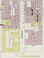
 Sanborn V. 8 Plate 153 publ. 1896.jpg 6,400 × 4,686; 4.53 MB
-
 Sanborn V. 8 Plate 154 publ. 1896.jpg 6,382 × 4,695; 6.67 MB
-
 Sanborn V. 8 Plate 155 publ. 1896.jpg 6,446 × 4,679; 5.43 MB
-
 Sanborn V. 8 Plate 156 publ. 1896.jpg 6,406 × 4,701; 4.9 MB
-
 Sanborn V. 8 Plate 157 publ. 1896.jpg 6,466 × 4,690; 5.4 MB
-
 Sanborn V. 8 Plate 158 publ. 1896.jpg 6,449 × 4,699; 5.48 MB
-
 Sanborn V. 8 Plate 159 publ. 1896.jpg 6,389 × 4,690; 4.5 MB
-
 Sanborn V. 8 Plate 160 publ. 1896.jpg 6,429 × 4,686; 5.32 MB
-
 Sanborn V. 8 Plate 161 publ. 1896.jpg 6,472 × 4,682; 4.16 MB
-
 Sanborn V. 8 Plate 162 publ. 1896.jpg 6,450 × 4,690; 5.15 MB
-
 Sanborn V. 8 Plate 163 publ. 1896.jpg 6,397 × 4,683; 5.28 MB
-
 Sanborn V. 8 Plate 164 publ. 1896.jpg 6,433 × 4,666; 4.32 MB
-
 Sanborn V. 8 Plate 165 publ. 1896.jpg 6,475 × 4,681; 4.51 MB
-
 Sanborn V. 8 Plate 166 publ. 1896.jpg 6,414 × 4,649; 5.7 MB
-
 Sanborn V. 8 Plate 167 publ. 1896.jpg 6,395 × 4,684; 4.75 MB
-
 Sanborn V. 8 Plate 168 publ. 1896.jpg 6,444 × 4,652; 5.09 MB
-
 Sanborn V. 8 Plate 169 publ. 1896.jpg 6,462 × 4,665; 5.34 MB
-
 Sanborn V. 8 Plate 170 publ. 1896.jpg 6,421 × 4,673; 4.82 MB
-
 Sanborn V. 8 Plate 171 publ. 1896.jpg 6,397 × 4,681; 6.48 MB
-
 Sanborn V. 8 Plate 172 publ. 1896.jpg 6,453 × 4,687; 6.57 MB
-
 Sanborn V. 8 Plate 173 publ. 1896.jpg 6,438 × 4,686; 5.03 MB
-
 Sanborn V. 8 Plate 174 publ. 1896.jpg 6,442 × 4,685; 6.34 MB
-
 Sanborn V. 8 Plate 175 publ. 1896.jpg 6,387 × 4,698; 5.39 MB
-
 Sanborn V. 8 Plate 176 publ. 1896.jpg 6,401 × 4,691; 5.83 MB
-
 Sanborn V. 8 Plate 177 publ. 1896.jpg 6,390 × 4,682; 4.69 MB
-
 Sanborn V. 8 Plate 178 publ. 1896.jpg 6,387 × 4,681; 5.61 MB


.jpg)


