Category:Street signs in Hampshire
Jump to navigation
Jump to search
Ceremonial counties of England: Bedfordshire · Berkshire · Buckinghamshire · Cambridgeshire · Cheshire · Cornwall · Cumbria · Derbyshire · Devon · Dorset · Durham · East Riding of Yorkshire · East Sussex · Essex · Gloucestershire · Greater London · Greater Manchester · Hampshire · Herefordshire · Hertfordshire · Kent · Lancashire · Leicestershire · Lincolnshire · Merseyside · Norfolk · North Yorkshire · Northamptonshire · Northumberland · Nottinghamshire · Oxfordshire · Rutland · Shropshire · Somerset · South Yorkshire · Staffordshire · Suffolk · Surrey · Tyne and Wear · Warwickshire · West Midlands · West Sussex · West Yorkshire · Wiltshire · Worcestershire
City-counties: Bristol · City of London
Former historic counties:
Other former counties:
City-counties: Bristol · City of London
Former historic counties:
Other former counties:
Subcategories
This category has only the following subcategory.
Media in category "Street signs in Hampshire"
The following 27 files are in this category, out of 27 total.
-
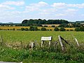
 Badger's Bank - geograph.org.uk - 1237619.jpg 640 × 480; 205 KB
-
 Blue and white street sign.jpg 5,184 × 3,456; 9.96 MB
-
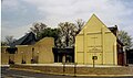
 Buriton, Hampshire 04.jpg 4,128 × 3,096; 10.98 MB
-

-
 Colourful street sign on Hayling Island - geograph.org.uk - 1416931.jpg 640 × 480; 112 KB
-
 Dances Way, West Town - geograph.org.uk - 709969.jpg 640 × 480; 49 KB
-
 Devils Lane sign, Liphook.jpg 2,816 × 2,112; 1.35 MB
-
-
 Footpath sign in St Peter's Road - geograph.org.uk - 1153288.jpg 640 × 480; 123 KB
-
 Hale Close, Ropley - panoramio (2).jpg 3,264 × 2,448; 4.61 MB
-
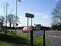
 Junction of Bevis and Sydney Roads - geograph.org.uk - 1373888.jpg 640 × 480; 79 KB
-

-

-
-
-

-
 Mill Close, Hayling Island - geograph.org.uk - 709822.jpg 640 × 480; 65 KB
-
 Palestine Road, Palestine - geograph.org.uk - 999871.jpg 640 × 480; 145 KB
-
 Redbridge Hill, off Romsey Road - geograph.org.uk - 1715465.jpg 553 × 415; 183 KB
-
 Sign for St. Swithun Street, SO23 - geograph.org.uk - 3279137.jpg 640 × 480; 65 KB
-
 Street signs, ancient and modern - geograph.org.uk - 699538.jpg 480 × 640; 82 KB
-

-
 Twittern from Tournerbury Lane - geograph.org.uk - 1517373.jpg 640 × 385; 84 KB
-
 Winchester (6287998111).jpg 4,256 × 2,832; 1.32 MB
-
 Zion Road, Palestine - geograph.org.uk - 491940.jpg 640 × 480; 138 KB
-
 Street sign - Marlowe Close - geograph.org.uk - 1269786.jpg 640 × 479; 105 KB
-
 Tubbs Lane - geograph.org.uk - 604679.jpg 640 × 480; 120 KB


.jpg)


.jpg)


