Category:Street signs in Essex
Jump to navigation
Jump to search
Ceremonial counties of England: Bedfordshire · Berkshire · Buckinghamshire · Cambridgeshire · Cheshire · Cornwall · Cumbria · Derbyshire · Devon · Dorset · Durham · East Riding of Yorkshire · East Sussex · Essex · Gloucestershire · Greater London · Greater Manchester · Hampshire · Herefordshire · Hertfordshire · Kent · Lancashire · Leicestershire · Lincolnshire · Merseyside · Norfolk · North Yorkshire · Northamptonshire · Northumberland · Nottinghamshire · Oxfordshire · Rutland · Shropshire · Somerset · South Yorkshire · Staffordshire · Suffolk · Surrey · Tyne and Wear · Warwickshire · West Midlands · West Sussex · West Yorkshire · Wiltshire · Worcestershire
City-counties: Bristol · City of London
Former historic counties:
Other former counties:
City-counties: Bristol · City of London
Former historic counties:
Other former counties:
Media in category "Street signs in Essex"
The following 27 files are in this category, out of 27 total.
-
 Faggoters Lane High Laver and Matching Essex England.jpg 3,878 × 3,102; 16.91 MB
-
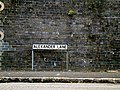 Alexander Lane sign - geograph.org.uk - 4688122.jpg 3,072 × 2,304; 3.1 MB
-
 Brindles Close sign - geograph.org.uk - 4684949.jpg 3,072 × 2,304; 1.88 MB
-
 Claughton Way Sign - geograph.org.uk - 2825513.jpg 3,072 × 2,304; 1.42 MB
-
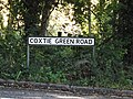 Coxtie Green Road sign - geograph.org.uk - 4678004.jpg 3,072 × 2,304; 1.98 MB
-
 Great Baddow Roadsign - geograph.org.uk - 1499330.jpg 3,072 × 2,304; 1.46 MB
-

-
 Halifax Way sign (geograph 5864355).jpg 3,790 × 2,842; 4.53 MB
-
 Halifax Way sign (geograph 5865347).jpg 3,892 × 2,919; 4.84 MB
-
 Horror Film Road - geograph.org.uk - 335919.jpg 640 × 480; 94 KB
-
 Hunter Avenue sign - geograph.org.uk - 4688261.jpg 2,995 × 2,244; 3.6 MB
-
 Hutton Drive sign - geograph.org.uk - 4685563.jpg 3,072 × 2,304; 1.95 MB
-
 Hutton Drive sign - geograph.org.uk - 4685915.jpg 3,072 × 2,304; 1.91 MB
-
 Long Ridings Avenue sign - geograph.org.uk - 4688134.jpg 3,072 × 2,304; 1.95 MB
-
 Middleton Hall Road sign - geograph.org.uk - 4683206.jpg 3,072 × 2,304; 1.99 MB
-
 Oliver Road sign - geograph.org.uk - 4688183.jpg 3,072 × 2,304; 1.84 MB
-
 Priests Lane sign - geograph.org.uk - 4683316.jpg 1,611 × 1,716; 1.07 MB
-
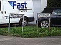 Priests Lane ^ Woodway signs - geograph.org.uk - 4683334.jpg 3,072 × 2,304; 2.12 MB
-
 Princes Way sign - geograph.org.uk - 4684884.jpg 3,072 × 2,304; 1.86 MB
-
 Road sign - geograph.org.uk - 487480.jpg 640 × 427; 174 KB
-
 Springfield Avenue sign - geograph.org.uk - 4685826.jpg 3,033 × 2,272; 3.23 MB
-
 Spurgate sign - geograph.org.uk - 4684886.jpg 2,912 × 2,181; 2.53 MB
-
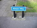 Street sign 'Kitson' Way Harlow - geograph.org.uk - 1213894.jpg 640 × 480; 86 KB
-
 Street-name sign, Stalin Road - geograph.org.uk - 4664854.jpg 891 × 1,024; 348 KB
-
 VWGolf2.jpg 688 × 467; 261 KB
-
 Which Road is Which^ - geograph.org.uk - 792350.jpg 640 × 480; 83 KB
-
 York Road sign - geograph.org.uk - 5869207.jpg 4,608 × 3,456; 3.99 MB


.jpg)
.jpg)


