Category:Street maps of Mariupol
Jump to navigation
Jump to search
Media in category "Street maps of Mariupol"
The following 26 files are in this category, out of 26 total.
-
 Budivelnykiv street.png 145 × 430; 45 KB
-
 Fontanna street.png 712 × 503; 258 KB
-
 Greek street.png 344 × 484; 142 KB
-
 Kalmiuskyi rayon.png 2,103 × 1,873; 2.74 MB
-
 Kazanceva street.png 203 × 382; 79 KB
-
 Kharlampijivska street.png 253 × 568; 101 KB
-
 Kuindzhies street.png 229 × 459; 101 KB
-
 Lavitckohos street.png 927 × 302; 205 KB
-
 Lomizovas street.png 58 × 369; 20 KB
-
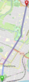 Metalurhiv avenue.png 187 × 519; 73 KB
-
 Mikhajla Hrushevskogo street.png 106 × 392; 42 KB
-
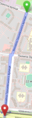
 Mykolaivska street.png 970 × 560; 430 KB
-
 Myru avenue.png 742 × 164; 125 KB
-
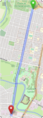
 Nicopolskyj avenue.png 978 × 236; 201 KB
-
 Peremohy avenue.png 634 × 97; 64 KB
-
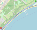 Prymorskyj boulevard.png 607 × 491; 131 KB
-
 Pushkina street.png 709 × 115; 59 KB
-
 Semashka street.png 729 × 224; 69 KB
-
 Shevchenkos boulevard.png 653 × 263; 167 KB
-
 Soborna street.png 841 × 298; 134 KB
-
 Street Heorgijvska.png 895 × 170; 109 KB
-
 Street Karpinskoho.png 185 × 507; 83 KB
-
 The architector Nilsen's street.png 91 × 507; 37 KB
-
 Torhova street.png 254 × 411; 87 KB
-
 Zemska street.png 97 × 455; 51 KB
-
 Райони Лівого берега.png 1,835 × 1,247; 1.72 MB


