Category:Maps of Mariupol
Jump to navigation
Jump to search
Wikimedia category | |||||
| Upload media | |||||
| Instance of | |||||
|---|---|---|---|---|---|
| Category combines topics | |||||
| Mariupol | |||||
city and seaport in Donetsk Oblast, Ukraine | |||||
| Pronunciation audio | |||||
| Instance of |
| ||||
| Part of | |||||
| Named after |
| ||||
| Location |
| ||||
| Located in or next to body of water | |||||
| Official language | |||||
| Head of government |
| ||||
| Inception |
| ||||
| Significant event | |||||
| Population |
| ||||
| Area |
| ||||
| Elevation above sea level |
| ||||
| official website | |||||
 | |||||
Subcategories
This category has the following 3 subcategories, out of 3 total.
Media in category "Maps of Mariupol"
The following 29 files are in this category, out of 29 total.
-
Density mar.png 897 × 1,000; 309 KB
-
Flag Map Of Mariupol (Ukraine).png 3,982 × 5,152; 2.21 MB
-
Illyicha mp mar.jpg 700 × 780; 114 KB
-
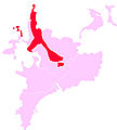
Ilyichevsky mar.jpg 700 × 780; 120 KB
-
Ilyichevsky mar.png 1,166 × 523; 446 KB
-
Livoberezhnyi rayon Mariupol.png 1,835 × 1,247; 1.71 MB
-
Map ukr Mariupol2.jpg 897 × 1,000; 116 KB
-
Mariupol ATD-2020 (ru).png 1,654 × 2,104; 272 KB
-
Mariupol pos.png 1,200 × 799; 195 KB
-
Mariupol tr 40.png 750 × 716; 354 KB
-
Mariupol tr 57.png 750 × 724; 431 KB
-
Mariupol tr 71.png 800 × 691; 460 KB
-
Mariupol tr 77.png 800 × 691; 469 KB
-
Mariupol tr 78.png 694 × 600; 376 KB
-
Mariupol-Novoazovsk (OpenStreetMap).png 1,665 × 939; 554 KB
-
Mariupol-Raion.png 296 × 410; 72 KB
-
Mariupol-Rayon 1932-1945 (ru).png 1,614 × 1,122; 153 KB
-
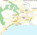
Ordzhonikidzevsky mar.png 608 × 414; 210 KB
-
Pollution mar.jpg 897 × 1,000; 361 KB
-
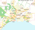
Primorsky mar.png 509 × 401; 169 KB
-
Raions of Mariupol.png 529 × 438; 88 KB
-
Siege of Mariupol (2022) (ru).svg 1,250 × 1,135; 75 KB
-
Siege of Mariupol (2022).svg 1,250 × 1,135; 75 KB
-
Starykrym mar.jpg 700 × 780; 98 KB
-
Talakovka mar.jpg 700 × 780; 94 KB
-
UA map Mariupol.png 1,200 × 799; 75 KB
-
Zhovtnevy mar.jpg 700 × 780; 103 KB


