Category:Stirling (civil parish)
Jump to navigation
Jump to search
Scottish parish in Stirling, Scotland, UK | |||||
| Upload media | |||||
| Instance of | |||||
|---|---|---|---|---|---|
| Part of |
| ||||
| Named after | |||||
| Location |
| ||||
| Population |
| ||||
| Area |
| ||||
 | |||||
Subcategories
This category has the following 4 subcategories, out of 4 total.
C
S
W
Media in category "Stirling (civil parish)"
The following 200 files are in this category, out of 838 total.
(previous page) (next page)-
 "Ici on parle un sort of français" - geograph.org.uk - 2720361.jpg 480 × 640; 65 KB
-
 'Wee Wallace' - geograph.org.uk - 2911851.jpg 480 × 640; 549 KB
-
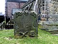
 A 1579 gravestone - geograph.org.uk - 5876920.jpg 1,600 × 1,280; 670 KB
-
 A bench on Gowan Hill - geograph.org.uk - 5888964.jpg 1,024 × 683; 186 KB
-
 A ditch beside the Royal Gardens - geograph.org.uk - 5949327.jpg 1,600 × 1,000; 330 KB
-
 A Merchant's Grave - geograph.org.uk - 4349162.jpg 640 × 484; 123 KB
-
 A pair of postboxes - geograph.org.uk - 5701313.jpg 1,280 × 1,081; 1.09 MB
-
 A path beside some outcrops - geograph.org.uk - 5888972.jpg 1,024 × 768; 303 KB
-
 A wild patch, Broomridge - geograph.org.uk - 5670723.jpg 1,024 × 683; 387 KB
-
 A9, Stirling - geograph.org.uk - 3155138.jpg 640 × 480; 228 KB
-
 Abbey Craig and Dumyat - geograph.org.uk - 4838138.jpg 3,264 × 2,448; 3.19 MB
-
 Abbey Craig and the Ochil Hills - geograph.org.uk - 2547205.jpg 1,500 × 1,125; 222 KB
-
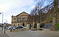 Albert Halls - geograph.org.uk - 5698371.jpg 1,280 × 814; 889 KB
-
 Albert Halls, detail - geograph.org.uk - 5703030.jpg 1,024 × 768; 190 KB
-
 Albert Halls, Stirling - geograph.org.uk - 5702664.jpg 1,600 × 948; 281 KB
-
 Allan Park Hotel, Stirling - geograph.org.uk - 1846078.jpg 640 × 480; 59 KB
-
 Allan Park South Church - geograph.org.uk - 5250555.jpg 640 × 480; 136 KB
-

-
 Apartment buildings on Forthside Way - geograph.org.uk - 5249734.jpg 640 × 324; 106 KB
-
 Approaching King's Knot - geograph.org.uk - 2017055.jpg 1,024 × 768; 115 KB
-

-

-
 Back O'Hill Road, Stirling - geograph.org.uk - 3606259.jpg 3,872 × 2,592; 4.79 MB
-
 Ballengeich Cemetery - geograph.org.uk - 3065893.jpg 640 × 465; 159 KB
-
 Ballengeich Cemetery - geograph.org.uk - 5885859.jpg 1,600 × 667; 282 KB
-
 Ballengeich Cemetery - geograph.org.uk - 5885867.jpg 1,024 × 706; 179 KB
-
 Ballengeich Cemetery - geograph.org.uk - 5885892.jpg 1,024 × 768; 205 KB
-
 Ballengeich Cemetery - geograph.org.uk - 6488928.jpg 1,024 × 685; 182 KB
-
 Ballengeich Cemetery, entrance - geograph.org.uk - 5885852.jpg 1,024 × 716; 199 KB
-
 Ballengeich Cemetery, the northern end - geograph.org.uk - 5885887.jpg 1,024 × 768; 207 KB
-
 Ballenleich Cemetery, Stirling - geograph.org.uk - 4236360.jpg 1,600 × 1,062; 721 KB
-
 Balmoral Place, Stirling - geograph.org.uk - 5703753.jpg 1,024 × 683; 168 KB
-
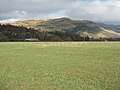
 Barley field near Cambuskenneth - geograph.org.uk - 3605226.jpg 3,872 × 2,592; 1.39 MB
-
 Bastion beside Dumbarton Road - geograph.org.uk - 5702992.jpg 1,600 × 1,084; 468 KB
-
 Beech at Stirling Castle - geograph.org.uk - 4839830.jpg 2,787 × 2,089; 2.51 MB
-
 Beginning of Funnel Cloud Over Stirling - geograph.org.uk - 2258828.jpg 3,264 × 2,448; 1.19 MB
-
 Beginning of Funnel Cloud Over Stirling - geograph.org.uk - 2258831.jpg 3,264 × 2,448; 835 KB
-
 Ben Ledi from Stirling Castle - geograph.org.uk - 4839951.jpg 3,264 × 2,448; 3.1 MB
-
 Beside the high-level path, King's Park - geograph.org.uk - 6287742.jpg 1,024 × 768; 305 KB
-
 Bhs, Thistles Shopping Centre, Stirling - geograph.org.uk - 5700043.jpg 1,280 × 960; 801 KB
-
 Bingo, Stirling - geograph.org.uk - 1846063.jpg 640 × 480; 65 KB
-
 Black Boy Fountain - geograph.org.uk - 5699686.jpg 1,280 × 996; 1.03 MB
-
 Black Boy Fountain - geograph.org.uk - 5699821.jpg 1,280 × 960; 845 KB
-
 Black Dub and Dripend - geograph.org.uk - 4841038.jpg 3,264 × 2,448; 2.92 MB
-
 Black ^ Lizars, Stirling - geograph.org.uk - 1846102.jpg 640 × 480; 57 KB
-

-
 Boer War memorial stone - geograph.org.uk - 5705089.jpg 1,600 × 1,200; 710 KB
-

-

-
 Boundary stone, St John Street, Stirling - geograph.org.uk - 6396225.jpg 1,460 × 1,946; 855 KB
-
 Building site on Goosecroft Road - geograph.org.uk - 4555540.jpg 640 × 480; 150 KB
-
 Bungalow on Causewayhead Road, Stirling - geograph.org.uk - 4235775.jpg 1,600 × 1,409; 1.03 MB
-
 Burghmuir Road, Stirling - geograph.org.uk - 5249799.jpg 640 × 404; 98 KB
-
 Busker outside M^S - geograph.org.uk - 5700006.jpg 1,280 × 1,176; 963 KB
-
 Cambuskenneth Abbey - geograph.org.uk - 2964122.jpg 4,320 × 3,240; 3.42 MB
-
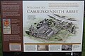 Cambuskenneth Abbey information - geograph.org.uk - 4838126.jpg 3,133 × 2,097; 2.18 MB
-
 Cambuskenneth Abbey near Stirling - geograph.org.uk - 4236381.jpg 1,062 × 1,600; 582 KB
-
 Cambuskenneth Abbey, bell tower - geograph.org.uk - 3446489.jpg 1,646 × 1,142; 450 KB
-
 Cambuskenneth Abbey, doocot ruins - geograph.org.uk - 2617678.jpg 1,920 × 1,440; 444 KB
-
 Cambuskenneth Abbey, remains (2) - geograph.org.uk - 2617749.jpg 1,024 × 768; 156 KB
-
 Cambuskenneth Abbey, remains - geograph.org.uk - 2617741.jpg 1,024 × 768; 151 KB
-
 Cambuskenneth Abbey, Royal grave (4) - geograph.org.uk - 2617667.jpg 1,920 × 1,440; 536 KB
-
 Cambuskenneth Abbey, Royal grave - geograph.org.uk - 2617600.jpg 1,024 × 768; 239 KB
-
 Cambuskenneth footbridge (2) - geograph.org.uk - 2617811.jpg 1,024 × 768; 233 KB
-
 Cambuskenneth Haugh (2) - geograph.org.uk - 2617777.jpg 1,024 × 768; 143 KB
-
 Cambuskenneth Haugh - geograph.org.uk - 2617763.jpg 1,024 × 768; 139 KB
-
 Cambuskenneth, Hoods Farm - geograph.org.uk - 2617422.jpg 1,024 × 768; 99 KB
-
 Cambuskenneth, Ladysneuk Road - geograph.org.uk - 2617795.jpg 1,024 × 768; 254 KB
-
 Cambuskenneth, South Street (2) - geograph.org.uk - 2617215.jpg 768 × 1,024; 210 KB
-
 Cambuskenneth, South Street (3) - geograph.org.uk - 2617224.jpg 1,024 × 768; 126 KB
-
 Cambuskenneth, South Street (4) - geograph.org.uk - 2617804.jpg 1,024 × 768; 117 KB
-
 Cambuskenneth, South Street - geograph.org.uk - 2617206.jpg 1,024 × 768; 122 KB
-
 Campanile Tower - geograph.org.uk - 2001169.jpg 640 × 480; 64 KB
-

-

-
 Car Park at Stirling Castle - geograph.org.uk - 3175258.jpg 1,600 × 1,200; 506 KB
-
 Car park, Sainsbury, Stirling - geograph.org.uk - 6286658.jpg 1,024 × 576; 220 KB
-
 Carlton Bingo Hall - geograph.org.uk - 5699887.jpg 1,280 × 837; 951 KB
-
 Carter's Toy Shop, Stirling - geograph.org.uk - 1846026.jpg 640 × 480; 60 KB
-
 Carved dragon on a gatepost - geograph.org.uk - 5946946.jpg 1,024 × 768; 229 KB
-
 Carved wigged head on Norrie's Lodging - geograph.org.uk - 6286612.jpg 1,024 × 576; 106 KB
-
 Carved wooden cross - geograph.org.uk - 5701079.jpg 1,024 × 802; 314 KB
-
 Carving and inscription above the Filling Station - geograph.org.uk - 5699589.jpg 1,280 × 1,548; 1.48 MB
-
 Castle wall - geograph.org.uk - 2547150.jpg 1,500 × 2,000; 896 KB
-
 Causewayhead Road - geograph.org.uk - 3602345.jpg 3,872 × 2,592; 4.46 MB
-

-

-
 Causewayhead Road railway bridge replacement - geograph.org.uk - 3687282.jpg 1,024 × 701; 257 KB
-

-
 Cemetery at Stirling Castle - geograph.org.uk - 6484009.jpg 1,799 × 1,199; 400 KB
-
 Cemetery below Stirling Castle - geograph.org.uk - 3212477.jpg 1,024 × 681; 142 KB
-

-
 Church of the Holy Rude and churchyard, Stirling - geograph.org.uk - 6277320.jpg 4,608 × 3,456; 3.49 MB
-
 Church of The Holy Rude cemetery - geograph.org.uk - 4542310.jpg 640 × 480; 180 KB
-
 Church of the Holy Rude, interior detail - geograph.org.uk - 6286593.jpg 768 × 1,024; 215 KB
-
 Church of the Holy Rude, Stirling - geograph.org.uk - 6277317.jpg 4,608 × 3,456; 3.8 MB
-
 Churchyard of the Holy Rood, Stirling - geograph.org.uk - 6488900.jpg 1,024 × 686; 180 KB
-
 Churchyard of the Holy Rood, Stirling - geograph.org.uk - 6488916.jpg 1,024 × 699; 138 KB
-
 City centre, Stirling - geograph.org.uk - 5013206.jpg 640 × 480; 84 KB
-
 Cleared site off Dumbarton Road - geograph.org.uk - 5702976.jpg 1,024 × 569; 125 KB
-
 Clock Tower, Allan Park - geograph.org.uk - 2911862.jpg 480 × 640; 523 KB
-
 Clydesdale Bank Building - geograph.org.uk - 5250581.jpg 607 × 640; 150 KB
-
 Clydesdale Bank Building - geograph.org.uk - 5250582.jpg 591 × 640; 153 KB
-
 Cold Beer at former Post Office - geograph.org.uk - 5701306.jpg 1,280 × 901; 815 KB
-
 Community Orchard, King's Park - geograph.org.uk - 6287725.jpg 1,024 × 768; 303 KB
-
 Condemned buildings, Raploch - geograph.org.uk - 1025091.jpg 640 × 359; 49 KB
-
 Cooperage Quay - geograph.org.uk - 1753522.jpg 640 × 480; 81 KB
-
 Corn Exchange - geograph.org.uk - 5697669.jpg 1,280 × 1,144; 814 KB
-
 Council Offices, Stirling - geograph.org.uk - 2871369.jpg 2,816 × 2,112; 1.16 MB
-
 Cowden - geograph.org.uk - 185116.jpg 640 × 478; 115 KB
-
 Craigforth - geograph.org.uk - 524142.jpg 640 × 424; 50 KB
-
 CTC plaque - geograph.org.uk - 5250621.jpg 624 × 640; 142 KB
-
 Curly Coo Bar - geograph.org.uk - 5701428.jpg 1,280 × 830; 706 KB
-
 Curly Coo Bar sign - geograph.org.uk - 6228827.jpg 3,200 × 4,267; 623 KB
-
 Dark clouds at Stirling Station - geograph.org.uk - 4727277.jpg 3,504 × 2,336; 2.94 MB
-
 Darnley Coffee House, 18 Bow Street, Stirling - geograph.org.uk - 4078481.jpg 3,456 × 5,184; 3.37 MB
-
 Date stone on the Bridge Clock Tower - geograph.org.uk - 5946909.jpg 768 × 1,024; 206 KB
-
 Dawn, Stirling - geograph.org.uk - 3174458.jpg 640 × 281; 176 KB
-
 Detail of Mar's Wark - geograph.org.uk - 2720964.jpg 640 × 480; 105 KB
-
 Development - geograph.org.uk - 4716617.jpg 640 × 480; 56 KB
-
 Ditch to the south of the King's Knot - geograph.org.uk - 5949095.jpg 1,600 × 1,200; 414 KB
-
 Ditch to the south of the King's Knot - geograph.org.uk - 5949264.jpg 1,024 × 768; 199 KB
-
 Door of the former High School - geograph.org.uk - 5702720.jpg 1,166 × 1,600; 454 KB
-
 Doorway of Argylls Lodging - geograph.org.uk - 2720719.jpg 465 × 640; 76 KB
-
 Drinking fountain, Kings Park, Stirling - geograph.org.uk - 4237330.jpg 800 × 600; 165 KB
-
 Drip Road - geograph.org.uk - 2838878.jpg 640 × 360; 206 KB
-
 Drip Road, Raploch, Stirling - geograph.org.uk - 6286655.jpg 1,024 × 576; 241 KB
-
 Drumming practice near Sirling Bridge - geograph.org.uk - 3602351.jpg 3,872 × 2,592; 4.63 MB
-
 Dumbarton Road at Glebe Avenue - geograph.org.uk - 5250560.jpg 640 × 284; 60 KB
-
 Dumbarton Road, the approach to Stirling - geograph.org.uk - 5707915.jpg 1,024 × 640; 134 KB
-
 East side of Stirling Castle - geograph.org.uk - 3212470.jpg 1,024 × 681; 165 KB
-
 Entering Cambuskenneth - geograph.org.uk - 2166100.jpg 640 × 426; 65 KB
-
 Entrance towers - geograph.org.uk - 2547210.jpg 1,500 × 2,000; 556 KB
-
 Erskine of Gogar's House, detail - geograph.org.uk - 6287530.jpg 768 × 1,024; 218 KB
-
 Escarpment beside path - geograph.org.uk - 5707991.jpg 1,024 × 768; 293 KB
-

-
 Falleninch, Stirling - geograph.org.uk - 3212443.jpg 1,024 × 681; 120 KB
-
 Farm at Camnuskenneth - geograph.org.uk - 3605262.jpg 3,872 × 2,592; 3.44 MB
-
 Farm track - geograph.org.uk - 1220984.jpg 640 × 400; 73 KB
-
 Farm track - geograph.org.uk - 5707920.jpg 1,024 × 768; 211 KB
-
 Farm track, Cambuskenneth - geograph.org.uk - 2166112.jpg 640 × 426; 51 KB
-
 Farmland at Falleninch - geograph.org.uk - 2674226.jpg 3,264 × 2,448; 3.75 MB
-
 Ferry Orchard - geograph.org.uk - 3154423.jpg 640 × 480; 338 KB
-
 First World War Memorial - geograph.org.uk - 5707723.jpg 1,600 × 1,200; 494 KB
-

-
 Flowerbeds in Springtime - geograph.org.uk - 5698559.jpg 1,280 × 1,029; 1.07 MB
-
 Footpath at Homestead Farm - geograph.org.uk - 5707982.jpg 1,024 × 640; 177 KB
-
 Footpath to Stirling Castle - geograph.org.uk - 3605771.jpg 3,872 × 2,592; 3.92 MB
-
 Former British Linen Bank building - geograph.org.uk - 5250607.jpg 480 × 640; 119 KB
-

-

-
 Former gravel pit in King's Park - geograph.org.uk - 5708077.jpg 1,024 × 640; 192 KB
-
 Former High School door - geograph.org.uk - 4555763.jpg 519 × 640; 182 KB
-
 Former industrial building, Forthside - geograph.org.uk - 3174444.jpg 640 × 480; 278 KB
-

-

-
 Former Post Office building - geograph.org.uk - 5250648.jpg 640 × 480; 133 KB
-
 Former Post Office building - geograph.org.uk - 5250649.jpg 640 × 480; 129 KB
-
 Forthside - geograph.org.uk - 3174438.jpg 640 × 480; 243 KB
-
 Forthside - geograph.org.uk - 3174441.jpg 640 × 480; 259 KB
-
 Forthside Bridge - geograph.org.uk - 3172958.jpg 640 × 480; 276 KB
-
 Forthside Bridge, Stirling - detail - geograph.org.uk - 6384595.jpg 1,024 × 768; 104 KB
-
 Forthside Bridge, Stirling Station - geograph.org.uk - 2911891.jpg 640 × 481; 400 KB
-
 Fountain and Clock, Stirling - geograph.org.uk - 1846075.jpg 640 × 480; 65 KB
-
 Fun fair, Stirling - geograph.org.uk - 3687245.jpg 640 × 425; 179 KB
-
 Garden at Stirling Castle - geograph.org.uk - 6484013.jpg 1,799 × 1,199; 525 KB
-
 George Christie clock tower - geograph.org.uk - 5700444.jpg 1,280 × 1,600; 389 KB
-
 George Christie clock tower, base detail - geograph.org.uk - 5700447.jpg 1,024 × 768; 217 KB
-
 George Christie clock tower, base detail - geograph.org.uk - 5700455.jpg 1,600 × 1,200; 336 KB
-
 George Christie Clocktower - geograph.org.uk - 5699671.jpg 1,280 × 1,581; 1.33 MB
-
 Georgian House B ^ B, Stirling - geograph.org.uk - 1846080.jpg 640 × 480; 60 KB
-
 Gowan Hill Cemetery from Stirling Castle - geograph.org.uk - 2674227.jpg 3,264 × 2,448; 4.34 MB
-
 Gowanhill Cemetery - geograph.org.uk - 2673621.jpg 3,264 × 2,448; 4.92 MB
-
 Gowanhill Cemetery - geograph.org.uk - 3997530.jpg 3,008 × 2,000; 1.71 MB
-
 GR Postbox (F8 90) - geograph.org.uk - 5699981.jpg 1,280 × 1,347; 1.22 MB
-
 Grieving angel, Holy Rude Kirkyard - geograph.org.uk - 2723446.jpg 480 × 640; 98 KB
-
 Hall of the Boys' Club - geograph.org.uk - 5702929.jpg 1,024 × 768; 147 KB
-
 Heading west from Stirling - geograph.org.uk - 5707914.jpg 1,024 × 640; 145 KB
-

-
 Henry Campbell-Bannerman (1836-1908) - geograph.org.uk - 5697719.jpg 1,280 × 1,280; 1.38 MB
-
 Hereford cattle, Cambuskenneth - geograph.org.uk - 2969373.jpg 640 × 480; 358 KB
-
 Herefords, Cambuskenneth - geograph.org.uk - 4131457.jpg 640 × 480; 334 KB
-
 Highest point, King's Park - geograph.org.uk - 5269403.jpg 800 × 533; 223 KB
-
 Historic buildings in Stirling - geograph.org.uk - 6152591.jpg 1,600 × 1,067; 427 KB
-
 Historic buildings in Stirling - geograph.org.uk - 6152593.jpg 1,600 × 1,067; 517 KB
-
 Holy Rude Gravestone - geograph.org.uk - 4349172.jpg 640 × 509; 119 KB
-
 Holy Rude Kirkyard - geograph.org.uk - 2723442.jpg 640 × 480; 117 KB
-
 Holy Rude, Stirling, August 2014 - geograph.org.uk - 4123723.jpg 640 × 480; 72 KB
-
 Holy Rude, Stirling, churchyard (a) - geograph.org.uk - 4123712.jpg 640 × 480; 60 KB
-
 Holy Rude, Stirling, churchyard (b) - geograph.org.uk - 4123742.jpg 640 × 480; 64 KB
-
 Holy Rude, Stirling, churchyard (c) - geograph.org.uk - 4123747.jpg 640 × 480; 68 KB
-
 Holy Rude, Stirling, churchyard (d) - geograph.org.uk - 4123749.jpg 640 × 480; 57 KB
-
 Holy Rude, Stirling, churchyard (e) - geograph.org.uk - 4123753.jpg 640 × 480; 85 KB
-
 Holy Rude, Stirling, churchyard (f) - geograph.org.uk - 4123769.jpg 640 × 480; 87 KB
-
 Holy Rude, Stirling, churchyard (g) - geograph.org.uk - 4123763.jpg 640 × 480; 91 KB
-
 Holy Trinity Episcopal Church, Stirling - geograph.org.uk - 5702676.jpg 1,024 × 683; 135 KB
-

-
 Hotel Collesio - geograph.org.uk - 4557716.jpg 640 × 398; 113 KB
-
 Houses on Glasgow Road - geograph.org.uk - 5664374.jpg 1,280 × 960; 935 KB
-
 Housing in Raploch - geograph.org.uk - 3606269.jpg 3,872 × 2,592; 4.32 MB


_-_geograph.org.uk_-_2617749.jpg)

_-_geograph.org.uk_-_2617667.jpg)

_-_geograph.org.uk_-_2617811.jpg)
_-_geograph.org.uk_-_2617777.jpg)


_-_geograph.org.uk_-_2617215.jpg)
_-_geograph.org.uk_-_2617224.jpg)
_-_geograph.org.uk_-_2617804.jpg)


_-_geograph.org.uk_-_5699981.jpg)


_-_geograph.org.uk_-_5697719.jpg)


_-_geograph.org.uk_-_4123712.jpg)
_-_geograph.org.uk_-_4123742.jpg)
_-_geograph.org.uk_-_4123747.jpg)
_-_geograph.org.uk_-_4123749.jpg)
_-_geograph.org.uk_-_4123753.jpg)
_-_geograph.org.uk_-_4123769.jpg)
_-_geograph.org.uk_-_4123763.jpg)


&filefrom=Ice+cream+van+outside+Stirling+Castle+-+geograph.org.uk+-+4123829.jpg#mw-category-media)