Category:St Boswells (civil parish)
Jump to navigation
Jump to search
Scottish parish in Scottish Borders, Scotland, UK | |||||
| Upload media | |||||
| Instance of | |||||
|---|---|---|---|---|---|
| Part of |
| ||||
| Named after | |||||
| Location |
| ||||
| Population |
| ||||
| Area |
| ||||
 | |||||
Subcategories
This category has the following 2 subcategories, out of 2 total.
N
S
- St. Boswells (28 F)
Media in category "St Boswells (civil parish)"
The following 200 files are in this category, out of 457 total.
(previous page) (next page)-
 "The Street" on A68 - geograph.org.uk - 4852317.jpg 640 × 451; 63 KB
-
 'Crystal Well' - geograph.org.uk - 3330203.jpg 600 × 800; 184 KB
-
 'Crystal Well' - Pumping Station - geograph.org.uk - 3330297.jpg 800 × 600; 161 KB
-
 'G House' - geograph.org.uk - 3914901.jpg 3,448 × 4,592; 3.65 MB
-
 'G House' Passageway - geograph.org.uk - 3914931.jpg 3,448 × 4,592; 2.85 MB
-
 A big grazing field at Elliston - geograph.org.uk - 3345203.jpg 640 × 427; 211 KB
-
 A blacksmith sign at St Boswells - geograph.org.uk - 3697626.jpg 571 × 640; 180 KB
-
 A car boot sale at St Boswells - geograph.org.uk - 3129715.jpg 640 × 450; 227 KB
-
 A car wash sign at St Boswells - geograph.org.uk - 4364297.jpg 450 × 640; 187 KB
-
 A cricket match at St Boswells - geograph.org.uk - 1814183.jpg 640 × 357; 153 KB
-
 A cricket match at St Boswells - geograph.org.uk - 4626110.jpg 640 × 427; 185 KB
-
 A crop, recently planted - geograph.org.uk - 3293155.jpg 640 × 480; 260 KB
-
 A dead elm tree near Whitelee - geograph.org.uk - 2326098.jpg 640 × 427; 151 KB
-
 A Disused Fire Door - geograph.org.uk - 3911725.jpg 3,448 × 4,592; 3.38 MB
-
 A donkey at Milestone Garden Centre - geograph.org.uk - 5634025.jpg 735 × 1,024; 811 KB
-
 A fun corner at Milestone - geograph.org.uk - 2514723.jpg 640 × 466; 192 KB
-
 A glimpse of Mertoun Bridge - geograph.org.uk - 3901663.jpg 640 × 480; 101 KB
-
 A Mix Of Old And New - geograph.org.uk - 3917591.jpg 4,592 × 3,448; 2.59 MB
-

-
 A River Tweed View - geograph.org.uk - 5182649.jpg 640 × 411; 107 KB
-
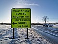 A road diversion sign at St Boswells - geograph.org.uk - 3312126.jpg 640 × 478; 196 KB
-
 A ruined mansion house at Elliston - geograph.org.uk - 3345210.jpg 640 × 427; 209 KB
-
 A sundial in St Boswells - geograph.org.uk - 3762683.jpg 480 × 640; 171 KB
-

-
 A68 entering St. Boswells - geograph.org.uk - 6004028.jpg 1,024 × 576; 137 KB
-
 A699 looking north east - geograph.org.uk - 5109898.jpg 640 × 480; 72 KB
-
 A699 road near Maxpoffle - geograph.org.uk - 3478480.jpg 1,024 × 768; 166 KB
-
 A699 towards Kelso - geograph.org.uk - 5109885.jpg 3,648 × 2,736; 2.02 MB
-
 A699 towards Kelso - geograph.org.uk - 5109901.jpg 640 × 480; 69 KB
-
 A699 towards Kelso - geograph.org.uk - 5113269.jpg 640 × 480; 79 KB
-
 A699 towards St Boswells - geograph.org.uk - 5112151.jpg 640 × 480; 53 KB
-
 A699, St Boswells - geograph.org.uk - 5112172.jpg 640 × 480; 57 KB
-
 A699, St Boswells - geograph.org.uk - 5112179.jpg 640 × 480; 68 KB
-
 An Old Factory Building At Charlesfield - geograph.org.uk - 3911716.jpg 3,448 × 4,592; 2.62 MB
-
 An Old Pump House - geograph.org.uk - 5182643.jpg 640 × 424; 141 KB
-
 Another Loading Bay - geograph.org.uk - 3914890.jpg 3,448 × 4,592; 3.4 MB
-
 Approaching a bend in the A68 near Birchbank Laretburn - geograph.org.uk - 2952214.jpg 1,458 × 1,045; 449 KB
-
 Arniesyde Plantation - geograph.org.uk - 3293158.jpg 640 × 480; 364 KB
-
 Arniesyde Plantation - geograph.org.uk - 3293160.jpg 640 × 480; 348 KB
-
 Arniesyde Plantation - geograph.org.uk - 6752420.jpg 1,024 × 683; 380 KB
-
 At the field edge - geograph.org.uk - 1050716.jpg 427 × 640; 141 KB
-

-
 Barley, Lesudden - geograph.org.uk - 1943505.jpg 640 × 480; 112 KB
-
 Barn Conversion, Whitelee Steading - geograph.org.uk - 2080593.jpg 640 × 480; 100 KB
-
 Benrig Cemetery - geograph.org.uk - 5112239.jpg 640 × 480; 95 KB
-
 Benrig Cemetery - geograph.org.uk - 5112243.jpg 640 × 480; 105 KB
-
 Benrig Cemetery - geograph.org.uk - 5182651.jpg 640 × 440; 110 KB
-
 Borders Gunroom (retail) - geograph.org.uk - 6379485.jpg 5,184 × 3,888; 602 KB
-
 Borders Toyota - geograph.org.uk - 3901350.jpg 640 × 480; 106 KB
-
 Bowden Burn at Newtown St Boswells - geograph.org.uk - 2348807.jpg 800 × 530; 204 KB
-
 Braeheads House back St Boswells.jpg 4,608 × 3,456; 5.17 MB
-
 Bridge over the Bowden Burn - geograph.org.uk - 4668266.jpg 800 × 534; 543 KB
-
 Bridge over the River Tweed - geograph.org.uk - 5011551.jpg 640 × 480; 83 KB
-
 Bridge, Dryburgh - geograph.org.uk - 4668906.jpg 800 × 534; 523 KB
-
 Bridge, Whitelee - geograph.org.uk - 4207684.jpg 800 × 600; 594 KB
-
 Buccleuch Arms Hotel - geograph.org.uk - 2952188.jpg 1,384 × 740; 306 KB
-
 Buccleuch Arms hotel, St Boswells - geograph.org.uk - 4138597.jpg 1,024 × 678; 171 KB
-
 Bus stop, St Boswells - geograph.org.uk - 1943499.jpg 640 × 480; 78 KB
-
 Cattle, Fens Haugh - geograph.org.uk - 4672282.jpg 800 × 534; 526 KB
-
 Caul, Mertoun - geograph.org.uk - 4672061.jpg 800 × 534; 454 KB
-
 Cemetery at Benrig - geograph.org.uk - 992716.jpg 640 × 480; 88 KB
-
 Cereal field at Lessuden Bank - geograph.org.uk - 5047400.jpg 1,024 × 682; 167 KB
-
 Charlesfield from the air - geograph.org.uk - 6389255.jpg 1,024 × 768; 300 KB
-
 Charlesfield Industrial Estate - geograph.org.uk - 6752421.jpg 1,024 × 683; 224 KB
-

-

-
 Chimney pots and red ivy - geograph.org.uk - 3697628.jpg 480 × 640; 177 KB
-
 Church Hall, St Boswells - geograph.org.uk - 4671853.jpg 800 × 534; 467 KB
-
 Church of Scotland, Newtown Church - geograph.org.uk - 4245269.jpg 1,600 × 1,062; 810 KB
-
 Clints, Mertoun - geograph.org.uk - 4672056.jpg 800 × 534; 465 KB
-
 Close up, Edward VII postbox, Benrig - geograph.org.uk - 5112273.jpg 1,064 × 1,737; 395 KB
-
 Close up, Postbox, St Boswells Post Office - geograph.org.uk - 5112262.jpg 1,845 × 2,966; 962 KB
-
 Confluence of West Burn and the River tweed - geograph.org.uk - 6378800.jpg 5,184 × 3,888; 801 KB
-
 Cottages near Thornielaw - geograph.org.uk - 1140089.jpg 640 × 480; 70 KB
-

-
 Cow and calf, Fens Haugh - geograph.org.uk - 4672272.jpg 800 × 534; 486 KB
-
 Cricket ground, St Boswells - geograph.org.uk - 4138591.jpg 1,024 × 678; 144 KB
-
 Cricket pitch, St Boswells - geograph.org.uk - 5112182.jpg 640 × 480; 54 KB
-
 Crop field near Northfield - geograph.org.uk - 5109889.jpg 640 × 480; 81 KB
-
 Crop field off the A699 - geograph.org.uk - 5109904.jpg 640 × 480; 84 KB
-
 Crystal Well, below Benrig House - geograph.org.uk - 3062698.jpg 4,000 × 3,000; 4.61 MB
-
 Cutting, Waverley Line - geograph.org.uk - 3797628.jpg 640 × 480; 259 KB
-
 Derelict Building At Charlesfield - geograph.org.uk - 3917585.jpg 3,448 × 4,592; 4.1 MB
-
 Deteriorating 'G House' At Charlesfield - geograph.org.uk - 3914915.jpg 4,592 × 3,448; 4.32 MB
-
 Distant view of Newtown St Boswells - geograph.org.uk - 3946555.jpg 640 × 480; 283 KB
-
 Donkey power for a water pump - geograph.org.uk - 3613571.jpg 1,024 × 682; 211 KB
-
 Donkeys at Milestone Garden Centre - geograph.org.uk - 5634028.jpg 1,024 × 683; 680 KB
-
 Donkeys, The Holmes - geograph.org.uk - 3947987.jpg 640 × 480; 238 KB
-
 Drinking a stirrup cup at St Boswells - geograph.org.uk - 2749443.jpg 458 × 640; 192 KB
-
 Dryad’s Saddle (Polyporus squamosus) - geograph.org.uk - 3538427.jpg 640 × 492; 195 KB
-
 Dryburgh Abbey - geograph.org.uk - 4280452.jpg 3,645 × 4,710; 7.22 MB
-
 Dryburgh Abbey - geograph.org.uk - 4280467.jpg 4,167 × 3,576; 7.23 MB
-
 Dryburgh Abbey - geograph.org.uk - 4280536.jpg 3,934 × 3,078; 7.1 MB
-
 Dryburgh Abbey Bridge - geograph.org.uk - 6609983.jpg 640 × 480; 94 KB
-
 Dryburgh Abbey Bridge - geograph.org.uk - 6609991.jpg 640 × 480; 151 KB
-
 Dryburgh Abbey Hotel - geograph.org.uk - 6378813.jpg 5,184 × 3,888; 765 KB
-
 Dryburgh footbridge - geograph.org.uk - 3901558.jpg 640 × 480; 123 KB
-
 Dryburgh Suspension Bridge (footbridge) - geograph.org.uk - 6413970.jpg 2,877 × 3,845; 5.57 MB
-
 Dryburgh Suspension Bridge (footbridge) 2 from north bank - geograph.org.uk - 6413992.jpg 3,456 × 4,608; 6.26 MB
-
 Dryburgh suspension bridge - geograph.org.uk - 2355963.jpg 800 × 530; 101 KB
-
 Dryburgh Suspension Bridge - geograph.org.uk - 6569940.jpg 1,600 × 1,063; 310 KB
-

-
 Dryburgh Suspension Bridge from The Temple - geograph.org.uk - 6569952.jpg 1,600 × 1,066; 565 KB
-
 Edward VII postbox, Benrig - geograph.org.uk - 5112270.jpg 640 × 480; 118 KB
-
 Edward VII postbox, Buccleuch Arms Hotel, St Boswells - geograph.org.uk - 5115878.jpg 1,064 × 1,818; 458 KB
-

-
 Entering St Boswells on the A68 - geograph.org.uk - 6440354.jpg 3,074 × 2,304; 2.54 MB
-
 Eroded river bank near Mertoun Mill - geograph.org.uk - 5851016.jpg 1,600 × 1,060; 529 KB
-
 Farm buildings at Whitelee - geograph.org.uk - 2348850.jpg 800 × 530; 208 KB
-
 Farmland at Charlesfield - geograph.org.uk - 1050743.jpg 640 × 415; 124 KB
-
 Farmland at Thornielaw - geograph.org.uk - 1050722.jpg 640 × 427; 141 KB
-
 Farmland at Thornielaw - geograph.org.uk - 3790453.jpg 640 × 480; 183 KB
-
 Farmland at Whinfield - geograph.org.uk - 2879120.jpg 640 × 427; 217 KB
-
 Farmland below Lessudden Bank - geograph.org.uk - 6378877.jpg 9,075 × 3,684; 727 KB
-
 Farmland near Mertoun Bridge - geograph.org.uk - 992711.jpg 640 × 480; 63 KB
-
 Farmland near Whitelee - geograph.org.uk - 5462995.jpg 1,600 × 1,060; 307 KB
-
 Farmland, Golf Course and the Eildon Hills - geograph.org.uk - 6379483.jpg 5,184 × 3,888; 439 KB
-
 Farmland, St Boswells - geograph.org.uk - 5112232.jpg 640 × 480; 68 KB
-
 Feeding Time At The Scottish Borders Donkey Sanctuary - geograph.org.uk - 3154859.jpg 3,448 × 4,592; 3.16 MB
-
 Fens - geograph.org.uk - 2210983.jpg 2,592 × 1,944; 1.59 MB
-
 Fens Haugh - geograph.org.uk - 4672270.jpg 800 × 534; 412 KB
-
 Fens Haugh - geograph.org.uk - 4672277.jpg 800 × 534; 444 KB
-

-
 Field entrance off the A699 - geograph.org.uk - 5112145.jpg 640 × 480; 84 KB
-
 Field near Maxton - geograph.org.uk - 3086439.jpg 640 × 480; 244 KB
-
 Field near Whitelee Farm - geograph.org.uk - 2210968.jpg 2,592 × 1,944; 1.38 MB
-
 Field outside Newton St Boswells - geograph.org.uk - 3293151.jpg 640 × 480; 263 KB
-
 Fields east of Bowden - geograph.org.uk - 2210962.jpg 2,592 × 1,944; 1.17 MB
-
 Fields near the Tweed - geograph.org.uk - 5852490.jpg 1,600 × 1,060; 374 KB
-

-
 Fire Door Warning Instructions - geograph.org.uk - 3911731.jpg 4,592 × 3,448; 2.62 MB
-
 Fisherman at Mertoun Mill, River Tweed - geograph.org.uk - 6569513.jpg 1,600 × 1,029; 409 KB
-
 Fisherman near Mertoun - geograph.org.uk - 2121491.jpg 800 × 530; 210 KB
-
 Fisherman on the Tweed at Dryburgh - geograph.org.uk - 2120830.jpg 800 × 530; 198 KB
-
 Fishing boat, Mertoun - geograph.org.uk - 4672066.jpg 800 × 534; 477 KB
-
 Fishing on the Tweed at Dryburgh - geograph.org.uk - 5849291.jpg 1,600 × 1,073; 603 KB
-
 Fishing on the Tweed, Mertoun - geograph.org.uk - 3613104.jpg 1,024 × 682; 273 KB
-
 Fly fishing on the Tweed - geograph.org.uk - 2120859.jpg 800 × 530; 198 KB
-
 Footbridge on Borders Abbeys Way - geograph.org.uk - 1862058.jpg 1,600 × 1,200; 928 KB
-
 Footbridge over Bowden Burn - geograph.org.uk - 4063773.jpg 480 × 640; 145 KB
-
 Footbridge over the River Tweed - geograph.org.uk - 6378826.jpg 5,184 × 3,888; 895 KB
-
 Footbridge over the River Tweed - geograph.org.uk - 6378828.jpg 5,184 × 3,888; 939 KB
-
 Footbridge over the River Tweed at Dryburgh - geograph.org.uk - 1862053.jpg 1,200 × 1,600; 841 KB
-
 Footbridge over West Burn - geograph.org.uk - 6378795.jpg 5,184 × 3,888; 968 KB
-
 Footbridge, Bowden Burn - geograph.org.uk - 6676295.jpg 1,600 × 1,200; 761 KB
-

-

-
 Gap in the cauld - geograph.org.uk - 4672069.jpg 800 × 534; 464 KB
-
 Gateway to the Tweed - geograph.org.uk - 3330195.jpg 800 × 600; 210 KB
-
 Golf course, St Boswells (2) - geograph.org.uk - 5849386.jpg 1,600 × 1,060; 498 KB
-
 Golf course, St Boswells - geograph.org.uk - 2120915.jpg 800 × 530; 215 KB
-
 Golf course, St Boswells - geograph.org.uk - 5849383.jpg 1,600 × 1,060; 439 KB
-
 Grazing off National Cycle Route 1 - geograph.org.uk - 5012300.jpg 640 × 480; 76 KB
-
 Green at St Boswells - geograph.org.uk - 4366515.jpg 800 × 477; 100 KB
-
 Heading north east from St Boswells - geograph.org.uk - 5112235.jpg 640 × 480; 92 KB
-
 Hedge trimming on the A68 - geograph.org.uk - 5149957.jpg 939 × 652; 117 KB
-
 High Street, St. Boswells - geograph.org.uk - 798237.jpg 640 × 480; 71 KB
-
 Hiltonshill and the Eildons from 'The Street' - geograph.org.uk - 3656815.jpg 1,024 × 626; 105 KB
-
 House near Tweed Horizons - geograph.org.uk - 1518863.jpg 640 × 480; 82 KB
-

-
 Houses at The Green, St Boswells - geograph.org.uk - 1753616.jpg 640 × 427; 140 KB
-
 Houses in Main Street, St Boswells - geograph.org.uk - 4100425.jpg 640 × 480; 171 KB
-
 Houses on the green at St Boswells - geograph.org.uk - 1519048.jpg 640 × 480; 93 KB
-
 Houses, St Boswells - geograph.org.uk - 5112185.jpg 640 × 417; 52 KB
-
 Housing in St Boswells - geograph.org.uk - 5047410.jpg 1,024 × 668; 197 KB
-
 Hungry sheep at Thornielaw - geograph.org.uk - 3797188.jpg 640 × 427; 193 KB
-
 Information sign below Benrig - geograph.org.uk - 2210997.jpg 2,592 × 1,944; 1.95 MB
-
 Interior Of A Former Munitions Factory Building - geograph.org.uk - 3911760.jpg 3,448 × 4,592; 2.71 MB
-
 Island and shingle bank in the Tweed - geograph.org.uk - 2120877.jpg 800 × 530; 200 KB
-
 Japanese Butterbur (Petasites japonicas) - geograph.org.uk - 3361263.jpg 640 × 529; 206 KB
-
 Japanese Butterbur (Petasites japonicas) - geograph.org.uk - 3361275.jpg 640 × 456; 193 KB
-
 Jenny Moore's Road - geograph.org.uk - 3086431.jpg 640 × 480; 237 KB
-
 Junction of B6404 and A68 in St Boswells - geograph.org.uk - 6440696.jpg 3,007 × 2,217; 1.93 MB
-
 Kirk Road - geograph.org.uk - 5112247.jpg 640 × 480; 70 KB
-
 Landslip above the River Tweed - geograph.org.uk - 4064086.jpg 640 × 480; 85 KB
-
 Lane by the church - geograph.org.uk - 3572042.jpg 4,310 × 3,012; 2.21 MB
-
 Lay-by, road and camera - geograph.org.uk - 6135524.jpg 1,600 × 872; 481 KB
-
 Layering in the river bank, Mertoun - geograph.org.uk - 2121518.jpg 800 × 530; 213 KB
-
 Lessudden Bank - geograph.org.uk - 4671873.jpg 800 × 534; 354 KB
-
 Lessudden House (geograph 1782237).jpg 640 × 481; 59 KB
-
 Lessudden House - geograph.org.uk - 3901628.jpg 640 × 480; 134 KB
-
 Llama at the Holmes - geograph.org.uk - 3901550.jpg 480 × 640; 150 KB
-
 Loading Bay - geograph.org.uk - 3911745.jpg 3,448 × 4,592; 2.32 MB
-
 Lodge on the A699 - geograph.org.uk - 5109879.jpg 640 × 480; 107 KB
-
 Looking Across The Rooftops At Charlesfield - geograph.org.uk - 3914947.jpg 4,592 × 3,448; 2.69 MB
-
 Looking east on the A699 - geograph.org.uk - 5109906.jpg 640 × 480; 69 KB
-
 Lower Dryburgh and Stable Cottages - geograph.org.uk - 6379480.jpg 5,184 × 3,888; 746 KB
-
 Main Street, St Boswells - geograph.org.uk - 3062660.jpg 4,000 × 3,000; 4.44 MB
-
 Main Street, St Boswells - geograph.org.uk - 3467073.jpg 640 × 449; 241 KB
-
 Main Street, St Boswells - geograph.org.uk - 4671849.jpg 800 × 534; 397 KB
-
 Main Street, St Boswells - geograph.org.uk - 5112227.jpg 640 × 480; 71 KB
-
 Meander on the River Tweed from the air - geograph.org.uk - 6598885.jpg 1,024 × 768; 550 KB
-
 Merton Bridge View - geograph.org.uk - 5182554.jpg 640 × 417; 88 KB
-
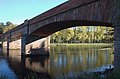 Mertoun Bridge - geograph.org.uk - 2121520.jpg 800 × 530; 135 KB
-
 Mertoun Bridge - geograph.org.uk - 3330189.jpg 800 × 600; 139 KB
-
 Mertoun Bridge - geograph.org.uk - 4672214.jpg 800 × 534; 389 KB
-
 Mertoun Bridge - geograph.org.uk - 4672224.jpg 800 × 534; 442 KB
-
 Mertoun Bridge - geograph.org.uk - 5182537.jpg 640 × 432; 123 KB
-
 Mertoun Bridge from B.A.Way through trees - geograph.org.uk - 6415089.jpg 4,608 × 3,456; 4.75 MB
-
 Mertoun Bridge from the cauld - geograph.org.uk - 2121513.jpg 800 × 530; 190 KB


_-_geograph.org.uk_-_6379485.jpg)


_-_geograph.org.uk_-_3538427.jpg)


_-_geograph.org.uk_-_6413970.jpg)
_2_from_north_bank_-_geograph.org.uk_-_6413992.jpg)


_-_geograph.org.uk_-_5849386.jpg)


_-_geograph.org.uk_-_3361263.jpg)
_-_geograph.org.uk_-_3361275.jpg)


.jpg)


&filefrom=Mertoun+Mill+%28disused%29+and+Cottages+-+geograph.org.uk+-+6379467.jpg#mw-category-media)