Category:Springburn, Glasgow
Jump to navigation
Jump to search
inner city area in Glasgow, Scotland, UK .jpg) | |||||
| Upload media | |||||
| Instance of | |||||
|---|---|---|---|---|---|
| Location |
| ||||
 | |||||
Subcategories
This category has the following 22 subcategories, out of 22 total.
A
B
- Barnhill railway station (8 F)
C
- Cowlairs Park (17 F)
L
- Springburn library (3 F)
N
P
- Petershill Park (7 F)
S
- Springburn Public Halls (4 F)
- Springburn railway station (9 F)
- Stobhill Hospital (12 F)
Media in category "Springburn, Glasgow"
The following 96 files are in this category, out of 96 total.
-
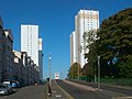
 A803 Springburn Road, Glasgow - geograph.org.uk - 5579020.jpg 1,024 × 768; 142 KB
-
 Ashfield Junction - geograph.org.uk - 591295.jpg 640 × 480; 105 KB
-
 Atlas Road - geograph.org.uk - 3258483.jpg 640 × 362; 98 KB
-
 Atlas Road, Springburn - geograph.org.uk - 1262214.jpg 640 × 480; 110 KB
-
 Auchentoshan Terrace - geograph.org.uk - 1780148.jpg 640 × 429; 130 KB
-
 Balgray Tower, Springburn - geograph.org.uk - 926263.jpg 480 × 640; 54 KB
-
 Balgrayhill flats (geograph 2129536).jpg 1,600 × 1,200; 247 KB
-
 Balgrayhill flats (geograph 5307466).jpg 1,600 × 1,047; 521 KB
-
 Balgrayhill flats - geograph.org.uk - 1323738.jpg 640 × 480; 126 KB
-
 Balgrayhill Road (geograph 3258534).jpg 640 × 429; 120 KB
-
 Balgrayhill towerblocks from the air (geograph 5374067).jpg 640 × 480; 140 KB
-

-
 Blagrayhill towerblocks from the air - geograph.org.uk - 5374063.jpg 640 × 480; 140 KB
-
 Broomfield Road (geograph 3259506).jpg 640 × 443; 140 KB
-
 Broomfield Road - geograph.org.uk - 5306501.jpg 1,600 × 1,046; 425 KB
-
 Broomknowes Road, Glasgow - geograph.org.uk - 2520302.jpg 640 × 480; 76 KB
-
 Campsie Street (geograph 3258499).jpg 640 × 429; 145 KB
-
 Cowlairs signalbox (Eastfield) 1978 - geograph.org.uk - 811658.jpg 640 × 427; 71 KB
-

-
-
 Eastfield View (geograph 4415536).jpg 640 × 390; 75 KB
-
 Edgefauld Place (geograph 3258504).jpg 640 × 345; 113 KB
-
 Edgefauld Road - geograph.org.uk - 2134884.jpg 480 × 640; 61 KB
-
 Edgefauld Road - geograph.org.uk - 5300372.jpg 1,600 × 1,200; 394 KB
-
 Edgefauld Road - geograph.org.uk - 5300406.jpg 1,600 × 1,148; 293 KB
-
 Elmvale Primary School and Janitor's Lodge (geograph 5305280).jpg 1,600 × 1,088; 305 KB
-
 Fernbank Street - geograph.org.uk - 5305114.jpg 1,600 × 1,200; 341 KB
-
 Fernbank Street - geograph.org.uk - 5305119.jpg 1,600 × 1,200; 351 KB
-
 Flats on Hawthorn Street (geograph 5305201).jpg 1,600 × 1,106; 283 KB
-
 Footbridge over Springburn Road - geograph.org.uk - 1323702.jpg 640 × 480; 167 KB
-
 Glasgow Springburn ScottishParliamentConstituency.PNG 162 × 136; 3 KB
-
 Glasgow Springburn ScottishParliamentConstituency.svg 162 × 143; 19 KB
-
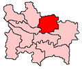
 Glasgow wards 2017 no17 Springburn.png 2,000 × 2,040; 504 KB
-
 Glasgow. Cowlairs. Derelict industry building. Carlisle Street.jpg 3,943 × 2,962; 2.3 MB
-
 Haig Street - geograph.org.uk - 2466062.jpg 640 × 480; 243 KB
-
 Hawthorn Street (geograph 5305267).jpg 1,600 × 1,200; 326 KB
-
 High rise from Hawthorn Street (geograph 2206818).jpg 2,048 × 1,262; 1.05 MB
-
 Highrise flats at Croftbank Street - geograph.org.uk - 1262209.jpg 480 × 640; 126 KB
-
 Housing on Carron Street - geograph.org.uk - 2129349.jpg 640 × 320; 51 KB
-

-
 Lenzie Terrace - geograph.org.uk - 1323720.jpg 640 × 480; 146 KB
-
 Lenzie Terrace - geograph.org.uk - 2129438.jpg 1,600 × 888; 310 KB
-
 Looking north on Springburn Road - geograph.org.uk - 1323477.jpg 640 × 480; 140 KB
-
 North Glasgow College - geograph.org.uk - 1780173.jpg 640 × 429; 120 KB
-
 North Glasgow College and Springburn - geograph.org.uk - 1780176.jpg 640 × 429; 123 KB
-

-
 North Glasgow Local Housing Office - geograph.org.uk - 1262221.jpg 640 × 480; 124 KB
-

-
 Petershill Road - geograph.org.uk - 1780150.jpg 640 × 429; 140 KB
-
 Petershill Road - geograph.org.uk - 2469735.jpg 640 × 480; 247 KB
-
 Railway bridge over Hawthorn Street (geograph 2126536).jpg 1,600 × 1,200; 417 KB
-
 Railway Bridge over Hawthorn Street - geograph.org.uk - 1203334.jpg 640 × 480; 60 KB
-
 Railway Bridge, Hawthorn Street (geograph 5300575).jpg 1,600 × 1,200; 331 KB
-
 Railway line in Bishopbriggs - geograph.org.uk - 1323760.jpg 640 × 480; 157 KB
-
 Redhouse Street (geograph 3258491).jpg 459 × 640; 146 KB
-
 Remploy Factory Springburn - geograph.org.uk - 1190260.jpg 640 × 450; 51 KB
-
 South end of Springburn Way, Springburn (geograph 7370427).jpg 1,024 × 768; 131 KB
-
 Springburn Academy (geograph 3258500).jpg 640 × 315; 88 KB
-
 Springburn Academy - geograph.org.uk - 2466094.jpg 640 × 399; 214 KB
-
 Springburn flats - geograph.org.uk - 1323708.jpg 640 × 480; 129 KB
-
 Springburn from the air (geograph 2987986).jpg 640 × 480; 183 KB
-
 Springburn from the air (geograph 5374097).jpg 640 × 480; 196 KB
-
 Springburn Heritage and Hope (geograph 1781439).jpg 503 × 640; 182 KB
-
 Springburn Heritage and Hope 1989 (geograph 1781443).jpg 429 × 640; 167 KB
-
 Springburn Road (A803) - geograph.org.uk - 1203287.jpg 640 × 480; 73 KB
-
 Springburn Road (geograph 2801336).jpg 640 × 480; 121 KB
-
 Springburn Road - geograph.org.uk - 2801331.jpg 640 × 480; 107 KB
-
 Springburn Road - geograph.org.uk - 2801333.jpg 640 × 480; 108 KB
-
 Springburn Road - geograph.org.uk - 2801341.jpg 640 × 480; 124 KB
-
 Springburn Road - geograph.org.uk - 553386.jpg 640 × 480; 98 KB
-
 Springburn Shopping Centre - geograph.org.uk - 553389.jpg 640 × 480; 79 KB
-
 Statue outside Springburn Leisure Centre - geograph.org.uk - 1323469.jpg 480 × 640; 142 KB
-
 StRolloxChemical 1831.jpg 1,000 × 653; 462 KB
-
 Syriam Street - geograph.org.uk - 2466100.jpg 640 × 480; 250 KB
-
 The Street railway journal (1898) (14575147659).jpg 2,256 × 1,096; 437 KB
-
 Tower Block UK photo glw1-27 (Springburn 1981-1).jpg 2,615 × 1,745; 682 KB
-
 Tower Block UK photo glw1-28 (Springburn 1982).jpg 2,631 × 1,734; 680 KB
-
 Tower Block UK photo glw2-53.jpg 1,755 × 2,591; 879 KB
-
 Tower Block UK photo glw2-54.jpg 2,607 × 1,737; 741 KB
-
 Tower Block UK photo glw2-55 (Balgrayhill 1983-1) (levels & colour balance).jpg 2,620 × 1,737; 1.61 MB
-
 Tower Block UK photo glw2-55 (Balgrayhill 1983-1.jpg).jpg 2,620 × 1,737; 733 KB
-
 Tower Block UK photo glw2-58 (Springburn 1983) (levels, colour balance, rotate).jpg 2,427 × 1,618; 1.42 MB
-
 Tower Block UK photo glw2-58 (Springburn 1983).jpg 2,615 × 1,731; 754 KB
-
 Tower Block UK photo glw2-59 (Springburn 1982-2).jpg 2,586 × 1,728; 753 KB
-
 Tower Block UK photo glw3-06 (Balgrayhill 1983-2).jpg 2,620 × 1,734; 845 KB
-
 Tower Block UK photo glw3-08.jpg 2,594 × 1,734; 811 KB
-
 Tower Block UK photo glw3-10 (Balgrayhill 1989-1).jpg 2,594 × 1,747; 753 KB
-
 Tower Block UK photo glw3-16 (Springburn 1981).jpg 2,631 × 1,755; 843 KB
-
 Tower Block UK photo glw3-18 (Balgrayhill 1982).jpg 2,612 × 1,726; 765 KB
-
 Tower Block UK photo glw6-19 (Red Road 1983-3) (adjust various).jpg 2,623 × 1,731; 2.1 MB
-
 Tower Block UK photo glw6-19 (Red Road 1983-3).jpg 2,623 × 1,731; 886 KB
-
 Tower blocks (geograph 7385248).jpg 1,600 × 1,098; 363 KB
-
 Tower Blocks, Balgrayhill Road, Glasgow - geograph.org.uk - 3969837.jpg 3,456 × 5,184; 5.59 MB
-
 Turner Road - geograph.org.uk - 1780137.jpg 640 × 429; 140 KB
-
 Wellfield Street - geograph.org.uk - 2134918.jpg 1,600 × 1,200; 547 KB
-


.jpg)
.jpg)

.jpg)
.jpg)


.jpg)


.jpg)
_1978_-_geograph.org.uk_-_811658.jpg)


.jpg)
.jpg)


.jpg)


.jpg)


.jpg)
.jpg)


.jpg)

.jpg)

.jpg)

.jpg)
.jpg)


.jpg)
.jpg)
.jpg)
_-_geograph.org.uk_-_1203287.jpg)
.jpg)


_(14575147659).jpg)
.jpg)
.jpg)


_(levels_%26_colour_balance).jpg)
.jpg)
_(levels,_colour_balance,_rotate).jpg)
.jpg)
.jpg)
.jpg)

.jpg)
.jpg)
.jpg)
_(adjust_various).jpg)
.jpg)
.jpg)


