Category:Barmulloch
Jump to navigation
Jump to search
district in Glasgow City, Scotland, UK .jpg) | |||||
| Upload media | |||||
| Instance of | |||||
|---|---|---|---|---|---|
| Location | Glasgow City, Scotland | ||||
 | |||||
Media in category "Barmulloch"
The following 20 files are in this category, out of 20 total.
-
 All Saints RC Church, Broomfield Road, Glasgow - geograph.org.uk - 3969730.jpg 5,184 × 3,456; 7.41 MB
-
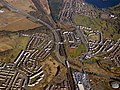
 Balornock from the air (geograph 5716315).jpg 640 × 480; 235 KB
-
 Barmulloch Community Centre and Library (geograph 5062916).jpg 3,504 × 2,336; 3.43 MB
-
 Barmulloch Community Development Company logo.png 300 × 300; 9 KB
-
 Barmulloch new builds.png 154 × 150; 13 KB
-

-
 Gartons Road - geograph.org.uk - 1262176.jpg 640 × 480; 113 KB
-
 Glasgow wards 2017 no17 Springburn.png 2,000 × 2,040; 504 KB
-
 Houses on Quarrywood Road, Barmulloch (geograph 5336769).jpg 640 × 480; 63 KB
-
 Houses on Robroyston Road, Barmulloch (geograph 5336765).jpg 640 × 480; 67 KB
-
 Quarrywood Road and the Red Road flats (geograph 2466788).jpg 640 × 480; 257 KB
-
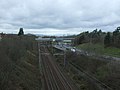 Railway towards Glasgow (geograph 5336764).jpg 640 × 480; 54 KB
-
 Robroyston Park Nature Reserve (geograph 2466777).jpg 640 × 480; 286 KB
-
 Robroyston Road, Barmulloch (geograph 5336766).jpg 640 × 480; 57 KB
-
 Rockfield Road, Robroyston (geograph 3483615).jpg 640 × 480; 95 KB
-
 Ryehill Road (geograph 2466123).jpg 640 × 480; 257 KB
-
 Ryehill Road, Barmulloch (geograph 6905430).jpg 1,600 × 1,090; 316 KB
-
 The M80 motorway from the air (geograph 5716335).jpg 640 × 480; 237 KB
-
 Tower Block UK photo glw6-17 (Red Road 1981) (cropped).jpg 916 × 1,099; 195 KB
-
 Tower Block UK photo glw6-17 (Red Road 1981).jpg 2,615 × 1,726; 710 KB

.jpg)
.jpg)


.jpg)
.jpg)
.jpg)
.jpg)
.jpg)
.jpg)
.jpg)
.jpg)
.jpg)
_(cropped).jpg)
.jpg)