Category:Spott, Scotland (civil parish)
Jump to navigation
Jump to search
Scottish parish | |||||
| Upload media | |||||
| Instance of | |||||
|---|---|---|---|---|---|
| Part of |
| ||||
| Named after | |||||
| Location |
| ||||
| Population |
| ||||
| Area |
| ||||
 | |||||
Subcategories
This category has the following 2 subcategories, out of 2 total.
E
S
Media in category "Spott, Scotland (civil parish)"
The following 200 files are in this category, out of 282 total.
(previous page) (next page)-
 A confusing sign near Spott - geograph.org.uk - 3459429.jpg 640 × 480; 157 KB
-
 A wheat field at Wester Broomhouse - geograph.org.uk - 3105247.jpg 640 × 469; 216 KB
-
 A1 northbound, Spott Roundabout - geograph.org.uk - 2957035.jpg 640 × 458; 53 KB
-
 A1 road junction - geograph.org.uk - 4577362.jpg 3,264 × 2,448; 2.71 MB
-
 Across the Bothwell Water - geograph.org.uk - 4640145.jpg 800 × 534; 236 KB
-
 Approaching Easter Broomhouse - geograph.org.uk - 4472248.jpg 640 × 480; 62 KB
-
 Approaching Spott - geograph.org.uk - 4472276.jpg 640 × 480; 62 KB
-
 Approaching the A1 - geograph.org.uk - 4493517.jpg 640 × 480; 40 KB
-
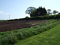
 Arable land above Spott - geograph.org.uk - 5398598.jpg 1,024 × 683; 266 KB
-
 Arable land above Woodhall Dean - geograph.org.uk - 4366883.jpg 800 × 533; 175 KB
-
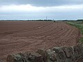
 Arable land, Spott - geograph.org.uk - 5412452.jpg 800 × 534; 218 KB
-
 Barley above Brock Wood - geograph.org.uk - 4587727.jpg 3,264 × 2,448; 4.48 MB
-
 Barley at Halls - geograph.org.uk - 4575171.jpg 3,264 × 2,448; 4.84 MB
-
 Bass Rock - geograph.org.uk - 2835863.jpg 640 × 360; 181 KB
-
 Beltondod - geograph.org.uk - 4472393.jpg 800 × 533; 356 KB
-
 Beltondod - geograph.org.uk - 5814351.jpg 1,024 × 576; 266 KB
-
 Bennet's Burn - geograph.org.uk - 5412457.jpg 800 × 534; 227 KB
-
 Black Loch - geograph.org.uk - 3301313.jpg 800 × 600; 149 KB
-
 Black Loch from track above the How Burn - geograph.org.uk - 3301306.jpg 800 × 600; 125 KB
-
 Bloomin' Marvellous - geograph.org.uk - 4001641.jpg 3,448 × 4,592; 3.78 MB
-
 Bothwell Water - geograph.org.uk - 5994444.jpg 1,024 × 575; 325 KB
-
 Bothwell Water and road - geograph.org.uk - 4640146.jpg 800 × 534; 163 KB
-
 Bridge at Tinker's Leap - geograph.org.uk - 3300032.jpg 800 × 600; 212 KB
-
 Bridge over Bothwell Water - geograph.org.uk - 4640143.jpg 800 × 534; 216 KB
-
 Bright Yellow Rape Fields above Spott Village - geograph.org.uk - 6153397.jpg 4,592 × 3,448; 4.02 MB
-
 Brock Burn ford - geograph.org.uk - 4577134.jpg 3,264 × 2,448; 3.91 MB
-

-
 Can spring be far behind^ - geograph.org.uk - 4880025.jpg 640 × 480; 435 KB
-
 Cattle at Hartside - geograph.org.uk - 4575156.jpg 3,264 × 2,448; 4.64 MB
-
 Channel Brae - geograph.org.uk - 2820947.jpg 640 × 360; 226 KB
-
 Combine at work, Doon - geograph.org.uk - 5361854.jpg 1,024 × 576; 292 KB
-
 Combining at Wester Broomhouse - geograph.org.uk - 3105237.jpg 640 × 473; 214 KB
-
 Control flag, Hartside - geograph.org.uk - 2829823.jpg 640 × 360; 232 KB
-
 Cottage at St Agnes - geograph.org.uk - 6021723.jpg 3,264 × 2,448; 4.16 MB
-
 Cottage, St Agnes - geograph.org.uk - 2622789.jpg 640 × 480; 76 KB
-
 Covered reservoir - geograph.org.uk - 4472257.jpg 640 × 480; 57 KB
-
 Covered reservoir, Broomhouse - geograph.org.uk - 5280544.jpg 1,024 × 683; 344 KB
-
 Crop field and hedgerow - geograph.org.uk - 4467953.jpg 640 × 480; 62 KB
-
 Crop field near Easter Broomhouse - geograph.org.uk - 4467949.jpg 640 × 480; 69 KB
-
 Crop field near Hurkletillane - geograph.org.uk - 4478852.jpg 640 × 480; 54 KB
-
 Crop field near Hurkletillane - geograph.org.uk - 4493509.jpg 640 × 480; 70 KB
-
 Crop field near Spott - geograph.org.uk - 4472275.jpg 640 × 480; 88 KB
-
 Crop field near the A1 - geograph.org.uk - 4472244.jpg 640 × 480; 75 KB
-
 Crop field towards woodland - geograph.org.uk - 4467960.jpg 640 × 480; 72 KB
-
 Crop field, Easter Broomhouse - geograph.org.uk - 4472251.jpg 640 × 480; 55 KB
-
 Crop field, Spott - geograph.org.uk - 4467952.jpg 640 × 480; 79 KB
-
 Crystal Rig grid connection - geograph.org.uk - 4089605.jpg 1,573 × 940; 394 KB
-
 Crystal Rig power station - geograph.org.uk - 4454960.jpg 800 × 533; 299 KB
-
 Crystal Rig power station - geograph.org.uk - 4472399.jpg 800 × 450; 321 KB
-

-
 Cycle route towards Dunbar - geograph.org.uk - 4493519.jpg 640 × 480; 54 KB
-
 Deuchrie meltwater channel - geograph.org.uk - 2899868.jpg 640 × 360; 215 KB
-
 Doocot at Elderside - geograph.org.uk - 4576187.jpg 3,264 × 2,448; 3 MB
-
 Doon Hill - geograph.org.uk - 2163982.jpg 800 × 600; 156 KB
-
 Dry Burn valley - geograph.org.uk - 3301324.jpg 800 × 600; 155 KB
-
 Dry Burn valley and Bell Craig - geograph.org.uk - 3301633.jpg 800 × 600; 138 KB
-
 Dunbar Parish Church - geograph.org.uk - 3956689.jpg 640 × 422; 158 KB
-
 Dunbar Service Reservoir - geograph.org.uk - 4577378.jpg 3,264 × 2,448; 4.36 MB
-
 Dunbar Service Reservoir - geograph.org.uk - 4577386.jpg 3,264 × 2,448; 4.27 MB
-
 East Kirkshotts Plantation - geograph.org.uk - 5232020.jpg 1,024 × 769; 625 KB
-
 East Lothian arable - geograph.org.uk - 5280554.jpg 1,024 × 683; 351 KB
-

-
-

-

-

-

-
 East Lothian Farms , Pathhead, near Halls - geograph.org.uk - 2027187.jpg 2,560 × 1,920; 3.42 MB
-

-

-

-
 East Lothian Farms , Wester Broomhouse, near Dunbar - geograph.org.uk - 2023875.jpg 2,560 × 1,920; 2.85 MB
-
 East Lothian Farms , Wester Broomhouse, near Dunbar - geograph.org.uk - 2023910.jpg 2,560 × 1,920; 2.62 MB
-
 East Lothian fieldscape - geograph.org.uk - 4587741.jpg 3,264 × 2,448; 5.27 MB
-

-

-
 East Lothian Landscape , Dunbar from the Summit of Doon Hill - geograph.org.uk - 1869135.jpg 2,560 × 1,920; 3.14 MB
-
 East Lothian Landscape , In The Valley of The Dry Burn - geograph.org.uk - 1869594.jpg 2,560 × 1,920; 3.4 MB
-

-
 East Lothian Landscape , Looking Up To The Chesters - geograph.org.uk - 1869534.jpg 2,560 × 1,920; 3.12 MB
-
 East Lothian Landscape , No More Knock Loch - geograph.org.uk - 2027221.jpg 2,560 × 1,920; 3.19 MB
-

-
 East Lothian Landscape , Pathhead Road-End, near Halls - geograph.org.uk - 2027162.jpg 2,560 × 1,920; 2.71 MB
-

-

-
 East Lothian Landscape , The Knock, near Halls - geograph.org.uk - 2027205.jpg 2,560 × 1,920; 3.2 MB
-
 East Lothian Landscape , The Nearest Tree to the Chesters - geograph.org.uk - 1869559.jpg 2,560 × 1,920; 3.18 MB
-

-

-

-

-

-

-

-
 East Lothian Locations , Spott Home Farm road-end - geograph.org.uk - 1869459.jpg 2,560 × 1,920; 3.28 MB
-

-
 East Lothian Trig Points , Doon Hill, near Dunbar - geograph.org.uk - 1869137.jpg 2,560 × 1,920; 3.14 MB
-
 Easter Broomhouse - geograph.org.uk - 4118521.jpg 800 × 600; 493 KB
-
 Easter Broomhouse - geograph.org.uk - 4470006.jpg 640 × 480; 63 KB
-
 Easter Broomhouse Cottages - geograph.org.uk - 4467946.jpg 640 × 480; 65 KB
-
 Easter Broomhouse Cottages - geograph.org.uk - 4577365.jpg 3,264 × 2,448; 3.94 MB
-
 Easter Broomhouse Standing Stone - geograph.org.uk - 2645063.jpg 427 × 640; 264 KB
-
 Easter Broomhouse Standing Stone - geograph.org.uk - 3134896.jpg 640 × 459; 227 KB
-
 Eastern approach to Spott village - geograph.org.uk - 4880032.jpg 640 × 480; 319 KB
-
 Entering Spott - geograph.org.uk - 4472262.jpg 640 × 480; 69 KB
-
 Entrance To Halls Farm Q Site Operations Bunker - geograph.org.uk - 4001674.jpg 4,592 × 3,448; 4.2 MB
-
 Estate cottages at Halls - geograph.org.uk - 4575167.jpg 3,264 × 2,448; 5.24 MB
-
 European Stone Stacking Championship Dunbar - geograph.org.uk - 5753606.jpg 2,048 × 1,536; 1.12 MB
-
 Farm road above Spott - geograph.org.uk - 5232016.jpg 1,024 × 769; 371 KB
-
 Farm road near Spott - geograph.org.uk - 5398601.jpg 1,024 × 683; 335 KB
-
 Farm road to Spott Home Farm - geograph.org.uk - 1887548.jpg 800 × 531; 239 KB
-
 Farm track off Spott Loan - geograph.org.uk - 4472286.jpg 640 × 480; 85 KB
-
 Farmland near The Brunt - geograph.org.uk - 1887537.jpg 800 × 531; 137 KB
-
 Farmland Near Woodhall Dean - geograph.org.uk - 4001627.jpg 3,448 × 4,592; 3.75 MB
-
 Field above Brock Wood - geograph.org.uk - 4880027.jpg 640 × 480; 354 KB
-
-
 Field edge track to Wester Broomhouse - geograph.org.uk - 5189504.jpg 3,609 × 2,707; 2.17 MB
-
 Field entrance off Spott Loan - geograph.org.uk - 4472283.jpg 640 × 480; 64 KB
-
 Field entrance, Spott - geograph.org.uk - 5361882.jpg 1,024 × 576; 410 KB
-
 Field near Spott - geograph.org.uk - 5905871.jpg 3,264 × 2,448; 3.91 MB
-
 Field near the A1 - geograph.org.uk - 4493516.jpg 640 × 480; 54 KB
-
 Fields near Old Belton - geograph.org.uk - 4576908.jpg 3,264 × 2,448; 4.46 MB
-
 Fields near Spott - geograph.org.uk - 4576839.jpg 3,264 × 2,448; 3.22 MB
-
 Filling the trailer - geograph.org.uk - 3105250.jpg 445 × 640; 212 KB
-
 Foot and cycle path - geograph.org.uk - 2821568.jpg 640 × 360; 194 KB
-
 Footbridge over Woodhall Burn - geograph.org.uk - 2391233.jpg 2,640 × 1,980; 1.93 MB
-
 Footbridge, Woodhall Dean - geograph.org.uk - 3299300.jpg 800 × 600; 228 KB
-
 Ford on road at Woodhall Burn - geograph.org.uk - 2391167.jpg 2,640 × 1,980; 1.46 MB
-
 Ford, Woodhall Dean - geograph.org.uk - 4368498.jpg 800 × 533; 268 KB
-
 Fun in the Waves at East Beach Dunbar - geograph.org.uk - 5421458.jpg 2,592 × 1,936; 2.24 MB
-
 Gate to St John's Well - geograph.org.uk - 4578437.jpg 3,264 × 2,448; 4.5 MB
-
 Halls Farm Q Site Operations Bunker Escape Hatch - geograph.org.uk - 4001694.jpg 3,448 × 4,592; 3.87 MB
-
 Hare Craig - geograph.org.uk - 4435357.jpg 2,440 × 1,380; 901 KB
-
 Hare near Woodhall Dean - geograph.org.uk - 4366808.jpg 800 × 533; 246 KB
-
 Hartside - geograph.org.uk - 4575142.jpg 3,264 × 2,448; 4.27 MB
-
 Herring Road path sign - geograph.org.uk - 4471442.jpg 800 × 533; 373 KB
-
 Herring Road signpost at Hartside - geograph.org.uk - 4575154.jpg 3,264 × 2,448; 2.22 MB
-
 Herring Road, Hartside - geograph.org.uk - 2820920.jpg 640 × 360; 191 KB
-
 High Road, Spott - geograph.org.uk - 4472265.jpg 640 × 480; 87 KB
-
 Holly Craig - geograph.org.uk - 2828924.jpg 640 × 360; 234 KB
-
 House at Halls - geograph.org.uk - 4575162.jpg 3,264 × 2,448; 4.83 MB
-
 House at Hurkletillane - geograph.org.uk - 4577336.jpg 3,264 × 2,448; 4.75 MB
-
 Houses on Canongate, Spott - geograph.org.uk - 4472260.jpg 640 × 480; 116 KB
-
 Housing at Dunbar - geograph.org.uk - 3956687.jpg 640 × 420; 170 KB
-
 In Woodhall Dean - geograph.org.uk - 3299295.jpg 800 × 600; 226 KB
-
 Industrial expansion in the Lammermuirs - geograph.org.uk - 6456213.jpg 1,751 × 775; 337 KB
-
 Inside Halls Farm Q Site Operations Bunker - geograph.org.uk - 4001708.jpg 3,448 × 4,592; 1.99 MB
-
 Knock Loch - geograph.org.uk - 2835884.jpg 640 × 360; 65 KB
-
 Knock Loch, Lothian Edge - geograph.org.uk - 2820937.jpg 640 × 360; 230 KB
-
 Lammermuir foothills - geograph.org.uk - 5412462.jpg 800 × 534; 231 KB
-

-
 Lochan east end - geograph.org.uk - 3301658.jpg 800 × 600; 126 KB
-
 Lochan near The Brunt - geograph.org.uk - 3301651.jpg 800 × 600; 152 KB
-
 Lochend from Easter Broomhouse - geograph.org.uk - 4578496.jpg 3,264 × 2,448; 4.94 MB
-
 Looking down Spott Loan - geograph.org.uk - 5905874.jpg 3,264 × 2,448; 4.33 MB
-
 Looking down towards Dunbar - geograph.org.uk - 6153343.jpg 4,592 × 3,448; 4.27 MB
-
 Looking over Woodhall Dean - geograph.org.uk - 5905862.jpg 3,264 × 2,448; 2.68 MB
-
 Looking towards North Berwick Law - geograph.org.uk - 6153360.jpg 4,592 × 3,448; 3.41 MB
-
 Looking towards Traprain Law - geograph.org.uk - 6153369.jpg 4,592 × 3,448; 4.71 MB
-
 Lothian Edge - geograph.org.uk - 2820927.jpg 640 × 360; 211 KB
-
 Lothian Edge - geograph.org.uk - 2820931.jpg 640 × 360; 217 KB
-
 Lothian Edge - geograph.org.uk - 2820942.jpg 640 × 360; 232 KB
-
 Lothian Edge - geograph.org.uk - 2828917.jpg 640 × 360; 222 KB
-
 Meltwater channel - geograph.org.uk - 2828926.jpg 640 × 360; 228 KB
-
 Meltwater channel - geograph.org.uk - 4435372.jpg 2,560 × 1,536; 1.33 MB
-
 Meltwater channels - geograph.org.uk - 4366977.jpg 800 × 533; 241 KB
-
 Minor road beside woodland, Bowerhouse - geograph.org.uk - 4493514.jpg 640 × 480; 111 KB
-
 Minor road near Bowerhouse - geograph.org.uk - 4493511.jpg 640 × 480; 61 KB
-
 Minor road near Hurkletillane - geograph.org.uk - 4493503.jpg 640 × 480; 60 KB
-
 Minor road towards Halls - geograph.org.uk - 4472271.jpg 640 × 480; 68 KB
-
 Minor road towards Halls - geograph.org.uk - 4472274.jpg 640 × 480; 66 KB
-
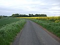
 Minor road towards Spott - geograph.org.uk - 4470007.jpg 640 × 480; 50 KB
-
 Minor road towards The Brunt - geograph.org.uk - 4472291.jpg 640 × 480; 81 KB
-
 Minor road, Hurkletillane - geograph.org.uk - 4493506.jpg 640 × 480; 60 KB
-
 Mossy Burn - geograph.org.uk - 5814338.jpg 1,024 × 576; 287 KB
-
 Mossy Burn - geograph.org.uk - 5814341.jpg 1,024 × 576; 296 KB
-
 New stone work - geograph.org.uk - 4577393.jpg 3,264 × 2,448; 4.91 MB
-
 Oilseed rape - geograph.org.uk - 2820963.jpg 640 × 360; 248 KB
-
 Oilseed rape - geograph.org.uk - 5280551.jpg 1,024 × 683; 344 KB
-
 Oilseed rape crop near Hurkletillane - geograph.org.uk - 4478853.jpg 640 × 480; 77 KB
-
 Oilseed rape crop south of Spott - geograph.org.uk - 4467959.jpg 640 × 480; 92 KB
-
 Old railway goods van near Black Loch - geograph.org.uk - 3301310.jpg 800 × 600; 120 KB
-
 On Friardykes Dod - geograph.org.uk - 5814319.jpg 1,024 × 576; 224 KB
-
 On the track to Oswald Dean - geograph.org.uk - 2163957.jpg 800 × 600; 224 KB
-
 Ordnance Survey Flush Bracket 394 - geograph.org.uk - 5189332.jpg 3,445 × 2,583; 1.96 MB
-
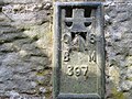 Ordnance Survey Flush Bracket 397 - geograph.org.uk - 5189313.jpg 3,339 × 2,503; 2.26 MB
-
 Ordnance Survey Flush Bracket 559 - geograph.org.uk - 5189309.jpg 4,000 × 3,000; 5.15 MB
-
 OSWALD DEAN sign - geograph.org.uk - 2163987.jpg 800 × 600; 166 KB
-
 Outcrop at Hare Craig - geograph.org.uk - 5383964.jpg 1,600 × 1,200; 469 KB
-
 Pallet store beside the A1 - geograph.org.uk - 5280549.jpg 1,024 × 683; 281 KB
-
 Part of Spott Mill - geograph.org.uk - 4576135.jpg 3,264 × 2,448; 5.21 MB
-
 Pasture near Pathhead - geograph.org.uk - 2899880.jpg 640 × 360; 224 KB
-
 Path in Woodhall Dean Nature Reserve - geograph.org.uk - 3299287.jpg 800 × 600; 158 KB
-
 Path, Spruce Cleugh - geograph.org.uk - 4368488.jpg 800 × 600; 331 KB
-
 Path, Woodhall Dean - geograph.org.uk - 4366817.jpg 800 × 533; 245 KB
-
 Path, Woodhall Dean - geograph.org.uk - 4367004.jpg 800 × 533; 360 KB
-
 Path, Woodhall Dean - geograph.org.uk - 4368483.jpg 800 × 533; 272 KB
-
 Path, Woodhall Dean - geograph.org.uk - 5398620.jpg 1,024 × 683; 573 KB
-
 Path, Woodhall Dean - geograph.org.uk - 5398640.jpg 1,024 × 683; 584 KB
-
 Path, Woodhall Dean - geograph.org.uk - 5398648.jpg 1,024 × 683; 619 KB


_-_geograph.org.uk_-_1865183.jpg)


&filefrom=Ploughed+field+near+Spott+-+geograph.org.uk+-+4880034.jpg#mw-category-media)