Category:Snow in the Shetland Islands
Jump to navigation
Jump to search
Council areas (municipalities) of Scotland: Aberdeen · Aberdeenshire · Angus · Argyll and Bute · Clackmannanshire · Dumfries and Galloway · East Ayrshire · East Dunbartonshire · East Lothian · East Renfrewshire · Edinburgh · Falkirk · Fife · Glasgow · Highland · Inverclyde · Midlothian · Moray · North Ayrshire · North Lanarkshire · Orkney Islands · Perth and Kinross · Renfrewshire · Scottish Borders · Shetland Islands · South Ayrshire · South Lanarkshire · Stirling · West Dunbartonshire · West Lothian

Media in category "Snow in the Shetland Islands"
The following 200 files are in this category, out of 289 total.
(previous page) (next page)-
-

-

-
 Air Ambulance G-GMAE and Scottish Ambulance Service Patient Transfer.jpg 5,992 × 3,535; 7.18 MB
-
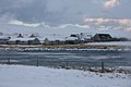
 Arctic Sea fog at Garths Voe - geograph.org.uk - 1739454.jpg 1,140 × 760; 286 KB
-
 Baliasta in the snow - geograph.org.uk - 3769540.jpg 1,024 × 681; 102 KB
-
 Baltasound houb, still, snowy morning - geograph.org.uk - 1154752.jpg 640 × 426; 109 KB
-
 Baltasound Manse - geograph.org.uk - 311566.jpg 640 × 425; 39 KB
-
 Beach at Grimister, Whalefirth - geograph.org.uk - 1064467.jpg 640 × 426; 115 KB
-

-
-
 Beach at Hamar, Baltasound, in the snow - geograph.org.uk - 1723359.jpg 800 × 533; 109 KB
-
 Beaw Field in snow - geograph.org.uk - 992421.jpg 640 × 426; 101 KB
-
 Blown snow on the Hill of Clibberswick - geograph.org.uk - 2198990.jpg 800 × 533; 128 KB
-

-
-
 Burn of Burrafirth and the Shore Station - geograph.org.uk - 1654574.jpg 800 × 533; 138 KB
-
 Burrafirth Shore Station in the snow - geograph.org.uk - 1055089.jpg 640 × 426; 73 KB
-
 Clivocast standing stone in the snow - geograph.org.uk - 1657460.jpg 640 × 427; 74 KB
-
 Cold and hungry, Baltasound - geograph.org.uk - 1691761.jpg 800 × 533; 79 KB
-

-

-
 Crossroads, Baltasound - geograph.org.uk - 2188296.jpg 800 × 534; 138 KB
-
 Crussa Field in the snow - geograph.org.uk - 1651490.jpg 800 × 533; 104 KB
-
 Daisy Park, Baltasound, in the snow - geograph.org.uk - 2177165.jpg 800 × 534; 148 KB
-
 Dale and Muckle Heog, Baltasound - geograph.org.uk - 1153049.jpg 640 × 426; 79 KB
-
 Dale IMG 7121 (24382621969).jpg 4,103 × 2,234; 2.67 MB
-
 Dale, Baltasound - geograph.org.uk - 2178363.jpg 800 × 534; 156 KB
-
 Dam Loch, Uyeasound, in snow - geograph.org.uk - 736028.jpg 640 × 426; 60 KB
-
 Damp hollow on Swinna Ness, in the snow - geograph.org.uk - 1723648.jpg 800 × 534; 148 KB
-
 Dandies, Uyeasound, from Clivocast - geograph.org.uk - 1657473.jpg 800 × 534; 186 KB
-
 Dike across the end of Swinna Ness - geograph.org.uk - 1723655.jpg 800 × 533; 95 KB
-
 Ditch at Northdale in the snow - geograph.org.uk - 2223902.jpg 534 × 800; 197 KB
-
 Ditch at the head of the voe, Baltasound - geograph.org.uk - 2177181.jpg 534 × 800; 209 KB
-
 Drifts behind a dyke on Nikkavord - geograph.org.uk - 1727094.jpg 800 × 533; 115 KB
-
 Dykes in the Snow IMG 6661 (16256096858).jpg 4,264 × 2,338; 3.69 MB
-
 Dykes in the Snow IMG 6662 (15823702093).jpg 4,272 × 2,328; 3.46 MB
-
 Easter Loch, Uyeasound - geograph.org.uk - 318511.jpg 600 × 399; 104 KB
-

-

-
 Farmland at Asta - geograph.org.uk - 1061005.jpg 640 × 481; 93 KB
-

-
 Former manse, Baltasound - geograph.org.uk - 1160802.jpg 640 × 426; 91 KB
-

-
 Frozen Dam Loch, Uyeasound - geograph.org.uk - 1657368.jpg 800 × 533; 125 KB
-
 Frozen Loch of Snarravoe - geograph.org.uk - 1657363.jpg 800 × 534; 147 KB
-
 Frozen Loch of Watlee - geograph.org.uk - 1729614.jpg 800 × 534; 102 KB
-
 Frozen pool at Raga, Whalefirth - geograph.org.uk - 1064524.jpg 640 × 426; 82 KB
-
 Frozen pool west of Sobul - geograph.org.uk - 1657328.jpg 800 × 533; 99 KB
-
 Frozen sheep trough, Keen of Hamar - geograph.org.uk - 1723776.jpg 640 × 427; 22 KB
-
 Grounded IMG 0073 (32444453320).jpg 4,190 × 2,320; 3.02 MB
-
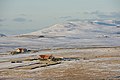
 Hagdale and Keen of Hamar in the snow - geograph.org.uk - 2202335.jpg 800 × 533; 188 KB
-

-

-
 Hamar - geograph.org.uk - 311579.jpg 398 × 600; 20 KB
-
 Hamar and Skeo Taing from Little Heog - geograph.org.uk - 2202828.jpg 800 × 534; 167 KB
-
 Hamar, Baltasound, in the snow - geograph.org.uk - 1723344.jpg 800 × 533; 70 KB
-
 Herra Hall - geograph.org.uk - 1064513.jpg 640 × 426; 85 KB
-
 Hilltop bar - geograph.org.uk - 740384.jpg 640 × 480; 80 KB
-
 Honeycomb snow on a dyke, Baltasound - geograph.org.uk - 2199752.jpg 800 × 533; 222 KB
-
 Hooded Crow (Corvus cornix), Baltasound - geograph.org.uk - 4795861.jpg 1,024 × 684; 137 KB
-

-
 Houlland from Baliasta - geograph.org.uk - 1717620.jpg 800 × 533; 133 KB
-
 Houllna Grouna from Baliasta - geograph.org.uk - 1717624.jpg 800 × 533; 159 KB
-
 House Under The Hill IMG 7387 (24454756460).jpg 4,158 × 2,273; 3.66 MB
-
 Ice at the head of Whale Firth - geograph.org.uk - 1064393.jpg 640 × 426; 97 KB
-
 Ice on an un-named lochan west of Sobul - geograph.org.uk - 1717539.jpg 800 × 534; 189 KB
-
 Keen of Hamar cliffs in the snow - geograph.org.uk - 1723659.jpg 800 × 533; 98 KB
-
 Kelda chalets, Baltasound - geograph.org.uk - 2178375.jpg 800 × 534; 158 KB
-
 Keldabrun, Baltasound - geograph.org.uk - 2178360.jpg 800 × 534; 155 KB
-
 Lamba Ness and Saxa Vord in the snow - geograph.org.uk - 1055247.jpg 640 × 426; 94 KB
-

-

-
 Loganair Islander at Fair Isle (cropped).jpg 510 × 340; 45 KB
-
 Loganair Islander at Fair Isle.jpg 640 × 480; 69 KB
-
 Looking across Harold's Wick - geograph.org.uk - 675208.jpg 640 × 426; 73 KB
-
 Looking across the voe from Skibhoul - geograph.org.uk - 734857.jpg 640 × 426; 86 KB
-

-
 Looking east from Skibhoul - geograph.org.uk - 734853.jpg 640 × 426; 75 KB
-
 Marrister Whalsay - geograph.org.uk - 634609.jpg 640 × 480; 69 KB
-
 Mavis Grind - geograph.org.uk - 1060931.jpg 640 × 480; 87 KB
-
 Mayfield, Baltasound - geograph.org.uk - 2178376.jpg 640 × 427; 48 KB
-
 Mid Head Dyke IMG 2757 (11249943475).jpg 4,272 × 2,429; 4.53 MB
-
 Mid Head Gate MG 0401 (24955465190).jpg 5,017 × 2,751; 3.7 MB
-
 Millbrae, Baltasound, in the snow - geograph.org.uk - 1691712.jpg 800 × 533; 115 KB
-
 Millburn Park, Baltasound, in the snow - geograph.org.uk - 3779928.jpg 1,024 × 768; 131 KB
-
 Millfield, Norwick - geograph.org.uk - 2198984.jpg 640 × 427; 38 KB
-
 Mires of Ramnageo in the snow - geograph.org.uk - 1505185.jpg 640 × 426; 59 KB
-
 More Snow IMG 0960 (16442797672).jpg 4,263 × 2,465; 3.82 MB
-
 Mouslee Hill and the Neap from Sotland - geograph.org.uk - 2223923.jpg 800 × 534; 175 KB
-
 Mulla, Voe, in the snow - geograph.org.uk - 992439.jpg 640 × 401; 108 KB
-
 Mullapund, Haroldswick, in the snow - geograph.org.uk - 1727721.jpg 800 × 534; 185 KB
-
 Muness - geograph.org.uk - 311536.jpg 600 × 398; 41 KB
-

-
 Nordalea Care Centre, Baltasound - geograph.org.uk - 2188299.jpg 800 × 534; 133 KB
-
 Norrendal, Whalsay, Shetland - geograph.org.uk - 132151.jpg 640 × 480; 53 KB
-
 North Booth, Haroldswick - geograph.org.uk - 2179704.jpg 640 × 426; 57 KB
-

-
 North end of Loch of Cliff - geograph.org.uk - 4795883.jpg 1,024 × 682; 202 KB
-
 North slope of Caldback Hill - geograph.org.uk - 335581.jpg 640 × 426; 52 KB
-
 North-east slopes of Little Heog - geograph.org.uk - 675196.jpg 426 × 640; 95 KB
-
 Norwick beach in the snow - geograph.org.uk - 2179707.jpg 800 × 533; 153 KB
-
 Norwick beach in the snow - geograph.org.uk - 2587040.jpg 1,024 × 682; 196 KB
-
 Norwick beach in the snow - geograph.org.uk - 3780968.jpg 1,024 × 681; 219 KB
-
 Norwick dunes in the snow - geograph.org.uk - 2202272.jpg 800 × 533; 123 KB
-

-
 Norwick from Valyie, in the snow - geograph.org.uk - 2202279.jpg 800 × 533; 75 KB
-
 Norwick meadows in the snow - geograph.org.uk - 2223893.jpg 800 × 534; 194 KB
-
 Nuckro Water, Whalsay, Shetland - geograph.org.uk - 132100.jpg 640 × 480; 52 KB
-

-
 Pettawater IMG 7107 (24632461812).jpg 4,264 × 2,553; 3.13 MB
-
 Pier at the head of Whale Firth - geograph.org.uk - 4797168.jpg 1,024 × 682; 171 KB
-
 Pigs in the snow, Baltasound - geograph.org.uk - 1505239.jpg 640 × 425; 70 KB
-
 Ponies in the snow - geograph.org.uk - 305946.jpg 600 × 399; 44 KB
-
 Radio towers on Bressay - geograph.org.uk - 2144058.jpg 3,024 × 2,016; 1.31 MB
-
 Raga, Whalefirth - geograph.org.uk - 1064504.jpg 640 × 426; 91 KB
-
-
 Road between Nikkavord Lea and SHE, Baltasound - geograph.org.uk - 3769557.jpg 1,024 × 681; 110 KB
-

-
 Road past Baltasound school - geograph.org.uk - 3368350.jpg 1,024 × 681; 134 KB
-
 Ruined kirk at Baliasta - geograph.org.uk - 2183061.jpg 800 × 533; 76 KB
-
 Sandalbrae, Baltasound - geograph.org.uk - 2178370.jpg 800 × 534; 128 KB
-
 Sandwater IMG 7104 (24655897771).jpg 4,272 × 2,371; 4.04 MB
-
 Saxa Vord in the snow - geograph.org.uk - 1055374.jpg 640 × 426; 93 KB
-
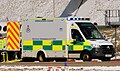 Scottish Ambulance Service Mercedes-Benz Sprinter at Sumburgh Airport.jpg 2,166 × 1,278; 990 KB
-

-
 Setter Hill, Whalsay, Shetland - geograph.org.uk - 132147.jpg 640 × 480; 53 KB
-
 Setter, Watlee, in the snow - geograph.org.uk - 1729605.jpg 640 × 427; 97 KB
-
 Setters Quarry, Little Heog - geograph.org.uk - 2202879.jpg 800 × 534; 225 KB
-
 Setters Quarry, Little Heog - geograph.org.uk - 2202883.jpg 800 × 534; 247 KB
-
 Sheep at supplemental feed, near Baliasta - geograph.org.uk - 3368340.jpg 1,024 × 681; 225 KB
-
 Sheep in snow - geograph.org.uk - 1060944.jpg 640 × 480; 61 KB
-
 Sheep in the snow near Halligarth, Baltasound - geograph.org.uk - 3780956.jpg 1,024 × 681; 198 KB
-

-
 Sheep in the snow, Baltasound - geograph.org.uk - 1725749.jpg 800 × 534; 130 KB
-
 Sheep in Winter, Whalsay, Shetland - geograph.org.uk - 132086.jpg 640 × 480; 50 KB
-
 Sheep on Hill of Caldback - geograph.org.uk - 1657311.jpg 800 × 534; 176 KB
-
 Sheep pen on the flanks of Sobul - geograph.org.uk - 1717543.jpg 800 × 534; 224 KB
-

-
 Shetland ponies, Shetland - geograph.org.uk - 1691745.jpg 800 × 534; 97 KB
-
-

-
 Silage bales in snow, Baltasound - geograph.org.uk - 2177158.jpg 800 × 534; 157 KB
-
 Skaw in the snow - geograph.org.uk - 3745510.jpg 1,024 × 681; 144 KB
-
 Skibberhoull, Whalsay, Shetland - geograph.org.uk - 132157.jpg 640 × 480; 58 KB
-
 Skibhoul Stores, Baltasound, in the snow - geograph.org.uk - 2177178.jpg 800 × 534; 189 KB
-
 Slopes of the Hill of Basta - geograph.org.uk - 1064362.jpg 640 × 426; 108 KB
-
 Small burn beside SHE, Baltasound - geograph.org.uk - 2199737.jpg 534 × 800; 146 KB
-
 Snow along a dyke, Mailand, Uyeasound - geograph.org.uk - 2193884.jpg 800 × 533; 221 KB
-
 Snow and ice on grass, Baltasound - geograph.org.uk - 3769413.jpg 1,024 × 682; 144 KB
-
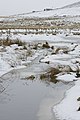
 Snow and ice on Loch of Snarravoe - geograph.org.uk - 1729826.jpg 640 × 427; 63 KB
-
 Snow at Daisy Park - geograph.org.uk - 311555.jpg 640 × 425; 37 KB
-

-
 Snow at Halligarth, Baltasound - geograph.org.uk - 3769454.jpg 681 × 1,024; 172 KB
-
 Snow at Setters Hill Estate, Baltasound - geograph.org.uk - 3769509.jpg 1,024 × 681; 96 KB
-
 Snow at Setters Hill Estate, Baltasound - geograph.org.uk - 3769510.jpg 1,024 × 681; 113 KB
-
 Snow at the head of the voe at Baltasound - geograph.org.uk - 3368356.jpg 1,024 × 681; 190 KB
-
 Snow at Underhoull - geograph.org.uk - 1717602.jpg 640 × 426; 83 KB
-
 Snow beside the Houb, Baltasound - geograph.org.uk - 2177147.jpg 534 × 800; 160 KB
-

-
 Snow in May, Baltasound - geograph.org.uk - 1851154.jpg 800 × 534; 254 KB
-
 Snow In May, Baltasound - geograph.org.uk - 1851180.jpg 800 × 533; 144 KB
-
 Snow in May, Daisy Park, Baltasound - geograph.org.uk - 2931533.jpg 800 × 534; 158 KB
-
 Snow in the Hills IMG 7053 (24713488775).jpg 4,250 × 2,221; 2.65 MB
-
 Snow in the Mountains IMG 7048 (24593694112).jpg 4,272 × 2,244; 3.9 MB
-
 Snow on Balta at dusk - geograph.org.uk - 5278225.jpg 1,024 × 681; 120 KB
-
 Snow on branches, Baltasound - geograph.org.uk - 3769401.jpg 1,024 × 681; 303 KB
-
 Snow on branches, Halligarth, Baltasound - geograph.org.uk - 3769445.jpg 1,024 × 681; 224 KB
-
 Snow on Escallonia, Baltasound - geograph.org.uk - 3368358.jpg 682 × 1,024; 207 KB
-
 Snow on Hill of Caldback - geograph.org.uk - 1657301.jpg 800 × 534; 200 KB
-
 Snow on pine needles, SHE, Baltasound - geograph.org.uk - 3769507.jpg 1,024 × 681; 191 KB
-
 Snow on pines, Setters Hill Estate, Baltasound - geograph.org.uk - 4794488.jpg 682 × 1,024; 137 KB
-
 Snow on Rosa rugosa, Baltasound - geograph.org.uk - 3368357.jpg 682 × 1,024; 119 KB
-
 Snow on Rosa rugosa, Baltasound - geograph.org.uk - 3769391.jpg 1,024 × 764; 118 KB
-
 Snow on Rosa rugosa, Baltasound - geograph.org.uk - 3769398.jpg 1,024 × 682; 174 KB
-
 Snow on Valla Field, from Baltasound school - geograph.org.uk - 5362854.jpg 1,600 × 1,065; 288 KB
-
 Snow over the voe at Baltasound - geograph.org.uk - 3368352.jpg 1,024 × 681; 137 KB
-
 Snow shower over Fetlar, from Clivocast - geograph.org.uk - 2186850.jpg 800 × 533; 107 KB
-
 Snow shower, North Booth, Haroldswick - geograph.org.uk - 2811811.jpg 800 × 533; 162 KB
-
 Snow Showers MG 0390 (24939770900).jpg 5,184 × 2,741; 4.29 MB
-
 Snow showers over Harold's Wick - geograph.org.uk - 2831273.jpg 800 × 532; 157 KB
-
 Snow showers over Mousa IMG 7951 (33077649235).jpg 5,147 × 2,822; 3.21 MB
-
 Snow showers, Voesgarth, Baltasound - geograph.org.uk - 2177164.jpg 800 × 532; 79 KB
-

-
 Snow-covered trees at Halligarth, Baltasound - geograph.org.uk - 3769457.jpg 1,024 × 681; 288 KB
-
 Snow-covered trees at Halligarth, Baltasound - geograph.org.uk - 3769459.jpg 1,024 × 681; 255 KB
-
 Snow-covered trees at Halligarth, Baltasound - geograph.org.uk - 3769461.jpg 1,024 × 681; 290 KB
-
 Snow-covered trees at Halligarth, Baltasound - geograph.org.uk - 3769464.jpg 1,024 × 681; 304 KB
-
 Snow-covered trees at Halligarth, Baltasound - geograph.org.uk - 3769468.jpg 1,024 × 681; 284 KB
-
 Snow-covered trees at Halligarth, Baltasound - geograph.org.uk - 3769470.jpg 1,024 × 681; 232 KB
-
 Snow-covered trees at Halligarth, Baltasound - geograph.org.uk - 3769472.jpg 1,024 × 682; 473 KB
-
 Snow-covered trees at Halligarth, Baltasound - geograph.org.uk - 3769479.jpg 682 × 1,024; 280 KB
-
 Snow-covered trees at Halligarth, Baltasound - geograph.org.uk - 3769488.jpg 1,024 × 682; 329 KB
-
 Snow-covered trees at Halligarth, Baltasound - geograph.org.uk - 3769564.jpg 1,024 × 681; 300 KB
-
 Snowbow IMG 8124 (24608578403).jpg 4,272 × 2,183; 2.77 MB
-
 Snowy branches at Halligarth, Baltasound - geograph.org.uk - 3769562.jpg 1,024 × 681; 210 KB
-
 Snowy branches at Halligarth, Baltasound - geograph.org.uk - 3769563.jpg 1,024 × 682; 206 KB
-
 Snowy Busta IMG 2769 (11293039036).jpg 4,264 × 2,473; 4.26 MB
-
 Snowy grass beside the Houb, Baltasound - geograph.org.uk - 3769423.jpg 1,024 × 682; 107 KB
-
 Snowy ivy, Halligarth, Baltasound - geograph.org.uk - 2199727.jpg 800 × 534; 261 KB


.jpg)


.jpg)
.jpg)


.jpg)


,_Baltasound_-_geograph.org.uk_-_4795861.jpg)


.jpg)


_protruding_through_the_snow,_Halligarth_-_geograph.org.uk_-_1727160.jpg)

.jpg)


.jpg)
.jpg)


.jpg)


.jpg)


.jpg)


.jpg)
.jpg)


.jpg)

.jpg)


.jpg)


.jpg)

