Category:Snow in South Lanarkshire
Jump to navigation
Jump to search
Media in category "Snow in South Lanarkshire"
The following 38 files are in this category, out of 38 total.
-
 A farmer feeding his sheep - geograph.org.uk - 713597.jpg 640 × 481; 69 KB
-
 A fine winter's day in Lanarkshire - geograph.org.uk - 713578.jpg 640 × 481; 67 KB
-
 A path during Snow time - panoramio.jpg 1,280 × 1,024; 745 KB
-
-
 At the summit of Dun Law. - geograph.org.uk - 334361.jpg 640 × 480; 113 KB
-
 Borrow Pit in Whitelee Forest - geograph.org.uk - 1073979.jpg 640 × 480; 181 KB
-
 Culter Fell summit. - geograph.org.uk - 135547.jpg 640 × 480; 16 KB
-
 Dukes Bridge - panoramio.jpg 1,280 × 1,024; 837 KB
-
 First snow of the winter - geograph.org.uk - 281101.jpg 640 × 480; 102 KB
-
 McDonald's East Kilbride - geograph.org.uk - 2291333.jpg 4,000 × 3,000; 2.98 MB
-
 Metal Men in the snow, Chatelherault Country Park (geograph 5694258).jpg 4,448 × 2,897; 2.29 MB
-
 New Lanark in the snow - geograph.org.uk - 1656343.jpg 640 × 480; 100 KB
-
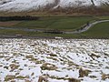
 Peden Head to Green Lowther - geograph.org.uk - 724065.jpg 640 × 480; 146 KB
-
 Pool on Glenharvie Moss - geograph.org.uk - 135546.jpg 640 × 480; 61 KB
-
 Sheepfold near North Shortcleugh - geograph.org.uk - 735074.jpg 640 × 480; 166 KB
-
 Shortcleuch Burn - geograph.org.uk - 735087.jpg 640 × 480; 134 KB
-
 Site of Lamington rail station - geograph.org.uk - 728216.jpg 640 × 480; 83 KB
-
 Snow covered farmland, Dolphinton. - geograph.org.uk - 20092.jpg 640 × 412; 92 KB
-
-

-
 Snow in garden in South Lanarkshire with scarecrow.jpg 1,536 × 2,048; 593 KB
-
 Snow in garden in South Lanarkshire.jpg 1,536 × 2,048; 737 KB
-
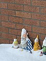 Snowy Gnomes.jpg 1,536 × 2,048; 434 KB
-
 Snowy View from Shield Road (geograph 2193672).jpg 640 × 480; 166 KB
-
 Sorry It's closed - panoramio.jpg 1,280 × 1,024; 627 KB
-
 Sycamore Crescent - geograph.org.uk - 752220.jpg 640 × 480; 98 KB
-
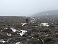 The heathery north-west ridge of Tinto - geograph.org.uk - 176392.jpg 640 × 480; 112 KB
-
 The James Hamilton Heritage Park (geograph 2190709).jpg 640 × 427; 135 KB
-

-

-
 Trig point and ice architecture, Tinto Hill - geograph.org.uk - 1731377.jpg 2,848 × 2,136; 1.51 MB
-
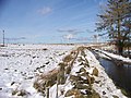
 Unclassified Road near Fullwood - geograph.org.uk - 713623.jpg 640 × 481; 64 KB
-
 White Hill toward Kirkton Wood - geograph.org.uk - 736331.jpg 640 × 480; 161 KB
-
 White Hill towards A74(M) and River Clyde - geograph.org.uk - 736310.jpg 640 × 480; 139 KB
-
 Whiteout buster. - geograph.org.uk - 135551.jpg 640 × 480; 29 KB
-
 Wind turbines on Thornmuir - geograph.org.uk - 713571.jpg 640 × 481; 95 KB
-

-
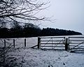
 Fence below Bleak Law - geograph.org.uk - 86180.jpg 640 × 480; 104 KB


.jpg)


.jpg)


.jpg)
_-_geograph.org.uk_-_176372.jpg)


_and_River_Clyde_-_geograph.org.uk_-_736310.jpg)


