Category:Snizort
Jump to navigation
Jump to search
Scottish parish in Highland, Scotland, UK | |||||
| Upload media | |||||
| Instance of | |||||
|---|---|---|---|---|---|
| Location |
| ||||
| Population |
| ||||
| Area |
| ||||
 | |||||
Subcategories
This category has the following 24 subcategories, out of 24 total.
A
- The Aird, Snizort (7 F)
- Annishader (14 F)
C
- Coulnacraggan (1 F)
- Crepkill (1 F)
- Cuidrach (8 F)
E
- Earlish (14 F)
G
- Glen Bernisdale (1 F)
- Glengrasco (2 F)
H
- Hinnisdal Bridge (5 F)
I
- Idrigill, Snizort (62 F)
K
- Keistle (1 F)
- Knott, Isle of Skye (2 F)
P
- Park Bernisdale (3 F)
- Peiness (1 F)
- Peinmore, Snizort (1 F)
- Prabost (3 F)
S
- Skeabost Bridge (8 F)
- South Cuil (2 F)
- Suledale (2 F)
U
Media in category "Snizort"
The following 200 files are in this category, out of 1,681 total.
(previous page) (next page)-
 'Panorama' to the north-west - geograph.org.uk - 5762414.jpg 640 × 156; 139 KB
-

-

-
 A fine drying day - geograph.org.uk - 2906138.jpg 640 × 480; 76 KB
-
 A fishing boat approaches Uig Pier - geograph.org.uk - 2695799.jpg 1,280 × 960; 472 KB
-
 A mini bealach - geograph.org.uk - 4017060.jpg 6,000 × 4,000; 4.97 MB
-

-
 A snowy bike - geograph.org.uk - 2223883.jpg 640 × 480; 137 KB
-
 A snowy Sheader road - geograph.org.uk - 2223817.jpg 640 × 480; 78 KB
-
 A Uig scene - geograph.org.uk - 3529338.jpg 750 × 563; 70 KB
-
 A view to Uig pier - geograph.org.uk - 6583570.jpg 2,592 × 1,944; 749 KB
-
 A walker on the Sheader road - geograph.org.uk - 2179306.jpg 640 × 480; 88 KB
-
 A warm Skye welcome awaits you at Uig^ - geograph.org.uk - 4731851.jpg 800 × 534; 239 KB
-
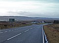
 A850 at Treaslane, Isle of Skye - geograph.org.uk - 5759007.jpg 800 × 600; 42 KB
-
 A850 crossing the Treaslane River - geograph.org.uk - 5760472.jpg 800 × 600; 39 KB
-
 A850 near Tayinloan Lodge - geograph.org.uk - 5758999.jpg 800 × 600; 69 KB
-

-
 A855 at the Old Man of Storr - geograph.org.uk - 6533939.jpg 1,280 × 853; 421 KB
-
 A855 below the Storr - geograph.org.uk - 6537147.jpg 1,280 × 960; 554 KB
-
 A87 above Caisteal Uisdein - geograph.org.uk - 5762177.jpg 1,024 × 768; 85 KB
-
 A87 above South Cuidrach - geograph.org.uk - 5793562.jpg 1,024 × 768; 96 KB
-
 A87 above South Cuil, Uig - geograph.org.uk - 5762548.jpg 1,024 × 768; 105 KB
-
 A87 above Uig - geograph.org.uk - 4540985.jpg 1,600 × 1,280; 670 KB
-
 A87 approaching Drochaid a' Cham Lòin - geograph.org.uk - 5762161.jpg 1,024 × 768; 103 KB
-
 A87 approaching North Cuil, Uig - geograph.org.uk - 5762549.jpg 1,024 × 731; 156 KB
-
 A87 at Borve - geograph.org.uk - 5761078.jpg 800 × 450; 45 KB
-
 A87 at Earlish, Isle of Skye - geograph.org.uk - 5762547.jpg 1,024 × 768; 125 KB
-
 A87 at Eyre - geograph.org.uk - 5761829.jpg 1,024 × 768; 122 KB
-
 A87 between Earlish and Kingsburgh - geograph.org.uk - 5402766.jpg 1,024 × 595; 146 KB
-
 A87 heading south near Eyre - geograph.org.uk - 5793583.jpg 1,024 × 731; 96 KB
-

-
 A87 leaving Uig - geograph.org.uk - 5486942.jpg 640 × 481; 58 KB
-
 A87 near Earlish - geograph.org.uk - 5762546.jpg 1,024 × 768; 116 KB
-
 A87 near Kingsburgh - geograph.org.uk - 5515561.jpg 640 × 481; 44 KB
-
 A87 north of Romesdal - geograph.org.uk - 5762152.jpg 1,024 × 731; 73 KB
-
 A87 passing Kingsburgh Community Woodland - geograph.org.uk - 5762167.jpg 1,024 × 768; 94 KB
-
 A87 south of Glen Hinnisdal - geograph.org.uk - 5793571.jpg 1,024 × 768; 113 KB
-
 A87 Uig - geograph.org.uk - 6567497.jpg 2,592 × 1,944; 1.04 MB
-
 Abandoned settlement east of Lyndale - geograph.org.uk - 2286417.jpg 640 × 480; 365 KB
-
 Abhain Bhat looking downstream - geograph.org.uk - 2075008.jpg 640 × 480; 125 KB
-
 Abhainn Bhat - geograph.org.uk - 2074999.jpg 640 × 480; 153 KB
-
 Abhainn Dhubh - geograph.org.uk - 2405326.jpg 640 × 480; 36 KB
-
 Above Loch Leathan - geograph.org.uk - 6537134.jpg 1,280 × 853; 487 KB
-
 Above Rubha Bhreidein - geograph.org.uk - 2286283.jpg 640 × 473; 198 KB
-
 Above the course of Lon Mor - geograph.org.uk - 4016344.jpg 6,000 × 4,000; 6.55 MB
-
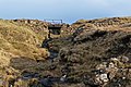
 Abstraction sluice on the Lòn Shobhar-airigh - geograph.org.uk - 5959601.jpg 1,024 × 768; 390 KB
-
 Access road to cottages - geograph.org.uk - 1210497.jpg 600 × 450; 424 KB
-
 Aeolian deposits on the Storr summit - geograph.org.uk - 1875506.jpg 640 × 480; 145 KB
-
 Afternoon nap - geograph.org.uk - 4821632.jpg 1,280 × 960; 813 KB
-
 Agricultural building at Glengrasco - geograph.org.uk - 1779454.jpg 640 × 480; 91 KB
-

-

-
 Agricultural outbuilding at Earlish - geograph.org.uk - 3132359.jpg 640 × 480; 80 KB
-
 Aird Point - geograph.org.uk - 4618232.jpg 640 × 480; 110 KB
-
 Allt an Loin Ruaidh - geograph.org.uk - 1210503.jpg 600 × 450; 389 KB
-
 Allt Dearg - geograph.org.uk - 2870836.jpg 640 × 480; 139 KB
-
 Allt Dearg - geograph.org.uk - 3062143.jpg 1,024 × 768; 237 KB
-
 Allt Dearg - geograph.org.uk - 3063237.jpg 1,280 × 960; 1.24 MB
-
 Allt Dearg - geograph.org.uk - 3063470.jpg 1,280 × 960; 1.2 MB
-
 Allt Dearg - geograph.org.uk - 3063493.jpg 1,024 × 768; 241 KB
-
 Allt Dearg gorge - geograph.org.uk - 3062176.jpg 1,280 × 960; 1.69 MB
-
 Allt Garbh - geograph.org.uk - 2469182.jpg 1,024 × 768; 271 KB
-
 Allt Garbh - geograph.org.uk - 2469202.jpg 768 × 1,024; 399 KB
-
 Along the A87 Road - geograph.org.uk - 3058887.jpg 800 × 600; 111 KB
-
 An aerial view of Idrigill - geograph.org.uk - 2923252.jpg 800 × 534; 275 KB
-
 An early morning view of Uig Pier - geograph.org.uk - 4241772.jpg 640 × 480; 109 KB
-
 An evening view of the pier from Idrigill - geograph.org.uk - 3465308.jpg 3,264 × 2,448; 3.05 MB
-
 An Storr - geograph.org.uk - 5760915.jpg 640 × 427; 288 KB
-
 Annishader - geograph.org.uk - 2481690.jpg 640 × 421; 195 KB
-
 Approach to Bealach Beag - geograph.org.uk - 4001845.jpg 1,500 × 1,007; 1.27 MB
-
 Approach to Skeabost House Hotel - geograph.org.uk - 2207870.jpg 1,024 × 768; 843 KB
-
 Approaching Bealach nan Coisichean - geograph.org.uk - 4538703.jpg 640 × 480; 162 KB
-
 Approaching hailstorm - geograph.org.uk - 3431780.jpg 640 × 418; 135 KB
-
 Approaching the hairpin by Idrigill - geograph.org.uk - 2923259.jpg 800 × 534; 352 KB
-
 As old as the hills.. - geograph.org.uk - 2922754.jpg 800 × 534; 295 KB
-
 Ascending towards the ridge - geograph.org.uk - 4018023.jpg 6,000 × 4,000; 4.83 MB
-
 At the cloud base on Beinn a' Chearcaill - geograph.org.uk - 3073412.jpg 640 × 480; 181 KB
-
 At the edge of the ridge - geograph.org.uk - 4018228.jpg 5,906 × 3,938; 4.35 MB
-
 At the top of Beinn an Righ - geograph.org.uk - 4016575.jpg 6,000 × 4,000; 6.2 MB
-
 B885 crossing moorland below Ben Grasco - geograph.org.uk - 5797730.jpg 1,024 × 576; 60 KB
-
 B885 north of Ben Grasco - geograph.org.uk - 5797732.jpg 1,024 × 731; 60 KB
-
 B885 passing standing and felled forest - geograph.org.uk - 5797756.jpg 1,024 × 576; 94 KB
-
 Back down the track - geograph.org.uk - 2645951.jpg 1,280 × 960; 1.15 MB
-
 Baling silage at Earlish - geograph.org.uk - 3117385.jpg 640 × 480; 109 KB
-
 Balnacnoc from Glen Conon - geograph.org.uk - 3223517.jpg 640 × 480; 87 KB
-
 Balnaknock -Baile nan Cnoc - geograph.org.uk - 3485040.jpg 3,264 × 2,448; 4.65 MB
-
 Banks of Loch Eyre - geograph.org.uk - 6567490.jpg 2,592 × 1,944; 1.48 MB
-
 Barn and Folly, Uig, Isle of Skye - geograph.org.uk - 5401719.jpg 683 × 1,024; 232 KB
-
 Basalt boulder near Needle Rock - geograph.org.uk - 6535876.jpg 1,280 × 960; 818 KB
-
 Beach at Poll a' Bhainne - geograph.org.uk - 2286305.jpg 640 × 475; 273 KB
-
 Beach below Knott - geograph.org.uk - 1214225.jpg 640 × 480; 202 KB
-
 Beach south of Dun Santavaig - geograph.org.uk - 946038.jpg 640 × 480; 183 KB
-
 Bealach a' Chuirn - geograph.org.uk - 4000785.jpg 1,500 × 1,000; 988 KB
-
 Bealach Amadal - geograph.org.uk - 2516555.jpg 640 × 469; 82 KB
-
 Bealach Amadal - geograph.org.uk - 5018349.jpg 640 × 421; 150 KB
-
 Bealach Beag - geograph.org.uk - 4938794.jpg 513 × 640; 314 KB
-
 Bealach Hartaval - geograph.org.uk - 4538728.jpg 640 × 480; 189 KB
-
 Bealach na Leacaich - geograph.org.uk - 1934280.jpg 640 × 480; 183 KB
-
 Bealach Uige - geograph.org.uk - 3483931.jpg 640 × 480; 93 KB
-
 Bearreraig Bay - geograph.org.uk - 2668065.jpg 2,245 × 952; 1.92 MB
-
 Bearreraig Bay - geograph.org.uk - 6725431.jpg 1,024 × 711; 183 KB
-
 Beat 2 Post Office pool sign - geograph.org.uk - 1585699.jpg 640 × 480; 131 KB
-
 Beinn an Lochain from the west - geograph.org.uk - 4016329.jpg 6,000 × 4,000; 6.21 MB
-
 Beinn an Righ - geograph.org.uk - 4016362.jpg 6,000 × 4,000; 5.58 MB
-
 Beinn Edra from the north - geograph.org.uk - 4063325.jpg 1,024 × 683; 658 KB
-
 Beinn Edra Trigpoint - geograph.org.uk - 2882497.jpg 640 × 427; 232 KB
-
 Beinn Tuath with cairn - geograph.org.uk - 4017043.jpg 6,000 × 4,000; 7.12 MB
-
 Below Beinn a Chapuill - geograph.org.uk - 4016295.jpg 6,000 × 4,000; 6.45 MB
-
 Below The Old Man of Storr - geograph.org.uk - 5582692.jpg 1,024 × 683; 220 KB
-
 Below the Storr - geograph.org.uk - 6537085.jpg 1,280 × 960; 304 KB
-
 Ben Grasco - geograph.org.uk - 2379461.jpg 1,600 × 1,074; 735 KB
-
 Ben Roishader - geograph.org.uk - 2469198.jpg 1,024 × 768; 221 KB
-
 Bench on the A87 in Uig - geograph.org.uk - 5729255.jpg 640 × 480; 49 KB
-
 Bend in the river - geograph.org.uk - 1145890.jpg 640 × 480; 87 KB
-
 Bernisdale - geograph.org.uk - 6199967.jpg 1,280 × 857; 920 KB
-
 Bernisdale junction - geograph.org.uk - 6199962.jpg 1,280 × 857; 892 KB
-
 Bernisdale towards Tote - geograph.org.uk - 3400201.jpg 640 × 480; 83 KB
-
 Beyond the waterfalls - geograph.org.uk - 4017631.jpg 6,000 × 4,000; 5.32 MB
-
 Bioda Buidhe - geograph.org.uk - 5211775.jpg 1,024 × 763; 315 KB
-
 Bird's Eye View - geograph.org.uk - 2379818.jpg 1,600 × 1,074; 882 KB
-
 Boat by Loch Mor - geograph.org.uk - 2244222.jpg 640 × 480; 182 KB
-
 Boat house at the Storr Lochs dam - geograph.org.uk - 3480645.jpg 640 × 480; 57 KB
-
 Boats in Uig Bay - geograph.org.uk - 2970582.jpg 640 × 480; 41 KB
-
 Boats on the shore of Loch Snizort Beag - geograph.org.uk - 1957603.jpg 640 × 456; 238 KB
-
 Bog on Ben Grasco - geograph.org.uk - 2087109.jpg 640 × 480; 88 KB
-
 Boggy pond below the Storr escarpment - geograph.org.uk - 6535695.jpg 1,280 × 960; 791 KB
-
 Borrow pit in Coille Ghlinne Bhig - geograph.org.uk - 1117292.jpg 640 × 480; 190 KB
-
 Borve junction - geograph.org.uk - 1131923.jpg 640 × 476; 71 KB
-
 Borve Standing Stones - geograph.org.uk - 2370482.jpg 1,600 × 1,074; 807 KB
-
 Boulder field north of Carn Liath - geograph.org.uk - 957274.jpg 640 × 480; 272 KB
-
 Boulders under the Storr - geograph.org.uk - 2629208.jpg 640 × 480; 93 KB
-
 Boundary Fence - geograph.org.uk - 2379405.jpg 1,074 × 1,600; 925 KB
-
 Bridge of Rha at Uig - geograph.org.uk - 3484766.jpg 3,264 × 2,448; 4.77 MB
-
 Bridge of Rha, Uig - geograph.org.uk - 2548480.jpg 800 × 533; 155 KB
-
 Bridge on the old A87 near Kingsburgh - geograph.org.uk - 2075084.jpg 640 × 480; 117 KB
-
-
 Bridge on the track to Bealach Uige - geograph.org.uk - 1139364.jpg 640 × 427; 161 KB
-
 Bridge over the Carbost Burn - geograph.org.uk - 1197006.jpg 640 × 480; 222 KB
-
 Bridge over the Lòn an Eireannaich - geograph.org.uk - 6452921.jpg 1,024 × 768; 738 KB
-
 Bridge over the Lòn na Leabaig - geograph.org.uk - 1145929.jpg 640 × 480; 116 KB
-
 Bridge over the River Haultin - geograph.org.uk - 5761825.jpg 1,024 × 576; 83 KB
-
 Bridge over the River Snizort - geograph.org.uk - 5797738.jpg 1,024 × 768; 126 KB
-
 Bridge over Treaslane River - winter - geograph.org.uk - 2206346.jpg 640 × 480; 139 KB
-
 Brigadoon - geograph.org.uk - 1214288.jpg 640 × 480; 210 KB
-
 Brigadoon, two years on - geograph.org.uk - 2305455.jpg 1,024 × 768; 749 KB
-
 Broadleaf trees in the forest - geograph.org.uk - 2645937.jpg 1,280 × 960; 1.48 MB
-
 Broadleaf trees in the forest - geograph.org.uk - 2646672.jpg 1,024 × 768; 230 KB
-
 Building plots near Lyndale - geograph.org.uk - 1210485.jpg 600 × 450; 320 KB
-
 Building plots near Lyndale - geograph.org.uk - 1210488.jpg 600 × 450; 326 KB
-
 Building site at Earlish - geograph.org.uk - 1615612.jpg 640 × 480; 97 KB
-
 Bull at The Cow Shed, Uig - geograph.org.uk - 5401006.jpg 1,024 × 683; 158 KB
-
 Bun-Sgoil Mhic Dhiarmaid - geograph.org.uk - 4980471.jpg 1,024 × 806; 222 KB
-
 Burial ground above Glen Uig - geograph.org.uk - 3484875.jpg 3,264 × 2,448; 3.15 MB
-
 Burn at Glenuachdarach - geograph.org.uk - 1934246.jpg 640 × 426; 210 KB
-
 Burn at Peinaha - geograph.org.uk - 1536475.jpg 640 × 480; 135 KB
-
 Burn on the slopes of Ben Grasco - geograph.org.uk - 1175422.jpg 480 × 640; 155 KB
-
 Bus Shelter - geograph.org.uk - 2377959.jpg 1,600 × 986; 573 KB
-
 Bus shelter at the junction - geograph.org.uk - 1217987.jpg 640 × 480; 82 KB
-

-
 Cairn on Beinn a' Chapuill - geograph.org.uk - 1065889.jpg 640 × 480; 141 KB
-
 Cairn on Beinn an Righ - geograph.org.uk - 4016618.jpg 6,000 × 4,000; 4.15 MB
-
 Cairn on Creagile - geograph.org.uk - 3431765.jpg 640 × 480; 233 KB
-
 Cairn on point 417 - geograph.org.uk - 4017832.jpg 640 × 480; 230 KB
-
 Cairn on the northern slopes of the Storr - geograph.org.uk - 2249314.jpg 1,024 × 661; 233 KB
-
 Cairn on the western slope of Beinn Gorm - geograph.org.uk - 1926346.jpg 640 × 474; 171 KB
-
 Cairn, Creagile - geograph.org.uk - 6504403.jpg 1,024 × 638; 159 KB
-

-
 CalMac's 'Hebrides' at Uig - geograph.org.uk - 5040875.jpg 3,264 × 2,448; 4.63 MB
-
 Calving in Glen Bernisdale - geograph.org.uk - 1185726.jpg 640 × 386; 200 KB
-
 Captain Fraser's Folly - geograph.org.uk - 2223837.jpg 640 × 480; 54 KB
-
 Captain Fraser's Folly above Uig Bay - geograph.org.uk - 2970603.jpg 640 × 480; 90 KB
-
 Captain Fraser's Folly and Uig bay - geograph.org.uk - 5486937.jpg 640 × 481; 44 KB
-
 Car on the C1233 - geograph.org.uk - 4821626.jpg 1,280 × 960; 851 KB
-
 Car park construction at the Storr - geograph.org.uk - 6510103.jpg 1,024 × 768; 710 KB
-
 Caravan conundrum - geograph.org.uk - 2519474.jpg 1,198 × 1,600; 505 KB
-
 Carbost Burn - geograph.org.uk - 1067101.jpg 640 × 480; 99 KB
-
 Carn Liath - geograph.org.uk - 856428.jpg 640 × 480; 152 KB
-
 Carn Liath - geograph.org.uk - 935843.jpg 640 × 480; 235 KB
-
 Carved bench in Kingsburgh Forest - geograph.org.uk - 2870470.jpg 640 × 480; 143 KB
-
 Castle Ewen - geograph.org.uk - 1940686.jpg 640 × 426; 175 KB
-
 Castle Ewen - geograph.org.uk - 1940709.jpg 640 × 426; 179 KB
-
 Castle Ewen - geograph.org.uk - 2865128.jpg 640 × 358; 63 KB
-
 Castle Ewen - geograph.org.uk - 2870818.jpg 640 × 480; 83 KB
-

-
 Castle Ewen in Fairy Glen - geograph.org.uk - 2870815.jpg 640 × 480; 67 KB
-
 Castle Ewen reflected on Lochan Mor Rhugh - geograph.org.uk - 2695763.jpg 1,280 × 960; 516 KB
-
 Castle Ewen, Glen Uig - geograph.org.uk - 6175325.jpg 1,280 × 850; 696 KB
-
 Castle Ewen, Glen Uig - geograph.org.uk - 6175326.jpg 1,280 × 720; 528 KB
-
 Cattle at Uig - geograph.org.uk - 2223889.jpg 640 × 480; 100 KB
-
 Cattle Court - geograph.org.uk - 2377966.jpg 1,600 × 1,074; 810 KB
-
 Cattle feeding station - geograph.org.uk - 1109401.jpg 600 × 476; 65 KB
-
 Cattle grid - geograph.org.uk - 1536551.jpg 640 × 480; 88 KB
-
 Cattle grid - geograph.org.uk - 2898201.jpg 640 × 360; 231 KB
-
 Cattle, Peinmore - geograph.org.uk - 2898197.jpg 640 × 360; 229 KB
-
 Ceann Loch Snizort Beag - geograph.org.uk - 1194027.jpg 640 × 478; 151 KB
-
 Cemetery at Skeabost - geograph.org.uk - 3486059.jpg 3,264 × 2,448; 4.59 MB
-
 Changes to the old road - geograph.org.uk - 6199954.jpg 1,280 × 857; 1.35 MB
-
 Chapel remains - geograph.org.uk - 3488174.jpg 2,048 × 1,536; 1.04 MB
-
 Chilly postbox - geograph.org.uk - 2207881.jpg 768 × 1,024; 358 KB
-
 Chilly spot for a picnic - geograph.org.uk - 2206396.jpg 1,024 × 768; 706 KB


