Category:Snake River in Idaho
Jump to navigation
Jump to search
Subcategories
This category has the following 50 subcategories, out of 50 total.
.
A
- American Falls (Snake River) (10 F)
B
C
D
F
- Fall Creek Falls (Idaho) (7 F)
- Fisher Bottom (12 F)
G
- Givens Hot Springs, Idaho (3 F)
- Grand View, Idaho (4 F)
H
- Hammett, Idaho (13 F)
- Homedale, Idaho (5 F)
I
K
L
M
- Marsing, Idaho (6 F)
N
O
- Owsley Bridge (3 F)
P
- Pillar Falls (Snake River) (4 F)
S
T
- Twin Falls (Idaho) (17 F)
W
Media in category "Snake River in Idaho"
The following 162 files are in this category, out of 162 total.
-
 08395-Lewiston, Idaho-1906-Loading Wheat on the Snake River-Brück & Sohn Kunstverlag.jpg 1,516 × 1,000; 674 KB
-
-
 08405-Lewiston, Idaho-1906-Sheep Ranch on Snake River-Brück & Sohn Kunstverlag.jpg 1,512 × 1,000; 584 KB
-

-

-

-
 American Falls bridge from OHQ.png 1,922 × 1,456; 1.2 MB
-

-

-
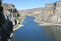
 Below falls 2016-09-28 348.jpg 4,608 × 3,072; 3.74 MB
-
 Below falls 2016-09-28 351.jpg 4,608 × 3,072; 3.92 MB
-
 Below falls 2016-09-28 361.jpg 3,072 × 4,608; 2.86 MB
-
 Below falls 2016-09-28 367.jpg 4,608 × 3,072; 3.25 MB
-
 Below falls 2016-09-28 368.jpg 4,608 × 3,072; 4.3 MB
-
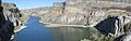 Below falls 2016-09-28.jpg 8,501 × 2,702; 4.32 MB
-
 Bluff-above-Swan-Valley (23301019724).jpg 1,900 × 1,266; 1.15 MB
-
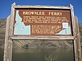 Brownleeferry.JPG 1,024 × 768; 272 KB
-
 Bulletin of the U.S. Department of Agriculture (1913) (20311920640).jpg 2,976 × 1,532; 1.02 MB
-
 Bulletin of the U.S. Department of Agriculture (1913-1923.) (20490560402).jpg 3,056 × 1,604; 1.85 MB
-
 Burley Idaho Snake River Sunset.JPG 1,600 × 1,200; 839 KB
-
 Cassier's magazine (1904) (14582527697).jpg 2,973 × 1,760; 4.37 MB
-
 Celebration Park Petroglyph- Historical.JPG 768 × 1,024; 172 KB
-
 ClearwaterEscarpment-Lewiston-USDA-1917.png 595 × 464; 301 KB
-
 Cymopterus petraeus plant-4-12-05.jpg 768 × 1,024; 98 KB
-
 DJI 00121567547723.jpg 3,840 × 2,160; 2.11 MB
-
 East along Snake River from Perrine Bridge, Apr 17.jpg 2,592 × 1,944; 2.36 MB
-
 Extinct volcano on Henry's Fork of Snake River. Fremont County, Idaho. - NARA - 516767.jpg 3,000 × 2,386; 1.19 MB
-
 FisherBottom (21149798563).jpg 10,529 × 3,541; 23.92 MB
-
 FisherBottom (21758903432).jpg 5,443 × 6,807; 23.75 MB
-
 FisherBottom (21770861355).jpg 5,472 × 3,648; 13.01 MB
-
 FisherBottom (21780228131).jpg 3,648 × 5,472; 13.19 MB
-
 Gifford Springs - panoramio.jpg 3,424 × 2,497; 3.38 MB
-
 Guffey Bridge (1).jpg 6,000 × 4,000; 6.2 MB
-
 Guffey Bridge (2).jpg 6,000 × 4,000; 6.27 MB
-
 Guffey Bridge (4).jpg 6,000 × 4,000; 5.91 MB
-
 Guffey Bridge (9).jpg 6,000 × 3,375; 5.22 MB
-
 Guffey Island.jpg 4,270 × 2,847; 2.42 MB
-
 HAFO FlowersRiver.jpg 525 × 375; 59 KB
-
 HAFO snake river.jpg 375 × 180; 30 KB
-
 Hagerman banner Snake River Overlook.jpg 6,437 × 918; 848 KB
-
 Hagerman Bluffs on the Snake River.jpg 12,383 × 2,622; 4.25 MB
-
 Hansen Bridge, Idaho.jpg 4,499 × 3,888; 17.01 MB
-
 Hasotino Site NPS - Idaho.jpg 285 × 186; 29 KB
-
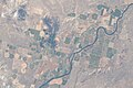 ISS-57 Grand View, Idaho.jpg 5,568 × 3,712; 2.87 MB
-
 Lagoon - panoramio (1).jpg 3,392 × 2,537; 4.24 MB
-
 Malad Gorge, Snake River - Flickr - brewbooks.jpg 3,888 × 2,592; 4.92 MB
-
 Minidoka2.jpg 2,592 × 1,944; 2.33 MB
-

-
 O.S.L. Bridge, Heyburn, Idaho.jpg 2,485 × 1,910; 650 KB
-

-
 Owsley Bridge - Hagerman Idaho.jpg 3,861 × 2,176; 3.18 MB
-
 Park on Snake River in Ontario, Oregon 01.jpg 6,000 × 4,000; 11.22 MB
-
 Perrine Bridge (49057322408).jpg 3,000 × 2,000; 5.04 MB
-
 Perrine Bridge (49057943553).jpg 3,000 × 2,247; 4.51 MB
-
 Perrine Bridge (49059341767).jpg 3,000 × 2,247; 4.92 MB
-
 Perrine Bridge 2016-09-28 322.jpg 4,608 × 3,072; 3.87 MB
-
 Perrine Bridge 2016-09-28 329.jpg 3,072 × 4,608; 3.61 MB
-
 Perrine Bridge 2016-09-28 332.jpg 3,072 × 4,608; 4.44 MB
-
 Perrine Bridge July 1989 a.jpg 3,012 × 2,062; 1.21 MB
-
 Perrine Bridge spanning the Snake River at Twin Falls, Idaho (cut).jpg 3,453 × 2,076; 2.17 MB
-
 Perrine Bridge spanning the Snake River at Twin Falls, Idaho.jpg 3,499 × 2,152; 1.2 MB
-
 Perrine Bridge Twin Falls (cut).jpg 4,329 × 1,926; 3.5 MB
-
 Perrine Bridge Twin Falls.jpg 5,119 × 3,444; 4.32 MB
-
 Perrine Bridge Twin Falls2.jpg 2,516 × 2,277; 5.69 MB
-
 Perrine Bridge, Twin Falls, ID.jpg 4,384 × 3,288; 4.19 MB
-
 Perrinebridge.jpg 1,152 × 1,716; 1.35 MB
-
 River - panoramio (10).jpg 3,488 × 2,616; 3.78 MB
-
 Riverbank - panoramio.jpg 3,316 × 2,312; 3.72 MB
-
 Shoshone Cañon, Idaho LOC 4296124526.jpg 1,024 × 796; 61 KB
-
 SHOSHONE FALLS, SNAKE RIVER, IDAHO - NARA - 524296.tif 3,000 × 2,505; 7.17 MB
-

-
 Shoshone Falls, Snake River, Idaho. LOC 4295374795.jpg 640 × 366; 53 KB
-
 Shoshone04.jpg 3,264 × 2,448; 3.24 MB
-
 Snake River (Idaho).jpg 3,472 × 2,604; 3.77 MB
-
 Snake River - panoramio (4).jpg 2,000 × 1,104; 3.08 MB
-
 Snake River - panoramio.jpg 3,408 × 2,423; 4.05 MB
-
 Snake River 1 - Guffey Butte-Black Butte Archaeological District Idaho.jpg 2,871 × 2,243; 655 KB
-
 Snake River 2 - Guffey Butte-Black Butte Archaeological District Idaho.jpg 2,857 × 2,246; 569 KB
-
 Snake River 2016-10-13 2319.jpg 4,608 × 3,072; 3.23 MB
-
 Snake River 2016-10-13 2320.jpg 4,608 × 3,072; 2.62 MB
-
 Snake River 2016-10-13 2321.jpg 4,608 × 3,072; 2.66 MB
-
 Snake River 2016-10-13 2343.jpg 4,608 × 3,072; 3.68 MB
-
 Snake River 20161013 130937.jpg 1,600 × 912; 523 KB
-
 Snake River Area of Critical Environmental Concern, Idaho (15481593919).jpg 1,000 × 667; 842 KB
-
 Snake River Area of Critical Environmental Concern, Idaho (15669062662).jpg 1,000 × 664; 607 KB
-
 Snake River at Celebration Park Idaho- algae on shoreline 2.jpg 1,024 × 768; 269 KB
-
 Snake River at Celebration Park Idaho- algae on shoreline.jpg 1,024 × 768; 213 KB
-
 Snake River at Celebration Park late July.jpg 1,024 × 768; 238 KB
-
 Snake River at Hagerman Fossil Beds National Monument 2016-10-13 2313.jpg 2,304 × 1,296; 489 KB
-

-
 Snake River before Boise.JPG 3,888 × 2,592; 4.79 MB
-
 Snake River below Shoshone Falls, Idaho, May 1899 (HARRIMAN 3).jpg 642 × 510; 44 KB
-
 Snake River Canyon, ID 2016-09 552.jpg 1,600 × 912; 709 KB
-
 Snake River Downstream the Hells Canyon Reservoir Dam.jpg 623 × 800; 191 KB
-
 Snake River Idaho - panoramio.jpg 2,000 × 1,124; 3.11 MB
-
 Snake river idaho falls.jpg 1,024 × 768; 343 KB
-
 Snake River Island Park.jpg 1,006 × 604; 151 KB
-
 Snake River Overlook (HaFo).jpg 8,041 × 2,039; 2.16 MB
-
 Snake River Overlook (Hagerman).jpg 7,499 × 2,726; 2.64 MB
-
 Snake RIver Overlook 2016-10-13 2310.jpg 4,608 × 3,072; 3.27 MB
-
 Snake RIver Overlook 2016-10-13 2312.jpg 4,608 × 3,072; 2.88 MB
-
 Snake RIver Overlook 2016-10-13 2313.jpg 4,608 × 2,592; 2.44 MB
-
 Snake RIver Overlook 2016-10-13 2314.jpg 4,608 × 2,592; 2.46 MB
-
 Snake RIver Overlook 2016-10-13 2316.jpg 4,608 × 3,072; 3.45 MB
-
 Snake River summer aerial (34297741910).jpg 3,264 × 2,448; 1.7 MB
-
 Snake River, Idaho, USA.jpg 3,888 × 2,592; 4.34 MB
-

-
 Snake01.jpg 3,264 × 2,448; 3.45 MB
-
 Snake02.jpg 3,264 × 2,448; 3.45 MB
-
 Snake03.jpg 3,264 × 2,448; 3.6 MB
-
 Snake04.jpg 3,264 × 2,448; 3.01 MB
-
 Snake05.jpg 3,264 × 2,448; 3.64 MB
-
 Snake06.jpg 3,264 × 2,448; 3.32 MB
-
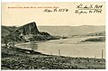
 SnakeRiver.jpg 540 × 334; 134 KB
-
 South under Perrine Bridge, Apr 17.jpg 1,944 × 2,592; 1.55 MB
-
 Southwest at Perrine Bridge, Apr 17.jpg 2,592 × 1,944; 2.33 MB
-
 Southwest under Perrine Bridge at Snake River, Apr 17.jpg 2,592 × 1,944; 2.35 MB
-
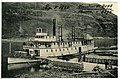
 Steamtug Jean.JPG 4,320 × 3,240; 5.69 MB
-
 Steelhead from Snake River at Lewiston, Idaho.jpg 3,264 × 1,840; 1.27 MB
-

-
 Swan-falls-dam-id-us.jpg 267 × 175; 16 KB
-

-
 Thousand Springs 2016-10-13 2361.jpg 4,608 × 3,072; 4.06 MB
-
 Thousand Springs 2016-10-13 2362.jpg 4,608 × 3,072; 3.67 MB
-
 Twin Falls Idaho (8205824633).jpg 585 × 591; 160 KB
-
 Twin Falls Idaho (8205824691).jpg 586 × 381; 70 KB
-
 Twin Falls, Idaho…Snake River bridge (7334003776).jpg 2,121 × 1,414; 2.73 MB
-
 U.S. Highway 93 bridge from within Snake River Canyon.jpeg 1,000 × 508; 102 KB
-

-

-

-
 US 30 bridge (Owsley site) 2106-10-13 2305.jpg 4,608 × 3,072; 3.36 MB
-

-

-

-

-

-

-

-

-

-

-

-

-

-

-

-

-

-

-

-

-

-

-

-

-

-
 Walcott-lake-id-us.png 801 × 650; 1.04 MB
-
 West along Snake River from Perrine Bridge, Apr 17.jpg 2,592 × 1,944; 2.38 MB
-
 Western Heritage Historic Byway - Golden Eagle at Swan Falls - NARA - 7722775.jpg 2,660 × 1,800; 3.53 MB
-
 Western Heritage Historic Byway - Swan Falls Dam - NARA - 7722780.jpg 2,050 × 1,363; 348 KB
-
 Western Heritage Historic Byway - The View from Dedication Point - NARA - 7722772.jpg 2,050 × 1,385; 491 KB


_in_Twin_Falls,_Idaho.jpg)


.jpg)
.jpg)


.jpg)

_(20311920640).jpg)
_(20490560402).jpg)

_(14582527697).jpg)


.jpg)
.jpg)
.jpg)

.jpg)
.jpg)
.jpg)
.jpg)


.jpg)


_-_NARA_-_68886311_(page_2).gif)

.jpg)


.jpg)
.jpg)
.jpg)


.jpg)

.jpg)


.jpg)


.jpg)
.jpg)


.jpg)
.jpg)


.jpg)


.jpg)


.jpg)
.jpg)
.jpg)

_2106-10-13_2305.jpg)


.jpg)
.jpg)
.jpg)
Categories:
- Snake River by state
- Rivers of Idaho
- Bodies of water in Nez Perce County, Idaho
- Bodies of water in Idaho County, Idaho
- Bodies of water in Adams County, Idaho
- Bodies of water in Washington County, Idaho
- Bodies of water in Payette County, Idaho
- Bodies of water in Canyon County, Idaho
- Bodies of water in Owyhee County, Idaho
- Bodies of water in Ada County, Idaho
- Bodies of water in Elmore County, Idaho
- Bodies of water in Gooding County, Idaho
- Bodies of water in Twin Falls County, Idaho
- Bodies of water in Jerome County, Idaho
- Bodies of water in Cassia County, Idaho
- Bodies of water in Minidoka County, Idaho
- Bodies of water in Blaine County, Idaho
- Bodies of water in Power County, Idaho
- Bodies of water in Bingham County, Idaho
- Bodies of water in Bannock County, Idaho
- Bodies of water in Bonneville County, Idaho
- Bodies of water in Jefferson County, Idaho
- Aquifers in the United States
- Snake-Columbia Shrub Steppe Ecoregion
- Locations along Interstate 15 in Idaho
- Locations along Interstate 84 in Idaho
- Locations along Interstate 86 (Idaho)
- Locations along Interstate 84 Business (Burley-Heyburn)
- Locations along U.S. Route 20 in Idaho
- Locations along U.S. Route 26 in Idaho
- Locations along U.S. Route 30 in Idaho
- Locations along U.S. Route 30S (Idaho–Utah–Wyoming) in Idaho
- Locations along U.S. Route 91 in Idaho
- Locations along U.S. Route 93 in Idaho
- Locations along U.S. Route 191 in Idaho
- Locations along Idaho State Highway 19
- Locations along Idaho State Highway 25
- Locations along Idaho State Highway 27
- Locations along Idaho State Highway 39
- Locations along Idaho State Highway 45
- Locations along Idaho State Highway 50
- Locations along Idaho State Highway 51
- Locations along Idaho State Highway 55
- Locations along Idaho State Highway 77
- Locations along Idaho State Highway 78
- Locations along Idaho State Highway 81
- Locations along Idaho State Highway 128
- Locations along Idaho State Highway 167
- Locations along the Western Heritage Historic Byway