Category:Seerenteich
Jump to navigation
Jump to search
| Object location | | View all coordinates using: OpenStreetMap |
|---|
reservoir in Germany  | |||||
| Upload media | |||||
| Instance of | |||||
|---|---|---|---|---|---|
| Location | Tharandt, Verwaltungsgemeinschaft Tharandt, Sächsische Schweiz-Osterzgebirge, Saxony, Germany | ||||
| Street address |
| ||||
| Heritage designation | |||||
| Inception |
| ||||
 | |||||
Media in category "Seerenteich"
The following 20 files are in this category, out of 20 total.
-
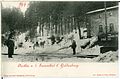
 00943-Grillenburg-1899-Seerenteich-Brück & Sohn Kunstverlag.jpg 1,542 × 1,000; 556 KB
-
-
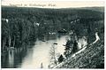
 13015-Grillenburg-1911-Partie am Seerenteich-Brück & Sohn Kunstverlag.jpg 1,466 × 1,000; 690 KB
-
 15989-Grillenburg-1913-Seerenteich-Brück & Sohn Kunstverlag.jpg 1,536 × 1,000; 609 KB
-
 15990-Grillenburg-1913-Seerenteich-Brück & Sohn Kunstverlag.jpg 1,514 × 1,000; 633 KB
-
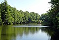
 20140618100DR Tharandt Seerenteich im Tharandter Wald.jpg 3,264 × 2,448; 4.99 MB
-
 20140618110DR Tharandt Seerenteich im Tharandter Wald.jpg 3,264 × 2,313; 4.21 MB
-
 20140618120DR Tharandt Seerenteich im Tharandter Wald.jpg 3,264 × 2,232; 4.41 MB
-
 20140618130DR Tharandt Seerenteich im Tharandter Wald.jpg 3,264 × 2,226; 4.65 MB
-
 20140618140DR Tharandt Seerenteich im Tharandter Wald.jpg 3,264 × 2,445; 4.53 MB
-
 20140618150DR Tharandt Seerenteich im Tharandter Wald.jpg 2,631 × 1,809; 2.12 MB
-
 20140618160DR Tharandt Seerenteich im Tharandter Wald.jpg 3,159 × 2,322; 5.35 MB
-
 22190-Grillenburg-1923-Seerenteich im Grillenburger Wald-Brück & Sohn Kunstverlag.jpg 1,524 × 1,000; 599 KB
-
 23822-Tharandt-1927-Seerenteich im Grillenburger Wald-Brück & Sohn Kunstverlag.jpg 1,537 × 1,000; 504 KB
-
 23823-Tharandt-1927-Weg nach dem Seerenteich-Brück & Sohn Kunstverlag.jpg 1,000 × 1,598; 557 KB
-

-
 Grillenburg-Seerenteich-1.jpg 4,548 × 2,416; 2.39 MB
-
 Grillenburg-Seerenteich-2.jpg 3,629 × 2,915; 2.63 MB
-
 Grillenburg-Seerenteich-3.jpg 5,774 × 2,671; 3.23 MB
-
 SeerenteichTharandterWald090207FotoAndreKaiser.JPG 712 × 534; 131 KB


