Category:Tharandter Wald
Jump to navigation
Jump to search
forest in Saxony, Germany  | |||||
| Upload media | |||||
| Instance of | |||||
|---|---|---|---|---|---|
| Named after | |||||
| Located in protected area | |||||
| Location | |||||
 | |||||
Subcategories
This category has the following 20 subcategories, out of 20 total.
F
- FND Basaltbruch am Ascherhübel (29 F)
- FND Kugelpechsteine (14 F)
G
- Gasthaus zum Landberg (11 F)
- Grave of Johann Heinrich Cotta (12 F)
H
- Heinrichseck (7 F)
K
- Klinik am Tharandter Wald (33 F)
M
P
- Porphyrfächer im Tharandter Wald (44 F)
S
T
- Triebenbach (Triebisch) (2 F)
W
- Warnsdorfer Quelle (12 F)
- Wernersbach (5 F)
Media in category "Tharandter Wald"
The following 172 files are in this category, out of 172 total.
-
 01230-Grillenburg-1899-Grillenburger Wald, Alte Eiche-Brück & Sohn Kunstverlag.jpg 1,000 × 1,519; 622 KB
-
 02947-Hetzdorf-Herrndorf-1903-am Tharandter Walde-Brück & Sohn Kunstverlag.jpg 1,449 × 1,000; 512 KB
-
 02963-Hetzdorf-Herrndorf-1903-am Tharandter Wald-Brück & Sohn Kunstverlag.jpg 1,000 × 1,526; 627 KB
-
 03070-Niederschöna-1903-Rittergutsteich, Tharandter Wald-Brück & Sohn Kunstverlag.jpg 1,562 × 1,000; 513 KB
-
 04249-Hetzdorf-Herrndorf-1903-Weg an der Schneise 18-Brück & Sohn Kunstverlag.jpg 1,000 × 1,539; 571 KB
-

-
 10552-Bad Hartha-1909-im Kurpark-Brück & Sohn Kunstverlag.jpg 1,536 × 1,000; 707 KB
-
 10553-Bad Hartha-1909-Poetenweg-Brück & Sohn Kunstverlag.jpg 1,507 × 1,000; 532 KB
-
 10555-Bad Hartha-1909-Borschelweg-Brück & Sohn Kunstverlag.jpg 1,536 × 1,000; 616 KB
-
 11903-Tharandt-1910-Partie aus dem Tharandter Walde-Brück & Sohn Kunstverlag.jpg 1,514 × 1,000; 672 KB
-

-
 14817-Herrndorf-Hetzdorf-1912-Bergschlößchen-Brück & Sohn Kunstverlag.jpg 1,534 × 1,000; 628 KB
-
 15687-Niederschöna-1913-Rittergutsteich-Brück & Sohn Kunstverlag.jpg 1,495 × 1,000; 522 KB
-
 15691-Niederschöna-1913-Rittergutsteich-Brück & Sohn Kunstverlag.jpg 1,466 × 1,000; 512 KB
-
-
 20140618100DR Tharandt Seerenteich im Tharandter Wald.jpg 3,264 × 2,448; 4.99 MB
-
 20140618110DR Tharandt Seerenteich im Tharandter Wald.jpg 3,264 × 2,313; 4.21 MB
-
 20140618120DR Tharandt Seerenteich im Tharandter Wald.jpg 3,264 × 2,232; 4.41 MB
-
 20140618130DR Tharandt Seerenteich im Tharandter Wald.jpg 3,264 × 2,226; 4.65 MB
-
 20140618140DR Tharandt Seerenteich im Tharandter Wald.jpg 3,264 × 2,445; 4.53 MB
-
 20140618150DR Tharandt Seerenteich im Tharandter Wald.jpg 2,631 × 1,809; 2.12 MB
-
 20140618160DR Tharandt Seerenteich im Tharandter Wald.jpg 3,159 × 2,322; 5.35 MB
-
 20140618170DR Tharandter Wald Tunnel unter Eisenbahn.jpg 3,181 × 2,373; 5.42 MB
-
 20140618180DR Tharandter Wald Tunnel unter Eisenbahn.jpg 3,168 × 2,313; 5.69 MB
-
 20140618200DR Spechtshausen (Tharandt) Forstamt.jpg 2,871 × 2,286; 3.81 MB
-
 20140618210DR Spechtshausen (Tharandt) Forstamt.jpg 3,142 × 2,370; 3.75 MB
-
 20140618215DR Spechtshausen (Tharandt) Forstamt.jpg 3,264 × 2,373; 3.76 MB
-
 20140618220DR Spechtshausen (Tharandt) Forstamt.jpg 3,264 × 2,298; 4.22 MB
-
 20140618230DR Spechtshausen (Tharandt) Forstdenkmal.jpg 2,099 × 2,980; 4.57 MB
-
 20140618235DR Spechtshausen (Tharandt) Forstdenkmal.jpg 1,964 × 3,186; 3.92 MB
-
 20140618240DR Spechtshausen (Tharandt) Forstdenkmal.jpg 2,303 × 3,180; 5.28 MB
-
 20140618245DR Spechtshausen (Tharandt) Forstdenkmal.jpg 1,744 × 3,084; 4.73 MB
-
 20140618250DR Spechtshausen (Tharandt) Forstdenkmal.jpg 1,896 × 2,759; 2.76 MB
-
 2016 Hainsberg Fichte im Tharandter Wald.jpg 5,120 × 3,413; 3.85 MB
-
 2016 Hainsberg Grenzstein Forstrevier Tharandt.jpg 5,120 × 3,413; 2.76 MB
-
 2016 Hainsberg Wanderwegweiser Backofenfels.jpg 3,414 × 5,120; 5.27 MB
-
 2016 Mohorn Grund GFM Tafel 13 Weg der Gesteine.jpg 3,529 × 2,349; 5.53 MB
-
 2016 Mohorn Grund Grenzstein 1.jpg 2,534 × 2,527; 3.72 MB
-
 2016 Mohorn Grund Grenzstein 2.jpg 2,549 × 2,550; 5.13 MB
-
 2016 Mohorn Grund Radwegweiser.jpg 2,261 × 1,510; 2.23 MB
-
 2016 Mohorn Grund Wanderwegweiser Tieftalweg.jpg 1,822 × 2,732; 2.39 MB
-
 2016 Mohorn Grund Wanderwegweiser.jpg 1,286 × 1,929; 1.21 MB
-
 2016 Pohrsdorf Borsdorfer Apfelwiese.jpg 5,120 × 2,880; 2.74 MB
-
 2016 Pohrsdorf Denkmal 650 Jahre.jpg 3,615 × 2,412; 3.92 MB
-
 2016 Pohrsdorf Spechtshausen - Wanderwegweiser G-Flügel.jpg 2,119 × 3,770; 3.63 MB
-
 2016 Pohrsdorf Wanderwegweiser 1.jpg 1,553 × 2,773; 1.74 MB
-
 2016 Pohrsdorf Wanderwegweiser Kirchweg alte Schule.jpg 3,263 × 1,843; 3.82 MB
-
 2016 Pohrsdorf Wettin-Eiche.jpg 5,120 × 3,413; 4.09 MB
-
 2016 Spechthausen Denkmal Verkehrsanbindung.jpg 1,959 × 3,488; 2.56 MB
-
 2016 Spechthausen Denkmalschutz Haus Nr. 12.jpg 2,953 × 1,969; 2.96 MB
-
 2016 Spechthausen Haus Nr. 16.jpg 5,120 × 3,413; 3.28 MB
-
 2017 Grillenburg Wanderwegweiser an der Jaghütte.jpg 5,120 × 3,413; 2.44 MB
-
 20181116180DR Tharandt Tharandter Wald bei Colmnitz.jpg 3,648 × 2,726; 6.69 MB
-
 20200526100DR Tharandt Panorama Tharandter Wald.jpg 3,648 × 2,052; 4.84 MB
-
 20231107.Tharandter Wald.-011.jpg 9,248 × 6,936; 11.28 MB
-
 20231107.Tharandter Wald.-012.jpg 6,936 × 9,248; 18.98 MB
-
 20231107.Tharandter Wald.-013.jpg 6,936 × 9,248; 14.98 MB
-
 20231107.Tharandter Wald.-014.jpg 6,936 × 9,248; 17.75 MB
-
 20231107.Tharandter Wald.-015.jpg 9,248 × 6,936; 14.32 MB
-
 20231107.Tharandter Wald.-016.jpg 9,248 × 6,936; 21.05 MB
-
 20231107.Tharandter Wald.-017.jpg 9,248 × 6,936; 18.93 MB
-
 20231107.Tharandter Wald.-021.jpg 9,248 × 6,936; 31.54 MB
-
 20231107.Tharandter Wald.-022.jpg 9,248 × 6,936; 31.14 MB
-
 23196-Hetzdorf-1925-Schneise 18-Brück & Sohn Kunstverlag.jpg 1,000 × 1,502; 585 KB
-
 23198-Hetzdorf-1925-Schneise 16-Brück & Sohn Kunstverlag.jpg 1,000 × 1,578; 530 KB
-
 24053-Hetzdorf-1927-Waldweg-Brück & Sohn Kunstverlag.jpg 1,000 × 1,543; 636 KB
-
 24127-Hartha-1927-Waldschänke bei Hartha - Hintergersdorf-Brück & Sohn Kunstverlag.jpg 1,546 × 1,000; 352 KB
-
 24128-Hartha-1927-Waldschänke bei Hartha - Hintergersdorf-Brück & Sohn Kunstverlag.jpg 1,556 × 1,000; 338 KB
-

-
 24455-Hartha-Hintergersdorf-1928-Harthaflügel-Brück & Sohn Kunstverlag.jpg 1,537 × 1,000; 806 KB
-
 25676-Grillenburg-1931-Grillenburger Wald-Brück & Sohn Kunstverlag.jpg 1,000 × 1,521; 392 KB
-
 27181-Grillenburg-1938-Sommerfrische, Waldpartie-Brück & Sohn Kunstverlag.jpg 1,500 × 1,000; 530 KB
-
 27793-Hetzdorf-1942-Sumpfmühle im Tharandter Wald-Brück & Sohn Kunstverlag.jpg 1,000 × 1,550; 621 KB
-
 27794-Hetzdorf-1942-Sumpfmühle im Tharandter Wald-Brück & Sohn Kunstverlag.jpg 1,563 × 1,000; 490 KB
-
 28038-Hetzdorf-1944-Blick auf Hetzdorf-Brück & Sohn Kunstverlag.jpg 1,509 × 1,000; 655 KB
-
 28039-Hetzdorf-1944-Waldweg-Brück & Sohn Kunstverlag.jpg 1,538 × 1,000; 747 KB
-
 28129-Grillenburg-1950-Waldpartie-Brück & Sohn Kunstverlag.jpg 1,517 × 1,000; 753 KB
-
 31964-Hetzdorf-1997-Kurklinik-Brück & Sohn Kunstverlag.jpg 3,520 × 2,508; 4.92 MB
-
-
 Basaltweg Tharandter Wald (1).jpg 3,000 × 4,000; 4.37 MB
-
 Basaltweg Tharandter Wald (2).jpg 4,000 × 3,000; 4.86 MB
-
 Basaltweg Tharandter Wald (3).jpg 4,000 × 3,000; 5.24 MB
-
 Basaltweg Tharandter Wald (4).jpg 4,000 × 3,000; 4.8 MB
-
 Basaltweg Tharandter Wald (5).jpg 2,248 × 4,000; 3.3 MB
-
 Bundesarchiv Bild 183-W0815-0019, Tharandt, Bergen von Bruchholz.jpg 800 × 574; 83 KB
-
 CFL 5519 Tharandter Rampe.jpg 2,816 × 2,112; 1.59 MB
-

-
 Forstgrenzstein1549KurortHartha051111FotoAndreKaiser.JPG 474 × 712; 86 KB
-
 ForstvermessungsdenkmalSpechtshausen051111FotoAndreKaiser.JPG 474 × 712; 134 KB
-

-

-
-

-

-

-

-

-

-
-

-
-

-

-

-

-

-

-

-

-
-

-
 Geologischer Wanderweg Tharandter Wald (01).jpg 4,000 × 2,248; 3.85 MB
-
 Geologischer Wanderweg Tharandter Wald (02).jpg 4,000 × 2,248; 3.95 MB
-
 Geologischer Wanderweg Tharandter Wald (03).jpg 4,000 × 2,248; 3.82 MB
-
 Geologischer Wanderweg Tharandter Wald (04).jpg 2,248 × 4,000; 3.15 MB
-
 Geologischer Wanderweg Tharandter Wald (05).jpg 4,000 × 3,000; 4.99 MB
-
 Geologischer Wanderweg Tharandter Wald (06).jpg 3,000 × 4,000; 4.16 MB
-
 Geologischer Wanderweg Tharandter Wald (07).jpg 4,000 × 3,000; 5.04 MB
-
 Geologischer Wanderweg Tharandter Wald (08).jpg 4,000 × 3,000; 4.89 MB
-
 Geologischer Wanderweg Tharandter Wald (09).jpg 4,000 × 3,000; 4.76 MB
-
 Geologischer Wanderweg Tharandter Wald (10).jpg 4,000 × 3,000; 4.62 MB
-
 Geologischer Wanderweg Tharandter Wald (11).jpg 4,000 × 3,000; 4.9 MB
-
 Geologischer Wanderweg Tharandter Wald (12).jpg 4,000 × 3,000; 4.88 MB
-
 Geologischer Wanderweg Tharandter Wald (13).jpg 4,000 × 2,248; 4.06 MB
-
 Geologischer Wanderweg Tharandter Wald (14).jpg 4,000 × 2,248; 4.02 MB
-
 Grillenburg 21.jpg 5,472 × 3,648; 9.79 MB
-
 Grillenburg Tharandter Wald 07.jpg 5,472 × 3,005; 14.27 MB
-
 Grillenburg-Triebenbach.jpg 2,736 × 3,648; 1.65 MB
-
 Hetzdorf, Jagdsäule.jpg 3,072 × 2,304; 4.35 MB
-
 Hetzdorf-Forstweg-Ruppertweg.jpg 3,648 × 2,432; 1.91 MB
-
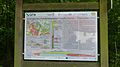
 Hetzdorf-Karte.jpg 3,447 × 2,657; 1.94 MB
-
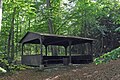 Hetzdorf-Pavillon.jpg 2,763 × 1,842; 1.52 MB
-
 Jadgsäule Tharandter Wald.JPG 534 × 712; 93 KB
-
 Jagdschloss Grillenburg.jpg 3,648 × 2,736; 1.7 MB
-
 Jagdturm Tharandter Wald.jpg 300 × 400; 38 KB
-
 Kilometerstein Sachsenring Tharandter Wald.jpg 1,896 × 2,848; 662 KB
-
 20140618190DR Tharandter Wald Kretzschmar-Bank.jpg 3,181 × 2,349; 4.63 MB
-
 Landberg im Tharanther Wald (1).jpg 4,000 × 2,248; 4.14 MB
-
 Landberg im Tharanther Wald (2).jpg 4,000 × 2,248; 3.97 MB
-
 Luftaufnahme tharandter Wald 2019-10-31.jpg 3,648 × 2,736; 1.92 MB
-
 Luftbild 046 Tharandter Wald Landberg.jpg 3,456 × 2,592; 4.56 MB
-
 Nacke Stein Tharanter Wald.jpg 4,896 × 3,672; 2.36 MB
-
 Niederschöna, von der Oberen Dorfstraße in den Tharandter Wald.JPG 3,072 × 2,304; 4.16 MB
-
 Orkan Kyrill, Sturmkraftauswirkung im Detail, Tharandter Wald.jpg 540 × 405; 90 KB
-
 Pilgerkreuz Heiliger Weg Tharandter Wald.jpg 2,848 × 2,134; 1.71 MB
-
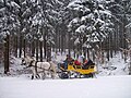
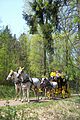 Postkutschenfahrt Tharandter Wald.jpg 1,896 × 2,848; 1 MB
-
 Postschlitten Grillenburg Tharandter Wald.jpg 1,424 × 1,067; 442 KB
-
 Postschlitten Tharandter Wald.jpg 1,728 × 1,296; 501 KB
-
 Salzlecke Tharandter Wald.jpg 576 × 432; 80 KB
-
 Sandsteinbruch Tharandter Wald.jpg 1,200 × 1,600; 592 KB
-
 SchutzhuettePferdestallTharandterWald051111FotoAndreKaiser.JPG 712 × 474; 108 KB
-
 Scleroderma citrinum LC0159.jpg 2,260 × 1,600; 3.96 MB
-
 Thar.Wald-BellmannsLos-3.jpg 1,951 × 1,301; 1.34 MB
-
 Thar.Wald-Meilerplatz.jpg 1,769 × 1,179; 1.29 MB
-
 Tharandter Wald 111.jpg 5,472 × 3,648; 16.34 MB
-
 Tharandter Wald 2.jpg 2,736 × 3,648; 3.51 MB
-
 Tharandter wald cotta gedenkstein.jpg 4,592 × 3,056; 5.93 MB
-
 Tharandter Wald Jakobsweg.jpg 400 × 299; 64 KB
-
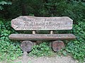
 Tharandter wald judeichs grab.jpg 4,592 × 3,056; 5.75 MB
-
 Tharandter Wald Kienberg.jpg 400 × 300; 19 KB
-
 Tharandter wald tausendster edelhirsch.jpg 4,592 × 3,056; 6.47 MB
-
 Tharandter Wald Wegweiser.JPG 401 × 526; 59 KB
-
 Tharandter Wald, Mittelpunkt Sachsens.jpg 6,000 × 4,000; 15.69 MB
-
 Tharandter Wald.jpg 1,277 × 888; 400 KB
-
 TharandterWaldKoenigin210609FotoAndreKaiser.JPG 485 × 550; 38 KB
-
 Triebischsee.jpg 4,032 × 2,268; 3.49 MB
-
 Walderlebnis Grillenburg Tharandter Wald.jpg 576 × 432; 56 KB
-
 Warnsdorfer Bach.jpg 3,648 × 2,736; 3.06 MB
-
 Wegweiser Tharandter Wald.jpg 432 × 576; 62 KB
-
 Weißeritztalhänge oberhalb Tharandt bei Somsdorf (4) Weiher.JPG 4,608 × 3,456; 5.46 MB
-
 WLE-Tour im Tharandter Wald (4).jpg 4,000 × 3,000; 4.8 MB
-
 WLE-Tour im Tharandter Wald (5).jpg 4,000 × 3,000; 4.77 MB


_Forstamt.jpg)
_Forstamt.jpg)
_Forstamt.jpg)
_Forstamt.jpg)
_Forstdenkmal.jpg)
_Forstdenkmal.jpg)
_Forstdenkmal.jpg)
_Forstdenkmal.jpg)
_Forstdenkmal.jpg)


.jpg)
.jpg)
.jpg)
.jpg)
.jpg)


_-_Kupferstich_01_Buche_(Tharand%27s_heilige_Hallen)_-_Fagus_sylvatica.jpg)


_Laux_auf_der_Karte_von_Oberrei.jpg)


.jpg)
.jpg)
.jpg)
.jpg)
.jpg)
.jpg)
.jpg)
.jpg)
.jpg)
.jpg)
.jpg)
.jpg)
.jpg)
.jpg)


.jpg)
.jpg)


_Weiher.JPG)
.jpg)
.jpg)