Category:Schneeberg (Lower Franconia)
Jump to navigation
Jump to search
market municipality of Germany    | |||||
| Upload media | |||||
| Instance of |
| ||||
|---|---|---|---|---|---|
| Part of |
| ||||
| Location | Miltenberg, Lower Franconia, Bavaria, Germany | ||||
| Population |
| ||||
| Area |
| ||||
| Elevation above sea level |
| ||||
| Different from | |||||
| official website | |||||
 | |||||
Subcategories
This category has the following 9 subcategories, out of 9 total.
G
- Gottersklinge (2 F)
H
K
- Karre-Franz-Höhle (8 F)
S
- Steinsarg am Zweiteberg (3 F)
- Steinsarg am Zwitscher (3 F)
Media in category "Schneeberg (Lower Franconia)"
The following 10 files are in this category, out of 10 total.
-
 DEU Schneeberg COA.svg 979 × 1,068; 44 KB
-
 Wappen von Schneeberg.png 150 × 160; 6 KB
-
 Bildstock bei Schneeberg an der Landesgrenze B47.jpg 3,120 × 4,160; 4.28 MB
-
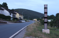 Blitzsaeule Schneeberg16062022.png 4,673 × 3,057; 23.87 MB
-

-

-
 Muttergottes auf dem Holderstock.JPG 1,944 × 2,592; 2.41 MB
-
 Schneeberg in MIL.png 584 × 738; 35 KB
-
 Schneeberg in MIL.svg 488 × 562; 1.22 MB
-
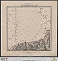 Topographische Karte über das Grossherzogthum Baden Blatt 03 Waldleiningen.jpg 2,768 × 2,924; 1.56 MB


_und_Hambrunn_(Bayern)_%E2%84%96_778_von_1859_0.jpg)
_und_Hambrunn_(Bayern)_%E2%84%96_778_von_1859_1.jpg)


