Category:Landkreis Miltenberg
Jump to navigation
Jump to search
Urban districts (cities): Amberg · Ansbach · Aschaffenburg · Augsburg · Bamberg · Bayreuth · Coburg · Erlangen · Fürth · Hof · Ingolstadt · Kaufbeuren · Kempten · Landshut · Memmingen · Munich · Nuremberg · Passau · Regensburg · Rosenheim · Schwabach · Schweinfurt · Straubing · Weiden in der Oberpfalz · Würzburg
district in Bavaria, Germany     | |||||
| Upload media | |||||
| Instance of |
| ||||
|---|---|---|---|---|---|
| Location | Lower Franconia, Bavaria, Germany | ||||
| Capital | |||||
| Head of government | |||||
| Inception |
| ||||
| Population |
| ||||
| Area |
| ||||
| Elevation above sea level |
| ||||
| official website | |||||
 | |||||
Subcategories
This category has the following 21 subcategories, out of 21 total.
*
H
M
V
Pages in category "Landkreis Miltenberg"
This category contains only the following page.
Media in category "Landkreis Miltenberg"
The following 16 files are in this category, out of 16 total.
-
 Bavaria mil.png 237 × 245; 15 KB
-
 Bezirksamt Miltenberg.JPG 526 × 427; 51 KB
-
 Karte Amt Amorbach 1836.png 983 × 545; 1,011 KB
-
 Karte Amt Miltenberg 1836.png 997 × 545; 1.03 MB
-
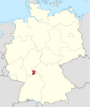
 Lage des Landkreises Miltenberg in Deutschland.PNG 176 × 234; 5 KB
-
 Landkreis Miltenberg 1970.png 581 × 599; 25 KB
-
 Landkreis Miltenberg.png 584 × 738; 42 KB
-
 Locator map MIL in Bavaria.svg 867 × 855; 1,010 KB
-
 Locator map MIL in Germany.svg 1,075 × 1,273; 581 KB
-
 MHV vs BNC connectors.jpg 2,048 × 1,063; 178 KB
-
 MIL in Bayern.svg 1,227 × 1,236; 311 KB
-
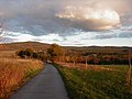 Neurod - Blick auf Spessart.jpg 1,280 × 960; 422 KB
-
 Place name sign Landkreis Miltenberg FRONT.jpg 2,160 × 3,840; 3.61 MB
-
 Place name sign Landkreis Miltenberg REAR.jpg 2,160 × 3,840; 2.75 MB
-
 Röm. Wachturm Wp 7-13 Hagwald 2.jpg 4,608 × 3,456; 7.39 MB
-
 SpessartBeiElsenfeld.jpg 3,840 × 2,160; 4.9 MB


