Category:Satellite pictures of Vietnam
Jump to navigation
Jump to search
Subcategories
This category has the following 4 subcategories, out of 4 total.
Media in category "Satellite pictures of Vietnam"
The following 34 files are in this category, out of 34 total.
-
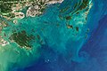 Bai Tu Long Bay.jpeg 5,358 × 3,572; 4.14 MB
-
 Ca Mau, Vietnam (50733328997).png 10,000 × 6,295; 36.22 MB
-
 Cuu Long.jpg 1,024 × 702; 115 KB
-
 Envisat image of the Mekong Delta in Vietnam ESA210677.jpg 1,346 × 1,346; 445 KB
-
 Envisat image of the Mekong Delta in Vietnam ESA210677.tiff 1,346 × 1,346; 4.59 MB
-
 Fires in Burma, Thailand, Laos, and Vietnam.jpg 6,872 × 4,581; 6.27 MB
-
 Floods in Vietnam.jpg 3,535 × 2,567; 5.28 MB
-
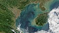 Gulf of Tonkin (cropped).jpg 3,629 × 2,041; 2.28 MB
-
 Gulf of Tonkin.jpg 5,912 × 3,163; 2.53 MB
-
 Haiphong 106.70132E 20.84440N.jpg 1,280 × 958; 192 KB
-
 Hanoi SPOT 1120.jpg 500 × 500; 112 KB
-
 Long Thanh Airport Sentinel-2 2019.jpg 1,129 × 731; 148 KB
-
 Mar de China Meridional - BM WMS 2004.jpg 1,060 × 989; 251 KB
-
 Mekong delta.jpg 624 × 624; 286 KB
-
 Phú Quốc Island in the Gulf of Thailand 2021-01-18-00 00 2021-01-18-23 59 Sentinel-2 L2A.jpg 9,930 × 4,539; 4.65 MB
-
 ReefBase highres STS034 STS034-86-65.jpg 2,000 × 2,000; 908 KB
-
 Rice fields, Vietnam ESA21898326.jpeg 13,814 × 9,722; 24.33 MB
-
 Rice-cropping systems in Vietnam’s Red River Delta ESA359048.jpg 3,590 × 2,816; 3.49 MB
-
 Seasonal flooding in Thailand and Cambodia 2002 October 9.jpg 1,150 × 1,500; 376 KB
-
 STS001-009-0112 - View of Vietnam (Raw scan).tif 4,400 × 4,600; 57.91 MB
-
 STS001-009-0113 - View of Vietnam (Raw scan).tif 4,400 × 4,600; 57.91 MB
-
 STS001-009-0114 - View of Vietnam (Raw scan).tif 4,400 × 4,600; 57.91 MB
-
 STS001-009-0115 - View of Vietnam (Raw scan).tif 4,400 × 4,600; 57.91 MB
-
 STS001-009-0116 - View of Vietnam (Raw scan).tif 4,400 × 4,600; 57.91 MB
-
 STS001-009-0117 - View of Vietnam (Raw scan).tif 4,400 × 4,600; 57.91 MB
-
 STS001-009-0118 - View of Vietnam (Raw scan).tif 4,400 × 4,600; 57.91 MB
-
 Thailand.A2001334.0350.500m.jpg 2,600 × 2,000; 1.04 MB
-
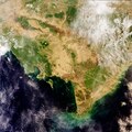
 Vietnam BMNG.png 1,375 × 2,841; 5.39 MB
-
 Vietnam satelliet.jpg 1,700 × 2,200; 951 KB
-
 Vietnam's Mekong Delta as seen by Envisat ESA225133.jpg 595 × 595; 300 KB
-
 Vietnam's Mekong Delta as seen by Envisat ESA225133.tiff 2,241 × 2,241; 14.39 MB
-
 Vietnam's Mekong Delta ESA219993.jpg 2,000 × 1,949; 1.84 MB
-
 Ảnh chụp vệ tinh khu vực trung tâm Hải Phòng.jpg 4,783 × 3,553; 3.66 MB
-
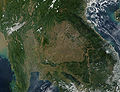
 Ảnh vệ tinh hồ Núi Cốc 2021-01-18-00 00 2021-01-18-23 59 Sentinel-2 L2A.jpg 9,930 × 4,539; 5.01 MB

.png)


.jpg)


