Category:Satellite pictures of Egypt
Jump to navigation
Jump to search
Countries of Africa: Algeria · Angola · Benin · Botswana · Burkina Faso · Burundi · Cameroon · Cape Verde · Central African Republic · Chad · Comoros · Democratic Republic of the Congo · Republic of the Congo · Djibouti · Egypt‡ · Equatorial Guinea · Eritrea · Eswatini · Ethiopia · Gabon · The Gambia · Ghana · Guinea · Guinea-Bissau · Ivory Coast · Kenya · Lesotho · Liberia · Libya · Madagascar · Malawi · Mali · Mauritania · Mauritius · Morocco · Mozambique · Namibia · Niger · Nigeria · Rwanda · São Tomé and Príncipe · Senegal · Seychelles · Sierra Leone · Somalia · South Africa · South Sudan · Sudan · Tanzania · Togo · Tunisia · Uganda · Zambia · Zimbabwe
Limited recognition: Somaliland – Other areas: Canary Islands · Ceuta · Madeira · Mayotte · Melilla · Réunion · Saint Helena, Ascension and Tristan da Cunha · Western Sahara
‡: partly located in Africa
Limited recognition: Somaliland – Other areas: Canary Islands · Ceuta · Madeira · Mayotte · Melilla · Réunion · Saint Helena, Ascension and Tristan da Cunha · Western Sahara
‡: partly located in Africa
| Category Satellite pictures of Egypt on sister projects: | |||||||||
|---|---|---|---|---|---|---|---|---|---|
Subcategories
This category has the following 14 subcategories, out of 14 total.
Media in category "Satellite pictures of Egypt"
The following 97 files are in this category, out of 97 total.
-
 25cm radar image of Aswan Dam, Egypt from Umbra Lab Inc.tif 13,134 × 13,136, 6 pages; 228.77 MB
-
 Alluvial Fans in Northeastern Egypt 2009-11-13 lrg.jpg 1,200 × 1,000; 333 KB
-
 Alluvial Fans in Northeastern Egypt 2009-11-13.jpg 720 × 480; 157 KB
-
 Arabische Wüste Satellit.jpg 184 × 384; 20 KB
-
 AS07-11-2000 (21355660044).jpg 4,400 × 4,600; 1.1 MB
-
 AS09-23-3521 (22050868795).jpg 4,400 × 4,600; 1.11 MB
-

-
 AS09-23-3522 (21428031454).jpg 4,400 × 4,600; 1.08 MB
-

-
 AS09-23-3523 (21863973349).jpg 4,400 × 4,600; 1.04 MB
-

-
 AS09-23-3524 (22024684686).jpg 4,400 × 4,600; 1.05 MB
-

-
 AS09-23-3533 (21428030034).jpg 4,400 × 4,600; 800 KB
-

-

-

-

-

-

-

-

-

-

-
 BarragemAssuão.jpg 1,160 × 960; 356 KB
-

-
 Cairo, Egypt (51847787246).jpg 8,925 × 5,535; 52.14 MB
-
 Cairo, Egypt ESA349457.jpg 6,000 × 3,927; 24.33 MB
-
 Canal of the pharaohs.jpg 244 × 184; 7 KB
-
 Dry Country of Turquoise.jpeg 2,406 × 2,339; 3.9 MB
-
 Dust storms off Egypt.jpg 2,000 × 1,771; 1.22 MB
-
 Earth from Space- Eastern Mediterranean ESA24921278.jpg 2,095 × 3,146; 2.1 MB
-
 Earth from Space- Eastern Mediterranean ESA24921278.tiff 4,656 × 6,990; 93.14 MB
-
 Earth observation taken by Expedition 68 crew (iss068e006657).jpeg 5,568 × 3,712; 2.78 MB
-
 East Egypt and the Red Sea Coast.jpg 3,840 × 2,160; 7.51 MB
-
 Eastern Desert ESA355212.jpg 1,920 × 1,526; 3.82 MB
-
 Eastern Desert ESA355212.tiff 6,268 × 4,982; 89.37 MB
-
 EastMediterraneo WFIMAZ1 20210816 021 010 L4 BAND4321.png 1,879 × 1,636; 4.83 MB
-
 Egypt (MODIS 2017-04-23).jpg 3,974 × 4,419; 1.1 MB
-
 Egypt - 2003 - MODIS.jpg 2,800 × 2,200; 821 KB
-
 Egypt Agricultural Expansion - Before (50309315062).png 13,760 × 10,960; 111.67 MB
-
 Egypt Agricultural Expansion - Before (50309330057).png 13,760 × 10,960; 142.86 MB
-
 Egypt base.jpg 1,074 × 2,000; 1,010 KB
-
 Egypt New Valley Project 26jan2003.jpg 450 × 364; 5 KB
-
 Egypt sat.png 1,265 × 1,173; 2.58 MB
-
 Egypt.A2007107.0905.1km.jpg 400 × 600; 43 KB
-
 Egypt.A2010286.0845.250m.jpg 3,400 × 4,400; 1.65 MB
-
 Egyptian crop circles ESA19334580.gif 1,920 × 1,080; 96.78 MB
-
 El Alamein, Egypt by Planet Labs.jpg 4,802 × 3,602; 3.74 MB
-
 Establishing El Gouna (2014).jpeg 1,362 × 1,362; 622 KB
-
 Ev10734 Sahara.A2001314.0910.2km.jpg 800 × 1,050; 163 KB
-
 Giza, Egypt.jpg 2,048 × 1,280; 1.07 MB
-
 Gosen.jpg 266 × 479; 136 KB
-
 Gulf of Aqaba - Gulf von Akaba.jpg 5,568 × 3,712; 4.68 MB
-
 Israel-Egypt-Gaza border region.jpg 720 × 480; 165 KB
-
 Iss069e000237.jpg 4,928 × 2,768; 4.02 MB
-
 Kairo gizeh aus dem weltall.jpg 3,032 × 2,008; 1.14 MB
-
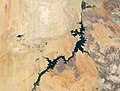
 Lake Nasser, Egypt ESA24001610.jpeg 7,334 × 8,468; 15.22 MB
-
 Lake Nasser, Egypt ESA24001610.tiff 7,334 × 8,468; 355.48 MB
-
 Lakenasser oli 2013-2020 lrg.jpeg 7,540 × 5,694; 5.12 MB
-
 MiddleEast tmo 2013349 lrg.jpg 4,353 × 3,608; 1.72 MB
-
 Minya Governorate, Egypt.jpg 2,048 × 1,280; 808 KB
-
 MODIS1000023 md.jpg 600 × 467; 95 KB
-
 Nighttime View of Northern Egypt and the Sinai Peninsula.jpg 4,928 × 3,280; 2.19 MB
-
 Nildelta.jpg 540 × 405; 54 KB
-
 Nile delta fog tmo 20240107 lrg.jpg 2,225 × 1,483; 937 KB
-
 Nile delta fog tmo 20240107.jpg 720 × 480; 143 KB
-
 Nile River and delta from orbit.jpg 700 × 550; 85 KB
-
 Nile River Valley, Egypt by Planet Labs.jpg 4,556 × 3,416; 3.78 MB
-
 NileDelta - Green earth.png 1,920 × 1,080; 2.46 MB
-
 Nubia NASA-WW places german.jpg 472 × 724; 58 KB
-
 Nubia NASA-WW.jpg 472 × 724; 42 KB
-
 PIA02647 - Nile - Egypt - 2001.jpg 1,604 × 1,745; 400 KB
-
 PIA02647 - Nile - Egypt - 2001.tif 1,604 × 1,745; 6.85 MB
-
 Red Sea 37.95521E 21.41271N.jpg 1,280 × 958; 182 KB
-
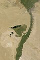 Satellite image of the Faiyum Oasis.jpg 640 × 960; 289 KB
-
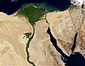
 Satellite picture of the Nile Delta, Egypt.jpg 1,000 × 750; 141 KB
-
 Satellite Sees Holiday Lights Brighten Cities - Cairo (15415292194).jpg 1,024 × 676; 81 KB
-
 Sentinel-3- better than good ESA357922.jpg 1,920 × 1,943; 3.12 MB
-
 Sentinel-3- better than good ESA357922.tiff 2,878 × 2,912; 24.01 MB
-
 Sharm El-Sheikh, Egypt.jpg 2,048 × 1,365; 818 KB
-
 Sinaifromspace.jpg 3,409 × 3,409; 3.6 MB
-
 SIR-C X-SAR Safsaf Oasis 2.jpg 1,038 × 1,232; 1.35 MB
-
 SIR-C X-SAR Safsaf Oasis comparison.jpg 2,100 × 1,232; 1.44 MB
-
 SIR-C X-SAR Safsaf Oasis.jpg 1,409 × 1,881; 871 KB
-
 Siwaoasiszm oli2 2023023.jpg 720 × 480; 418 KB
-
 Sohag by NASA.jpg 640 × 426; 104 KB
-
 SpaceX Dragon CRS-15 - 43290164865.jpg 5,568 × 3,712; 4 MB
-
 Suez Canal ESA224312.tiff 2,161 × 2,484; 18.56 MB
-
 The Nile and Egypt by day.jpg 990 × 659; 192 KB
-
 The Nile and Egypt by night.jpg 990 × 657; 238 KB
-
 The Nile Delta and the Sinai Peninsula ESA200130.jpg 827 × 827; 362 KB
-
 Toshka-see.jpg 656 × 492; 156 KB
-
 Valley of the Kings & River Nile, Egypt (34461164041).jpg 12,632 × 13,088; 32.79 MB
-
 View of the ISS taken during Crew-2 flyaround (ISS066-E-080034).jpg 5,568 × 3,712; 5.16 MB
-
 · Localización de Nag Hammadi en Egipto ·.jpg 799 × 839; 118 KB
-
 이집트 룩소르 카르나크신전 (1437).jpeg 1,024 × 1,024; 748 KB


.jpg)
.jpg)

.jpg)

.jpg)

.jpg)

.jpg)


_(12868402644).jpg)
.jpg)


.jpeg)


.jpg)

.png)
.png)


.jpeg)


.jpg)


.jpg)
.jpg)

.jpeg)