Category:SVG political maps of Europe
Jump to navigation
Jump to search
Temperate regions: North America · South America · Africa · Europe · Asia · – Polar regions: – Other regions: Afro-Eurasia ·
| NO WIKIDATA ID FOUND! Search for SVG political maps of Europe on Wikidata | |
| Upload media |
Subcategories
This category has the following 5 subcategories, out of 5 total.
Media in category "SVG political maps of Europe"
The following 46 files are in this category, out of 46 total.
-
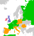
2019 European Parliament (Blank).svg 535 × 645; 619 KB
-
2019 European Parliament (Post-Brexit).svg 535 × 645; 705 KB
-
2019 European Parliament election Pre Brexit.svg 793 × 814; 3.35 MB
-
Carte des chambres hautes en Europe.svg 7,500 × 7,945; 597 KB
-
Carte des modes de scrutin en Europe-étroit.svg 680 × 520; 297 KB
-
Carte des modes de scrutin en Europe.svg 7,500 × 7,945; 612 KB
-
Caucasus regions map blank.svg 2,006 × 1,618; 229 KB
-
Central Europe Regions.svg 1,069 × 892; 381 KB
-
ELF member countries.svg 512 × 392; 321 KB
-
EU Globe No Borders 2020.svg 541 × 541; 152 KB
-
EU Globe No Borders.svg 792 × 792; 5.4 MB
-
EU in the World 2020.svg 1,003 × 443; 1.32 MB
-
EU in the World.svg 940 × 415; 1.6 MB
-
EU on a globe.svg 541 × 541; 152 KB
-
EU27 (2019) as a single entity in the world.svg 951 × 553; 503 KB
-
EU27 as a single entity.svg 680 × 520; 302 KB
-
EU27-2007 globe.svg 541 × 541; 480 KB
-
EU27-2007 world.svg 999 × 553; 560 KB
-
EU27-2008 as a single entity in the world.svg 999 × 553; 561 KB
-
EU27-2008 on a globe.svg 541 × 541; 222 KB
-
EU28 as a single entity in the world.svg 951 × 553; 503 KB
-
EU28 as a single entity.svg 680 × 520; 299 KB
-
EU28-2020 on a globe.svg 541 × 541; 200 KB
-
Euro outside.svg 474 × 454; 388 KB
-
Europa-it-politica-classic-color.svg 841 × 731; 901 KB
-
Europa-it-politica-coloured.svg 841 × 731; 964 KB
-
Europa-it-politica-names-big.svg 559 × 500; 536 KB
-
Europa-politica-coloured-es.svg 2,296 × 1,997; 658 KB
-
Europe map Toki Pona.svg 593 × 606; 1.06 MB
-
Europe orthographic Caucasus Urals boundary (with borders).svg 537 × 536; 411 KB
-
Europe orthographic Caucasus Urals boundary (with UN borders).svg 537 × 536; 406 KB
-
European governements Map.svg 680 × 540; 400 KB
-
European integration gradient.svg 680 × 520; 711 KB
-
European integration.svg 1,550 × 1,300; 7.33 MB
-
European Political Community.svg 680 × 520; 651 KB
-
European Union as a single entity.svg 680 × 520; 172 KB
-
European Union main map.svg 680 × 520; 376 KB
-
European Union map.svg 454 × 450; 371 KB
-
Left-wing populist parties in European national parliaments (May 2021).svg 1,200 × 1,000; 807 KB
-
Location of Lublin Triangle.svg 512 × 433; 302 KB
-
Map of Europe and neighbors.svg 833 × 663; 2.16 MB
-
Philosophical map of Europe - ru.svg 1,401 × 1,398; 1.01 MB
-
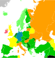
Poll about perceived EU balance benefit (2018).svg 646 × 691; 402 KB
-
Poll about remaining or leaving EU (2018).svg 646 × 691; 403 KB
-
Right-wing populist parties in European national parliaments (March 2021).svg 1,200 × 1,000; 698 KB


