Category:SVG political maps of Belgium
Jump to navigation
Jump to search
Media in category "SVG political maps of Belgium"
The following 7 files are in this category, out of 7 total.
-
 Administrative regions of Belgium.svg 425 × 354; 188 KB
-
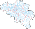
 Belgian administrative arrondissements.svg 1,650 × 1,344; 363 KB
-
 Belgium administrative.svg 1,370 × 1,113; 267 KB
-
 Map of Belgium.svg 1,650 × 1,344; 832 KB
-
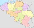
 Provinces de Belgique sans noms.svg 425 × 354; 35 KB
-
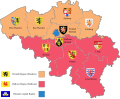 Provinces of Belgium with CoA-en.svg 1,000 × 819; 995 KB
-
 Taalgebieden in Belgie.svg 501 × 399; 147 KB


