Category:SVG maps of the Society Islands
Jump to navigation
Jump to search
Media in category "SVG maps of the Society Islands"
The following 19 files are in this category, out of 19 total.
-
 Bora Bora Kingdom.svg 711 × 250; 68 KB
-
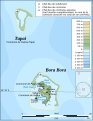 BoraBora topographic map-fr.svg 714 × 923; 531 KB
-
 BoraBora topographic map-mk.svg 714 × 923; 536 KB
-
 Huahine Kingdom.svg 711 × 250; 68 KB
-
 Huahine topographic map - with communes associées.svg 714 × 830; 332 KB
-
 Huahine topographic map-fr.svg 714 × 830; 536 KB
-
 Huahine topographic map-mk.svg 714 × 830; 538 KB
-
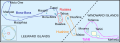
 Leeward Islands (Society Islands) topographic map-de.svg 2,000 × 1,000; 1.57 MB
-
 Leeward Islands (Society Islands) topographic map-fr.svg 2,000 × 1,000; 1.6 MB
-
 Leeward Islands (Society Islands) topographic map-mk.svg 2,000 × 1,000; 1.6 MB
-
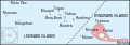
 Maupiti topographic map-fr.svg 469 × 611; 1.68 MB
-
 Maupiti topographic map-mk.svg 469 × 611; 1.68 MB
-
 Raiatea Kingdom.svg 711 × 250; 67 KB
-
 Society kingdoms.svg 711 × 250; 75 KB
-
 Tahaa and Raiatea topographic map - with communes et communes associées.svg 714 × 1,143; 333 KB
-
 Tahaa and Raiatea topographic map-de.svg 714 × 1,143; 496 KB
-
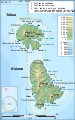 Tahaa and Raiatea topographic map-fr.svg 714 × 1,143; 533 KB
-
 Tahaa and Raiatea topographic map-mk.svg 714 × 1,143; 536 KB
-
 Tahiti Kingdom.svg 711 × 250; 68 KB


_topographic_map-de.svg)
_topographic_map-fr.svg)
_topographic_map-mk.svg)


