Category:SVG locator maps of districts of Bihar
Jump to navigation
Jump to search
States of India: Andhra Pradesh · Arunachal Pradesh · Assam · Bihar · Chhattisgarh · Goa · Gujarat · Haryana · Himachal Pradesh · Jharkhand · Karnataka · Kerala · Madhya Pradesh · Maharashtra · Manipur · Meghalaya · Mizoram · Nagaland · Odisha · Rajasthan · Sikkim · Tamil Nadu · Telangana · Tripura · Uttar Pradesh · Uttarakhand · West Bengal
Union territories: Jammu and Kashmir · Ladakh ·
Former states of India:
Former union territories:
Union territories: Jammu and Kashmir · Ladakh ·
Former states of India:
Former union territories:
Media in category "SVG locator maps of districts of Bihar"
The following 38 files are in this category, out of 38 total.
-
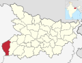
 Bihar district location map Araria.svg 983 × 755; 809 KB
-
 Bihar district location map Arwal.svg 983 × 755; 809 KB
-
 Bihar district location map Aurangabad.svg 983 × 755; 809 KB
-
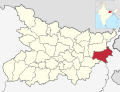
 Bihar district location map Banka.svg 983 × 755; 809 KB
-
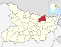
 Bihar district location map Begusarai.svg 983 × 755; 809 KB
-
 Bihar district location map Bhagalpur.svg 983 × 755; 809 KB
-
 Bihar district location map Bhojpur.svg 983 × 755; 809 KB
-
 Bihar district location map Buxar.svg 983 × 755; 809 KB
-
 Bihar district location map Darbhanga.svg 983 × 755; 809 KB
-
 Bihar district location map East Champaran.svg 983 × 755; 809 KB
-
 Bihar district location map Gaya.svg 983 × 755; 809 KB
-
 Bihar district location map Gopalganj.svg 983 × 755; 809 KB
-
 Bihar district location map Jamui.svg 983 × 755; 809 KB
-
 Bihar district location map Jehanabad.svg 983 × 755; 809 KB
-
 Bihar district location map Kaimur.svg 983 × 755; 809 KB
-
 Bihar district location map Katihar.svg 983 × 755; 809 KB
-
 Bihar district location map Khagaria.svg 983 × 755; 809 KB
-
 Bihar district location map Kishanganj.svg 983 × 755; 809 KB
-
 Bihar district location map Lakhisarai.svg 983 × 755; 809 KB
-
 Bihar district location map Madhepura.svg 983 × 755; 809 KB
-
 Bihar district location map Madhubani.svg 983 × 755; 809 KB
-
 Bihar district location map Munger.svg 983 × 755; 809 KB
-
 Bihar district location map Muzaffarpur.svg 983 × 755; 809 KB
-
 Bihar district location map Nalanda.svg 983 × 755; 809 KB
-
 Bihar district location map Nawada.svg 983 × 755; 809 KB
-
 Bihar district location map Patna.svg 983 × 755; 809 KB
-
 Bihar district location map Purnia.svg 983 × 755; 809 KB
-
 Bihar district location map Rohtas.svg 983 × 755; 809 KB
-
 Bihar district location map Saharsa.svg 983 × 755; 809 KB
-
 Bihar district location map Samastipur.svg 983 × 755; 809 KB
-
 Bihar district location map Saran.svg 983 × 755; 809 KB
-
 Bihar district location map Sheikhpura.svg 983 × 755; 809 KB
-
 Bihar district location map Sheohar.svg 983 × 755; 809 KB
-
 Bihar district location map Sitamarhi.svg 983 × 755; 809 KB
-
 Bihar district location map Siwan.svg 983 × 755; 809 KB
-
 Bihar district location map Supaul.svg 983 × 755; 809 KB
-
 Bihar district location map Vaishali.svg 983 × 755; 809 KB
-
 Bihar district location map West Champaran.svg 983 × 755; 809 KB


