Category:SVG locator maps of Sint Eustatius (location map scheme)
Jump to navigation
Jump to search
Countries of North America: Antigua and Barbuda · The Bahamas · Barbados · Belize · Canada · Costa Rica · Cuba · Dominica · Dominican Republic · El Salvador · Grenada · Guatemala · Haiti · Honduras · Jamaica · Mexico · Nicaragua · Panama · Saint Kitts and Nevis · Saint Lucia · Saint Vincent and the Grenadines · Trinidad and Tobago‡ · United States of America‡
Other territories: Anguilla · Cayman Islands · Greenland · Guadeloupe · Martinique · Puerto Rico · Saint Barthélemy · Turks and Caicos Islands
‡: partly located in North America
Other territories: Anguilla · Cayman Islands · Greenland · Guadeloupe · Martinique · Puerto Rico · Saint Barthélemy · Turks and Caicos Islands
‡: partly located in North America

|
SVG maps in this category are part of a locator map series applying the (de) widespread location map scheme. Please see root category to browse for more. |
.svg)
.svg)
.svg)
.svg)
.svg)
.svg)
.svg)
Locator maps design recommendations ▼ | |
|---|---|
Principles
Design Guidelines are based on ▸location map design of the German map shop (in German). It's preferable to derive new locator maps from existing location maps. Please keep both size and ratio in this case. Thus the new locator maps may still be applied as location map (▸Guide). Marker color is supposed to be darkred. Waterbodies may be transparent, to show other objects better. Please be aware that this guide is only a recommendation. It’s not an inevitable law!
Highlight small areas
“Remote” areas and mini maps
Mini maps show where the depicted area actually is situated. Check out ▸Vorlage:Positionskarte+ (in German) and ▸Modèle:Carte en coin (in French) of how to insert a mini map in virtually every map.
Disputed areas
Greyed special objects
Backgrounds
|

-en.svg)

.svg)
.svg)
.svg)

_(US48).svg)
_(small_islands_magnified)_(-mini_map_-rivers).svg)
.svg)
_(extra_close)_(US48).svg)
.svg)
_(zoom).svg)

.svg)


_(UNMIK).svg)
.svg)
_(disputed_hatched).svg)
_(claimed_and_disputed_hatched).svg)
.svg)
.svg)
_(%2Ball_claims_hatched).svg)

.svg)
_(shade).svg)
_(shade)_(special_marker).svg)
_(-mini_map).svg)
_(-mini_map).svg)
_(-mini_map).svg)


.svg)

.svg)

Media in category "SVG locator maps of Sint Eustatius (location map scheme)"
The following 7 files are in this category, out of 7 total.
-
 Kingdom of the Netherlands in its region (Sint Eustatius special).svg 922 × 519; 6.92 MB
-
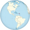 Saint Eustatius on the globe (Americas centered).svg 797 × 797; 1.12 MB
-
 Sint Eustatius in its region (zoom).svg 351 × 197; 4.37 MB
-
 Sint Eustatius in its region.svg 351 × 197; 6.88 MB
-
 Sint Eustatius in the Kingdom of the Netherlands.svg 922 × 519; 7.21 MB
-
 Sint Eustatius of Venezuela in North America (-mini map -rivers).svg 1,181 × 1,185; 5.96 MB
-
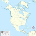 Sint Eustatius of Venezuela in North America.svg 1,181 × 1,185; 6.92 MB
.svg)
.svg)
.svg)


.svg)
