Category:Roxburgh (civil parish)
Jump to navigation
Jump to search
Scottish parish in Scottish Borders, Scotland, UK | |||||
| Upload media | |||||
| Instance of | |||||
|---|---|---|---|---|---|
| Part of |
| ||||
| Named after | |||||
| Location |
| ||||
| Population |
| ||||
| Area |
| ||||
 | |||||
Media in category "Roxburgh (civil parish)"
The following 200 files are in this category, out of 343 total.
(previous page) (next page)-
 "Engineering in Wood", Roxburgh - geograph.org.uk - 4074734.jpg 640 × 480; 426 KB
-
 A barley landscape - geograph.org.uk - 3089100.jpg 640 × 480; 260 KB
-

-
 A minor road near Heiton - geograph.org.uk - 2768406.jpg 640 × 480; 250 KB
-
 A round bale in a stubble field - geograph.org.uk - 3129648.jpg 640 × 480; 254 KB
-
 A Roxburgh Jackdaw - geograph.org.uk - 5346872.jpg 1,024 × 1,024; 790 KB
-
 A steep field, Roxburgh - geograph.org.uk - 2760911.jpg 640 × 360; 250 KB
-
 A stone on The Law - geograph.org.uk - 1251776.jpg 640 × 417; 159 KB
-
 A Tweed scene - geograph.org.uk - 3705992.jpg 640 × 480; 73 KB
-
 A wheat field near Roxburgh - geograph.org.uk - 4790857.jpg 1,024 × 683; 288 KB
-
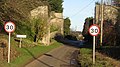
 A698 at Heiton village boundary - geograph.org.uk - 5843359.jpg 1,024 × 724; 115 KB
-
 A698 leaving Heiton - geograph.org.uk - 5843363.jpg 1,024 × 748; 122 KB
-
 A698 Main Street, Heiton - geograph.org.uk - 6355489.jpg 1,024 × 684; 202 KB
-
 A698 near Fiends Causeway - geograph.org.uk - 5845497.jpg 1,024 × 789; 169 KB
-
 A698 towards Jedburgh - geograph.org.uk - 6355496.jpg 1,024 × 684; 169 KB
-
 A698 towards Jedburgh - geograph.org.uk - 6356368.jpg 1,024 × 684; 195 KB
-
 A699 towards Kelso - geograph.org.uk - 5113337.jpg 640 × 480; 91 KB
-
 A699 towards Kelso - geograph.org.uk - 5113340.jpg 640 × 480; 96 KB
-
 A699 towards Kelso - geograph.org.uk - 5113508.jpg 640 × 480; 65 KB
-
 A699 towards Kelso - geograph.org.uk - 5113549.jpg 640 × 480; 82 KB
-
 A699 towards Kelso - geograph.org.uk - 5113584.jpg 640 × 480; 94 KB
-
 A699 towards Kelso - geograph.org.uk - 5113609.jpg 640 × 480; 79 KB
-
 A699, Trows - geograph.org.uk - 5113527.jpg 640 × 480; 73 KB
-
 Across the Tweed to Floors Castle - geograph.org.uk - 4903999.jpg 4,320 × 2,741; 2.96 MB
-
 An old stump on The Law - geograph.org.uk - 1251827.jpg 427 × 640; 128 KB
-
 Approach to Whitehillfoot Farm - geograph.org.uk - 4365198.jpg 800 × 388; 58 KB
-
 Approaching Roxburgh - geograph.org.uk - 2768280.jpg 640 × 360; 251 KB
-
 Approaching Roxburgh Junction - geograph.org.uk - 2796467.jpg 640 × 360; 274 KB
-
 Approaching Roxburgh Junction - geograph.org.uk - 2796476.jpg 640 × 360; 242 KB
-
 Arable field rising from the Borders Abbeys Way - geograph.org.uk - 6422326.jpg 4,608 × 3,456; 3.55 MB
-
 Arable land, Fairnington - geograph.org.uk - 2327153.jpg 640 × 480; 227 KB
-
 Arable land, Heiton - geograph.org.uk - 2768392.jpg 640 × 480; 261 KB
-
 Arable land, Heiton - geograph.org.uk - 2768400.jpg 640 × 480; 292 KB
-
 Arable land, Roxburgh - geograph.org.uk - 2768287.jpg 640 × 360; 232 KB
-
 Arable land, Rutherford Burnside - geograph.org.uk - 2332647.jpg 640 × 480; 257 KB
-
 Arable land, Sunlawshill - geograph.org.uk - 3089109.jpg 640 × 480; 294 KB
-
 Assorted ducks on the River Teviot - geograph.org.uk - 4074840.jpg 640 × 480; 536 KB
-
 Barley near Trows - geograph.org.uk - 3093760.jpg 640 × 360; 208 KB
-
 Barley stubble, Pirnie - geograph.org.uk - 3645084.jpg 640 × 360; 213 KB
-
 Barley stubble, Pirnie - geograph.org.uk - 3645120.jpg 640 × 360; 225 KB
-
 Barley, Trows - geograph.org.uk - 3093745.jpg 640 × 360; 220 KB
-
 Baron's Folly - geograph.org.uk - 3900801.jpg 1,024 × 678; 203 KB
-
 Baron's Folly - geograph.org.uk - 6201319.jpg 1,024 × 768; 209 KB
-
 Baron's Folly - geograph.org.uk - 6201321.jpg 1,024 × 768; 211 KB
-
 Baron's Folly - geograph.org.uk - 6201337.jpg 1,024 × 768; 225 KB
-
 Baron's Folly and the Waterloo Monument - geograph.org.uk - 3900773.jpg 1,024 × 678; 103 KB
-
 Baron's Folly Loch - geograph.org.uk - 3293079.jpg 640 × 360; 221 KB
-
 Baron's Folly Moss - geograph.org.uk - 2211041.jpg 2,592 × 1,944; 1.05 MB
-
 Baron's Folly on Down Law - geograph.org.uk - 1032266.jpg 640 × 427; 124 KB
-
 Baron's Folly Pond - geograph.org.uk - 1032318.jpg 640 × 427; 139 KB
-
 Baron's Folly Pond - geograph.org.uk - 1032324.jpg 640 × 427; 130 KB
-
 Baron's Folly Pond - geograph.org.uk - 1032340.jpg 640 × 427; 135 KB
-
 Baron’s Folly - geograph.org.uk - 5243289.jpg 640 × 430; 163 KB
-
 Bend in the river - geograph.org.uk - 6422264.jpg 4,608 × 3,456; 5.56 MB
-
 Beside Folly Loch - geograph.org.uk - 3171769.jpg 1,200 × 900; 402 KB
-
 Beside the Duke's Strip - geograph.org.uk - 4790869.jpg 1,024 × 683; 350 KB
-
 Birch corner - geograph.org.uk - 2768266.jpg 640 × 360; 235 KB
-
 Birch woods, Bowmont Forest - geograph.org.uk - 1049189.jpg 640 × 480; 146 KB
-
 Boardwalk on the Borders Abbeys Way - geograph.org.uk - 4074660.jpg 640 × 480; 584 KB
-
 Borders Abbey Way at Roxburgh - geograph.org.uk - 2201513.jpg 2,560 × 1,920; 1,017 KB
-
 Borders Abbeys Way alongside River Teviot - geograph.org.uk - 6421911.jpg 4,608 × 3,456; 5.14 MB
-
 Borders Abbeys Way alongside the Teviot - geograph.org.uk - 3073787.jpg 800 × 530; 149 KB
-
 Borders Abbeys Way and fishing hut - geograph.org.uk - 4074800.jpg 640 × 480; 561 KB
-
 Borders Abbeys Way finger post on dismantled railway line - geograph.org.uk - 6423003.jpg 4,608 × 3,456; 4.34 MB
-
 Borders Abbeys Way following the River Teviot - geograph.org.uk - 6422964.jpg 4,608 × 3,456; 3.65 MB
-
 Bowmont Court - geograph.org.uk - 2760935.jpg 640 × 480; 250 KB
-
 Bowmount Court - geograph.org.uk - 2085612.jpg 3,555 × 2,179; 2.56 MB
-
 Bridge over former railway line, Heiton - geograph.org.uk - 3417584.jpg 800 × 600; 209 KB
-
 By The River Teviot - geograph.org.uk - 5344534.jpg 640 × 469; 139 KB
-
 Casting on the River Teviot - geograph.org.uk - 4074808.jpg 640 × 480; 570 KB
-

-
 Cottages near Roxburgh cemetery - geograph.org.uk - 1316481.jpg 640 × 480; 85 KB
-
 Country road in the Scottish Borders - geograph.org.uk - 1140190.jpg 640 × 480; 85 KB
-
 Country road passing woodland and loch - geograph.org.uk - 6271282.jpg 4,608 × 3,456; 3.8 MB
-

-
 Covered seating on the banks of the Teviot - geograph.org.uk - 6422294.jpg 4,608 × 3,456; 4.98 MB
-

-
 Cropped field near Roxburgh Mains - geograph.org.uk - 1316441.jpg 640 × 435; 55 KB
-
 Croquet lawn - geograph.org.uk - 2087169.jpg 3,648 × 2,736; 3.47 MB
-
 Cultivated field, Fairnington - geograph.org.uk - 2327161.jpg 640 × 480; 267 KB
-
 Daisies and oilseed rape - geograph.org.uk - 6201336.jpg 1,024 × 768; 341 KB
-
 Defensive works, Roxburgh Castle - geograph.org.uk - 5113612.jpg 640 × 480; 85 KB
-
 Down Law - geograph.org.uk - 1032281.jpg 640 × 427; 128 KB
-
 Down Law and Baron's Folly - geograph.org.uk - 2211043.jpg 2,592 × 1,944; 1.48 MB
-
 Driveway, Roxburghe Hotel - geograph.org.uk - 3089086.jpg 640 × 480; 323 KB
-
 Duke's Strip - geograph.org.uk - 4790849.jpg 1,024 × 683; 524 KB
-
 Duke's Strip - geograph.org.uk - 4790871.jpg 1,024 × 683; 528 KB
-
 Dyke, Roxburgh Moor - geograph.org.uk - 3643427.jpg 640 × 360; 246 KB
-
 Eagle Owl near Roxburgh - geograph.org.uk - 4067920.jpg 1,600 × 1,071; 443 KB
-
 Edge of Big Wood - geograph.org.uk - 2327178.jpg 640 × 480; 251 KB
-
 Entering Roxburgh village on the Borders Abbey Way - geograph.org.uk - 6422443.jpg 4,608 × 3,456; 3.69 MB
-
 Farm buildings, Roxburgh Mill - geograph.org.uk - 3074000.jpg 800 × 530; 101 KB
-
 Farm buildings, Trows - geograph.org.uk - 5113515.jpg 640 × 480; 46 KB
-
 Farm track, Fairnington - geograph.org.uk - 3616428.jpg 640 × 480; 289 KB
-
 Farmland at Down Law - geograph.org.uk - 1032261.jpg 640 × 427; 141 KB
-
 Farmland at Roxburgh Mains - geograph.org.uk - 5618864.jpg 1,024 × 683; 863 KB
-
 Farmland at Roxburgh Newtown - geograph.org.uk - 1251840.jpg 640 × 427; 126 KB
-
 Farmland below Down Law - geograph.org.uk - 3901526.jpg 1,024 × 678; 212 KB
-
 Farmland by Fairnington - geograph.org.uk - 3092195.jpg 640 × 360; 237 KB
-
 Farmland near Heiton - geograph.org.uk - 2087191.jpg 3,648 × 2,736; 3.23 MB
-
 Farmland near Heiton - geograph.org.uk - 2087208.jpg 3,648 × 2,736; 3.63 MB
-

-
 Field above Baron's Folly Loch - geograph.org.uk - 3092166.jpg 640 × 360; 217 KB
-
-
 Field of barley by the River Teviot - geograph.org.uk - 4074831.jpg 640 × 480; 478 KB
-
 Field track to Heiton - geograph.org.uk - 3417609.jpg 800 × 600; 140 KB
-
 Field, Trows - geograph.org.uk - 3093749.jpg 640 × 360; 201 KB
-
 Fields and dip adjacent to A698 - geograph.org.uk - 4365211.jpg 800 × 405; 44 KB
-
 Filling their heads with historical information - geograph.org.uk - 6421936.jpg 4,608 × 3,456; 5.04 MB
-
 Fishing hut opposite Sunlaws Mill - geograph.org.uk - 4074663.jpg 640 × 480; 612 KB
-
 Fishing on the River Teviot - geograph.org.uk - 3073784.jpg 800 × 530; 163 KB
-
 Fishing on the River Tweed near Kelso - geograph.org.uk - 3222910.jpg 640 × 414; 219 KB
-
 Floors Castle - geograph.org.uk - 3860826.jpg 640 × 444; 87 KB
-
 Floors Castle - geograph.org.uk - 3972489.jpg 640 × 427; 152 KB
-
 Fly fishing on the River Teviot - geograph.org.uk - 4074816.jpg 640 × 480; 612 KB
-
 Footbridge at Roxburgh Viaduct - geograph.org.uk - 6422476.jpg 3,456 × 4,608; 4.22 MB
-
 Footbridge below the viaduct - geograph.org.uk - 4903925.jpg 3,240 × 4,320; 4.41 MB
-
 From castle to kirk - geograph.org.uk - 4904022.jpg 3,240 × 4,320; 3.56 MB
-
 From the northwestern edge of Bowmont Forest - geograph.org.uk - 4155056.jpg 1,024 × 678; 238 KB
-
 Golf course by the Teviot - geograph.org.uk - 3654104.jpg 1,024 × 682; 212 KB
-
 Grass, fern, hedge and tree - geograph.org.uk - 3028429.jpg 640 × 480; 113 KB
-
 Grazing near the River Tweed - geograph.org.uk - 5113344.jpg 640 × 480; 58 KB
-
 Grazing near the River Tweed - geograph.org.uk - 5113590.jpg 640 × 480; 92 KB
-
 Grazing, Roxburgh Barns - geograph.org.uk - 5113555.jpg 640 × 480; 67 KB
-
 Greenish bales on Roxburgh Moor - geograph.org.uk - 3643403.jpg 640 × 360; 205 KB
-
 Harlaw Wood - geograph.org.uk - 2768295.jpg 640 × 480; 394 KB
-
 Harvest bales at Whitehillfoot - geograph.org.uk - 3129606.jpg 640 × 425; 213 KB
-
 Heading east towards Kelso - geograph.org.uk - 5113342.jpg 640 × 480; 60 KB
-
 Heading south on the Borders Abbeys Way - geograph.org.uk - 6422313.jpg 4,608 × 3,456; 3.57 MB
-

-
 Hedge trimmer, A699 - geograph.org.uk - 2768303.jpg 640 × 480; 334 KB
-
 Hedge-lined minor road approaching Pirnie - geograph.org.uk - 5996859.jpg 4,000 × 3,000; 4.11 MB
-
 Hedge-lined minor road heading towards Fairnington - geograph.org.uk - 5996850.jpg 4,000 × 3,000; 4.2 MB
-
 Heighton - geograph.org.uk - 3089091.jpg 640 × 480; 253 KB
-
 Heiton Mill - geograph.org.uk - 4074789.jpg 640 × 480; 456 KB
-
 Heiton Mill by the River Teviot - geograph.org.uk - 3073983.jpg 800 × 530; 136 KB
-
 Heiton Mill over the River Teviot - geograph.org.uk - 6422397.jpg 4,608 × 3,456; 3.39 MB
-
 Heiton Mill View - geograph.org.uk - 5344525.jpg 640 × 480; 103 KB
-
 Heiton Mill, River Teviot - geograph.org.uk - 3417581.jpg 800 × 600; 81 KB
-
 Hereford Bull in a very relaxed position - geograph.org.uk - 6422413.jpg 4,608 × 3,456; 5.75 MB
-
 Horse-drawn plough at Roxburgh Mill farm - geograph.org.uk - 3074002.jpg 800 × 530; 174 KB
-
 Housing development at Roxburgh - geograph.org.uk - 3417597.jpg 800 × 600; 105 KB
-
 How long is this going to take^ - geograph.org.uk - 3222897.jpg 640 × 457; 252 KB
-
 I don't like being disturbed - geograph.org.uk - 6422426.jpg 4,608 × 3,456; 5.83 MB
-
 Jedburgh Railway - geograph.org.uk - 2760951.jpg 640 × 360; 294 KB
-
 Jedburgh Railway trackbed - geograph.org.uk - 2796481.jpg 640 × 480; 358 KB
-

-
 Junction of minor country lanes - geograph.org.uk - 6271271.jpg 4,608 × 3,456; 3.57 MB
-
 Kelso , Floors Castle - geograph.org.uk - 2321022.jpg 3,008 × 2,000; 1.35 MB
-
 Kelso , Floors Castle - geograph.org.uk - 2321026.jpg 3,008 × 2,000; 1.2 MB
-
 Kelso , Floors Castle - geograph.org.uk - 2321031.jpg 3,008 × 2,000; 1.38 MB
-
 Kelso Branch - geograph.org.uk - 2760907.jpg 640 × 360; 257 KB
-
 Kelso Branch - geograph.org.uk - 2790505.jpg 640 × 360; 265 KB
-
 Kelso Branch Railway - geograph.org.uk - 2796402.jpg 640 × 360; 224 KB
-
 Kelso Branch Railway - geograph.org.uk - 3086984.jpg 640 × 360; 233 KB
-
 Kelso Branch Railway - geograph.org.uk - 3088667.jpg 640 × 480; 355 KB
-
 Lane near Ladyrig - geograph.org.uk - 3417618.jpg 800 × 600; 135 KB
-
 Lane to Roxburgh Mill farm - geograph.org.uk - 3073995.jpg 800 × 530; 164 KB
-
 Leaving Heiton - geograph.org.uk - 2684992.jpg 640 × 480; 32 KB
-
 Loch below Baron's Folly - geograph.org.uk - 3901506.jpg 1,024 × 678; 102 KB
-

-
 Looking north east on the A699 - geograph.org.uk - 5113514.jpg 640 × 480; 66 KB
-
 Looking Northeast along Roxburgh Castle - geograph.org.uk - 1704902.jpg 4,000 × 3,000; 4.05 MB
-
 Looking Southwest over the Roxburgh Castle Moat - geograph.org.uk - 1704908.jpg 3,000 × 4,000; 3.69 MB
-
 Lost dyke - geograph.org.uk - 4790836.jpg 1,024 × 576; 452 KB
-
 Main Street, Heiton - geograph.org.uk - 3165407.jpg 800 × 542; 60 KB
-
 Maxton Round Plantation - geograph.org.uk - 3092211.jpg 640 × 480; 353 KB
-
 Minor road at Heiton - geograph.org.uk - 3417617.jpg 800 × 600; 109 KB
-
 Minor road down to Roxburgh Mill - geograph.org.uk - 6422405.jpg 4,608 × 3,456; 3.84 MB
-
 Minor road heading towards Fairnington - geograph.org.uk - 5996831.jpg 4,000 × 3,000; 4.16 MB
-
 Minor road heading towards Pirnie - geograph.org.uk - 1140199.jpg 640 × 480; 53 KB
-
 Minor road near Fairnington - geograph.org.uk - 3901517.jpg 1,024 × 678; 290 KB
-
 Minor road to Heiton Mill - geograph.org.uk - 2085630.jpg 2,736 × 3,648; 5.01 MB
-
 Minor road to Pirnie near Big Wood - geograph.org.uk - 5997454.jpg 4,000 × 3,000; 3.01 MB
-
 Minor road towards Roxburgh - geograph.org.uk - 5113563.jpg 640 × 480; 49 KB
-
 Muddy farm track off the A699 - geograph.org.uk - 5113537.jpg 640 × 480; 54 KB
-
 Muirhouselaw Wood - geograph.org.uk - 3092215.jpg 640 × 480; 349 KB
-
 Nearly at Roxburgh - geograph.org.uk - 1316444.jpg 640 × 480; 89 KB
-
 North side of Down Law - geograph.org.uk - 3092203.jpg 640 × 360; 231 KB
-
 Oats, Pirnie - geograph.org.uk - 3616425.jpg 640 × 480; 293 KB
-
 Old Milestone by the A699, west of Kelso - geograph.org.uk - 6035245.jpg 398 × 640; 347 KB
-
 Old weir for Sunlaws Mill - geograph.org.uk - 4074670.jpg 640 × 480; 538 KB
-
 Old weir on the River Teviot - geograph.org.uk - 4074824.jpg 640 × 480; 585 KB
-
 Ordnance Survey Flush Bracket S8488 - geograph.org.uk - 4771935.jpg 4,000 × 3,000; 5.43 MB
-
 Over field to Folly Loch - geograph.org.uk - 6271279.jpg 4,608 × 3,456; 3.89 MB
-
 Over field to loch and woodland - geograph.org.uk - 6271286.jpg 4,608 × 3,456; 4.49 MB
-
 Over Roxburgh triangulation pillar - geograph.org.uk - 3088653.jpg 640 × 360; 242 KB
-
 Overgrown path by the Teviot - geograph.org.uk - 3073803.jpg 800 × 530; 208 KB
-

-

-
 Pirnie - geograph.org.uk - 2327166.jpg 640 × 480; 306 KB
-
 Ploughed field, Pirnie - geograph.org.uk - 5217235.jpg 1,024 × 683; 260 KB
-

-
 Potatoes - geograph.org.uk - 3645114.jpg 640 × 360; 240 KB
-
 Potatoes, Roxburgh Newtown - geograph.org.uk - 3086991.jpg 640 × 360; 229 KB
-
 Railway bridge, Roxburgh Newtown - geograph.org.uk - 3293034.jpg 640 × 360; 221 KB
-
 Rapids on the River Teviot - geograph.org.uk - 4074857.jpg 640 × 480; 544 KB
-
 Recently cultivated field north of Peniel Heugh - geograph.org.uk - 2140619.jpg 2,000 × 1,123; 1.37 MB
-
 Remains of Roxburgh Castle - geograph.org.uk - 4314106.jpg 2,592 × 1,573; 1.45 MB
-
 Remains of Roxburgh Castle - geograph.org.uk - 5751049.jpg 1,600 × 1,067; 281 KB


&filefrom=River+Teviot+-+geograph.org.uk+-+2201975.jpg#mw-category-media)