Category:Rowson Street, New Brighton
Jump to navigation
Jump to search
| Object location | | View all coordinates using: OpenStreetMap |
|---|

Rowson Street runs from the junction of Rake Lane and Magazine Lane, New Brighton, to Marine Promenade. Is part of the B5143 until it meets the A554 Seabank Road.
Subcategories
This category has the following 7 subcategories, out of 7 total.
Media in category "Rowson Street, New Brighton"
The following 10 files are in this category, out of 10 total.
-
 Benchmark on Rowson Street opp Field Road.jpg 3,956 × 3,028; 8.53 MB
-
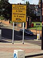 Benkid77 A554 crash warning sign 090809.JPG 2,736 × 3,648; 3.47 MB
-
 Benkid77 Roundabout, New Brighton 1 090809.JPG 3,648 × 2,736; 3.48 MB
-
 Post box on Rowson Street, New Brighton.jpg 2,456 × 3,296; 4.07 MB
-
 Post box on Rowson Street - Cardigan Road.jpg 2,751 × 3,751; 4.91 MB
-
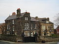 Houses on Rowson Street, New Brighton (1).jpg 4,608 × 3,456; 3.98 MB
-
 North & South Wales Bank, New Brighton 2017.jpg 4,366 × 3,729; 8.14 MB
-
 Roundabout, A554, New Brighton - IMG 1233.JPG 4,320 × 3,240; 2.53 MB
-
 Rowson Street towards Marine Point.jpg 5,135 × 3,371; 18.14 MB
-
 Rowson Street, New Brighton.jpg 5,066 × 3,257; 9.09 MB


.jpg)


