Category:Roads in Merthyr Tydfil County Borough
Jump to navigation
Jump to search

Subcategories
This category has the following 11 subcategories, out of 11 total.
Media in category "Roads in Merthyr Tydfil County Borough"
The following 13 files are in this category, out of 13 total.
-
 Between the Reservoirs - geograph.org.uk - 1451324.jpg 640 × 480; 88 KB
-
 Intersection on the common - geograph.org.uk - 625722.jpg 640 × 477; 58 KB
-
 Junction of Beacon Heights - geograph.org.uk - 634049.jpg 640 × 480; 50 KB
-
 Lane above Mount Pleasant - geograph.org.uk - 1004981.jpg 640 × 427; 187 KB
-
 Lane into Merthyr Vale - geograph.org.uk - 1004963.jpg 640 × 427; 170 KB
-
 Near Tir Lan farm on a snowy day - geograph.org.uk - 1241333.jpg 640 × 480; 111 KB
-
 North of Ponsticill - geograph.org.uk - 93344.jpg 640 × 422; 79 KB
-
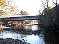 Pont Rhun Troedyrhiw - geograph.org.uk - 83302.jpg 640 × 480; 188 KB
-

-
 Road junction by Pontsticill Reservoir - geograph.org.uk - 83882.jpg 640 × 480; 65 KB
-
 Road to Mynydd Cilfach-yr-encil - geograph.org.uk - 1004895.jpg 640 × 427; 186 KB
-
 Track of Roman road, Gelligaer Common (geograph 1968870).jpg 3,296 × 2,472; 1.91 MB
-
 Track up towards A470 - geograph.org.uk - 564447.jpg 640 × 480; 100 KB


.jpg)
