Category:A465 road in Merthyr Tydfil County Borough
Jump to navigation
Jump to search
Media in category "A465 road in Merthyr Tydfil County Borough"
The following 24 files are in this category, out of 24 total.
-
 A465 near Pant - geograph.org.uk - 3790751.jpg 640 × 481; 47 KB
-
 A465 Road Scene - geograph.org.uk - 484425.jpg 640 × 491; 80 KB
-
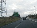
 A465 roundabout ahead - geograph.org.uk - 3131307.jpg 640 × 457; 55 KB
-
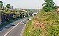
 A465 westbound at Dowlais Top - geograph.org.uk - 3790750.jpg 640 × 481; 54 KB
-
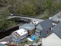 Bridge over Taf Fawr from the Cefn Coed Viaduct.jpg 239 × 179; 33 KB
-

-

-
 Dowlais Top Roundabout Construction - geograph.org.uk - 478617.jpg 638 × 175; 29 KB
-
-

-
 Filling station by A465 at Dowlais Top - geograph.org.uk - 2498660.jpg 800 × 563; 290 KB
-
 Heads of the Valleys Road - geograph.org.uk - 2791349.jpg 3,296 × 2,472; 1.89 MB
-
 Heads of the Valleys Road - geograph.org.uk - 2791350.jpg 3,296 × 2,472; 1.86 MB
-
 Junction of A465 and local road - geograph.org.uk - 634048.jpg 640 × 480; 77 KB
-
-
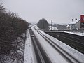
 Railway Bridge, Cefn-coed-y-cymmer - geograph.org.uk - 83884.jpg 640 × 480; 92 KB
-
 Roadside hotel - geograph.org.uk - 735763.jpg 636 × 467; 206 KB
-
 Roundabout at Dowlais Top - geograph.org.uk - 3010564.jpg 640 × 480; 112 KB
-

-
-
 The view of A465 viaduct (Merthyr Tydfil).jpg 359 × 269; 44 KB
-

-
 Top End of Gurnos - geograph.org.uk - 831348.jpg 640 × 480; 72 KB
-
 Viaducts old and new near Merthyr Tydfil - geograph.org.uk - 409461.jpg 640 × 480; 118 KB


.jpg)


