Category:Road signs in County Down
Jump to navigation
Jump to search
Media in category "Road signs in County Down"
The following 156 files are in this category, out of 156 total.
-
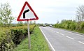
 "Bend to left" sign near Dundonald - geograph.org.uk - 2526276.jpg 640 × 366; 87 KB
-
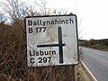
 "Bend to left" sign near Lisburn - geograph.org.uk - 2030595.jpg 539 × 343; 119 KB
-

-
-

-
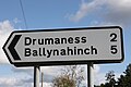
 "C" road sign near Ballynahinch - geograph.org.uk - 1739708.jpg 560 × 420; 86 KB
-
 "C" road sign, Saintfield - geograph.org.uk - 1581099.jpg 640 × 480; 81 KB
-
 "Picnic area" sign near Newtownards (2) - geograph.org.uk - 1992137.jpg 613 × 412; 105 KB
-
 "Road humps" sign, Belfast - geograph.org.uk - 1970068.jpg 635 × 396; 113 KB
-
 "Road junction" sign near Newtownards - geograph.org.uk - 1861256.jpg 836 × 510; 101 KB
-

-

-

-

-
 "Welcome to Dromore", Mossvale - geograph.org.uk - 1407797.jpg 640 × 480; 83 KB
-
 Anahilt Presbyterian Church sign, January 2011.JPG 4,272 × 2,848; 3 MB
-
 Annacloy signs, September 2010 (01).JPG 2,848 × 4,272; 5.79 MB
-
 Annacloy signs, September 2010 (02).JPG 2,848 × 4,272; 5.72 MB
-
 Annacloy signs, September 2010 (03).JPG 4,272 × 2,848; 5.37 MB
-
 Annacloy signs, September 2010 (04).JPG 4,272 × 2,848; 3.62 MB
-
 Annadorn (01), October 2009.JPG 4,272 × 2,848; 4.75 MB
-
 Annadorn (03), October 2009.JPG 4,272 × 2,848; 4.18 MB
-
 Annadorn (12), October 2009.JPG 4,272 × 2,848; 4.92 MB
-
 Annadorn (13), October 2009.JPG 2,848 × 4,272; 5.29 MB
-
 Approaching the Six Road Ends - geograph.org.uk - 214843.jpg 560 × 420; 105 KB
-
 Ballydugan (32), October 2009.JPG 4,272 × 2,848; 5.45 MB
-
 Ballygowan road sign, August 2010 (01).JPG 4,272 × 2,848; 3.79 MB
-
 Ballygowan road sign, August 2010 (02).JPG 4,272 × 2,848; 4.64 MB
-
 Ballysallagh Road near Clandeboye (p) - geograph.org.uk - 780551.jpg 384 × 512; 210 KB
-
 Ballysallagh Road near Clandeboye - geograph.org.uk - 780551.jpg 640 × 512; 363 KB
-
 Bank Parade road sign, Newry, March 2010.JPG 4,272 × 2,848; 3.77 MB
-
 Bilingual welcome sign Rostrevor.jpg 1,024 × 1,024; 696 KB
-
 Castle Espie Wetland Centre, January 2011 (02).JPG 4,272 × 2,848; 5.24 MB
-
 Castle Island Road, signs, October 2009.JPG 2,848 × 4,272; 5.23 MB
-
 Castlewellan road sign, May 2010 (01).JPG 4,272 × 2,848; 5.48 MB
-
 Castlewellan road sign, May 2010 (02).JPG 4,272 × 2,848; 5.73 MB
-
 Castlewellan Road, Clough, May 2010 (04).JPG 4,272 × 2,848; 4.12 MB
-
 Castlewellan Road, near Clough - geograph.org.uk - 595720.jpg 640 × 426; 73 KB
-
 Church Street road signs, Downpatrick, February 2010.JPG 4,272 × 2,848; 3.24 MB
-
 Circular Road, Castlewellan (04), December 2009.JPG 2,848 × 4,272; 3.98 MB
-
 Clough (01), October 2009.JPG 4,272 × 2,848; 4.37 MB
-
 Clough (03), October 2009.JPG 2,848 × 4,272; 3.24 MB
-
 Clough (04), October 2009.JPG 4,272 × 2,848; 3.97 MB
-
 Clough (05), October 2009.JPG 2,848 × 4,272; 4.5 MB
-
 Clough (09), October 2009.JPG 2,848 × 4,272; 2.64 MB
-
 Clough (35), October 2009.JPG 2,848 × 4,272; 5.19 MB
-
 Comber Road, Ballygowan, August 2010 (01).JPG 4,272 × 2,848; 3.07 MB
-
 County Down (27), August 2009.JPG 4,272 × 2,848; 3.34 MB
-
 Cumran Lane, Clough, May 2010 (03).JPG 4,272 × 2,848; 4.99 MB
-
 Cycle route sign, Downpatrick, September 2009.JPG 4,272 × 2,848; 4.02 MB
-
 Delamont Country Park, June 2012 (01).JPG 4,272 × 2,848; 6.74 MB
-
 Delamont road sign, April 2010.JPG 4,272 × 2,848; 4.46 MB
-
 Down (010), October 2009.JPG 4,272 × 2,848; 3.28 MB
-
 Down (044), October 2009.JPG 4,272 × 2,848; 5.32 MB
-
 Down (047), October 2009.JPG 4,272 × 2,848; 4.87 MB
-
 Down (058), October 2009.JPG 2,848 × 4,272; 4.67 MB
-
 Down (062), October 2009.JPG 4,272 × 2,848; 6.22 MB
-
 Down (15), October 2009.JPG 4,272 × 2,848; 6.17 MB
-
 Down (15p), October 2009.JPG 2,112 × 2,816; 2.92 MB
-
 Downpatrick signs (03), August 2009.JPG 2,848 × 4,272; 3.8 MB
-
 Downpatrick signs (06), August 2009.JPG 2,848 × 4,272; 5.29 MB
-
 Downpatrick signs (07), August 2009.JPG 2,848 × 4,272; 4.08 MB
-
 Downpatrick signs (10), August 2009.JPG 2,848 × 4,272; 2.63 MB
-
 Dromore Road, Ballynahinch, November 2010 (02).JPG 4,272 × 2,848; 3.81 MB
-
 Dromore Road, Ballynahinch, November 2010 (04).JPG 2,848 × 4,272; 3.43 MB
-
 Dublin Road, Castlewellan, May 2010 (02).JPG 4,272 × 2,848; 3.72 MB
-
 Dundrum road sign, August 2010.JPG 4,272 × 2,848; 3.09 MB
-
 Dundrum Road, County Down, May 2011 (02).JPG 4,272 × 2,848; 5.99 MB
-
 Dundrum Road, County Down, May 2011 (03).JPG 4,272 × 2,848; 6.12 MB
-
 Dundrum Road, County Down, May 2011 (04).JPG 2,848 × 4,272; 4.66 MB
-
 Dundrum Road, County Down, May 2011 (05).JPG 2,848 × 4,272; 4.73 MB
-
 Dundrum Road, County Down, May 2011 (06).JPG 4,272 × 2,848; 4.77 MB
-
 Dundrum Road, County Down, May 2011 (07).JPG 4,272 × 2,848; 4.95 MB
-
 Dundrum Road, County Down, May 2011 (08).JPG 4,272 × 2,848; 4.45 MB
-
 Ferry Street, Portaferry (17), October 2009.JPG 4,272 × 2,848; 3.19 MB
-
 Fingerpost, Hilltown - geograph.org.uk - 1438638.jpg 640 × 393; 59 KB
-
 Flyover site near Dromore (4) - geograph.org.uk - 1415135.jpg 640 × 429; 104 KB
-
 Grove Road, Spa, County Down, November 2010 (04).JPG 4,272 × 2,848; 3.46 MB
-
 Keelstown Road, County Down, September 2010 (03).JPG 2,848 × 4,272; 2.49 MB
-
 Kilkeel Road sign, May 2010.JPG 4,272 × 2,848; 4.3 MB
-
 Killough (22), October 2009.JPG 4,272 × 2,848; 6.08 MB
-
 Killough (23), October 2009.JPG 4,272 × 2,848; 7.89 MB
-
 Killough (24), October 2009.JPG 4,272 × 2,848; 5.95 MB
-
 Loughinisland (02), October 2009.JPG 4,272 × 2,848; 5.79 MB
-
 Mini-roundabout sign, Comber, June 2010.JPG 4,272 × 2,848; 3.68 MB
-
 New Street road signs, Newry, March 2010.JPG 4,272 × 2,848; 4.06 MB
-
 Newcastle, County Down (31), August 2009.JPG 2,848 × 4,272; 3.52 MB
-
 One way sign, Crossgar, February 2010.JPG 2,848 × 4,272; 3.87 MB
-
 One Way sign, Spa, County Down, November 2010.JPG 4,272 × 2,848; 4.99 MB
-
 Park Lane, Hillsborough, County Down, February 2011 (01).JPG 2,848 × 4,272; 4.39 MB
-
 Pedestrian precinct sign, Newtownards, March 2010.JPG 4,272 × 2,848; 5.58 MB
-
 Portaferry signs (02), October 2009.JPG 2,848 × 4,272; 4.13 MB
-
 Pre-Worboys, Donaghadee - geograph.org.uk - 309937.jpg 640 × 426; 123 KB
-
 Quay Brae, Ardglass, November 2010 (03).JPG 4,272 × 2,848; 4.65 MB
-
 Quay Road, road sign, October 2009.JPG 4,272 × 2,848; 3.92 MB
-
 Quay Street road signs, Newcastle, County Down, May 2010.JPG 4,272 × 2,848; 7.14 MB
-
 Quoile Road signs, Downpatrick, April 2010 (01).JPG 4,272 × 2,848; 3.6 MB
-
 Quoile Road signs, Downpatrick, April 2010 (02).JPG 2,848 × 4,272; 4.12 MB
-
 Railway Street, Comber, June 2010 (02).JPG 4,272 × 2,848; 5.91 MB
-
 Raod signs, Downpatrick, April 2010 (01).JPG 4,272 × 2,848; 5.94 MB
-
 Raod signs, Downpatrick, April 2010 (03).JPG 4,272 × 2,848; 6.33 MB
-
 Road sign, Belfast Road, Downpatrick, February 2010 (01).JPG 2,848 × 4,272; 4.09 MB
-
 Road sign, Downpatrick, February 2010 (01).JPG 2,848 × 4,272; 5.05 MB
-
 Road sign, Downpatrick, February 2010 (02).JPG 4,272 × 2,848; 4.26 MB
-
 Road sign, Downpatrick, September 2010 (01).JPG 4,272 × 2,848; 4.77 MB
-
 Road sign, Dundrum Road (01), January 2010.JPG 4,272 × 2,848; 4.76 MB
-
 Road sign, Dundrum Road (02), January 2010.JPG 4,272 × 2,848; 2.8 MB
-
 Road sign, New Bridge Street, Downpatrick, February 2010 (01).JPG 4,272 × 2,848; 4.38 MB
-
 Road sign, New Bridge Street, Downpatrick, February 2010 (02).JPG 4,272 × 2,848; 3.19 MB
-
 Road sign, New Bridge Street, Downpatrick, February 2010 (03).JPG 2,848 × 4,272; 4.45 MB
-
 Road sign, Old Road, January 2010.JPG 2,848 × 4,272; 4.88 MB
-
 Road sign, Strangford - 1606994.jpg 320 × 240; 16 KB
-
 Road sign, Strangford - geograph.org.uk - 1606994.jpg 640 × 420; 41 KB
-
 Road signs, Downpatrick (01), January 2010.JPG 4,272 × 2,848; 3.38 MB
-
 Road signs, Downpatrick (02), January 2010.JPG 2,848 × 4,272; 3.25 MB
-
 Road signs, Downpatrick (03), January 2010.JPG 2,848 × 4,272; 4.46 MB
-
 Road signs, Downpatrick (04), January 2010.JPG 2,848 × 4,272; 3.38 MB
-
 Road signs, Dromore - geograph.org.uk - 1129889.jpg 624 × 416; 94 KB
-
 Road signs, Newtownards, March 2010 (01).JPG 4,272 × 2,848; 3.83 MB
-
 Roadworks sign, Dundrum, January 2010.JPG 2,848 × 4,272; 4.32 MB
-
 Saintfield Road, Ballygowan, August 2010 (04).JPG 2,848 × 4,272; 2.76 MB
-
 Saintfield Road, Ballygowan, August 2010 (05).JPG 2,848 × 4,272; 3.25 MB
-
 Saintfield Road, Ballygowan, August 2010 (06).JPG 4,272 × 2,848; 4.73 MB
-
 Saintfield Road, Ballygowan, August 2010 (12).JPG 2,848 × 4,272; 5.44 MB
-
 School sign, Annacloy, September 2010.JPG 2,848 × 4,272; 3 MB
-
 School sign, John Street, Crossgar, February 2010.JPG 2,848 × 4,272; 3.97 MB
-
 School sign, Spa, November 2010.JPG 2,848 × 4,272; 5.48 MB
-
 Sheepland Road, Ardglass, September 2010.JPG 4,272 × 2,848; 4.47 MB
-
 Signs at Drumaconnell East - geograph.org.uk - 1553853.jpg 640 × 480; 140 KB
-
 Signs at Killysavan - geograph.org.uk - 1541846.jpg 640 × 480; 115 KB
-
 Signs on the Sheepland Road near Ardglass - geograph.org.uk - 405231.jpg 560 × 420; 103 KB
-
 Signs, the Quay Brae, Ardglass - geograph.org.uk - 405160.jpg 600 × 400; 136 KB
-
 St Johns (46), October 2009.JPG 4,272 × 2,848; 4.24 MB
-
 St Johns (48), October 2009.JPG 2,848 × 4,272; 4.26 MB
-
 St Johns (49), October 2009.JPG 4,272 × 2,848; 3.64 MB
-
 St Patricks Day Inter Church Procession, Downpatrick, March 2010 (06).JPG 2,848 × 4,272; 4.2 MB
-
 Strangford (17), August 2009.JPG 4,272 × 2,848; 3.65 MB
-
 Strangford (18), August 2009.JPG 4,272 × 2,848; 3.53 MB
-
 Strangford (18c), August 2009.JPG 3,776 × 2,832; 3.15 MB
-
 Strangford (21), August 2009.JPG 4,272 × 2,848; 3.48 MB
-
 Strangford (36), August 2009.JPG 2,848 × 4,272; 3.49 MB
-
 Strangford Road, road sign (01), October 2008.JPG 4,272 × 2,848; 5.18 MB
-
 Strangford Road, road sign (02), October 2009.JPG 4,272 × 2,848; 3.75 MB
-
 Strangford Road, road sign (03), October 2009.JPG 4,272 × 2,848; 4.1 MB
-
 Strangford Road, road sign (04), October 2009.JPG 2,848 × 4,272; 5.51 MB
-
 Struell Wells (21), October 2009.JPG 4,272 × 2,848; 4.73 MB
-
 The Mall road sign, Newry, March 2010.JPG 4,272 × 2,848; 4.67 MB
-
 Traffic island, Dundrum, January 2010.JPG 2,848 × 4,272; 5.06 MB
-
 Trevor Hill road sign, Newry, March 2010.JPG 2,848 × 4,272; 3.74 MB
-
 Tullynacree Road, Annacloy, September 2010 (01).JPG 4,272 × 2,848; 6.33 MB
-
 Tullynacree Road, Annacloy, September 2010 (03).JPG 4,272 × 2,848; 5.34 MB
-
 Upper Clifton, Bangor - 1393370.jpg 512 × 384; 275 KB
-
 Upper Clifton, Bangor - geograph.org.uk - 1393370.jpg 640 × 480; 426 KB
-
 Finger-post near Annacloy - geograph.org.uk - 740074.jpg 576 × 432; 55 KB
-
 Finger-post sign near Newry - geograph.org.uk - 1421233.jpg 512 × 384; 50 KB
-
 Kilmore village over the weak bridge - geograph.org.uk - 338141.jpg 640 × 480; 90 KB


_-_geograph.org.uk_-_4304265.jpg)
_-_geograph.org.uk_-_4476363.jpg)
_-_geograph.org.uk_-_4567980.jpg)


_-_geograph.org.uk_-_1992137.jpg)


.JPG)
.JPG)
.JPG)
.JPG)
,_October_2009.JPG)
,_October_2009.JPG)
,_October_2009.JPG)
,_October_2009.JPG)

,_October_2009.JPG)
.JPG)
.JPG)
_-_geograph.org.uk_-_780551.jpg)


.JPG)

.JPG)
.JPG)
.JPG)


,_December_2009.JPG)
,_October_2009.JPG)
,_October_2009.JPG)
,_October_2009.JPG)
,_October_2009.JPG)
,_October_2009.JPG)
,_October_2009.JPG)
.JPG)
,_August_2009.JPG)
.JPG)

.JPG)

,_October_2009.JPG)
,_October_2009.JPG)
,_October_2009.JPG)
,_October_2009.JPG)
,_October_2009.JPG)
,_October_2009.JPG)
,_October_2009.JPG)
,_August_2009.JPG)
,_August_2009.JPG)
,_August_2009.JPG)
,_August_2009.JPG)
.JPG)
.JPG)
.JPG)

.JPG)
.JPG)
.JPG)
.JPG)
.JPG)
.JPG)
.JPG)
,_October_2009.JPG)

_-_geograph.org.uk_-_1415135.jpg)
.JPG)
.JPG)

,_October_2009.JPG)
,_October_2009.JPG)
,_October_2009.JPG)
,_October_2009.JPG)


,_August_2009.JPG)


.JPG)

,_October_2009.JPG)

.JPG)


.JPG)
.JPG)
.JPG)
.JPG)
.JPG)
.JPG)
.JPG)
.JPG)
.JPG)
,_January_2010.JPG)
,_January_2010.JPG)
.JPG)
.JPG)
.JPG)


,_January_2010.JPG)
,_January_2010.JPG)
,_January_2010.JPG)
,_January_2010.JPG)

.JPG)

.JPG)
.JPG)
.JPG)
.JPG)


,_October_2009.JPG)
,_October_2009.JPG)
,_October_2009.JPG)
.JPG)
,_August_2009.JPG)
,_August_2009.JPG)
,_August_2009.JPG)
,_August_2009.JPG)
,_August_2009.JPG)
,_October_2008.JPG)
,_October_2009.JPG)
,_October_2009.JPG)
,_October_2009.JPG)
,_October_2009.JPG)


.JPG)
.JPG)


