Category:Road signs in Belfast
Jump to navigation
Jump to search
Media in category "Road signs in Belfast"
The following 54 files are in this category, out of 54 total.
-
 "Blind people" sign, Belfast - geograph.org.uk - 1620906.jpg 640 × 408; 99 KB
-
 "No entry" sign, Belfast - geograph.org.uk - 2112565.jpg 640 × 460; 48 KB
-
 20mph zone sign, Belfast - geograph.org.uk - 1700267.jpg 640 × 402; 75 KB
-
 Belfast (025), October 2009.JPG 2,848 × 4,272; 3.77 MB
-
 Belfast (052), October 2009.JPG 2,848 × 4,272; 3.72 MB
-
 Belfast (084), October 2009.JPG 4,272 × 2,848; 4.36 MB
-
 Belfast (093), October 2009.JPG 4,272 × 2,848; 4.56 MB
-
 Belfast (136), October 2009.JPG 2,848 × 4,272; 3.01 MB
-
 Belfast (258), October 2009.JPG 2,848 × 4,272; 4.26 MB
-
 Belfast (273), October 2009.JPG 4,272 × 2,848; 3.4 MB
-
 Belfast (280), October 2009.JPG 4,272 × 2,848; 5.62 MB
-
 Belfast buses (13408042353).jpg 2,240 × 1,680; 1.94 MB
-
 Boojum, Belfast, May 2013.JPG 4,272 × 2,848; 4.09 MB
-
 Bus Lane, Malone Road Belfast (2) - geograph.org.uk - 713450.jpg 638 × 640; 108 KB
-
 Bus Lane, Malone Road Belfast - geograph.org.uk - 713449.jpg 583 × 640; 111 KB
-
 Castle Lane, Belfast, March 2011 (02).JPG 2,848 × 4,272; 3.83 MB
-
 Circular Road sign, Belfast - geograph.org.uk - 1636771.jpg 618 × 395; 86 KB
-
 Cycle path, Apollo Road - geograph.org.uk - 1722405.jpg 640 × 480; 299 KB
-
 Danny Blanchflower bus stop, Belfast - geograph.org.uk - 1766237.jpg 1,135 × 760; 128 KB
-
 Divis Street, Belfast, May 2011 (01).JPG 2,848 × 4,272; 4.04 MB
-
 Divis Street, Belfast, May 2011 (02).JPG 2,848 × 4,272; 5.56 MB
-
 Donegall Place, Belfast, May 2010.JPG 2,848 × 4,272; 4.39 MB
-
 Frederick Street, Belfast, July 2010 (03).JPG 4,272 × 2,848; 4.56 MB
-
 Frederick Street, Belfast, July 2010 (04).JPG 4,272 × 2,848; 3.37 MB
-
 Frederick Street, Belfast, July 2010 (05).JPG 4,272 × 2,848; 3.41 MB
-
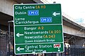
 Gantry sign, Belfast - geograph.org.uk - 1746974.jpg 904 × 479; 109 KB
-
 Great George's Street, Belfast (2) - geograph.org.uk - 1490437.jpg 640 × 381; 72 KB
-
 Howard Street, Belfast, October 2010 (01).JPG 4,272 × 2,848; 3.5 MB
-
 Kings Bridge, Belfast, May 2010 (03).JPG 2,848 × 4,272; 2.44 MB
-
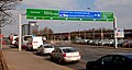
 Motorway sign, Belfast (3) - geograph.org.uk - 1760656.jpg 640 × 411; 102 KB
-
 New Lodge Tower Blocks - geograph.org.uk - 4845.jpg 640 × 331; 49 KB
-
 No Entry to Joy Street in Belfast, Northern Ireland, 1974.jpg 1,499 × 1,049; 272 KB
-
 North Queen Street, Belfast, July 2010 (03).JPG 4,272 × 2,848; 3.78 MB
-
 Ormeau Avenue signs, Belfast, October 2010 (01).JPG 2,848 × 4,272; 2.91 MB
-
 Queens Bridge road sign, Belfast, April 2010.JPG 4,272 × 2,848; 3.13 MB
-

-
 Roundabout sign, Belfast - geograph.org.uk - 1439648.jpg 640 × 439; 59 KB
-

-

-
 Security concerns at Flax Street - geograph.org.uk - 1460173.jpg 640 × 480; 82 KB
-
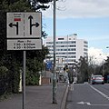
 Signs, Malone Road - geograph.org.uk - 1019949.jpg 480 × 640; 259 KB
-
 Stranmillis Embankment road sign, Belfast, May 2010 (01).JPG 4,272 × 2,848; 5.44 MB
-
 Stranmillis Road sign, Belfast, May 2010 (02).JPG 2,848 × 4,272; 3.18 MB
-
 The Dunbar Link, Belfast (3) - geograph.org.uk - 1716048.jpg 640 × 390; 69 KB
-
-
 The Westlink, Belfast (11) - geograph.org.uk - 1625898.jpg 640 × 347; 93 KB
-
 The Westlink, Belfast (12) - geograph.org.uk - 1715674.jpg 640 × 399; 65 KB
-
 The Westlink, Belfast (14) - geograph.org.uk - 1731356.jpg 640 × 371; 73 KB
-
 The Westlink, Belfast (20) - geograph.org.uk - 873380.jpg 640 × 400; 76 KB
-
 The Westlink, Belfast (7) - geograph.org.uk - 1587192.jpg 640 × 392; 57 KB
-
 University Avenue, Belfast, August 2010 (02).JPG 4,272 × 2,848; 3.59 MB
-
 Victoria Street road sign, Belfast, July 2010.JPG 4,272 × 2,848; 3.72 MB
-
 Westlink sign, Belfast - geograph.org.uk - 1608232.jpg 640 × 458; 88 KB
-
 York Street, Belfast (1) - geograph.org.uk - 702448.jpg 640 × 377; 75 KB


,_October_2009.JPG)
,_October_2009.JPG)
,_October_2009.JPG)
,_October_2009.JPG)
,_October_2009.JPG)
,_October_2009.JPG)
,_October_2009.JPG)
,_October_2009.JPG)
.jpg)

_-_geograph.org.uk_-_713450.jpg)

.JPG)


.JPG)
.JPG)

.JPG)
.JPG)
.JPG)

_-_geograph.org.uk_-_1490437.jpg)
.JPG)
.JPG)
_-_geograph.org.uk_-_1760656.jpg)


.JPG)
.JPG)


_-_geograph.org.uk_-_596287.jpg)


.JPG)
.JPG)
_-_geograph.org.uk_-_1716048.jpg)
_-_geograph.org.uk_-_1346950.jpg)
_-_geograph.org.uk_-_1625898.jpg)
_-_geograph.org.uk_-_1715674.jpg)
_-_geograph.org.uk_-_1731356.jpg)
_-_geograph.org.uk_-_873380.jpg)
_-_geograph.org.uk_-_1587192.jpg)
.JPG)


_-_geograph.org.uk_-_702448.jpg)